National Register of Historic Places listings in Greene County, Georgia
This is a list of properties and districts in Greene County, Georgia that are listed on the National Register of Historic Places (NRHP).
- This National Park Service list is complete through NPS recent listings posted February 5, 2021.[1]


location of Greene County in Georgia
Current listings
| [2] | Name on the Register | Image | Date listed[3] | Location | City or town | Description |
|---|---|---|---|---|---|---|
| 1 | Dr. Calvin M. Baber House | 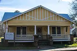 Dr. Calvin M. Baber House |
December 17, 1987 (#87001439) |
Penfield Rd. 33°35′04″N 83°10′26″W |
Greensboro | |
| 2 | Bethesda Baptist Church and Cemetery | 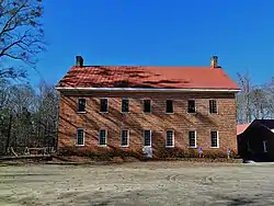 Bethesda Baptist Church and Cemetery |
August 6, 1998 (#98000967) |
Jct. of Cty Rd. 120 and Cty Rd. 129 33°39′07″N 83°00′36″W |
Union Point | |
| 3 | Brown-Bryson Farm | June 10, 1999 (#99000693) |
1760 Siloam-Veazey Rd. 33°31′43″N 83°06′11″W |
Siloam | ||
| 4 | Church of the Redeemer | 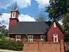 Church of the Redeemer |
September 9, 1987 (#87001440) |
Jct. of Main and North Sts. 33°34′42″N 83°10′56″W |
Greensboro | |
| 5 | Copeland Site (9GE18) | May 19, 1989 (#89000373) |
Address Restricted |
Greensboro | ||
| 6 | Early Hill Plantation | 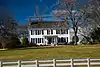 Early Hill Plantation |
June 13, 1997 (#97000559) |
Lickskillet Rd. 0.5 NE of US 278 33°35′18″N 83°13′00″W |
Greensboro | |
| 7 | Greene County Courthouse | 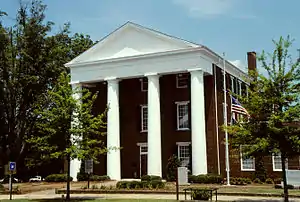 Greene County Courthouse |
September 18, 1980 (#80001083) |
GA 12 33°34′36″N 83°10′56″W |
Greensboro | |
| 8 | Greensboro Commercial Historic District | 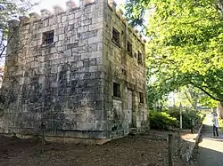 Greensboro Commercial Historic District |
November 6, 1987 (#87001438) |
Broad and Main Sts. 33°34′33″N 83°10′56″W |
Greensboro | |
| 9 | Greensboro Depot | September 9, 1987 (#87001441) |
West St. 33°34′42″N 83°11′03″W |
Greensboro | ||
| 10 | Jefferson Hall | 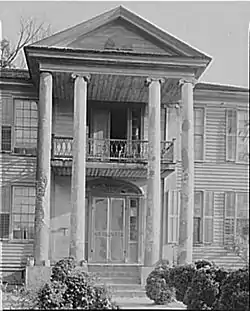 Jefferson Hall |
August 10, 1989 (#89001100) |
GA 12/U.S. Route 278 33°36′12″N 83°02′24″W |
Union Point | |
| 11 | Mary Leila Cotton Mill and Village | 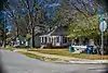 Mary Leila Cotton Mill and Village |
September 9, 1987 (#87001443) |
Roughly bounded by Cherry and Buffalo Sts. and Richland Ave., GA RR, Spring and Mill, and Mapple Sts. 33°34′47″N 83°11′14″W |
Greensboro | |
| 12 | Moore-Crutchfield Place | April 12, 1990 (#90000549) |
GA 15, SE of Siloam 33°31′58″N 83°04′23″W |
Siloam | ||
| 13 | North Street-East Street Historic District | September 9, 1987 (#87001444) |
North, East, Greene, and Walnut Sts. 33°34′41″N 83°10′44″W |
Greensboro | ||
| 14 | Penfield Historic District | 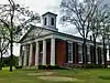 Penfield Historic District |
January 20, 1976 (#76000637) |
7 mi. N of Greensboro on GA 5925 33°40′07″N 83°10′11″W |
Penfield | |
| 15 | Phillip Poullain House | September 9, 1987 (#87001448) |
Penfield Rd. 33°35′05″N 83°10′41″W |
Greensboro | ||
| 16 | Peter W. Printup Plantation | September 5, 1985 (#85001977) |
GA 44 33°36′40″N 83°05′37″W |
Union Point | ||
| 17 | Siloam Historic District | 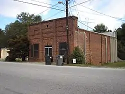 Siloam Historic District |
July 26, 2001 (#01000740) |
Roughly centered on Main St., Union Point Hwy., and Church St. 33°32′05″N 83°04′55″W |
Siloam | |
| 18 | Siloam Junior High School | 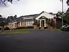 Siloam Junior High School |
February 20, 2002 (#02000036) |
473 GA 15S 33°31′55″N 83°04′34″W |
Siloam | |
| 19 | South Street-Broad Street-Main Street-Laurel Street Historic District | September 9, 1987 (#87001450) |
South, Broad, Main, and Laurel Sts. 33°34′26″N 83°11′14″W |
Greensboro | ||
| 20 | South Walnut Street Historic District | September 9, 1987 (#87001449) |
S. Walnut, E. South, and E. Broad Sts. 33°34′24″N 83°10′48″W |
Greensboro | ||
| 21 | Springfield Baptist Church | 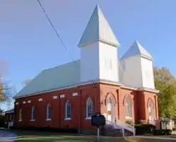 Springfield Baptist Church |
September 9, 1987 (#87001451) |
Canaan Circle 33°34′39″N 83°10′41″W |
Greensboro | |
| 22 | Union Manufacturing Company | February 24, 1989 (#89000026) |
500 Sibley Ave. 33°36′47″N 83°04′22″W |
Union Point | ||
| 23 | Union Point Historic District | January 7, 1991 (#90002100) |
Roughly bounded by Lamb Ave., Washington Rd., Old Crawfordville Rd. and Hendry St. 33°37′01″N 83°04′27″W |
Union Point | ||
| 24 | Woodville Baptist Church and School | April 15, 1999 (#99000455) |
Jct. of E. Peachtree Ave. and Chestnut St. 33°40′14″N 83°06′00″W |
Woodville |
Former listings
| [2] | Name on the Register | Image | Date listed | Date removed | Location | City or town | Summary |
|---|---|---|---|---|---|---|---|
| 1 | King-Knowles-Gheesling House | September 9, 1987 (#87001442) | February 6, 2020 | North St. 33°34′42″N 83°10′58″W |
Greensboro |
References
- "National Register of Historic Places: Weekly List Actions". National Park Service, United States Department of the Interior. Retrieved on February 5, 2021.
- Numbers represent an alphabetical ordering by significant words. Various colorings, defined here, differentiate National Historic Landmarks and historic districts from other NRHP buildings, structures, sites or objects.
- The eight-digit number below each date is the number assigned to each location in the National Register Information System database, which can be viewed by clicking the number.
| Wikimedia Commons has media related to National Register of Historic Places in Greene County, Georgia. |
| Topics | |
|---|---|
| Lists by state |
|
| Lists by insular areas | |
| Lists by associated state | |
| Other areas | |
| Related | |
| |
This article is issued from Wikipedia. The text is licensed under Creative Commons - Attribution - Sharealike. Additional terms may apply for the media files.