National Register of Historic Places listings in Baldwin County, Georgia
This is a list of properties and districts in Baldwin County, Georgia that are listed on the National Register of Historic Places (NRHP).
- This National Park Service list is complete through NPS recent listings posted January 29, 2021.[1]

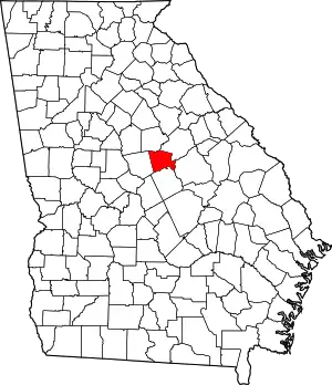
Location of Baldwin County in Georgia
Current listings
| [2] | Name on the Register | Image | Date listed[3] | Location | City or town | Description |
|---|---|---|---|---|---|---|
| 1 | Andalusia | %253B_Milledgeville%252C_Georgia%253B_January_29%252C_2011.jpg.webp) Andalusia |
February 8, 1980 (#80000968) |
NW of Milledgeville on U.S. 441 33°07′31″N 83°16′04″W |
Milledgeville | The home of Flannery O'Connor from 1951 until her death[4] |
| 2 | Atkinson Hall, Georgia College | 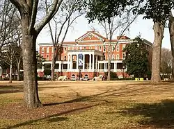 Atkinson Hall, Georgia College |
January 20, 1972 (#72000359) |
Georgia College campus 33°04′49″N 83°13′51″W |
Milledgeville | |
| 3 | Barrowville | December 14, 1978 (#78000958) |
E of Milledgeville on GA 22/24 33°05′18″N 83°12′17″W |
Milledgeville | ||
| 4 | Maj. Francis Boykin House | 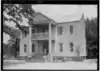 Maj. Francis Boykin House |
November 14, 1978 (#78000959) |
10 mi. (16 km) SE of Milledgeville off GA 24 33°00′41″N 83°05′22″W |
Milledgeville | |
| 5 | Central Building, State Lunatic Asylum | Central Building, State Lunatic Asylum |
July 20, 1978 (#78000960) |
Broad St. 33°03′01″N 83°13′19″W |
Milledgeville | |
| 6 | Central State Hospital Cemeteries | 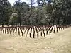 Central State Hospital Cemeteries |
July 12, 2005 (#05000694) |
3 mi. SE of Milledgeville, centered on Cedar Lm, at Central State Hospital, bet. US 441 and GA 112 33°02′20″N 83°13′12″W |
Hardwick | |
| 7 | Devereux-Coleman House | 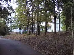 Devereux-Coleman House |
April 8, 1993 (#93000214) |
167 Kenan Dr. 33°08′49″N 83°17′00″W |
Milledgeville | |
| 8 | Fort-Hammond-Willis House | 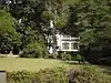 Fort-Hammond-Willis House |
March 25, 2003 (#03000173) |
1760 Irwinton Rd. 33°03′27″N 83°13′46″W |
Milledgeville | |
| 9 | Fowler Apartments | August 21, 1997 (#97000861) |
430 W. McIntosh St. 33°04′52″N 83°14′01″W |
Milledgeville | ||
| 10 | Milledgeville Historic District | 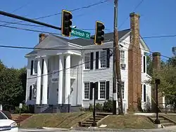 Milledgeville Historic District |
June 28, 1972 (#72000360) |
Bounded by Irwin, Thomas, and Warren Sts. and Fishing Creek 33°04′42″N 83°13′43″W |
Milledgeville | |
| 11 | Old Governor's Mansion | .jpg.webp) Old Governor's Mansion |
May 13, 1970 (#70000194) |
120 S. Clark St. 33°04′43″N 83°13′53″W |
Milledgeville | National Historic Landmark |
| 12 | Old State Capitol | .jpg.webp) Old State Capitol |
May 13, 1970 (#70000195) |
Greene St. 33°04′40″N 83°13′32″W |
Milledgeville | |
| 13 | Samuel Rockwell House | 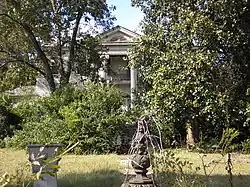 Samuel Rockwell House |
April 19, 1978 (#78000961) |
165 Allen Memorial Dr. 33°03′24″N 83°13′57″W |
Milledgeville | |
| 14 | Roe-Harper House | March 6, 1986 (#77000437) |
SE of conjunction of US 441 and Corral Rd. 33°09′57″N 83°16′39″W |
Milledgeville | ||
| 15 | Rose Hill | April 3, 2017 (#100000821) |
1534 Irwinton Rd. 33°03′40″N 83°13′35″W |
Milledgeville | Now part of Lockerly Arboretum | |
| 16 | John Rutherford House | 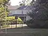 John Rutherford House |
March 21, 1978 (#78000962) |
550 Allen Memorial Dr. 33°03′18″N 83°14′28″W |
Milledgeville | |
| 17 | Storehouse, State Lunatic Asylum | 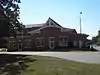 Storehouse, State Lunatic Asylum |
June 15, 1978 (#78000963) |
Broad St. and Lawrence Rd. 33°03′03″N 83°13′26″W |
Milledgeville | |
| 18 | Thalian Hall | 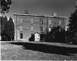 Thalian Hall |
March 21, 1978 (#78000964) |
Allen Memorial and Ivey Drs. 33°03′19″N 83°14′43″W |
Milledgeville | Demolished in 1990 |
| 19 | Westbrook-Hubert Farm | June 13, 1997 (#97000558) |
143 Little Rd. 33°09′24″N 83°20′17″W |
Meriwether | ||
| 20 | Westover | Westover |
February 12, 1987 (#87000094) |
151 Meriwether Rd. NW 33°07′50″N 83°17′44″W |
Milledgeville | |
| 21 | Woodville | June 22, 1979 (#79000695) |
3 mi. (4.8 km) S of Milledgeville on GA 243 33°01′04″N 83°14′32″W |
Milledgeville | ||
| 22 | Dr. Charles and Louise Zattau House | 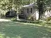 Dr. Charles and Louise Zattau House |
July 3, 2012 (#12000381) |
290 Lakeside Dr. 33°06′01″N 83°14′18″W |
Milledgeville |
Former listings
| [2] | Name on the Register | Image | Date listed | Date removed | Location | City or town | Summary |
|---|---|---|---|---|---|---|---|
| 1 | Old State Prison Building | 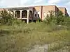 Old State Prison Building |
May 8, 1979 (#79000694) | April 26, 2019 | 3 mi. (4.8 km) W of Milledgeville on GA 22 33°05′40″N 83°16′31″W |
Milledgeville |
See also
| Wikimedia Commons has media related to National Register of Historic Places in Baldwin County, Georgia. |
References
- "National Register of Historic Places: Weekly List Actions". National Park Service, United States Department of the Interior. Retrieved on January 29, 2021.
- Numbers represent an alphabetical ordering by significant words. Various colorings, defined here, differentiate National Historic Landmarks and historic districts from other NRHP buildings, structures, sites or objects.
- The eight-digit number below each date is the number assigned to each location in the National Register Information System database, which can be viewed by clicking the number.
- Henson, Steve (August 21, 1979), National Register of Historic Places Inventory — Registration Form: Andalusia (PDF), retrieved February 15, 2018.
| Topics | |
|---|---|
| Lists by state |
|
| Lists by insular areas | |
| Lists by associated state | |
| Other areas | |
| Related | |
| |
This article is issued from Wikipedia. The text is licensed under Creative Commons - Attribution - Sharealike. Additional terms may apply for the media files.