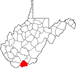
National Register of Historic Places listings in Mercer County, West Virginia
This is a list of the National Register of Historic Places listings in Mercer County, West Virginia.
This is intended to be a complete list of the properties and districts on the National Register of Historic Places in Mercer County, West Virginia, United States. The locations of National Register properties and districts for which the latitude and longitude coordinates are included below, may be seen in an online map.[1]
There are 18 properties and districts listed on the National Register in the county.
- This National Park Service list is complete through NPS recent listings posted January 29, 2021.[2]
Barbour - Berkeley - Boone - Braxton - Brooke - Cabell - Calhoun - Clay - Doddridge - Fayette - Gilmer - Grant - Greenbrier - Hampshire - Hancock - Hardy - Harrison - Jackson - Jefferson - Kanawha - Lewis - Lincoln - Logan - Marion - Marshall - Mason - McDowell - Mercer - Mineral - Mingo - Monongalia - Monroe - Morgan - Nicholas - Ohio - Pendleton - Pleasants - Pocahontas - Preston - Putnam - Raleigh - Randolph - Ritchie - Roane - Summers - Taylor - Tucker - Tyler - Upshur - Wayne - Webster - Wetzel - Wirt - Wood - Wyoming |
Current listings
| [3] | Name on the Register | Image | Date listed[4] | Location | City or town | Description |
|---|---|---|---|---|---|---|
| 1 | Bluefield Downtown Commercial Historic District | 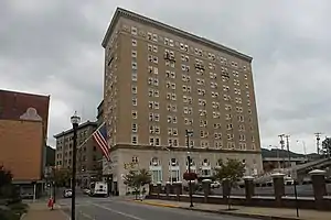 Bluefield Downtown Commercial Historic District |
March 18, 1987 (#87000630) |
Roughly bounded by Princeton Ave. and Scott, High, and Russell Sts. 37°16′04″N 81°13′18″W |
Bluefield | |
| 2 | Bramwell Historic District |  Bramwell Historic District |
February 10, 1983 (#83003244) |
Main, Rose, Bloch, Duhring, Wyatt, Church, and N. and S. River Sts. 37°19′26″N 81°18′35″W |
Bramwell | |
| 3 | Bramwell Additions Historic District | 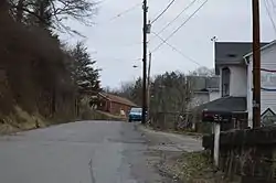 Bramwell Additions Historic District |
August 3, 1995 (#95000877) |
Along Bluestone Ave. SW of US 92, also two discontiguous areas N and W along the Bluestone R.; Parts of Bluestone Ave., Clifton St., Renova St., Simmons Ave., Simmons St. and Spring St. 37°19′26″N 81°18′15″W |
Bramwell | |
| 4 | Country Club Hill Historic District | November 5, 1992 (#92000878) |
Along Whitethorn, Lebanon and Liberty Sts. 37°14′56″N 81°14′00″W |
Bluefield | ||
| 5 | Easley House | Easley House |
July 29, 1992 (#92000879) |
1500 College Ave. 37°15′01″N 81°14′12″W |
Bluefield | |
| 6 | Col. William Henderson French House | March 12, 1976 (#76001940) |
South of Athens off WV 20 37°23′46″N 81°01′36″W |
Athens | ||
| 7 | Dr. James W. Hale House | 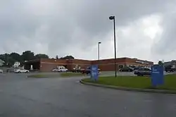 Dr. James W. Hale House |
March 12, 1976 (#76001941) |
1034 Mercer St. 37°22′06″N 81°05′54″W |
Princeton | |
| 8 | Hancock House | 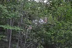 Hancock House |
January 17, 1990 (#89001783) |
300 Sussex St. 37°16′33″N 81°13′13″W |
Bluefield | |
| 9 | Jefferson Street Historic District | 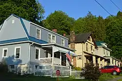 Jefferson Street Historic District |
July 29, 1992 (#92000877) |
Along Jefferson St. between Cumberland Rd. and College Ave. 37°15′05″N 81°13′02″W |
Bluefield | |
| 10 | Dr. Robert B. McNutt House |  Dr. Robert B. McNutt House |
July 25, 2001 (#01000777) |
1522 N. Walker St. 37°22′02″N 81°06′10″W |
Princeton | |
| 11 | Mercer County Courthouse | 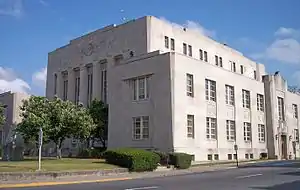 Mercer County Courthouse |
November 28, 1980 (#80004032) |
Courthouse Sq. 37°21′56″N 81°06′12″W |
Princeton | |
| 12 | Mercer Street Historic District | 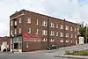 Mercer Street Historic District |
October 17, 2003 (#03001060) |
Mercer St. between N. 1st St. and North St. 37°22′13″N 81°05′15″W |
Princeton | |
| 13 | Municipal Building | 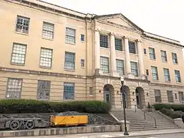 Municipal Building |
May 29, 1979 (#79002591) |
514 Bland St. 37°16′04″N 81°13′22″W |
Bluefield | |
| 14 | President's House, Bluefield State College | December 3, 1999 (#99001400) |
Rock St. 37°16′04″N 81°14′09″W |
Bluefield | ||
| 15 | Princeton Post Office | July 6, 2020 (#100005316) |
920 Mercer St. 37°22′11″N 81°05′46″W |
Princeton | Now houses the Princeton Public Library. | |
| 16 | South Bluefield Historic District | 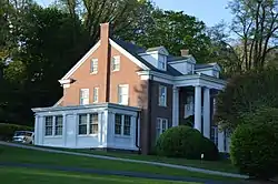 South Bluefield Historic District |
July 29, 1992 (#92000876) |
Along Mountain View Rd., Bland Rd., Oakhurst, and Parkway 37°15′29″N 81°12′55″W |
Bluefield | |
| 17 | Upper Oakhurst Historic District | 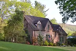 Upper Oakhurst Historic District |
July 29, 1992 (#92000875) |
Along Oakhurst Ave., Groveland Dr., Edgewood Rd., and Mountain View Rd. 37°15′45″N 81°12′22″W |
Bluefield | |
| 18 | Virginian Railway Yard Historic District | May 1, 2003 (#03000351) |
0.5 mi (0.80 km) north of junction of WV 20 and railroad tracks 37°22′41″N 81°05′11″W |
Princeton |
See also
| Wikimedia Commons has media related to National Register of Historic Places in Mercer County, West Virginia. |
References
- The latitude and longitude information provided in this table was derived originally from the National Register Information System, which has been found to be fairly accurate for about 99% of listings. Some locations in this table may have been corrected to current GPS standards.
- "National Register of Historic Places: Weekly List Actions". National Park Service, United States Department of the Interior. Retrieved on January 29, 2021.
- Numbers represent an alphabetical ordering by significant words. Various colorings, defined here, differentiate National Historic Landmarks and historic districts from other NRHP buildings, structures, sites or objects.
- The eight-digit number below each date is the number assigned to each location in the National Register Information System database, which can be viewed by clicking the number.
| Topics | ||
|---|---|---|
| Lists by county |
| |
| Other lists | ||
| ||
Municipalities and communities of Mercer County, West Virginia, United States | ||
|---|---|---|
| Cities | Mercer County map | |
| Towns | ||
| CDPs | ||
| Other communities |
| |
| Ghost town | ||
| Footnotes | ‡This populated place also has portions in an adjacent county or counties | |
| ||