Ottawa County, Oklahoma
Ottawa County is a county located in the northeastern corner of the U.S. state of Oklahoma. As of the 2010 census, the population was 31,848.[1] Its county seat is Miami.[2] The county was named for the Ottawa Tribe of Oklahoma.[3] It is also the location of the federally recognized Modoc Tribe of Oklahoma and the Quapaw Tribe of Indians, which is based in Quapaw.
Ottawa County | |
|---|---|
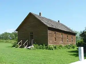 Modoc Mission Church (2010) | |
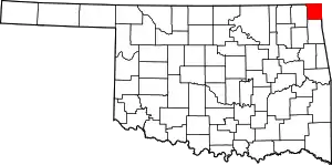 Location within the U.S. state of Oklahoma | |
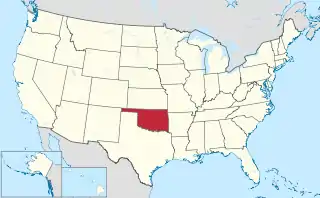 Oklahoma's location within the U.S. | |
| Coordinates: 36°50′N 94°49′W | |
| Country | |
| State | |
| Founded | 1907 |
| Seat | Miami |
| Largest city | Miami |
| Area | |
| • Total | 485 sq mi (1,260 km2) |
| • Land | 471 sq mi (1,220 km2) |
| • Water | 14 sq mi (40 km2) 2.8%% |
| Population | |
| • Estimate (2018) | 31,175 |
| • Density | 68/sq mi (26/km2) |
| Congressional district | 2nd |
| Website | ottawa |
Ottawa County comprises the Miami, OK Micropolitan Statistical Area, which is included in the Joplin-Miami, MO-OK Combined Statistical Area. The county borders both Kansas and Missouri.
History
Archaeological studies indicate this area was inhabited for thousands of years by succeeding cultures of prehistoric indigenous peoples. According to the Encyclopedia of Oklahoma History & Culture, at the start of the 20th century, there were eight known Archaic sites (6000 B. C. to 1 A. D.), sixteen Woodland sites (1 A. D. to 1000 A.D.), and six Plains Village sites (1000 to 1500 A. D.).[3]
The Osage Nation had moved into the area from Missouri and Kansas by the 19th century, under pressure from European-American encroachment on their lands. They ceded this land to the Federal Government in exchange for another area farther west in Indian Territory. In 1828, the Western Cherokee, the first group of this nation to relocate west of the Mississippi River, ceded their land in Western Arkansas to the Federal Government in exchange for some of the land just vacated by the Osage.
In 1831, the Federal Government reacquired part of what would eventually become Ottawa County in order to resettle some smaller tribes that had been forced west from the Midwest under its Indian Removal program. These included two tribes of Iroquois, Shawnee, Quapaw, Peoria, Kaskaskia, Miami, Ottawa and Wyandotte. The Neosho Agency administered the affairs of these tribes from 1837 until 1871. In that year, it was renamed as the Quapaw Agency, serving only the tribes in Indian Territory.[3]
The Modoc band led by Captain Jack in northern California was exiled and relocated here in 1873, after being taken as prisoner following their defeat in the Modoc War. The 153 members were settled at the Quapaw Agency. After regaining federally recognized status in 1978 as the Modoc Tribe of Oklahoma, they were given land of their own under federal trust in this county. Native Americans make up nearly 17% of the population in the county.
This county is part of the Tri-state District, a center of lead and zinc mining through the first half of the 20th century. Unrestricted mining resulted in severe environmental degradation and mining centers such as Picher, Oklahoma in the county were included within the Tar Creek Superfund Site in 1980. Environmental remediation has been conducted, but the state and federal government have also closed Picher as a city and relocated nearly all its residents since the early 21st century. In 1996 the government found that 34% of the children of Picher, OK had lead poisoning due to groundwater, air and dust effects.
Geography
According to the U.S. Census Bureau, the county has a total area of 485 square miles (1,260 km2), of which 471 square miles (1,220 km2) is land and 14 square miles (36 km2) (2.8%) is water.[4] It is the fourth-smallest county in Oklahoma by area. The eastern part of the county lies in the Ozark Plains, while the western is in the Neosho Lowlands.[3]
Adjacent counties
- Cherokee County, Kansas (north)
- Newton County, Missouri (east)
- McDonald County, Missouri (southeast)
- Delaware County (south)
- Craig County (west)
Demographics
| Historical population | |||
|---|---|---|---|
| Census | Pop. | %± | |
| 1910 | 15,713 | — | |
| 1920 | 41,108 | 161.6% | |
| 1930 | 38,542 | −6.2% | |
| 1940 | 35,849 | −7.0% | |
| 1950 | 32,218 | −10.1% | |
| 1960 | 28,301 | −12.2% | |
| 1970 | 29,800 | 5.3% | |
| 1980 | 32,870 | 10.3% | |
| 1990 | 30,561 | −7.0% | |
| 2000 | 33,194 | 8.6% | |
| 2010 | 31,848 | −4.1% | |
| 2018 (est.) | 31,175 | [5] | −2.1% |
| U.S. Decennial Census[6] 1790-1960[7] 1900-1990[8] 1990-2000[9] 2010-2013[1] | |||

As of the census[10] of 2000, there were 33,194 people, 12,984 households, and 9,114 families residing in the county. The population density was 27/km2 (70/mi2). There were 14,842 housing units at an average density of 12/km2 (32/mi2). The racial makeup of the county was 74.15% White, 0.58% Black or African American, 16.53% Native American, 0.29% Asian, 0.14% Pacific Islander, 1.54% from other races, and 6.78% from two or more races. 3.20% of the population were Hispanic or Latino of any race.
There were 12,984 households, out of which 30.90% had children under the age of 18 living with them, 55.60% were married couples living together, 10.70% had a female householder with no husband present, and 29.80% were non-families. 26.60% of all households were made up of individuals, and 13.60% had someone living alone who was 65 years of age or older. The average household size was 2.48 and the average family size was 2.98.
In the county, the population was spread out, with 25.70% under the age of 18, 9.70% from 18 to 24, 24.80% from 25 to 44, 22.90% from 45 to 64, and 16.90% who were 65 years of age or older. The median age was 37 years. For every 100 females there were 94.30 males. For every 100 females age 18 and over, there were 90.10 males.
The median income for a household in the county was $27,507, and the median income for a family was $32,368. Males had a median income of $25,725 versus $18,879 for females. The per capita income for the county was $14,478. About 13.00% of families and 16.60% of the population were below the poverty line, including 23.80% of those under age 18 and 12.20% of those age 65 or over.
Politics
| Voter Registration and Party Enrollment as of January 15, 2019[11] | |||||
|---|---|---|---|---|---|
| Party | Number of Voters | Percentage | |||
| Democratic | 7,572 | 44.54% | |||
| Republican | 6,359 | 37.41% | |||
| Others | 3,069 | 18.06% | |||
| Total | 17,000 | 100% | |||
Prior to 2008, Ottawa County was a swing county in presidential elections, backing the national winner in all but three presidential elections from 1912 to 2004. It has since become a Republican stronghold similar to the rest of the state, with Donald Trump's 2016 47.2 point win over Hillary Clinton being the most lopsided margin of victory in the county's electoral history.
| Year | Republican | Democratic | Third parties |
|---|---|---|---|
| 2016 | 71.4% 7,631 | 24.2% 2,584 | 4.4% 475 |
| 2012 | 64.8% 6,466 | 35.2% 3,509 | |
| 2008 | 61.8% 6,905 | 38.2% 4,268 | |
| 2004 | 59.4% 7,443 | 40.6% 5,086 | |
| 2000 | 49.3% 5,625 | 49.5% 5,647 | 1.2% 139 |
| 1996 | 35.9% 4,127 | 50.8% 5,844 | 13.3% 1,533 |
| 1992 | 31.4% 4,141 | 47.7% 6,304 | 20.9% 2,764 |
| 1988 | 42.9% 5,026 | 56.8% 6,658 | 0.4% 45 |
| 1984 | 56.8% 7,666 | 42.8% 5,781 | 0.4% 58 |
| 1980 | 49.3% 6,362 | 47.6% 6,143 | 3.2% 414 |
| 1976 | 39.8% 4,985 | 59.5% 7,446 | 0.7% 84 |
| 1972 | 68.6% 8,348 | 30.1% 3,657 | 1.3% 158 |
| 1968 | 44.5% 5,000 | 42.9% 4,820 | 12.6% 1,421 |
| 1964 | 35.0% 4,090 | 65.0% 7,589 | |
| 1960 | 53.3% 6,520 | 46.7% 5,705 | |
| 1956 | 54.1% 6,730 | 46.0% 5,721 | |
| 1952 | 51.9% 7,211 | 48.1% 6,692 | |
| 1948 | 37.3% 4,304 | 62.7% 7,243 | |
| 1944 | 46.2% 5,056 | 53.7% 5,876 | 0.1% 13 |
| 1940 | 42.1% 5,738 | 57.7% 7,873 | 0.3% 35 |
| 1936 | 37.8% 4,697 | 61.7% 7,658 | 0.5% 57 |
| 1932 | 28.2% 3,210 | 71.8% 8,175 | |
| 1928 | 64.0% 8,144 | 35.3% 4,488 | 0.7% 88 |
| 1924 | 50.1% 5,197 | 43.6% 4,522 | 6.3% 658 |
| 1920 | 54.8% 5,270 | 41.3% 3,974 | 3.9% 372 |
| 1916 | 43.9% 1,642 | 50.1% 1,875 | 6.1% 228 |
| 1912 | 45.8% 1,315 | 48.2% 1,384 | 6.0% 171 |
Economy
Lead and zinc mining has been important to the county economy since 1890, and Quapaw lands have been exploited for mining, first by lease. They were restricted in terms of receiving royalties and were generally excluded by discrimination from mining jobs. By 1910, the local mining industry was controlled by a few large corporations, including Commerce Mining and Royalty Company, the Eagle-Picher Company, the Childers Mining Company, the LaClede Lead and Zinc Company, and the American Lead and Zinc Company. In 1926, at the region's peak of production, Ottawa County was the largest source of lead and zinc in the world. By the 1960s most of the mines had closed, leaving mine shafts, sinkholes, chat piles, and other dangers for future cleanup. Such areas have been designated as part of the Tar Creek Superfund Site by the US Environmental Protection Agency. Tripoli, primarily used as an abrasive, was found near Peoria in 1912, and was mined into the twenty-first century.[3]
Today, Ottawa County, together with nearby Delaware County to the south, have a large impact on tourism in Oklahoma. Said counties combined are the third-largest tourism destination in the state, following only the Oklahoma City and Tulsa metropolitan areas.[13]
Communities
Unincorporated communities
NRHP sites
The following sites are in Ottawa County are listed on the National Register of Historic Places:
- Cities Service Station, Afton
- Coleman Theatre, Miami
- George L. Coleman Sr., House, Miami
- Commerce Building/Hancock Building, Miami
- Horse Creek Bridge, Afton
- John Patrick McNaughton Barn, Quapaw
- Miami Marathon Oil Company Service Station, Miami
- Miami Original Nine-Foot Section of Route 66 Roadbed, Miami
- Modoc Mission Church and Cemetery, Miami
- Narcissa D-X Gas Station, Miami
- Ottawa County Courthouse, Miami
- Peoria Indian School, Miami
- Peoria Tribal Cemetery, Miami
- Riviera Courts--Motel, Miami
- Tri-State Zinc and Lead Ore Producers Association Office, Picher
See also
References
- "State & County QuickFacts". United States Census Bureau. Archived from the original on June 6, 2011. Retrieved November 12, 2013.
- "Find a County". National Association of Counties. Retrieved June 7, 2011.
- O'Dell, Larry. Encyclopedia of Oklahoma History & Culture. "Ottawa County." Retrieved March 6, 2015.
- "2010 Census Gazetteer Files". United States Census Bureau. August 22, 2012. Retrieved February 21, 2015.
- "Population and Housing Unit Estimates". Retrieved December 26, 2019.
- "U.S. Decennial Census". United States Census Bureau. Retrieved February 21, 2015.
- "Historical Census Browser". University of Virginia Library. Retrieved February 21, 2015.
- Forstall, Richard L., ed. (March 27, 1995). "Population of Counties by Decennial Census: 1900 to 1990". United States Census Bureau. Retrieved February 21, 2015.
- "Census 2000 PHC-T-4. Ranking Tables for Counties: 1990 and 2000" (PDF). United States Census Bureau. April 2, 2001. Retrieved February 21, 2015.
- "U.S. Census website". United States Census Bureau. Retrieved January 31, 2008.
- "Oklahoma Registration Statistics by County" (PDF). OK.gov. January 15, 2019. Retrieved February 27, 2019.
- Leip, David. "Dave Leip's Atlas of U.S. Presidential Elections". uselectionatlas.org. Retrieved March 29, 2018.
- "Ottawa, Delaware counties generates $519 million combined in visitor spending as 'welcome mat' for Oklahoma". Kaylea M. Hutson-Miller, Tulsa World, October 19, 2019. Retrieved October 19, 2019.
External links
- Official website
- Ottawa County Map
- Oklahoma Digital Maps: Digital Collections of Oklahoma and Indian Territory
Places adjacent to Ottawa County, Oklahoma | |
|---|---|
Municipalities and communities of Ottawa County, Oklahoma, United States | ||
|---|---|---|
| Cities | Ottawa County map | |
| Towns | ||
| CDPs | ||
| Unincorporated communities |
| |
| Ghost towns | ||
| Indian reservation | ||
| Footnotes | ‡This populated place also has portions in an adjacent county or counties | |
| ||
Oklahoma City (capital) | ||
| Topics |
|  |
| Society |
| |
| Regions | ||
| Largest cities | ||
| Counties |
| |
| Authority control |
|---|