Eagle Valley (Oregon)
The Eagle Valley is a farming and timber-producing region in northeastern Oregon in the United States.[1]
Eagle Valley | |
|---|---|
Valley | |
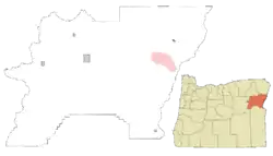 Location of Eagle Valley in Baker County, Oregon. | |
| Coordinates: 44°43′30″N 117°08′12″W | |
| Country | United States |
| Region | Eastern Oregon |
| Principal communities | Richland New Bridge Sparta |
| Area code(s) | 541 and 458 |
Located along the Snake River and its tributaries, the valley forms part of historic region of Baker County near the Idaho border. The largest community in the Eagle Valley is Richland. The unincorporated communities of New Bridge and Sparta are also located in the area of Eagle Valley.
The valley forms a relatively isolated enclave southeast of the Wallowa-Whitman National Forest. It is separated from the nearby Pine Valley. The valley is characterized by a mediterran climate that allows a long growing season for the farmers and ranchers in the area. The town of Richland is notable for its Eagle Valley Day Festival, named after the Eagle Valley.[2] Oregon Route 86 crosses the valley from Baker City into Richland, then into Halfway.[3]
References
- "Feature Detail Report for: Eagle Valley". usgs.gov. United States Geological Survey. Retrieved 18 May 2015.
- "Eagle Valley Days in Richland". Travel Oregon. Retrieved 18 May 2015.
- "Hells Canyon Scenic Byway Map". Hells Canyon Scenic Byway. Archived from the original on July 11, 2011. Retrieved 18 May 2015.
