Polk County, Oregon
Polk County is one of the 36 counties in the U.S. state of Oregon. As of the 2010 census, the population was 75,403, making it the least populous county in the Willamette Valley.[1] The county seat is Dallas.[2] The county is named for James Knox Polk, the 11th president of the United States.
Polk County | |
|---|---|
.jpg.webp) Polk County Courthouse in Dallas | |
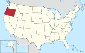
 Location within the U.S. state of Oregon | |
 Oregon's location within the U.S. | |
| Coordinates: 44°55′N 123°25′W | |
| Country | |
| State | |
| Founded | December 22, 1845 |
| Named for | James K. Polk |
| Seat | Dallas |
| Largest city | Salem (portion) |
| Area | |
| • Total | 744 sq mi (1,930 km2) |
| • Land | 741 sq mi (1,920 km2) |
| • Water | 3.1 sq mi (8 km2) 0.4%% |
| Population (2010) | |
| • Total | 75,403 |
| • Estimate (2019) | 86,085 |
| • Density | 102/sq mi (39/km2) |
| Time zone | UTC−8 (Pacific) |
| • Summer (DST) | UTC−7 (PDT) |
| Congressional district | 5th |
| Website | www |
Polk County is part of the Salem, OR Metropolitan Statistical Area, which is also included in the Portland-Vancouver-Salem, OR-WA Combined Statistical Area. It is located in the Willamette Valley.
History

The Oregon Provisional Legislature created Polk County from Yamhill District on December 22, 1845, granting to it the entire southwestern portion of present-day Oregon to the California border. County boundaries were periodically changed to reflect the creation of Benton and Lincoln counties. Many other counties were subsequently carved out of these as settlement spread towards the south, leaving Polk County many counties away from its former border with California.
The first county seat was a settlement on the north side of Rickreall Creek named Cynthian (also known as Cynthia Ann). In 1852 city officials renamed Cynthian to Dallas after Vice President George M. Dallas, vice president (1845–1849) to James Polk. During the 1880s and 1890s, there were a series of unsuccessful efforts to move the county seat to nearby Independence.
Geography
According to the U.S. Census Bureau, the county has a total area of 744 square miles (1,930 km2), of which 741 square miles (1,920 km2) is land and 3.1 square miles (8.0 km2) (0.4%) is water.[3]
About two thirds of Polk County, the western part, is forest, mostly of the coniferous and mixed varieties, bordering on temperate rain forest around Laurel Mountain, the wettest place in Oregon.[4]
The eastern half of the county lies in the Willamette Valley. The Willamette River forms the eastern border of the county, separating it from neighboring Marion County.
Adjacent counties
- Tillamook County (northwest)
- Yamhill County (north)
- Marion County (east)
- Linn County (southeast)
- Benton County (south)
- Lincoln County (west)
National protected areas
Demographics
| Historical population | |||
|---|---|---|---|
| Census | Pop. | %± | |
| 1860 | 3,625 | — | |
| 1870 | 4,701 | 29.7% | |
| 1880 | 6,601 | 40.4% | |
| 1890 | 7,858 | 19.0% | |
| 1900 | 9,923 | 26.3% | |
| 1910 | 13,469 | 35.7% | |
| 1920 | 14,181 | 5.3% | |
| 1930 | 16,858 | 18.9% | |
| 1940 | 19,989 | 18.6% | |
| 1950 | 26,317 | 31.7% | |
| 1960 | 26,523 | 0.8% | |
| 1970 | 35,349 | 33.3% | |
| 1980 | 45,203 | 27.9% | |
| 1990 | 49,541 | 9.6% | |
| 2000 | 62,380 | 25.9% | |
| 2010 | 75,403 | 20.9% | |
| 2019 (est.) | 86,085 | [5] | 14.2% |
| U.S. Decennial Census[6] 1790–1960[7] 1900–1990[8] 1990–2000[9] 2010–2019[1] | |||
2000 census
As of the census[10][11] of 2010, there were 75,403 people, 28,288 households, and 19,545 families living in the county. The population density was 102 people per square mile (39/km2). There were 30,302 housing units at an average density of 41 per square mile (16/km2). The racial makeup of the county was 85.9% White, 0.6% Black or African American, 2.1% Native American, 1.9% Asian, 0.3% Pacific Islander, 5.4% from other races, and 3.8% from two or more races. 12.1% of the population were Hispanic or Latino of any race.
There were 28,288 households, out of which 32.4% had children under the age of 18 living with them, 54.2% were married couples living together, 10.3% had a female householder with no husband present, and 30.9% were non-families. 23% of all households were made up of individuals, and 9.8% had someone living alone who was 65 years of age or older. The average household size was 2.60 and the average family size was 3.06.
In the county, the population was spread out, with 24.3% under the age of 18 and 14.8% 65 years of age or older. The median age was 37.1 years. For every 100 females, there were 94.8 males. For every 100 females age 18 and over, there were 91.8 males.
As of the 2000 census, the median income for a household in the county was $42,311, and the median income for a family was $50,483. Males had a median income of $36,667 versus $26,272 for females. The per capita income for the county was $19,282. About 6.30% of families and 11.50% of the population were below the poverty line, including 12.50% of those under age 18 and 5.50% of those age 65 or over.
2010 census
As of the 2010 United States Census, there were 75,403 people, 28,288 households, and 19,545 families living in the county.[12] The population density was 101.8 inhabitants per square mile (39.3/km2). There were 30,302 housing units at an average density of 40.9 per square mile (15.8/km2).[13] The racial makeup of the county was 85.9% white, 2.1% American Indian, 1.9% Asian, 0.6% black or African American, 0.3% Pacific islander, 5.4% from other races, and 3.8% from two or more races. Those of Hispanic or Latino origin made up 12.1% of the population.[12] In terms of ancestry, 22.4% were German, 16.4% were English, 10.4% were Irish, and 6.4% were American.[14]
Of the 28,288 households, 32.4% had children under the age of 18 living with them, 54.2% were married couples living together, 10.3% had a female householder with no husband present, 30.9% were non-families, and 23.0% of all households were made up of individuals. The average household size was 2.60 and the average family size was 3.06. The median age was 37.1 years.[12]
The median income for a household in the county was $50,975 and the median income for a family was $61,418. Males had a median income of $46,616 versus $35,371 for females. The per capita income for the county was $24,345. About 8.8% of families and 12.9% of the population were below the poverty line, including 17.2% of those under age 18 and 6.8% of those age 65 or over.[15]
Politics
Though Polk County is located in western Oregon, politically it falls in line with the eastern side of the state. The majority of registered voters who are part of a political party in Polk County, as well as most rural counties in Oregon, are members of the Republican Party.[16]
In the 2012 presidential election, 50.54 percent of Polk County voters voted for Republican Mitt Romney, while 46.21 percent voted for Democrat Barack Obama, and 3.25 percent either voted for a Third Party candidate or wrote in a candidate.[17] These numbers show a shift toward the Republican candidate when compared to the 2008 presidential election, in which 48.92% of Polk County voters voted for Republican John McCain, while 48.43 percent voted for Barack Obama, and 2.64 percent either voted for a Third Party candidate or wrote in a candidate.[18] Obama's 2008 performance was the best by a Democrat since Lyndon Johnson carried the county in 1964; the only other Democrats to ever carry Polk County have been Franklin Roosevelt in 1932 and 1936, Woodrow Wilson in 1912, and William Jennings Bryan in 1896.[19]
Presidential Elections
| Year | Republican | Democratic | Third parties |
|---|---|---|---|
| 2020 | 49.1% 23,732 | 47.5% 22,917 | 3.4% 1,642 |
| 2016 | 47.0% 18,940 | 40.8% 16,420 | 12.3% 4,935 |
| 2012 | 50.5% 17,819 | 46.2% 16,292 | 3.3% 1,146 |
| 2008 | 48.9% 17,714 | 48.4% 17,536 | 2.6% 957 |
| 2004 | 55.0% 19,508 | 43.6% 15,484 | 1.4% 497 |
| 2000 | 52.7% 14,988 | 41.9% 11,921 | 5.4% 1,540 |
| 1996 | 45.3% 11,478 | 43.2% 10,942 | 11.5% 2,911 |
| 1992 | 39.4% 10,082 | 37.3% 9,551 | 23.4% 5,981 |
| 1988 | 51.2% 10,553 | 46.7% 9,626 | 2.1% 442 |
| 1984 | 59.2% 12,678 | 40.6% 8,709 | 0.2% 45 |
| 1980 | 48.7% 10,006 | 38.2% 7,833 | 13.1% 2,692 |
| 1976 | 48.7% 8,528 | 46.4% 8,141 | 4.9% 861 |
| 1972 | 57.6% 8,985 | 37.9% 5,908 | 4.6% 716 |
| 1968 | 55.7% 6,997 | 39.5% 4,961 | 4.9% 613 |
| 1964 | 37.1% 4,319 | 62.7% 7,292 | 0.2% 18 |
| 1960 | 59.4% 6,709 | 40.5% 4,578 | 0.1% 11 |
| 1956 | 61.3% 6,404 | 38.7% 4,047 | 0.0% 0 |
| 1952 | 69.4% 6,850 | 30.2% 2,983 | 0.4% 36 |
| 1948 | 54.0% 4,328 | 43.1% 3,451 | 2.9% 233 |
| 1944 | 53.2% 3,904 | 45.2% 3,318 | 1.6% 118 |
| 1940 | 50.4% 4,211 | 48.8% 4,077 | 0.7% 60 |
| 1936 | 34.6% 2,246 | 56.9% 3,694 | 8.6% 558 |
| 1932 | 39.1% 2,548 | 56.9% 3,705 | 4.0% 261 |
| 1928 | 64.4% 3,244 | 34.3% 1,724 | 1.3% 66 |
| 1924 | 52.8% 2,755 | 31.0% 1,621 | 16.2% 847 |
| 1920 | 59.0% 2,709 | 36.0% 1,653 | 5.1% 232 |
| 1916 | 47.9% 2,899 | 47.0% 2,844 | 5.1% 311 |
| 1912 | 32.1% 1,043 | 36.9% 1,201 | 31.0% 1,008 |
| 1908 | 51.9% 1,456 | 39.7% 1,113 | 8.5% 238 |
| 1904 | 63.7% 1,380 | 24.0% 521 | 12.3% 267 |
Economy
The major industries of the county are agriculture, forest products, manufacturing, and education. Polk County has the second-largest area devoted to viticulture in Oregon, at 1,322 acres (5.35 km2). Western Oregon University in Monmouth is a major employer.
Communities
Cities
- Dallas (county seat)
- Falls City
- Independence
- Monmouth
- Salem (part)
- Willamina (part)
Census-designated places
Unincorporated communities
References
- "State & County QuickFacts". United States Census Bureau. Archived from the original on July 17, 2011. Retrieved November 15, 2013.
- "Find a County". National Association of Counties. Retrieved June 7, 2011.
- "2010 Census Gazetteer Files". United States Census Bureau. August 22, 2012. Retrieved February 28, 2015.
- "Geography & Climate". Moving To Portland. Archived from the original on February 15, 2012. Retrieved March 28, 2012.
- "Population and Housing Unit Estimates". Retrieved March 26, 2020.
- "U.S. Decennial Census". United States Census Bureau. Retrieved February 28, 2015.
- "Historical Census Browser". University of Virginia Library. Retrieved February 28, 2015.
- Forstall, Richard L., ed. (March 27, 1995). "Population of Counties by Decennial Census: 1900 to 1990". United States Census Bureau. Retrieved February 28, 2015.
- "Census 2000 PHC-T-4. Ranking Tables for Counties: 1990 and 2000" (PDF). United States Census Bureau. April 2, 2001. Retrieved February 28, 2015.
- "U.S. Census website". United States Census Bureau. Retrieved May 14, 2011.
- "Polk County, Oregon". State & County QuickFacts. United States Census Bureau. Archived from the original on July 17, 2011. Retrieved March 20, 2014.
- "DP-1 Profile of General Population and Housing Characteristics: 2010 Demographic Profile Data". United States Census Bureau. Archived from the original on February 13, 2020. Retrieved February 23, 2016.
- "Population, Housing Units, Area, and Density: 2010 – County". United States Census Bureau. Archived from the original on February 13, 2020. Retrieved February 23, 2016.
- "DP02 SELECTED SOCIAL CHARACTERISTICS IN THE UNITED STATES – 2006–2010 American Community Survey 5-Year Estimates". United States Census Bureau. Archived from the original on February 13, 2020. Retrieved February 23, 2016.
- "DP03 SELECTED ECONOMIC CHARACTERISTICS – 2006–2010 American Community Survey 5-Year Estimates". United States Census Bureau. Archived from the original on February 13, 2020. Retrieved February 23, 2016.
- "Voter Registration by County" (PDF). Oregon Secretary of State. February 2014. p. 1. Retrieved March 20, 2014.
- "November 6, 2012, General Election Abstract of Votes: United States President" (PDF). Oregon Secretary of State. Retrieved March 20, 2014.
- "November 4, 2008, General Election Abstracts of Votes: United States President" (PDF). Oregon Secretary of State. Retrieved 2014-03-20.
- Menendez, Albert J.; The Geography of Presidential Elections in the United States, 1868–2004, pp. 284–285 ISBN 0786422173
- Leip, David. "Dave Leip's Atlas of U.S. Presidential Elections". uselectionatlas.org. Retrieved April 11, 2018.
Further reading
- H.O. Lang (ed.), History of the Willamette Valley: Being a Description of the Valley and its Resources, with an Account of its Discovery and Settlement by White Men, and its Subsequent History; Together with Personal Reminiscences of its Early Pioneers. Portland: Himes and Lang, 1885.
- Portrait and Biographical Record of the Willamette Valley, Oregon, Containing Original Sketches of Many Well Known Citizens of the Past and Present. Chicago: Chapman Publishing Co., 1903.
External links
 Media related to Polk County, Oregon at Wikimedia Commons
Municipalities and communities of Polk County, Oregon, United States | ||
|---|---|---|
| Cities | Polk County map | |
| CDPs | ||
| Unincorporated communities | ||
| Indian reservation | ||
| Ghost towns | ||
| Footnotes | ‡This populated place also has portions in an adjacent county or counties | |
| ||

| Authority control |
|---|
Places adjacent to Polk County, Oregon | ||||||||||
|---|---|---|---|---|---|---|---|---|---|---|
| ||||||||||