Union County, Oregon
Union County is one of the 36 counties in the U.S. state of Oregon. As of the 2010 census, the population was 25,748.[1] Its county seat is La Grande.[2]
Union County | |
|---|---|
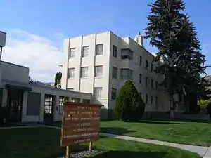 Union County Courthouse in La Grande | |
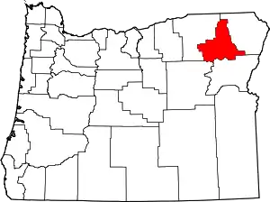 Location within the U.S. state of Oregon | |
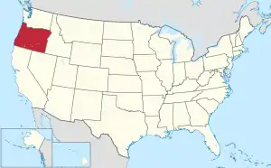 Oregon's location within the U.S. | |
| Coordinates: 45°19′38″N 118°05′36″W | |
| Country | |
| State | |
| Founded | October 14, 1864 |
| Seat | La Grande |
| Largest city | La Grande |
| Area | |
| • Total | 2,039 sq mi (5,280 km2) |
| • Land | 2,037 sq mi (5,280 km2) |
| • Water | 1.9 sq mi (5 km2) 0.1%% |
| Population (2010) | |
| • Total | 25,748 |
| • Estimate (2019) | 26,835 |
| • Density | 13/sq mi (5/km2) |
| Time zone | UTC−8 (Pacific) |
| • Summer (DST) | UTC−7 (PDT) |
| Congressional district | 2nd |
| Website | www |
Union County comprises the La Grande, OR Micropolitan Statistical Area. It is one of the eight counties of eastern Oregon.
History
According to Oregon Geographic Names, the county is named for the town of Union. Union County was originally part of Wasco County. The northern end of the Grande Ronde Valley was the first part to be settled.[3] During the 1860s, population growth in eastern Oregon prompted the State Legislature to split Umatilla and Baker Counties from Wasco County in 1862. Further settlement in the Grande Ronde Valley led to the division of Baker County to create Union County on October 14, 1864. The county doubled in population between 1880 and 1890.[3]
The choice of a county seat resulted in competition, based on geography and on economic and population growth, between La Grande and the city of Union. The county seat alternated between Union and La Grande until it permanently came to rest at La Grande in 1905. Between 1875 and 1913, adjustments were made between Union County's borders and the borders of Baker, Umatilla, and Wallowa counties.
Geography
According to the U.S. Census Bureau, the county has a total area of 2,039 square miles (5,280 km2), of which 2,037 square miles (5,280 km2) is land and 1.9 square miles (4.9 km2) (0.1%) is water.[4] The Forest Service owns 47% of the land in the county.
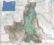
Adjacent counties
- Umatilla County (northwest)
- Wallowa County (northeast)
- Baker County (southeast)
- Grant County (southwest)
Demographics
| Historical population | |||
|---|---|---|---|
| Census | Pop. | %± | |
| 1870 | 2,552 | — | |
| 1880 | 6,550 | 156.7% | |
| 1890 | 12,044 | 83.9% | |
| 1900 | 16,070 | 33.4% | |
| 1910 | 16,191 | 0.8% | |
| 1920 | 16,636 | 2.7% | |
| 1930 | 17,492 | 5.1% | |
| 1940 | 17,399 | −0.5% | |
| 1950 | 17,962 | 3.2% | |
| 1960 | 18,180 | 1.2% | |
| 1970 | 19,377 | 6.6% | |
| 1980 | 23,921 | 23.5% | |
| 1990 | 23,598 | −1.4% | |
| 2000 | 24,530 | 3.9% | |
| 2010 | 25,748 | 5.0% | |
| 2019 (est.) | 26,835 | [5] | 4.2% |
| U.S. Decennial Census[6] 1790-1960[7] 1900-1990[8] 1990-2000[9] 2010-2019[1] | |||
2000 census
As of the census[10] of 2000, there were 24,530 people, 9,740 households, and 6,516 families living in the county. The population density was 12 people per square mile (5/km2). There were 10,603 housing units at an average density of 5 per square mile (2/km2). The racial makeup of the county was 94.29% White, 0.85% Native American, 0.85% Asian, 0.62% Pacific Islander, 0.51% Black/African American, 1.22% from other races, and 1.67% from two or more races. Hispanics and Latinos of any race constitute 2.45% of the population. 20.2% were of German, 15.5% American, 12.2% English and 10.5% Irish ancestry.
There were 9,740 households, out of which 30.00% had children under the age of 18 living with them, 55.10% were married couples living together, 8.50% had a female householder with no husband present, and 33.10% were non-families. 26.10% of all households were made up of individuals, and 10.80% had someone living alone who was 65 years of age or older. The average household size was 2.45 and the average family size was 2.94.
In the county, the population was spread out, with 24.60% under the age of 18, 12.10% from 18 to 24, 23.50% from 25 to 44, 25.00% from 45 to 64, and 14.70% who were 65 years of age or older. The median age was 38 years. For every 100 females there were 95.10 males. For every 100 females age 18 and over, there were 92.40 males.
The median income for a household in the county was $33,738, and the median income for a family was $40,520. Males had a median income of $33,028 versus $21,740 for females. The per capita income for the county was $16,907. About 8.50% of families and 13.80% of the population were below the poverty line, including 13.60% of those under age 18 and 9.50% of those age 65 or over.
2010 census
As of the 2010 United States Census, there were 25,748 people, 10,501 households, and 6,804 families living in the county.[11] The population density was 12.6 inhabitants per square mile (4.9/km2). There were 11,489 housing units at an average density of 5.6 per square mile (2.2/km2).[12] The racial makeup of the county was 93.1% white, 1.1% American Indian, 0.9% Pacific islander, 0.8% Asian, 0.5% black or African American, 1.3% from other races, and 2.3% from two or more races. Those of Hispanic or Latino origin made up 3.9% of the population.[11] In terms of ancestry, 25.2% were German, 17.8% were Irish, 17.3% were English, and 6.9% were American.[13]
Of the 10,501 households, 28.2% had children under the age of 18 living with them, 51.3% were married couples living together, 9.5% had a female householder with no husband present, 35.2% were non-families, and 27.6% of all households were made up of individuals. The average household size was 2.38 and the average family size was 2.89. The median age was 40.0 years.[11]
The median income for a household in the county was $42,162 and the median income for a family was $52,558. Males had a median income of $40,720 versus $30,373 for females. The per capita income for the county was $22,947. About 10.5% of families and 16.1% of the population were below the poverty line, including 22.6% of those under age 18 and 10.2% of those age 65 or over.[14]
Communities
Cities
- Cove
- Elgin
- Imbler
- Island City
- La Grande (county seat)
- North Powder
- Summerville
- Union
Government and politics
.gif)
Like the rest of eastern Oregon, the majority of registered voters who are part of a political party in Union County belong to the Republican Party.[15] In the 2016 presidential election, 65 percent of Union County voters voted for Republican Donald Trump, while 25 percent voted for Democrat Hillary Clinton and 10 percent of voters either voted for a Third Party candidate or wrote in a candidate.[16] These numbers show a large shift away from the Democratic party towards third party candidates when compared to the 2012 presidential election, when 63.2% of Union Country voters voted for Mitt Romney, 32.9% voted for Barack Obama, and 3.8% of voters either voted for a third party candidate or wrote in a candidate.
| Year | Republican | Democratic | Third parties |
|---|---|---|---|
| 2016 | 65.0% 8,431 | 25.1% 3,249 | 9.9% 1,288 |
| 2012 | 63.3% 7,636 | 32.9% 3,973 | 3.8% 461 |
| 2008 | 60.2% 7,581 | 36.6% 4,613 | 3.2% 400 |
| 2004 | 65.7% 8,879 | 32.8% 4,428 | 1.6% 212 |
| 2000 | 64.9% 7,836 | 29.6% 3,577 | 5.5% 663 |
| 1996 | 47.7% 5,414 | 38.6% 4,379 | 13.7% 1,552 |
| 1992 | 36.4% 4,223 | 34.4% 3,990 | 29.1% 3,375 |
| 1988 | 50.2% 5,061 | 46.4% 4,682 | 3.4% 347 |
| 1984 | 61.4% 6,645 | 38.2% 4,134 | 0.5% 50 |
| 1980 | 57.8% 6,514 | 32.6% 3,677 | 9.6% 1,081 |
| 1976 | 52.0% 5,111 | 43.5% 4,280 | 4.5% 438 |
| 1972 | 56.5% 5,073 | 36.4% 3,272 | 7.1% 640 |
| 1968 | 49.0% 3,796 | 44.0% 3,409 | 7.0% 542 |
| 1964 | 34.1% 2,553 | 65.8% 4,929 | 0.1% 7 |
| 1960 | 47.5% 3,689 | 52.5% 4,081 | 0.0% 0 |
| 1956 | 46.1% 3,749 | 53.9% 4,389 | 0.0% 0 |
| 1952 | 53.7% 4,114 | 46.0% 3,526 | 0.3% 23 |
| 1948 | 39.8% 2,668 | 56.9% 3,808 | 3.3% 222 |
| 1944 | 37.6% 2,413 | 61.5% 3,951 | 0.9% 60 |
| 1940 | 36.7% 2,642 | 62.5% 4,500 | 0.8% 54 |
| 1936 | 22.6% 1,517 | 69.2% 4,643 | 8.2% 552 |
| 1932 | 26.9% 1,705 | 70.1% 4,450 | 3.1% 195 |
| 1928 | 59.1% 3,219 | 39.6% 2,154 | 1.3% 71 |
| 1924 | 42.9% 2,428 | 32.1% 1,816 | 25.1% 1,419 |
| 1920 | 56.7% 2,844 | 37.8% 1,899 | 5.5% 277 |
| 1916 | 39.8% 2,253 | 54.5% 3,086 | 5.8% 326 |
| 1912 | 21.4% 671 | 34.8% 1,090 | 43.8% 1,373[lower-alpha 1] |
| 1908 | 50.7% 1,510 | 40.0% 1,191 | 9.4% 279 |
| 1904 | 62.9% 1,884 | 25.9% 775 | 11.3% 337 |
Oregon Legislative Assembly
Union County is located in Oregon State House District 58 which is currently represented by Greg Baretto. It is also located in Oregon State Senate District 29, represented by Bill Hansell. Both Barreto and Hansell are registered Republicans.[18]
Board of Commissioners
Union County is represented and governed by three commissioners. The Union County Board of Commissioners is currently made up of Paul Anderes, Matt Scarfo, and Donna Beverage. [19]
Economy
The initial economic interest in Union County was mining, but most of the mines were in the area annexed by Baker County in 1901. The local economy continues to be based on natural resources, including farming (wheat, fruit, vegetables, mint, and grass seed), ranching (cattle and sheep), and timber. The ridges of Pyles Canyon are the site of the Elkhorn Valley Wind Farm, owned and operated by Horizon Wind Energy and whose power is sold to Idaho Power.[20] Since October 2010, the county board of commissioners has supported a "strategic investment program" for another wind power project in Oregon, Horizon Wind Energy's proposed Antelope Ridge Wind Farm;[21] after delays due to concerns about the project's impact on wildlife,[22] the project has received support from Oregon Department of Fish and Wildlife.[23]
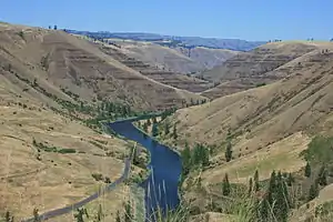
Nearby mountains and streams offer hunting, fishing, skiing, and camping, all of which attract vacationers. Attractions include the Anthony Lakes (and its ski area), Minam River, Mount Emily, Blue Mountains, Umatilla National Forest, Wallowa–Whitman National Forest (including Eagle Cap Wilderness), Catherine Creek State Park, Hilgard Junction State Recreation Area, Thief Valley Reservoir, Cove Hot Springs Pool, the Hot Lake Hotel (first built in the 1860s due to nearby hot springs), and the Eagle Cap Excursion Train.
Notable people
- John Lamoreau, former county official and author of Waging Peace: A Study in Biblical Pacifism
Notes
- The leading “other” candidate, Progressive Theodore Roosevelt, received 946 votes, while Socialist Eugene Debs received 334 votes, Prohibition candidate Eugene Chafin received 93 votes.
References
- "State & County QuickFacts". United States Census Bureau. Archived from the original on February 25, 2016. Retrieved November 15, 2013.
- "Find a County". National Association of Counties. Retrieved June 7, 2011.
- Bailey, Barbara Ruth (1982). Main Street: Northeastern Oregon. Oregon Historical Society. pp. 25–26. ISBN 0-87595-073-6.
- "2010 Census Gazetteer Files". United States Census Bureau. August 22, 2012. Retrieved February 28, 2015.
- "Population and Housing Unit Estimates". Retrieved March 26, 2020.
- "U.S. Decennial Census". United States Census Bureau. Retrieved February 28, 2015.
- "Historical Census Browser". University of Virginia Library. Retrieved February 28, 2015.
- Forstall, Richard L., ed. (March 27, 1995). "Population of Counties by Decennial Census: 1900 to 1990". United States Census Bureau. Retrieved February 28, 2015.
- "Census 2000 PHC-T-4. Ranking Tables for Counties: 1990 and 2000" (PDF). United States Census Bureau. April 2, 2001. Retrieved February 28, 2015.
- "U.S. Census website". United States Census Bureau. Retrieved January 31, 2008.
- "DP-1 Profile of General Population and Housing Characteristics: 2010 Demographic Profile Data". United States Census Bureau. Archived from the original on February 13, 2020. Retrieved February 23, 2016.
- "Population, Housing Units, Area, and Density: 2010 - County". United States Census Bureau. Archived from the original on February 13, 2020. Retrieved February 23, 2016.
- "DP02 SELECTED SOCIAL CHARACTERISTICS IN THE UNITED STATES – 2006-2010 American Community Survey 5-Year Estimates". United States Census Bureau. Archived from the original on February 13, 2020. Retrieved February 23, 2016.
- "DP03 SELECTED ECONOMIC CHARACTERISTICS – 2006-2010 American Community Survey 5-Year Estimates". United States Census Bureau. Archived from the original on February 13, 2020. Retrieved February 23, 2016.
- http://records.sos.state.or.us/ORSOSWebDrawer/Recordpdf/6812395 Retrieved 4/20/09
- http://www.union-county.org/ Retrieved 2016-12-02
- Leip, David. "Dave Leip's Atlas of U.S. Presidential Elections". uselectionatlas.org. Retrieved April 11, 2018.
- http://www.votesmart.org/search.php?search=97850&submit_lastname-zip.x=0&submit_lastname-zip.y=12 Retrieved October 22, 2009
- http://union-county.org/commissioners/ Retrieved on January 10, 2019
- "Elkhorn Valley Wind Farm". EDP Renováveis. Archived from the original on January 1, 2012. Retrieved 2012-02-02.
Elkhorn Valley Wind Farm spreads across the ridges of Pyles Canyon in Union County, Oregon... Commercial operation began in December 2007, and Idaho Power buys the wind farm's green energy.
- Proposed Antelope Ridge SIP from the county's official website as of 2012-02-02
- An impact on wildlife, an article by Charlie Gillis published April 15, 2011 by The Observer
- ODFW and EDP Renewables North America agree to a solution for the coexistence of wildlife and the proposed Antelope Ridge Wind Farm, a November 14, 2011 announcement from the website of the Oregon Department of Fish and Wildlife
External links
- Official website
- Union County graveyards from Oregon Tombstone Transcription Project
Municipalities and communities of Union County, Oregon, United States | ||
|---|---|---|
| Cities | Map of Oregon highlighting Union County | |
| Unincorporated communities | ||
| Indian reservation | ||
| Ghost town | ||
| ||

| Authority control |
|---|