Gulmi District
Gulmi District (Nepali: गुल्मी जिल्ला![]() Listen ), a part of Lumbini Province, is one of the seventy-seven districts of Nepal. The district, with Tamghas as its headquarters, covers an area of 1,149 km2 (444 sq mi), had a population of 296,654 in 2001, 280,160 in 2011 and 268,597 in 2016.[1]
Listen ), a part of Lumbini Province, is one of the seventy-seven districts of Nepal. The district, with Tamghas as its headquarters, covers an area of 1,149 km2 (444 sq mi), had a population of 296,654 in 2001, 280,160 in 2011 and 268,597 in 2016.[1]
Gulmi District
गुल्मी | |
|---|---|
District | |
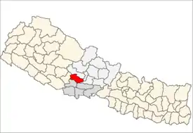
 Location of Gulmi (dark yellow) in Province 5 | |
| Country | |
| Province | Lumbini Province |
| Admin HQ. | Tamghas |
| Government | |
| • Type | Coordination committee |
| • Body | DCC, Gulmi |
| Area | |
| • Total | 1,149 km2 (444 sq mi) |
| Population (2011) | |
| • Total | 280,160 |
| • Density | 240/km2 (630/sq mi) |
| Time zone | UTC+05:45 (NPT) |
| Postal Codes | 32600 |
| Telephone Code | 079 |
| Main Language(s) | Nepali |
| Website | ddcgulmi.gov.np |
Introduction
Gulmi District is renowned for coffee and orange farming. Gulmi is rich in natural resources such as cobalt, and its natural environment attracts tourists. Local celebrations of Maghe Sankranti and other festivals are popular among both tourists and locals. Landmarks include Bichitra Cave in Dhurkot, Resunga, with its rich biodiversity and historic value, and the religious and historical sites Gyawa Kshetra, Charpala, Musikot, Isma, Wami Taksar and Purtighat. Ruru, now also known as Ridi, is a market center where many temples are situated. Dhurkot's rural municipality wards number 1 and 2, Nayagaun and Pipaldhara, are known for their orange production. They export oranges to India and also sell more than 10 crore (100 million) rupees' worth of oranges in the main market of Nepal.
The district government offices are in Tamghas, a small town situated at the bottom of two hills, Resunga and Arjun. Historically Tamghas was the first municipality established in Gulmi. Currently there are ten rural municipalities, plus the two municipalities of Resunga and Musikot.
Divisions
Gulmi district is divided into total 12 Local level bodies in which two are municipality and ten are rural municipalities[2] as below:
- Municipalities
- Rural municipalities
Communications
There are 76 post offices in the district including one main district post office and 14 area police offices. There are nine telecenters,[3] six FM radio stations, and eight cable TV networks. According to Nepal Telecom, there were 82,318 GSM mobile subscribers in the district as of 2015.
Geography and climate

| Climate Zone[4] | Elevation Range | % of Area |
|---|---|---|
| Upper Tropical | 300 to 1,000 meters 1,000 to 3,300 ft. |
23.5% |
| Subtropical | 1,000 to 2,000 meters 3,300 to 6,600 ft. |
71.9% |
| Temperate | 2,000 to 3,000 meters 6,400 to 9,800 ft. |
4.6% |
Demographics
At the time of the 2011 Nepal census, Gulmi District had a population of 280,160. Of these, 96.2% spoke Nepali, 2.0% Magar and 0.9% Newari as their first language.[5]
References
- "National Population and Housing Census 2011(National Report)" (PDF). Central Bureau of Statistics. Government of Nepal. November 2012. Archived from the original (PDF) on 2013-05-25. Retrieved November 2012. Check date values in:
|access-date=(help) - "स्थानीय तहहरुको विवरण" [Details of the local level bodies]. www.mofald.gov.np/en (in Nepali). Ministry of Federal Affairs and Local Development. Retrieved 17 July 2018.
- "Telecenters in Nepal". TechSansar. Retrieved October 18, 2015.
- The Map of Potential Vegetation of Nepal - a forestry/agroecological/biodiversity classification system (PDF), . Forest & Landscape Development and Environment Series 2-2005 and CFC-TIS Document Series No.110., 2005, ISBN 87-7903-210-9, retrieved Nov 22, 2013
- 2011 Nepal Census, Social Characteristics Tables
| Wikimedia Commons has media related to Gulmi District. |