South Salmara district
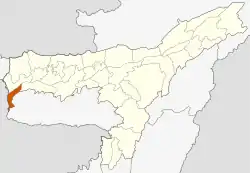
South Salmara Mankachar is an administrative district in the state of Assam in India. The district headquarters are located at Hatsingimari village which is situated at about 245 km from Guwahati. It was earlier a sub-division of the Dhubri District.
South Salmara Mankachar district | |
|---|---|
 | |
| Coordinates: 25.68°N 89.98°E | |
| Country | |
| State | Assam |
| Division | Lower Assam |
| Headquarters | Hatsingimari |
| Area | |
| • Total | 568 km2 (219 sq mi) |
| Population (2011) | |
| • Total | 555,114 |
| • Density | 980/km2 (2,500/sq mi) |
| Time zone | UTC+05:30 (IST) |
| ISO 3166 code | IN-AS |
| Vehicle registration | AS-34 |
Etymology
The name South Salmara Mankachar comes from the Legislative constituency South Salmara.
History
South Salmara Mankachar was created by bifurcating Old Dhubri district in 2016. On 15 August 2015 Assam's Chief Minister Tarun Gogoi announced 5 new administrative district in Assam; South Salmara Mankachar was one among those. On 9 February 2016 Commissioner, Lower Assam and Central Assam Division Md. Mahtab Uddin Ahmed, IAS inaugurated South Salmara Mankachar as an administrative district at a function in Hatsingimari with the presence of thousands of people.There are few historical sites in the district. However, the famous ones are the tomb of Mir Jumla and Kamakhya Temple at Mankachar.
Geography
South Salmara Mankacahr district occupies an area of 568 square kilometres (219 sq mi). It occupies 980/km 2 (2,500/sq mi) of density and is an administrative district in the state of Assam in India. The district headquarters are located at Hatsingimari town which is situated at about 245 km from Guwahati, the state capital. Earlier it was a sub-division of Dhubri District. It shares its borders with Bangladesh in the west and Meghalaya in the south-east.The general topography of South Salmara Mankachar district is plain with patches of small hillocks like Bansali, Rangatari, etc. All these are situated in the southwestern part of the district. Mighty river Brahmaputra is flowing through this district from east to west with its tributaries. Other rivers are Jinjiram, Kalonadi (also known as Ganol) etc. The average annual rainfall of the district is 2,916 mm.
Economy
South Salmara Mankachar District is primarily dependent on agricultural and forest products. The main source of income is paddy (both winter and autumn) with surplus production. Jute and mustard seed occupy the major share of cash crops. Wheat, maize, pulses and sugarcane are also grown moderately. From forest, mainly timber and bamboo add to the income, though boulders and sand are also available. Fish, milk, meat, and eggs have small contributions to the economy. Currently, three tea gardens, whose contribution to the district economy is almost negligible, cover an area of 1362.33 hectares. Land revenue collection is minimal, whereas tax from check gates and excise duty occupy much of the government exchequer. Devoid of major industrial production, the district uses more funds for administration, development, and welfare works than it provides.
Its rich natural wealth is yet to be explored and some believe that proper utilisation of natural resources could provide a boost for the struggling economy.
Divisions
There are one Sub-Division(Sadar) and 2 Revenue Circles:
- South Salmara Revenue Circle Office
- Hatsingimari (Sadar)
- Mankachar Revenue Circle Office
There is a Census Town: Mankachar.
The district has 3 police stations.
There are two Assam Legislative Assembly constituencies in this district: 21 Mankachar, 22 South Salmara.[1] All two are in the Dhubri Lok Sabha constituency.[2]
Demographics
Religion in South Salmara district
About 95.2% population are Muslims, 4.5% are Hindu and rest 0.3% are Christians and Sikhs.
Education
There are several renowned govt. and private schools and colleges in the district. Some of them are:-
- South Salmara College, South Salmara
- Rani Bhavani priya Higher Secondary School, South Salmara
- South Salmara Junior College, South Salmara
- Mankachar College, Mankachar
- Sarbajanin Hatsingimari Jatiya Vidyalaya,
- Rainbow English Academy, Hatsingimari
- Hatsingimari Science Academy,Hatsingimari
- Magnet Academy , Hatsingimari
- Assam Professional Academy, Hatsingimari
- Namoni Axam Jatiya Vidyalaya
- Shankar Azaan Jatiya Vidyalaya
- Elite Academy
- Hatsingimari Junior College, Hatsingimari
- Hatsingimari College,Hatsingimari
- Vision National Academy, Kharuabandha
- Apollo Academy, Hatsingimari
- Elegant English Academy,Hatsingimari
- Ajmal college of arts & science, Hatsingimari
Moreover, there are many private coaching and tuition classes in this place. Students from Meghalaya and other parts of the district comes here for their schooling.
Culture
The culture of the people in this district is a fusion of Assamese and Bengali cultures.Most of the people speak Tangaili Bangla (East Bengal Dialect) and few people speak Goalparia dialect. Those who speak Goalparia dialect are called Ujani and those who speak Tangaili Bengali are called Bhatiya in the district. There are few differences between the Ujani and Bhatiya cultures. Both of Ujani and Bhatiya use Assamese as their mother language Ghoti and Tribal peoples, who are few in numbers also like Hajong and Garos contribute to the culture of the district. The man of the district wear pant,paijama andKurtas and the women ware Saree as their traditional dress.
Transport
Airway
Nearest airport at Rupshi which is about 72.8 km away from the headquarter Hatsingimari . It was constructed during World War II by the British Govt. mainly for military purpose. Till 1983, the Indian Airlines and some private commercial flights operated regularly between Calcutta, Guwahati and Dhubri. Now it is totally closed. However, recently the ministry of DONER, GOI, has taken some initiative to renovate and functionalise the airport.
Waterway
The town had a very busy river port on the bank of the Brahmaputra, which was used as an international trade centre with the neighbouring countries, especially in the British era. At present, the port is lying idle. However, small ferries transport people to and fro Dhubri every day.
Railway
There is no Railway station in the district.
Road
There is no National Highway in the district. Transportation takes place through state maintained pwd roads, which are full of potholes. Hatsingimari is in the centre place in the District while one part of Hatsingimari town is attached with Assam-Meghalaya border. There is no PWD road between South Salmara and Mankachar. only overland communication from South Salmara to Mankachar is Fulbari–Singimari road through Meghalaya.
Town
Mankachar is the only town in the District other than the district capital.
References
- "List of Assembly Constituencies showing their Revenue & Election District wise break - up" (PDF). Chief Electoral Officer, Assam website. Archived from the original (PDF) on 22 March 2012. Retrieved 26 September 2011.
- "List of Assembly Constituencies showing their Parliamentary Constituencies wise break - up" (PDF). Chief Electoral Officer, Assam website. Archived from the original (PDF) on 22 March 2012. Retrieved 26 September 2011.
- "C-16 Population By Mother Tongue - South Salmara". censusindia.gov.in. Retrieved 16 August 2020.