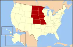
West North Central states
The West North Central states form one of the nine geographic subdivisions within the United States that are officially recognized by the U.S. Census Bureau.
West North Central Region | |
|---|---|
 | |
| Composition | |
| Metropolitan areas | |
| Largest city | Minneapolis-St. Paul, MN |
| Area | |
| • Total | 507,913 sq mi (1,315,490 km2) |
| Population (2010 est.) | |
| • Total | 20,505,437 |
| • Density | 40/sq mi (16/km2) |
Seven states compose the division: Iowa, Kansas, Minnesota, Missouri, Nebraska, North Dakota and South Dakota and it makes up the western half of the United States Census Bureau's larger region of the Midwest, the eastern half of which consists of the East North Central states of Illinois, Indiana, Michigan, Ohio and Wisconsin.[1] The Mississippi River marks the bulk of the boundary between these two divisions.
The West North Central states are regarded as constituting the core of the nation's "Farm Belt." Another name popularly applied to the division is the "Agricultural Heartland," or simply the "Heartland."
Since the early 1990s, the West North Central division has consistently had the lowest unemployment rate in the United States (especially in its many college towns), and has also been noted for its plentiful supply of affordable housing.
As of 2010, the West North Central states had a combined population of 20,505,437. This number is a 6.6% increase from 19,237,739 in 2000. The West North Central region covers 507,913 square miles (1,315,489 km2) of land, and has an average population density of 40.37 people per square mile.
| State | 2010 est. | Land area |
|---|---|---|
| Iowa | 3,090,416 | 56,272 |
| Kansas | 2,893,957 | 82,277 |
| Minnesota | 5,420,380 | 86,939 |
| Missouri | 6,044,171 | 69,709 |
| Nebraska | 1,868,516 | 77,354 |
| North Dakota | 723,393 | 70,700 |
| South Dakota | 844,877 | 77,116 |
| City | 2010 Pop. | |
|---|---|---|
| 1 | Kansas City, Missouri | 467,007 |
| 2 | Omaha, Nebraska | 434,353 |
| 3 | Minneapolis, Minnesota | 400,070 |
| 4 | Wichita, Kansas | 386,552 |
| 5 | St. Louis, Missouri | 318,416 |
| 6 | St. Paul, Minnesota | 294,873 |
| 7 | Lincoln, Nebraska | 268,738 |
| 8 | Des Moines, Iowa | 207,510 |
| 9 | Overland Park, Kansas | 181,260 |
| 10 | Sioux Falls, South Dakota | 164,676 |
| 1 | Twin Cities (MN-WI) | 3,459,146 |
| 2 | St. Louis, MO-IL | 2,810,056 |
| 3 | Kansas City, Missouri-KS | 2,035,334 |
| 4 | Omaha, Nebraska-IA | 865,350 |
| 5 | Wichita, Kansas | 623,061 |
| 6 | Des Moines, Iowa | 580,255 |
| 7 | Springfield, Missouri | 436,712 |
| 8 | Quad Cities IA-IL (Davenport) | 382,630 |
| 9 | Lincoln, Nebraska | 302,157 |
| 10 | Duluth, MN-WI | 279,771 |
Politics
| Parties | |||||
| Democratic-Republican | Democratic | Republican | Liberal Republican | Populist | Progressive |
- Bold denotes election winner.
Notes
- † McCain and Trump won the overall state, but Barack Obama won Nebraska's 2nd congressional district in the 2008 election, while Joe Biden won it in the 2020 election.
See also
References
- Statistical Abstract of the United States 1995 (PDF) (Report). U.S. Bureau of the Census. 1995. Retrieved April 9, 2020.