Beaufort-en-Santerre
Beaufort-en-Santerre is a commune in the Somme department in Hauts-de-France in northern France.
Beaufort-en-Santerre | |
|---|---|
_1.jpg.webp) The church in Beaufort-en-Santerre | |
Location of Beaufort-en-Santerre 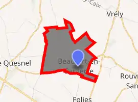
| |
 Beaufort-en-Santerre  Beaufort-en-Santerre | |
| Coordinates: 49°46′34″N 2°40′09″E | |
| Country | France |
| Region | Hauts-de-France |
| Department | Somme |
| Arrondissement | Péronne |
| Canton | Moreuil |
| Intercommunality | CC Terre de Picardie |
| Government | |
| • Mayor (2001–2008) | Claude Morel |
| Area 1 | 4.59 km2 (1.77 sq mi) |
| Population (2017-01-01)[1] | 204 |
| • Density | 44/km2 (120/sq mi) |
| Time zone | UTC+01:00 (CET) |
| • Summer (DST) | UTC+02:00 (CEST) |
| INSEE/Postal code | 80067 /80170 |
| Elevation | 84–98 m (276–322 ft) (avg. 90 m or 300 ft) |
| 1 French Land Register data, which excludes lakes, ponds, glaciers > 1 km2 (0.386 sq mi or 247 acres) and river estuaries. | |
Geography
The commune is situated on the junction of the D329 and D161 roads, 25 kilometres (16 mi) southeast of Amiens.
Population
| Year | 1962 | 1968 | 1975 | 1982 | 1990 | 1999 | 2006 |
|---|---|---|---|---|---|---|---|
| Population | 93 | 103 | 95 | 116 | 133 | 138 | 161 |
| From the year 1962 on: No double counting—residents of multiple communes (e.g. students and military personnel) are counted only once. | |||||||
References
- "Populations légales 2017". INSEE. Retrieved 6 January 2020.
| Wikimedia Commons has media related to Beaufort-en-Santerre. |
| Authority control |
|---|
This article is issued from Wikipedia. The text is licensed under Creative Commons - Attribution - Sharealike. Additional terms may apply for the media files.