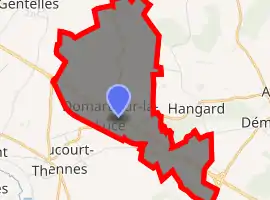
Domart-sur-la-Luce
Domart-sur-la-Luce is a commune in the Somme department in Hauts-de-France in northern France.
Domart-sur-la-Luce | |
|---|---|
_France_(2).JPG.webp) The town hall in Domart-sur-la-Luce | |
 Coat of arms | |
Location of Domart-sur-la-Luce 
| |
 Domart-sur-la-Luce  Domart-sur-la-Luce | |
| Coordinates: 49°49′01″N 2°28′59″E | |
| Country | France |
| Region | Hauts-de-France |
| Department | Somme |
| Arrondissement | Montdidier |
| Canton | Moreuil |
| Intercommunality | CC Avre Luce Noye |
| Government | |
| • Mayor (2001–2008) | Jacques Marquet |
| Area 1 | 8.59 km2 (3.32 sq mi) |
| Population (2017-01-01)[1] | 419 |
| • Density | 49/km2 (130/sq mi) |
| Time zone | UTC+01:00 (CET) |
| • Summer (DST) | UTC+02:00 (CEST) |
| INSEE/Postal code | 80242 /80110 |
| Elevation | 32–104 m (105–341 ft) (avg. 46 m or 151 ft) |
| 1 French Land Register data, which excludes lakes, ponds, glaciers > 1 km2 (0.386 sq mi or 247 acres) and river estuaries. | |
Geography
The commune is situated on the D934 road, on the banks of the Luce, some 14 miles (23 km) southeast of Amiens.
Population
| Year | 1962 | 1968 | 1975 | 1982 | 1990 | 1999 | 2006 |
|---|---|---|---|---|---|---|---|
| Population | 241 | 264 | 261 | 338 | 375 | 425 | 425 |
| From the year 1962 on: No double counting—residents of multiple communes (e.g. students and military personnel) are counted only once. | |||||||
History
Domart is sited on an old Roman road, known as the ‘chaussée d'Agrippa’ (Agrippa way), named after the general and politician. The road ran between Amiens and Noyon.
Known from writings of 1105, the first seigneur of Domart appears in 1154, called Ibert or Aubert. His château, now all but disappeared, was home to the seigneurs of Domart until the end of the 18th century, as well as to the Princes of Savoy.
At the time of the French Revolution, there were nearly 700 inhabitants of Domart. As with so many villages in this area of France, Domart was practically destroyed during World War I.
See also
References
- "Populations légales 2017". INSEE. Retrieved 6 January 2020.
| Wikimedia Commons has media related to Domart-sur-la-Luce. |
