Pont-Noyelles
Pont-Noyelles is a commune in the Somme department in Hauts-de-France in northern France.
Pont-Noyelles | |
|---|---|
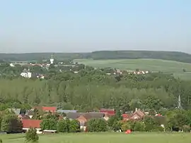 A general view of Pont-Noyelles | |
Location of Pont-Noyelles 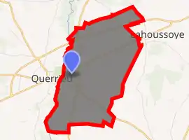
| |
 Pont-Noyelles  Pont-Noyelles | |
| Coordinates: 49°56′27″N 2°26′31″E | |
| Country | France |
| Region | Hauts-de-France |
| Department | Somme |
| Arrondissement | Amiens |
| Canton | Corbie |
| Intercommunality | CC Val de Somme |
| Government | |
| • Mayor (2001–2008) | Jacky Durier |
| Area 1 | 8.62 km2 (3.33 sq mi) |
| Population (2017-01-01)[1] | 840 |
| • Density | 97/km2 (250/sq mi) |
| Time zone | UTC+01:00 (CET) |
| • Summer (DST) | UTC+02:00 (CEST) |
| INSEE/Postal code | 80634 /80115 |
| Elevation | 32–123 m (105–404 ft) (avg. 60 m or 200 ft) |
| 1 French Land Register data, which excludes lakes, ponds, glaciers > 1 km2 (0.386 sq mi or 247 acres) and river estuaries. | |
Geography
The commune is situated at the junction of the D929, D30 and D115 roads, some 8 miles (13 km) northeast of Amiens, in the valley of the small river Hallue.
Population
| Year | Pop. | ±% p.a. |
|---|---|---|
| 1968 | 326 | — |
| 1975 | 538 | +7.42% |
| 1982 | 715 | +4.15% |
| 1990 | 800 | +1.41% |
| 1999 | 789 | −0.15% |
| 2007 | 726 | −1.03% |
| 2012 | 781 | +1.47% |
| 2017 | 840 | +1.47% |
| Source: INSEE[2] | ||
History
Pont-Noyelles was the scene of one of the battles of the Franco-Prussian War. On 23 and 24 December 1870, French troops, led by Colonel Louis Faidherbe routed German forces led by Edwin Freiherr von Manteuffel at the Battle of Hallue. A memorial at the site of the General's headquarters commemorates the battle.
See also
References
- "Populations légales 2017". INSEE. Retrieved 6 January 2020.
- Population en historique depuis 1968, INSEE
| Wikimedia Commons has media related to Pont-Noyelles. |
| Authority control |
|
|---|
This article is issued from Wikipedia. The text is licensed under Creative Commons - Attribution - Sharealike. Additional terms may apply for the media files.