Thièvres, Somme
Thièvres is a commune in the Somme department in Hauts-de-France in northern France.
Thièvres | |
|---|---|
.JPG.webp) The town hall in Thièvres | |
Location of Thièvres 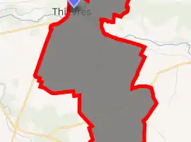
| |
 Thièvres  Thièvres | |
| Coordinates: 50°07′44″N 2°27′15″E | |
| Country | France |
| Region | Hauts-de-France |
| Department | Somme |
| Arrondissement | Péronne |
| Canton | Albert |
| Intercommunality | Pays du Coquelicot |
| Government | |
| • Mayor (2001–2008) | Max Coffigniez |
| Area 1 | 1.26 km2 (0.49 sq mi) |
| Population (2017-01-01)[1] | 62 |
| • Density | 49/km2 (130/sq mi) |
| Time zone | UTC+01:00 (CET) |
| • Summer (DST) | UTC+02:00 (CEST) |
| INSEE/Postal code | 80756 /80560 |
| Elevation | 70–136 m (230–446 ft) (avg. 73 m or 240 ft) |
| 1 French Land Register data, which excludes lakes, ponds, glaciers > 1 km2 (0.386 sq mi or 247 acres) and river estuaries. | |
Geography
The commune is situated 17 miles (27 km) north of Amiens, on the D1 road. The village Thièvres is divided between two communes: one part in the Somme department and the other, larger part in the Pas-de-Calais department (Thièvres, Pas-de-Calais). The nineteenth-century church was built in the territory of the Pas-de-Calais.
Thièvres also stands at the confluence of the rivers Authie and Kilienne.
Population
| Year | Pop. | ±% p.a. |
|---|---|---|
| 1968 | 70 | — |
| 1975 | 54 | −3.64% |
| 1982 | 55 | +0.26% |
| 1990 | 46 | −2.21% |
| 1999 | 44 | −0.49% |
| 2007 | 52 | +2.11% |
| 2012 | 59 | +2.56% |
| 2017 | 62 | +1.00% |
| Source: INSEE[2] | ||
See also
References
- "Populations légales 2017". INSEE. Retrieved 6 January 2020.
- Population en historique depuis 1968, INSEE
| Wikimedia Commons has media related to Thièvres (Somme). |
This article is issued from Wikipedia. The text is licensed under Creative Commons - Attribution - Sharealike. Additional terms may apply for the media files.