Laviéville
Laviéville is a commune in the Somme department in Hauts-de-France in northern France.
Laviéville | |
|---|---|
.JPG.webp) The town hall in Laviéville | |
Location of Laviéville 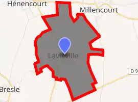
| |
 Laviéville  Laviéville | |
| Coordinates: 49°59′30″N 2°34′36″E | |
| Country | France |
| Region | Hauts-de-France |
| Department | Somme |
| Arrondissement | Péronne |
| Canton | Albert |
| Intercommunality | Pays du Coquelicot |
| Government | |
| • Mayor (2001–2008) | Michel Watelain |
| Area 1 | 2.15 km2 (0.83 sq mi) |
| Population (2017-01-01)[1] | 171 |
| • Density | 80/km2 (210/sq mi) |
| Time zone | UTC+01:00 (CET) |
| • Summer (DST) | UTC+02:00 (CEST) |
| INSEE/Postal code | 80468 /80300 |
| Elevation | 72–107 m (236–351 ft) (avg. 100 m or 330 ft) |
| 1 French Land Register data, which excludes lakes, ponds, glaciers > 1 km2 (0.386 sq mi or 247 acres) and river estuaries. | |
Geography
The commune is situated on the D119 road, some 16 miles (26 km) northeast of Amiens.
Population
| Year | 1962 | 1968 | 1975 | 1982 | 1990 | 1999 | 2006 |
|---|---|---|---|---|---|---|---|
| Population | 98 | 104 | 126 | 129 | 136 | 134 | 154 |
| From the year 1962 on: No double counting—residents of multiple communes (e.g. students and military personnel) are counted only once. | |||||||
See also
References
- "Populations légales 2017". INSEE. Retrieved 6 January 2020.
| Wikimedia Commons has media related to Laviéville (Somme). |
| Authority control |
|---|
This article is issued from Wikipedia. The text is licensed under Creative Commons - Attribution - Sharealike. Additional terms may apply for the media files.