Martainneville
Martainneville is a commune in the Somme department in Hauts-de-France in northern France.
Martainneville | |
|---|---|
.JPG.webp) The town hall and school in Martainneville | |
 Coat of arms | |
Location of Martainneville 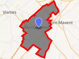
| |
 Martainneville  Martainneville | |
| Coordinates: 50°00′03″N 1°42′27″E | |
| Country | France |
| Region | Hauts-de-France |
| Department | Somme |
| Arrondissement | Abbeville |
| Canton | Gamaches |
| Intercommunality | CC Aumale - Blangy-sur-Bresle |
| Government | |
| • Mayor (2001–2008) | Jean-Jacques Nantois |
| Area 1 | 7.58 km2 (2.93 sq mi) |
| Population (2017-01-01)[1] | 422 |
| • Density | 56/km2 (140/sq mi) |
| Time zone | UTC+01:00 (CET) |
| • Summer (DST) | UTC+02:00 (CEST) |
| INSEE/Postal code | 80518 /80140 |
| Elevation | 84–114 m (276–374 ft) (avg. 98 m or 322 ft) |
| 1 French Land Register data, which excludes lakes, ponds, glaciers > 1 km2 (0.386 sq mi or 247 acres) and river estuaries. | |
Geography
Martainneville is situated on the D190 road, some 10 miles (16 km) southwest of Abbeville. The railway line, opened in 1872, that moved both freight and passengers, is now closed (in 1993).[2]
Population
| Year | Pop. | ±% p.a. |
|---|---|---|
| 1968 | 400 | — |
| 1975 | 384 | −0.58% |
| 1982 | 334 | −1.97% |
| 1990 | 321 | −0.50% |
| 1999 | 343 | +0.74% |
| 2007 | 379 | +1.26% |
| 2012 | 424 | +2.27% |
| 2017 | 422 | −0.09% |
| Source: INSEE[3] | ||
See also
References
- "Populations légales 2017". INSEE. Retrieved 6 January 2020.
- "Source:Fcvnet". Archived from the original on 2012-02-10. Retrieved 2008-03-04.
- Population en historique depuis 1968, INSEE
This article is issued from Wikipedia. The text is licensed under Creative Commons - Attribution - Sharealike. Additional terms may apply for the media files.
