Fouencamps
Fouencamps is a commune in the Somme department in Hauts-de-France in northern France.
Fouencamps | |
|---|---|
 The church in Fouencamps | |
Location of Fouencamps 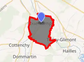
| |
 Fouencamps  Fouencamps | |
| Coordinates: 49°49′33″N 2°24′31″E | |
| Country | France |
| Region | Hauts-de-France |
| Department | Somme |
| Arrondissement | Montdidier |
| Canton | Ailly-sur-Noye |
| Intercommunality | CC Avre Luce Noye |
| Government | |
| • Mayor (2001–2008) | Yves-Robert Leconte |
| Area 1 | 3.65 km2 (1.41 sq mi) |
| Population (2017-01-01)[1] | 208 |
| • Density | 57/km2 (150/sq mi) |
| Time zone | UTC+01:00 (CET) |
| • Summer (DST) | UTC+02:00 (CEST) |
| INSEE/Postal code | 80337 /80440 |
| Elevation | 27–99 m (89–325 ft) (avg. 85 m or 279 ft) |
| 1 French Land Register data, which excludes lakes, ponds, glaciers > 1 km2 (0.386 sq mi or 247 acres) and river estuaries. | |
Geography
Fouencamps is situated along the D90 road, some 7 miles (11 km) southeast of Amiens, between two small rivers that flow into the river Somme
Population
| Year | 1962 | 1968 | 1975 | 1982 | 1990 | 1999 | 2006 |
|---|---|---|---|---|---|---|---|
| Population | 213 | 219 | 196 | 184 | 214 | 239 | 233 |
| From the year 1962 on: No double counting—residents of multiple communes (e.g. students and military personnel) are counted only once. | |||||||
Places of interest
See also
References
- "Populations légales 2017". INSEE. Retrieved 6 January 2020.
| Wikimedia Commons has media related to Fouencamps. |
| Authority control |
|---|
This article is issued from Wikipedia. The text is licensed under Creative Commons - Attribution - Sharealike. Additional terms may apply for the media files.
