Guyencourt-sur-Noye
Guyencourt-sur-Noye is a commune in the Somme department in Hauts-de-France in northern France.
Guyencourt-sur-Noye | |
|---|---|
_1.jpg.webp) The church in Guyencourt-sur-Noye | |
Location of Guyencourt-sur-Noye 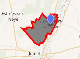
| |
 Guyencourt-sur-Noye  Guyencourt-sur-Noye | |
| Coordinates: 49°46′51″N 2°22′18″E | |
| Country | France |
| Region | Hauts-de-France |
| Department | Somme |
| Arrondissement | Montdidier |
| Canton | Ailly-sur-Noye |
| Intercommunality | CC Avre Luce Noye |
| Government | |
| • Mayor (2001–2008) | Henri Moser |
| Area 1 | 3.81 km2 (1.47 sq mi) |
| Population (2017-01-01)[1] | 177 |
| • Density | 46/km2 (120/sq mi) |
| Time zone | UTC+01:00 (CET) |
| • Summer (DST) | UTC+02:00 (CEST) |
| INSEE/Postal code | 80403 /80250 |
| Elevation | 37–115 m (121–377 ft) (avg. 45 m or 148 ft) |
| 1 French Land Register data, which excludes lakes, ponds, glaciers > 1 km2 (0.386 sq mi or 247 acres) and river estuaries. | |
Geography
The commune is situated on the D116 road, by the banks of the river Noye, some 10 miles (16 km) south of Amiens.
History
In 1692, the village name was written as Guiencourt.
Prehistoric flint tools have been found in the vicinity
Population
| Year | 1896 | 1962 | 1968 | 1975 | 1982 | 1990 | 1999 | 2006 |
|---|---|---|---|---|---|---|---|---|
| Population | 207 | 136 | 147 | 175 | 186 | 196 | 201 | 179 |
| From the year 1962 on: No double counting—residents of multiple communes (e.g. students and military personnel) are counted only once. | ||||||||
See also
References
- "Populations légales 2017". INSEE. Retrieved 6 January 2020.
| Wikimedia Commons has media related to Guyencourt-sur-Noye. |
| Authority control |
|---|
This article is issued from Wikipedia. The text is licensed under Creative Commons - Attribution - Sharealike. Additional terms may apply for the media files.