Le Plessier-Rozainvillers
Le Plessier-Rozainvillers is a commune in the Somme department in Hauts-de-France in northern France.
Le Plessier-Rozainvillers | |
|---|---|
_France_(2).JPG.webp) The town hall and school in Le Plessier-Rozainvillers | |
Location of Le Plessier-Rozainvillers 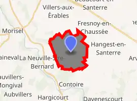
| |
 Le Plessier-Rozainvillers  Le Plessier-Rozainvillers | |
| Coordinates: 49°45′03″N 2°33′14″E | |
| Country | France |
| Region | Hauts-de-France |
| Department | Somme |
| Arrondissement | Montdidier |
| Canton | Moreuil |
| Intercommunality | CC Avre Luce Noye |
| Government | |
| • Mayor (2001–2008) | Pierre Viltart |
| Area 1 | 10.17 km2 (3.93 sq mi) |
| Population (2017-01-01)[1] | 755 |
| • Density | 74/km2 (190/sq mi) |
| Time zone | UTC+01:00 (CET) |
| • Summer (DST) | UTC+02:00 (CEST) |
| INSEE/Postal code | 80628 /80110 |
| Elevation | 53–109 m (174–358 ft) (avg. 103 m or 338 ft) |
| 1 French Land Register data, which excludes lakes, ponds, glaciers > 1 km2 (0.386 sq mi or 247 acres) and river estuaries. | |
Geography
The commune is situated on the D137 and D54 crossroads, 32 kilometres (20 mi) southeast of Amiens.
Population
| Year | 1962 | 1968 | 1975 | 1982 | 1990 | 1999 | 2006 |
|---|---|---|---|---|---|---|---|
| Population | 576 | 632 | 624 | 577 | 582 | 566 | 607 |
| From the year 1962 on: No double counting—residents of multiple communes (e.g. students and military personnel) are counted only once. | |||||||
See also
References
- "Populations légales 2017". INSEE. Retrieved 6 January 2020.
| Wikimedia Commons has media related to Le Plessier-Rozainvillers. |
| Authority control |
|---|
This article is issued from Wikipedia. The text is licensed under Creative Commons - Attribution - Sharealike. Additional terms may apply for the media files.