Domléger-Longvillers
Domléger-Longvillers is a commune in the Somme department in Hauts-de-France in northern France.
Domléger-Longvillers | |
|---|---|
.JPG.webp) The church in Longvillers | |
Location of Domléger-Longvillers 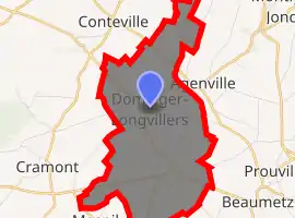
| |
 Domléger-Longvillers  Domléger-Longvillers | |
| Coordinates: 50°09′40″N 2°05′12″E | |
| Country | France |
| Region | Hauts-de-France |
| Department | Somme |
| Arrondissement | Amiens |
| Canton | Doullens |
| Intercommunality | CC Territoire Nord Picardie |
| Government | |
| • Mayor (2001–2008) | Jocelyne Lombart |
| Area 1 | 8.91 km2 (3.44 sq mi) |
| Population (2017-01-01)[1] | 302 |
| • Density | 34/km2 (88/sq mi) |
| Time zone | UTC+01:00 (CET) |
| • Summer (DST) | UTC+02:00 (CEST) |
| INSEE/Postal code | 80245 /80370 |
| Elevation | 100–142 m (328–466 ft) (avg. 141 m or 463 ft) |
| 1 French Land Register data, which excludes lakes, ponds, glaciers > 1 km2 (0.386 sq mi or 247 acres) and river estuaries. | |
Its inhabitants are called Domlégeois and Domlégeoises.[2]
Geography
The commune is situated on the D267 and D46 crossroads, some 16 miles (26 km) northeast of Abbeville.
Its surrounded by the common Agenville, Cramont and Conteville, Domléger-Longvillers is located 19 km north-east of Abbeville's largest city nearby.[3]
Population
| Year | 1962 | 1968 | 1975 | 1982 | 1990 | 1999 | 2006 |
|---|---|---|---|---|---|---|---|
| Population | 354 | 372 | 312 | 255 | 257 | 267 | 276 |
| From the year 1962 on: No double counting—residents of multiple communes (e.g. students and military personnel) are counted only once. | |||||||
See also
References
- "Populations légales 2017". INSEE. Retrieved 6 January 2020.
- "Annuaire-mairie"
- "Annuaire-Mairie"
| Wikimedia Commons has media related to Domléger-Longvillers. |
| Authority control |
|---|
This article is issued from Wikipedia. The text is licensed under Creative Commons - Attribution - Sharealike. Additional terms may apply for the media files.