Courcelette
Courcelette is a commune in the Somme department in Hauts-de-France in northern France.
Courcelette | |
|---|---|
 | |
Location of Courcelette 
| |
 Courcelette  Courcelette | |
| Coordinates: 50°03′32″N 2°44′52″E | |
| Country | France |
| Region | Hauts-de-France |
| Department | Somme |
| Arrondissement | Péronne |
| Canton | Albert |
| Intercommunality | Pays du Coquelicot |
| Government | |
| • Mayor (2020–2026) | Michel Dacheux |
| Area 1 | 4.66 km2 (1.80 sq mi) |
| Population (2017-01-01)[1] | 154 |
| • Density | 33/km2 (86/sq mi) |
| Time zone | UTC+01:00 (CET) |
| • Summer (DST) | UTC+02:00 (CEST) |
| INSEE/Postal code | 80216 /80300 |
| Elevation | 109–156 m (358–512 ft) (avg. 150 m or 490 ft) |
| 1 French Land Register data, which excludes lakes, ponds, glaciers > 1 km2 (0.386 sq mi or 247 acres) and river estuaries. | |
Geography
Courcelette is situated on the D929 and D107 crossroads, some 30 miles (48 km) northeast of Amiens.
History
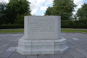
Courcelette was a major tactical objective in the Battle of Flers-Courcelette during the Somme Offensive of the First World War during which the village was razed. The village was assigned as the major objective of the Canadian Corps during that battle and they succeeded in capturing it. Accordingly, the actions and sacrifices of the Canadians are commemorated at the Courcelette Memorial which is just south of the village beside the D929 roadway.
Population
| Year | 1962 | 1968 | 1975 | 1982 | 1990 | 1999 | 2006 | 2014 |
|---|---|---|---|---|---|---|---|---|
| Population | 158 | 180 | 176 | 150 | 142 | 133 | 141 | 149 |
| From the year 1962 on: No double counting—residents of multiple communes (e.g. students and military personnel) are counted only once. | ||||||||
References
- "Populations légales 2017". INSEE. Retrieved 6 January 2020.
| Wikimedia Commons has media related to Courcelette. |
| Authority control |
|
|---|
This article is issued from Wikipedia. The text is licensed under Creative Commons - Attribution - Sharealike. Additional terms may apply for the media files.