Rambures
Rambures is a commune in the Somme department in Hauts-de-France in northern France.
Rambures | |
|---|---|
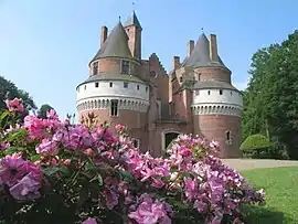 The chateau in Rambures | |
 Coat of arms | |
Location of Rambures 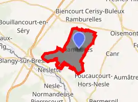
| |
 Rambures  Rambures | |
| Coordinates: 49°56′38″N 1°42′15″E | |
| Country | France |
| Region | Hauts-de-France |
| Department | Somme |
| Arrondissement | Amiens |
| Canton | Poix-de-Picardie |
| Intercommunality | CC Somme Sud-Ouest |
| Government | |
| • Mayor (2001–2008) | Jean-Claude Gandon |
| Area 1 | 9.9 km2 (3.8 sq mi) |
| Population (2017-01-01)[1] | 343 |
| • Density | 35/km2 (90/sq mi) |
| Time zone | UTC+01:00 (CET) |
| • Summer (DST) | UTC+02:00 (CEST) |
| INSEE/Postal code | 80663 /80140 |
| Elevation | 122–181 m (400–594 ft) (avg. 139 m or 456 ft) |
| 1 French Land Register data, which excludes lakes, ponds, glaciers > 1 km2 (0.386 sq mi or 247 acres) and river estuaries. | |
Geography
Rambures is situated on the D180 and D110 crossroads, some 15 miles (24 km) southwest of Abbeville.
Apples of the variety named Rambour originated here.
Population
| Year | Pop. | ±% p.a. |
|---|---|---|
| 1968 | 444 | — |
| 1975 | 404 | −1.34% |
| 1982 | 363 | −1.52% |
| 1990 | 367 | +0.14% |
| 1999 | 365 | −0.06% |
| 2007 | 410 | +1.46% |
| 2012 | 376 | −1.72% |
| 2017 | 343 | −1.82% |
| Source: INSEE[2] | ||
Places of interest
- The Château de Rambures, an unusual fortress, being built almost entirely of bricks, the only example of its kind in Picardie. Its park contains a rose garden and remarkable trees (Parc et Roseraie du Château de Rambures).
See also
References
- "Populations légales 2017". INSEE. Retrieved 6 January 2020.
- Population en historique depuis 1968, INSEE
| Wikimedia Commons has media related to Rambures. |
| Authority control |
|
|---|
This article is issued from Wikipedia. The text is licensed under Creative Commons - Attribution - Sharealike. Additional terms may apply for the media files.
