Srinagar district
Situated at the center of the Kashmir valley, Srinagar is the second most populous district in the Indian Union Territory of Jammu and Kashmir, after Jammu District and is home to the summer capital (Srinagar) of Jammu and Kashmir (The capital moves to Jammu city in the winter).[2] The largest city is Srinagar.
Srinagar district | |
|---|---|
District of Jammu and Kashmir | |
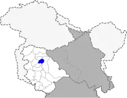 Location of Srinagar District within Jammu & Kashmir union territory | |
| Coordinates: 34°05′N 74°50′E | |
| Country | |
| Union territory | Jammu and Kashmir |
| Headquarters | Srinagar |
| Area | |
| • Total | 1,979 km2 (764 sq mi) |
| Population (2011) | |
| • Total | 1,250,173[1] |
| Time zone | UTC+05:30 (IST) |
| Literacy | 69.41% |
| Website | http://srinagar.nic.in/ |
As of 2011 it is the second most populous district of Jammu and Kashmir (out of 22), after Jammu.[3]
Administration
Srinagar district has 2 Sub-Divisions i.e. Srinagar West and Srinagar East.
7 Tehsils are:
- Central Shalteng
- Chanapora/ Natipora
- Eidgah
- Khanyar
- Pantha chowk
- Srinagar North
- Srinagar South.
- Harwan
- Qammerwari
- Khonmoh
- Srinagar
These blocks consist of a number of panchayats and villages.
Politics
Srinagar District has 1 parliamentary constituency i.e Srinagar and 8 assembly constituencies:
Demographics
Srinagar district: mother-tongue of population, according to the 2011 Census.[7]
According to the 2011 census Srinagar district has a population of 1,236,829,[3] roughly equal to the nation of Estonia[8] or the US state of New Hampshire.[9] This gives it a ranking of 381st in India (out of a total of 640).[3] The district has a population density of 703 inhabitants per square kilometre (1,820/sq mi).[3] Its population growth rate over the decade 2001–2011 was 20.35%.[3] Srinagar has a sex ratio of 900 females for every 1,000 males[3] (this varies with religion), and a literacy rate of 69.41%.[3]
| Srinagar district: religion, gender ratio, and % urban of population, according to the 2011 Census.[6] | |||||||||
|---|---|---|---|---|---|---|---|---|---|
| Hindu | Muslim | Christian | Sikh | Buddhist | Jain | Other | Not stated | Total | |
| Total | 42,540 | 1,177,342 | 2,746 | 12,187 | 285 | 74 | 2 | 1,653 | 1,236,829 |
| 3.44% | 95.19% | 0.22% | 0.99% | 0.02% | 0.01% | 0.00% | 0.13% | 100.00% | |
| Male | 35,925 | 605,244 | 1,771 | 6,975 | 171 | 39 | 1 | 998 | 651,124 |
| Female | 6,615 | 572,098 | 975 | 5,212 | 114 | 35 | 1 | 655 | 585,705 |
| Gender ratio (% female) | 15.6% | 48.6% | 35.5% | 42.8% | 40.0% | 47.3% | 50.0% | 39.6% | 47.4% |
| Sex ratio (no. of females per 1,000 males) |
184 | 945 | 551 | 747 | – | – | – | 656 | 900 |
| Urban | 42,513 | 1,160,071 | 2,743 | 12,185 | 285 | 74 | 2 | 1,643 | 1,219,516 |
| Rural | 27 | 17,271 | 3 | 2 | 0 | 0 | 0 | 10 | 17,313 |
| % Urban | 99.9% | 98.5% | 99.9% | 100.0% | 100.0% | 100.0% | 100.0% | 99.4% | 98.6% |
| Srinagar district: mother-tongue of population, according to the 2011 Census.[7] | |||
|---|---|---|---|
| Mother tongue code | Mother tongue | People | Percentage |
| 001002 | Assamese | 1,149 | 0.09% |
| 002007 | Bengali | 2,834 | 0.23% |
| 003001 | Bodo/Boro | 89 | 0.01% |
| 004001 | Dogri | 1,917 | 0.15% |
| 005018 | Gujarati | 658 | 0.05% |
| 006102 | Bhojpuri | 698 | 0.06% |
| 006195 | Garhwali | 198 | 0.02% |
| 006207 | Gojri/Gujjari/Gujar | 8,202 | 0.66% |
| 006235 | Haryanvi | 334 | 0.03% |
| 006240 | Hindi | 23,304 | 1.88% |
| 006340 | Kumauni | 136 | 0.01% |
| 006439 | Pahari | 2,967 | 0.24% |
| 006489 | Rajasthani | 828 | 0.07% |
| 007016 | Kannada | 654 | 0.05% |
| 008005 | Kashmiri | 1,164,212 | 94.13% |
| 008019 | Dardi | 71 | 0.01% |
| 011016 | Malayalam | 1,130 | 0.09% |
| 012003 | Manipuri | 435 | 0.04% |
| 013071 | Marathi | 2,213 | 0.18% |
| 014011 | Nepali | 292 | 0.02% |
| 015043 | Odia | 1,282 | 0.10% |
| 016038 | Punjabi | 10,408 | 0.84% |
| 020027 | Tamil | 1,793 | 0.14% |
| 021046 | Telugu | 1,371 | 0.11% |
| 022015 | Urdu | 3,410 | 0.28% |
| 024001 | Afghani/Kabuli/Pashto | 112 | 0.01% |
| 029002 | Balti | 349 | 0.03% |
| 040001 | English | 195 | 0.02% |
| 053005 | Gujari | 1,590 | 0.13% |
| 073003 | Ladakhi | 1,071 | 0.09% |
| 109005 | Shina | 191 | 0.02% |
| 115008 | Tibetan | 1,703 | 0.14% |
| – | Others | 1,033 | 0.08% |
| Total | 1,236,829 | 100.00% | |
Weather
| Climate data for Srinagar (1971–1986) | |||||||||||||
|---|---|---|---|---|---|---|---|---|---|---|---|---|---|
| Month | Jan | Feb | Mar | Apr | May | Jun | Jul | Aug | Sep | Oct | Nov | Dec | Year |
| Average high °C (°F) | 7.0 (44.6) |
8.2 (46.8) |
14.1 (57.4) |
20.5 (68.9) |
24.5 (76.1) |
29.6 (85.3) |
30.1 (86.2) |
29.6 (85.3) |
27.4 (81.3) |
22.4 (72.3) |
15.1 (59.2) |
8.2 (46.8) |
19.7 (67.5) |
| Average low °C (°F) | −2 (28.4) |
−0.7 (30.7) |
3.4 (38.1) |
7.9 (46.2) |
10.8 (51.4) |
14.9 (58.8) |
18.1 (64.6) |
17.5 (63.5) |
12.1 (53.8) |
5.8 (42.4) |
0.9 (33.6) |
−1.5 (29.3) |
7.3 (45.1) |
| Average precipitation mm (inches) | 48 (1.9) |
68 (2.7) |
121 (4.8) |
85 (3.3) |
68 (2.7) |
39 (1.5) |
62 (2.4) |
76 (3.0) |
28 (1.1) |
33 (1.3) |
28 (1.1) |
54 (2.1) |
710 (27.9) |
| Average precipitation days (≥ 1.0 mm) | 6.6 | 7.3 | 10.2 | 8.8 | 8.1 | 5.7 | 7.9 | 6.8 | 3.5 | 2.8 | 2.8 | 5.1 | 75.6 |
| Source: HKO[10] | |||||||||||||
Places of worship
- Hari Parbat
- Hazratbal Shrine
- Jamia Masjid, Srinagar, one of the oldest mosques in Kashmir
- Shah-i-Hamadan Mosque
- Shrine of Makhdoom Sahib
- Shankaracharya temple, possibly the oldest shrine in Kashmir

See also
- List of colleges in Srinagar
- List of schools in Srinagar
References
- "Srinagar District". 24 November 2020.
- 2011 census J&K
- "District Census 2011". Census2011.co.in. 2011. Retrieved 20 July 2020.
- , Srinagar District, Jammu and Kashmir.
- "ERO's and AERO's". CEO JK. Chief Electoral Officer, Jammu and Kashmir.
- C-1 Population By Religious Community – Jammu & Kashmir (Report). Office of the Registrar General & Census Commissioner, India. Retrieved 28 July 2020.
- C-16 Population By Mother Tongue – Jammu & Kashmir (Report). Office of the Registrar General & Census Commissioner, India. Retrieved 18 July 2020.
- US Directorate of Intelligence. "Country Comparison:Population". Retrieved 1 October 2011.
Estonia 1,282,963 July 2011 est.
- "2010 Resident Population Data". U. S. Census Bureau. Retrieved 30 September 2011.
New Hampshire 1,316,470
- "Climatological Information for Srinigar, India". Hong Kong Observatory. November 2010. Retrieved 19 November 2017.
External links
- Official website
- Greater Kashmir, daily English newspaper from Srinagar, Kashmir
- Soan Meeraas, A Kashmiri newspaper from Srinagar, Kashmir
Places adjacent to Srinagar district | ||||||||||
|---|---|---|---|---|---|---|---|---|---|---|
| ||||||||||