Kulgam district
Kulgam District is a district in the Indian union territory of Jammu and Kashmir.[1] The district contains the block, tehsil and town of Kulgam.
Kulgam district | |
|---|---|
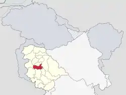 Location in Jammu and Kashmir | |
| Coordinates: 33°38′24″N 75°01′12″E | |
| Country | India |
| Union Territory | Jammu and Kashmir |
| Headquarters | Kulgam |
| Government | |
| • Type | Urban Local Bodies |
| • Body | Municipal Committee |
| Area | |
| • Total | 1,067 km2 (412 sq mi) |
| Population (2011) | |
| • Total | 424,483 |
| • Density | 400/km2 (1,000/sq mi) |
| Languages | |
| • Official | Kashmiri, Urdu |
| Time zone | UTC+5:30 (IST) |
| PIN | 192231 |
| Vehicle registration | JK18 |
| Website | http://kulgam.gov.in |
Location
Kulgam is situated near the Pir Panjal Ranges, overlooking the left bank of Veshaw River, along a rough, hilly road from Larow. Nallah Veshav, which drains most of the northern face of Pir Panjal, is the main left-bank tributary of the Jhelum River and traverses through District Kulgam. The Veshev is broken into a number of channels to provide drinking water and irrigation for huge tracts of the district's land.
Town Kulgam is situated about 68 km (42 mi) from Srinagar and about 17 km (11 mi) from Anantnag. Roads connect to the neighbouring districts of Shopian, Pulwama, Anantnag, and Banihal.
Demographics
According to the 2011 census, Kulgam district has a population of 424,483.[2] This gives it a ranking of 554th in India (out of 640).[2] The district has a population density of 925 inhabitants per square kilometre (2,400/sq mi).[2] Its population growth rate over the decade 2001–2011 was 7.3%.[2] Kulgam has a sex ratio of 951 females for every 1000 males[2] (this varies with religion), and a literacy rate of 60.3 percent. According to officials demographics is improving at a good rate.
Kulgam district: mother-tongue of population, according to the 2011 Census.[4]
| Kulgam district: religion, gender ratio, and % urban of population, according to the 2011 Census.[3] | |||||||||
|---|---|---|---|---|---|---|---|---|---|
| Hindu | Muslim | Christian | Sikh | Buddhist | Jain | Other | Not stated | Total | |
| Total | 4,267 | 418,076 | 460 | 1,035 | 27 | 25 | 9 | 584 | 424,483 |
| 1.01% | 98.49% | 0.11% | 0.24% | 0.01% | 0.01% | 0.00% | 0.14% | 100.00% | |
| Male | 3,324 | 213,069 | 264 | 581 | 19 | 12 | 5 | 346 | 217,620 |
| Female | 943 | 205,007 | 196 | 454 | 8 | 13 | 4 | 238 | 206,863 |
| Gender ratio (% female) | 22.1% | 49.0% | 42.6% | 43.9% | 29.6% | 52.0% | 44.4% | 40.8% | 48.7% |
| Sex ratio (no. of females per 1,000 males) |
284 | 962 | – | 781 | – | – | – | 688 | 951 |
| Urban | 2,141 | 78,219 | 116 | 85 | 6 | 3 | 0 | 43 | 80,613 |
| Rural | 2,126 | 339,857 | 344 | 950 | 21 | 22 | 9 | 541 | 343,870 |
| % Urban | 50.2% | 18.7% | 25.2% | 8.2% | 22.2% | 12.0% | 0.0% | 7.4% | 19.0% |
| Kulgam district: mother-tongue of population, according to the 2011 Census.[4] | |||
|---|---|---|---|
| Mother tongue code | Mother tongue | People | Percentage |
| 001002 | Assamese | 22 | 0.01% |
| 002007 | Bengali | 149 | 0.04% |
| 004001 | Dogri | 229 | 0.05% |
| 005018 | Gujarati | 25 | 0.01% |
| 006207 | Gojri/Gujjari/Gujar | 26,827 | 6.32% |
| 006240 | Hindi | 1,964 | 0.46% |
| 006438 | Padari | 37 | 0.01% |
| 006439 | Pahari | 2,031 | 0.48% |
| 007016 | Kannada | 35 | 0.01% |
| 008005 | Kashmiri | 390,125 | 91.91% |
| 011016 | Malayalam | 47 | 0.01% |
| 013071 | Marathi | 73 | 0.02% |
| 014011 | Nepali | 29 | 0.01% |
| 015043 | Odia | 47 | 0.01% |
| 016006 | Bilaspuri Kahluri | 21 | 0.00% |
| 016038 | Punjabi | 1,007 | 0.24% |
| 020027 | Tamil | 391 | 0.09% |
| 021046 | Telugu | 72 | 0.02% |
| 022015 | Urdu | 340 | 0.08% |
| 024001 | Afghani/Kabuli/Pashto | 89 | 0.02% |
| 044013 | Kalari | 142 | 0.03% |
| 053005 | Gujari | 488 | 0.11% |
| 055007 | Khasi | 107 | 0.03% |
| – | Others | 186 | 0.04% |
| Total | 424,483 | 100.00% | |
Administration
District Kulgam was separated from district Anantnag, along with several other new districts, and made administratively separate from 2 April 2007.
Kulgam district consists of eight blocks: D.k.Marg, Quimoh, Pahloo, Damhal Hanji Pora, Devsar, Jammu and Kashmir, Kulgam, and Frisal and Behibagh.[5] Each block consists of a number of panchayats (English: 'assembly rule', a traditional system of local government).
The district has seven administrative units (Tehsils): Kulgam, Damhal Hanji Pora, Devsar, Frisal, Pahloo, Yaripora, and Qaimoh. Kulgam district has seven important towns: Frisal, Yaripora, Kulgam, Devsar, Qaimoh and Damhal Hanji Pora. Five of these have received municipality status; Damhal Hanji Pora has yet to be recognized as a municipality.
There are five police stations in the district at: Kulgam, Damhal Hanji Pora, Qazigund, Yaripora and Devsar, and six police posts at: Qaimoh, Frisal, Mir Bazar, Behibagh, Kund and Jawahir Tunnel.[6]
Kulgam has two sub-divisions: Kulgam and Damhal Hanji Pora.
Politics
Kulgam district has 4 assembly constituencies: Noorabad, Kulgam, Homshailibugh, and Devsar.[7] The parties of the current members of the legislative assembly (MLAs) are: Indian National Congress (INC) for Devsar, Jammu and Kashmir National Conference (JKNC) for Homshailibugh, Jammu and Kashmir Peoples Democratic Party (PDP) for Noorabad, and the Communist Party of India (Marxist) (CPM) for Kulgam.
Homshallibugh J&K is 39th assembly segment has three municipal towns – Yaripora, Frisal and Qaimoh – which are also tehsil headquarters. Yaripora is an education and health block, while Qaimoh is agriculture as well as education and health blocks. Frisal is a community development block.[8]
History
Tazkira Sadat-i-Simanania, compiled by 13th-century scholar and poet Swaleh Reshi, gives the name of place as "Shampora". Syed Hussain Simnani later renamed it "Kulgam" (kul for 'clan' and gram for 'village' in Sanskrit). Simnani is said to have invited Mir Sayyid Ali Hamadani to Kashmir, with poets including Nund Rishi (Sheikh Noor-ud-din Noorani (RA)) and Lalleshwari. These poets and their disciples manifested the composite culture or Kashmiriyat, promoting and encouraging religious and cultural harmony even when viewed as heretics by other Asiatic countries.
The form of administration from Sher Shah Suri's reign led to creation of a Tehsil during Mughal Rule, through the aegis of Sheikh Hamza Makhdoom. This had jurisdiction encompassing Doru, Banihal, Gulabgarh, and Shopian. After time, constituent units including Pulwama, Shopian, and Reasi attained the status of district.
The area had been a hunting place for Mughal emperors and Dogra rulers, especially for Shahanshah Shah Jehan, who laid the "Chinar Bagh" [9] and Maharaja Hari Singh, who discovered the virgin potential of sanctuary at Kutbal. The District is the birthplace of Sheikh Noor-ud-din Noorani, the founder of the Rishi order, and of the forefathers of Allama Iqbal and Jawaharlal Nehru.
Militancy
There has been militancy in Kashmir since 1989. Beginning in the 1990s there was an upsurge of militants in the district, particularly the Lashkar-e-Taiba.[10][11] In addition to assassination and inciting riots,[12] the militants encourage the populace to boycott elections.[13]
Road facility
Kulgam has following roads connecting it to various assembly segments and with NH1A (major district roads):
- Kulgam - Anantnag Main Road
- Kulgam - Wanpoh via Ban
- Kulgam - Yaripora
- Kulgam - Aharbal via Nehama
- Kulgam - Aharbal via Damhal Hanji Pora
- Kulgam - Damhal Hanji Pora via Adijan
- Kulgam - Shopian via Nillow
- Kulgam - Shopian via Nehama
- Kulgam - Devsar
- Kulgam - Qazigund
- Kulgam - Ahmedabad via Khul
Health facilities
- District Hospital at Kulgam
- Sub district hospital at Yaripora
- Sub district hospital at Qazigund
- Sub district hospital D. H.Pora
Habitation and environment
The main source of livelihood in the district is agriculture and horticulture. The low-lying areas of Kulgam are very fertile for rice cultivation, and are considered as the 'Rice Bowl of Kashmir'. The higher elevations are known for production of apples. Livestock and sheep-rearing is a subsidiary occupation among the rural population, particularly in the higher elevations.
Kulgam District is covered by the Pir Panjal mountain range on the southwest side, acting as a massive topographical protection. The area is significantly covered in forestation.
Tourism
Town Kulgam is situated about 68 km (42 mi) from Srinagar and about 17 km (11 mi) from Anantnag. Aside from places of spiritual interest, the district has tourist spots like Aharbal water fall on Veshev Nallah which is a place of sight-seeing in the extreme south-west. High pastures and meadows are also places of tourist attraction in the area from Kund to Ladigasan (ahead of Aherbal clefts). The District also has an abundance of natural water from springs such as Kausar Nag, Waseknag, Khee Nag, etc.
References
- "History | District Kulgam". kulgam.nic.in. Government of Jammu and Kashmir. Retrieved 8 March 2019.
- "District Census 2011". Census2011.co.in. 2011. Retrieved 30 September 2011.
- C-1 Population By Religious Community – Jammu & Kashmir (Report). Office of the Registrar General & Census Commissioner, India. Retrieved 28 July 2020.
- C-16 Population By Mother Tongue – Jammu & Kashmir (Report). Office of the Registrar General & Census Commissioner, India. Retrieved 18 July 2020.
- Statement showing the number of blocks in respect of 22 Districts of Jammu and Kashmir State including newly Created Districts Archived 2008-09-10 at the Wayback Machine dated 2008-03-13, accessed 2008-08-30
- "About District/ Administrative Setup/ Police", District Kulgam, District Administration Kulgam, retrieved 5 October 2020
- "ERO's and AERO's". Chief Electoral Officer, Jammu and Kashmir. Archived from the original on 22 October 2008. Retrieved 28 August 2008.
- "Jammu Kashmir at a Glance". jkdfp.org. Democratic Freedom Party: JK.
- "Chinar Bagh srinagar". google.co.in/maps. Google maps.
- "Top Lashkar-e-Taiba militant killed". NDTV. 16 September 2007. Archived from the original on 11 March 2007.
- "Gunbattle on between militants, security forces in south Kashmir". The Times of india. 25 May 2014. Archived from the original on 25 May 2014.
- "J-K: 2 militants killed in Kulgam, 3 miscreants arrested in Srinagar". One India News. 1 November 2010. Archived from the original on 25 May 2014. Retrieved 25 May 2014.
- Pandit, M. Saleem (24 April 2014). "Low voter turnout in Kashmir due to militants' poll boycott call". The Times of india.
Places adjacent to Kulgam district | |
|---|---|