Samba district
Samba District is a district in the Indian Union territory of Jammu and Kashmir formed in 2006.[2] Before its formation, this area was part of Jammu district and Kathua district.
Samba district | |
|---|---|
District of Jammu and Kashmir | |
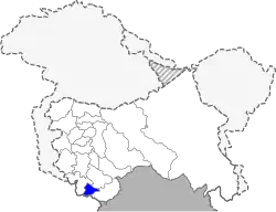 Location of Samba district in Jammu and Kashmir | |
| Coordinates: 32°33′N 75°07′E | |
| Country | India |
| Union Territory | Jammu and Kashmir |
| Division | Jammu Division |
| Headquarters | Samba, Jammu and Kashmir |
| Tehsils | Samba |
| Area | |
| • Total | 914 km2 (353 sq mi) |
| Population (2011) | |
| • Total | 318,898 |
| • Density | 350/km2 (900/sq mi) |
| • Urban | 16.8% |
| Demographics | |
| • Literacy | 81.41% |
| • Sex ratio | 886 |
| Time zone | UTC+05:30 (IST) |
| Vehicle registration | JK-21 |
| Website | http://samba.nic.in/ |
Geography
The district covers Samba town and adjoining tehsils: Vijaypur and village Supwal and Garhwal tehsil of Kathua. The district is separated from the Jammu district by "Purmandal Bridge". Samba is situated on the bank of Basantar River.
Samba district consists of four blocks: Samba, Vijay Pur, Purmandal, and Ghagwal.[3] Each block consists of GREF panchayats. The biggest village in Rajpura.
History
Samba was reportedly established in 1400 AD.[4] It came under the suzerainty of Jammu in 1816 A.D., while it was annexed by Raja Gulab Singh in 1846 A.D. Historically Samba consisted of 22 towns (also known as Mandi), each headed by a separate family. Prior to 1947, Samba was a tehsil.[5] Samba became a district in 2006.
Politics
Samba District has two assembly constituencies: Samba and Vijaypur.[6] Both are part of Jammu (Lok Sabha constituency).[7]
Demographics
According to the 2011 census, Samba District had a population of 318,898,[8] roughly equal to The Bahamas.[9] It is the 568th largest in India (of 640). The district has a population density of 318 inhabitants per square kilometre (820/sq mi). Its population growth rate over the decade of 2001 to 2011 was 16.9%. Samba has a sex ratio of 886 females for every 1,000 males, and a literacy rate of 81.4%.
Religion
Samba district has an overwhelming Hindu majority, spread among Muslims, Sikhs, and others are the minority in the Samba district.
Samba district: mother-tongue of population, according to the 2011 Census.[10]
| Samba district: religion, gender ratio, and % urban of population, according to the 2011 Census.[8] | |||||||||
|---|---|---|---|---|---|---|---|---|---|
| Hindu | Muslim | Christian | Sikh | Buddhist | Jain | Other | Not stated | Total | |
| Total | 275,311 | 22,950 | 2,306 | 17,961 | 48 | 16 | 6 | 300 | 318,898 |
| 86.33% | 7.20% | 0.72% | 5.63% | 0.02% | 0.01% | 0.00% | 0.09% | 100.00% | |
| Male | 145,930 | 12,308 | 1,434 | 9,254 | 29 | 8 | 5 | 156 | 169,124 |
| Female | 129,381 | 10,642 | 872 | 8,707 | 19 | 8 | 1 | 144 | 149,774 |
| Gender ratio (% female) | 47.0% | 46.4% | 37.8% | 48.5% | 39.6% | 50.0% | 16.7% | 48.0% | 47.0% |
| Sex ratio (no. of females per 1,000 males) |
887 | 865 | 608 | 941 | – | – | – | – | 886 |
| Urban | 47,411 | 2,669 | 1,218 | 2,205 | 20 | 1 | 0 | 91 | 53,615 |
| Rural | 227,900 | 20,281 | 1,088 | 15,756 | 28 | 15 | 6 | 209 | 265,283 |
| % Urban | 17.2% | 11.6% | 52.8% | 12.3% | 41.7% | 6.3% | 0.0% | 30.3% | 16.8% |
Samba district
| |||
|---|---|---|---|
| Mother tongue code | Mother tongue | People | Percentage |
| 001002 | Assamese | 353 | 0.11% |
| 002007 | Bengali | 706 | 0.22% |
| 003001 | Bodo/Boro | 57 | 0.02% |
| 003003 | Kachari | 21 | 0.01% |
| 004001 | Dogri | 269,559 | 84.53% |
| 005018 | Gujarati | 75 | 0.02% |
| 005052 | Pattani | 26 | 0.01% |
| 006086 | Bhadrawahi | 111 | 0.03% |
| 006102 | Bhojpuri | 611 | 0.19% |
| 006125 | Bundeli/Bundel khandi | 164 | 0.05% |
| 006142 | Chhattisgarhi | 920 | 0.29% |
| 006195 | Garhwali | 102 | 0.03% |
| 006207 | Gojri/Gujjari/Gujar | 13,766 | 4.32% |
| 006235 | Haryanvi | 116 | 0.04% |
| 006240 | Hindi | 8,683 | 2.72% |
| 006340 | Kumauni | 520 | 0.16% |
| 006400 | Marwari | 19 | 0.01% |
| 006439 | Pahari | 1,980 | 0.62% |
| 006489 | Rajasthani | 157 | 0.05% |
| 007016 | Kannada | 119 | 0.04% |
| 008005 | Kashmiri | 615 | 0.19% |
| 008019 | Dardi | 361 | 0.11% |
| 010008 | Maithili | 55 | 0.02% |
| 010013 | Thati | 16 | 0.01% |
| 011016 | Malayalam | 297 | 0.09% |
| 012003 | Meitei (Manipuri) | 201 | 0.06% |
| 013071 | Marathi | 596 | 0.19% |
| 014011 | Nepali | 162 | 0.05% |
| 015043 | Odia | 243 | 0.08% |
| 016038 | Punjabi | 15,798 | 4.95% |
| 018040 | Santali | 42 | 0.01% |
| 020027 | Tamil | 237 | 0.07% |
| 021046 | Telugu | 248 | 0.08% |
| 022015 | Urdu | 237 | 0.07% |
| 028001 | Arabic/Arbi | 34 | 0.01% |
| 040001 | English | 15 | 0.00% |
| 042001 | Gangte | 19 | 0.01% |
| 053005 | Gujari | 325 | 0.10% |
| 071008 | Kuki | 50 | 0.02% |
| 082005 | Lushai/Mizo | 84 | 0.03% |
| 091009 | Munda | 24 | 0.01% |
| 096002 | Paite | 16 | 0.01% |
| 114015 | Thado | 19 | 0.01% |
| – | Others | 1,139 | 0.36% |
| Total | 318,898 | 100.00% | |
Festivals & Fairs of Samba
Rath Kharda Mela
An eight day fair is organised in Narsingh and Annapurna Temple in Ghagwal of Samba district of Jammu division. This fair involves taking out procession of deity on a chariot. Hence named Rath Kharda Mela. Thousands of devotees are drawn from neighbouring states of Punjab and Himachal Pradesh and also other parts of Jammu region. People from hilly areas of Jammu like: Basohli, Doda, Kishtwar, Bani, Dudu Basantgarh put stalls in this fair and sell the handicrafts and woolen items like Pattus, blankets & shawls.[12]
During this fair, the temple is decorated with flowers and lights. Devotees visit the temple and pay obeisance to the main deity, Bhagwan Narsimha. A Bhandara is also organised for the devotees. Local farmers sow their fields in the name of Bhagwan Narsimha and while harvesting their crops offer a part of it to the temple during this fair.[13]
Besides Ghagwal, Rath Kharda Mela is also held at other places of Jammu division like: Ramgarh tehsil of Udhampur district, Parnala village in Billawar tehsil and Hatli village in Kathua.[14]
Famous People
- Alla Rakha Indian Classical Musician and tabla player
References
- https://samba.gov.in/geography/
- "History". District Samba (Jammu and Kashmir), Government of Jammu and Kashmir. Retrieved 15 January 2020.
- Statement showing the number of blocks in respect of 22 Districts of Jammu and Kashmir State including newly Created Districts Archived 10 September 2008 at the Wayback Machine dated 2008-03-13, accessed 2008-08-30
- "District Samba". Government of Jammu and Kashmir. Retrieved 10 June 2020.
- Snedden, Christopher (2015), Understanding Kashmir and Kashmiris, Oxford University Press, p. xxi, ISBN 978-1-84904-342-7
- "ERO's and AERO's". Chief Electoral Officer, Jammu and Kashmir. Archived from the original on 22 October 2008. Retrieved 28 August 2008.
- "Assembly Constituencies - Corresponding Districts and Parliamentary Constituencies of Jammu and Kashmir". Chief Electoral Officer, Jammu and Kashmir. Archived from the original on 31 December 2008. Retrieved 30 October 2008.
- C-1 Population By Religious Community – Jammu & Kashmir (Report). Office of the Registrar General & Census Commissioner, India. Retrieved 28 July 2020.
- US Directorate of Intelligence. "Country Comparison:Population". Retrieved 1 October 2011.
Bahamas, The 313,312
- C-16 Population By Mother Tongue – Jammu & Kashmir (Report). Office of the Registrar General & Census Commissioner, India. Retrieved 18 July 2020.
- "C-1 Population By Religious Community". Census. Retrieved 10 June 2019.
- "Rath Kardha Mela commences". State Times. Retrieved 25 January 2021.
- Excelsior, Daily (28 December 2019). "8-day Rath Kardha Mela begins at Narsingh Dass temple Ghagwal". Jammu Kashmir Latest News | Tourism | Breaking News J&K. Retrieved 25 January 2021.
- "Rath Khardha Mela commences at Ghagwal - Early Times Newspaper Jammu Kashmir". www.earlytimes.in. Retrieved 25 January 2021.
External links
Places adjacent to Samba district | ||||||||||
|---|---|---|---|---|---|---|---|---|---|---|
| ||||||||||