Tandag
Tandag, officially the City of Tandag (Surigaonon: Siyudad nan Tandag; Tagalog: Lungsod ng Tandag), is a 5th class city and capital of the province of Surigao del Sur, Philippines. According to the 2015 census, it has a population of 56,364 people. [3] This constitutes 9.52% of the population in Surigao del Sur.[5]
Tandag | |
|---|---|
| City of Tandag | |
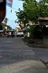
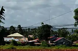 Houses in Barangay Telaje near Capitol Road | |
 Seal | |
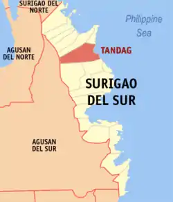 Map of Surigao del Sur with Tandag highlighted | |
OpenStreetMap 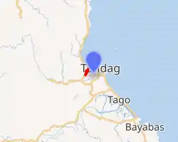
| |
.svg.png.webp) Tandag Location within the Philippines | |
| Coordinates: 9°04′N 126°11′E | |
| Country | |
| Region | Caraga (Region XIII) |
| Province | Surigao del Sur |
| District | 1st District |
| Cityhood | 23 June 2007 |
| Barangays | 21 |
| Government | |
| • Type | Sangguniang Panlungsod |
| • Mayor | Roxanne C. Pimentel |
| • Vice Mayor | Eleanor D. Momo |
| • Representative | Prospero A. Pichay Jr. |
| • Electorate | 39,771 voters (2019) |
| Area | |
| • Total | 291.73 km2 (112.64 sq mi) |
| Elevation | 88 m (289 ft) |
| Population | |
| • Total | 56,364 |
| • Density | 190/km2 (500/sq mi) |
| • Households | 12,014 |
| Economy | |
| • Income class | 5th city income class |
| • Poverty incidence | 29.62% (2015)[4] |
| • Revenue | ₱466,592,887.18 (2016) |
| Time zone | UTC+08:00 (PST) |
| ZIP code | 8300 |
| PSGC | |
| IDD : area code | +63 (0)86 |
| Climate type | tropical rainforest climate |
| Native languages | Tandaganon Surigaonon Agusan Cebuano Tagalog |
| Website | www |
Farming and fishing are the main economic activity for most of the people in Tandag. Chief farm products are rice, corn, and coconut. Livestock and poultry raising are also important sources of income. Tandag has a national secondary airport and a seaport.
Tandag City has a land area of 291.73 square kilometers or 112.64 square miles. This constitutes 5.91% of the land area of Surigao del Sur. The population density of the city is at 193 inhabitants per square kilometer or 500 inhabitants per square mile.[5]
Etymology
Many versions have been given regarding the name of Tandag. One version states that Father Calan, Father Encarnacion, and another priest were on their way to visit chieftain Suba to baptize his people. When one of the missionaries asked a native rowing their boat what name of the place was with fingers pointing downward, the native thought the priest meant the school of fish. He answered "tamda", meaning look down. This name later became Tandag. Father Encarnacion, a member of the group, was later killed by the natives.
Another version states that when De la Vega landed in Tandag to subdue the ferocious Caragas (as the rebellious natives were called then), he did not know the name of the place so he inquired from a native who was gathering the leaves of an herb locally known as tangad. The native, who did not understand Spanish, answered "tangad". Later, the name was changed to Tandag.
Another story tells of a group of Spanish soldiers and missionaries who lost their way. When they asked for correct direction, the natives, who could not understand Spanish, only laughed at them all the while saying the word "tank", meaning lost. Thus, the name Tandag means lost.
History

- Long before Tandag became what it is today—the bustling capital town of Surigao del Sur was inhabited by the Manobos and the Mamanwas who lived along the river banks under the leadership of Suba, their Chieftain. Suba was later converted into Christianity by Father Juan de la Encarnacion, a Spanish missionary. After Legazpi’s final conquest to the Philippines in 1609, the Spanish government sent missionaries to subdue the hostile natives. One of these missionaries was Father Juan de la Vega who was assigned to Tandag. In an effort to establish a symbol of authority, Fr. dela Vega erected a stone fort and built a small settlement about a size of a football field enclosed by a stone wall. Out of this settlement rose the town of Tandag, which later on became a center of faith.
- During this period, Tandag became a port of call to the Spanish Galleon that sailed along the southern part of Mindanao. Until today, it is believed that somewhere underneath the sea near Tandag's Linongao Islands lies a sunken galleon.
- In 1650, Tandag became the capital town of Surigao or Caraga, then a district that covered the present provinces of Agusan del Sur, Agusan del Norte, Surigao del Sur, Surigao del Norte, and a part of Davao. As the center of faith and capital town, Tandag was fortified with cottas which were erected sometime in the 18th century. The cottas were placed in the northern part of the town and near the old cemetery on the western side. These fortifications served to protect the town from Moro raids.
- In several separate attacks between 1754 and 1767, the Moro pirates wrought havoc and destruction to Tandag. Father Jose Ducos, a Jesuit from Iligan, came to the rescue and rebuilt Tandag. He established the Tandag Garrison and restored the Tandag priory. Although a part of the Tandag fort survived, it was demolished during the Second World War. Calamities like typhoons and earthquakes destroyed what remained of it. This explains why there are no remains of these structures that could be seen today.
- World War II – For much of the war, Tandag was free from Japanese occupation when the American and Filipino military forces surrendered in May 1942. However, on 27 April 1944, about 500 Japanese troops landed by a number of boats a short distance outside town. Most of the residents fled to the mountains nearby when the Japanese arrived. The 10th Military District of the U.S. Army maintained a guerrilla presence in Mindanao in World War II. Capt. Charles Hansen led a small group of guerrillas against the Japanese. Outnumbered, the guerrillas were unable to dislodge the Japanese and about ten days later another group of guerrillas made a second attempt to force the Japanese out. The Japanese remained in town several weeks and left after causing much damage in Tandag.[6][7]
- Real transformation was finally afforded to Tandag via Republic Act No. 2786, an act that created Surigao del Sur and whose salient measure made Tandag the capital and seat of the provincial government of Surigao del Sur.
- On 23 June 2007, Tandag, by virtue of Republic Act No. 9392, became a city.
Cityhood
Geography
Tandag City is located along the northeastern coast of Mindanao facing the Philippine Sea. It is bounded on the north by the municipalities of Cortes and Lanuza, on the east by the Philippine Sea, on the south by the towns of Tago and San Miguel, and on the west by the province of Agusan del Sur. It is located 448 nautical miles from Manila and 150 nautical miles from Cebu. The distance from Surigao City in the north to Tandag is about 200 kilometres (120 mi) and 331 kilometres (206 mi) is the distance from Davao City to the south.
Barangays
Tandag is politically subdivided into 21 barangays. Majority of the barangays are considered rural areas.
- Awasian (Tandag Airport)
- Bag-ong Lungsod (Poblacion)
- Bioto
- Bongtud (Poblacion)
- Buenavista (includes Mahayag)
- Dagocdoc (Poblacion)
- Mabua (Poblacion)
- Mabuhay
- Maitum
- Maticdum
- Pandanon
- Pangi
- Quezon
- Rosario
- Salvacion
- San Agustin Norte
- San Agustin Sur or Dawis
- San Antonio
- San Isidro
- San Jose
- Telaje (Poblacion)
Climate
Tandag has a tropical rainforest climate (Af) with heavy to very heavy rainfall year-round and extremely heavy rainfall in January.
| Climate data for Tandag | |||||||||||||
|---|---|---|---|---|---|---|---|---|---|---|---|---|---|
| Month | Jan | Feb | Mar | Apr | May | Jun | Jul | Aug | Sep | Oct | Nov | Dec | Year |
| Average high °C (°F) | 28.9 (84.0) |
29.0 (84.2) |
29.8 (85.6) |
31.0 (87.8) |
31.8 (89.2) |
31.7 (89.1) |
31.8 (89.2) |
31.9 (89.4) |
31.9 (89.4) |
31.4 (88.5) |
30.4 (86.7) |
29.5 (85.1) |
30.8 (87.4) |
| Daily mean °C (°F) | 25.6 (78.1) |
25.6 (78.1) |
26.1 (79.0) |
27.0 (80.6) |
27.7 (81.9) |
27.5 (81.5) |
27.6 (81.7) |
27.6 (81.7) |
27.5 (81.5) |
27.3 (81.1) |
26.6 (79.9) |
26.1 (79.0) |
26.9 (80.3) |
| Average low °C (°F) | 22.3 (72.1) |
22.2 (72.0) |
22.5 (72.5) |
23.0 (73.4) |
23.7 (74.7) |
23.4 (74.1) |
23.4 (74.1) |
23.4 (74.1) |
23.2 (73.8) |
23.2 (73.8) |
22.9 (73.2) |
22.7 (72.9) |
23.0 (73.4) |
| Average rainfall mm (inches) | 769 (30.3) |
647 (25.5) |
487 (19.2) |
346 (13.6) |
252 (9.9) |
178 (7.0) |
174 (6.9) |
146 (5.7) |
163 (6.4) |
212 (8.3) |
462 (18.2) |
654 (25.7) |
4,490 (176.7) |
| Source: Climate-Data.org[8] | |||||||||||||
Demographics
| Year | Pop. | ±% p.a. |
|---|---|---|
| 1903 | 3,751 | — |
| 1918 | 14,573 | +9.47% |
| 1939 | 12,702 | −0.65% |
| 1948 | 14,099 | +1.17% |
| 1960 | 10,441 | −2.47% |
| 1970 | 19,847 | +6.63% |
| 1975 | 21,775 | +1.88% |
| 1980 | 25,386 | +3.12% |
| 1990 | 34,351 | +3.07% |
| 1995 | 39,222 | +2.52% |
| 2000 | 44,327 | +2.66% |
| 2007 | 50,459 | +1.80% |
| 2010 | 52,114 | +1.18% |
| 2015 | 56,364 | +1.50% |
| Source: Philippine Statistics Authority [3] [9] [10] | ||
It consists of twenty-one (21) barangays. Six of which are urban barangays, five are coastal barangays, four are built-up expansions, and six are hinterland barangays. The urban barangays comprise 1,594.10 hectares; 3,464.61 hectares for coastal barangays; 2,233.15 hectares for built-up expansion barangays and 4,964.34 hectares for hinterland barangays.
Languages
Major languages spoken are Tandaganon (a language closely related to Surigaonon) and Cebuano (Mindanao variant). Filipino and English are widely used in schools, businesses, and government offices.
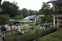
Culture and festivals
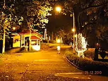
_in_Tandag.jpg.webp)
- Tandag annually celebrates the feast day of San Nicolas de Tolentino, Tandag's patron saint, every 10th of September. A novena in honor of San Nicholas is held for nine consecutive days starting the 1st of September in the San Nicholas de Tolentino Cathedral. It is the highlight of the City's Fiesta. In connection to this, a week-long celebration is organized by the Local Government Unit of Tandag. Parades, concerts, and bazaars are just some of the activities lined up for the said celebration.
- Diwatahan Festival is held every January in honor of the Santo Niño. Tandag City also organizes a one-day cultural dance competition for interested dance groups held at the Tandag City Plaza. Diwatahan Festival is the counterpart of Cebu City's Sinulog festival.
- Since Tandag is the capital of the province of Surigao del Sur, it hosts the annual Araw ng Surigao del Sur Celebration. A trade fair showcasing products from the different municipalities of Surigao del Sur is one of the events in the celebration. Another event is a local pageant, Mutya ng Surigao del Sur, held at the Tandag City Gymnasium in Bongtud.

- Charter Day is held every 23rd day of June to celebrate the cityhood of Tandag. Different events are held during the day. Laguboh![11] is a drums and lyre corps competition among elementary and secondary schools in the city.
- Summer Kite Festival – an annual event initiated by the City Government of Tandag enhancing the artistic talent and creativity among the teenagers through the making of fantastic designs of kite enjoying the sun, sand and sea during summer time.
- Eco Sports Festival – Tandag City is a coastal city, with 10 of its 21 barangays facing the Pacific Ocean. Thus, the City Government of Tandag initiates a three-day event consisting of activities that promote the good care for the ocean. The events are participated by the youth sector, enhancing their skills in different activities like skim boarding, Frisbee, beach volleyball, urban adventure race, and sand castle sculpture making. For the culmination of the Ocean Month Celebration, there are live performances of bands from all over the country.
- TAMDA Festival – a Tandaganon variation of the word "Tan-awa" which means to "see beneath" or "to take care of". This showcases the correct and historically accurate cultural festival and explains the Tandaganons' art – dances, rituals, music, life ways, and creative expressions. It is an annual event of Tandag City in celebration of the Charter Day held every 23 June.
Tourism
- San Isidro – Busay Falls[12]
- Bioto – Cold Spring[13]
- Pangi – Bugsukan Falls & Tagbak stream[13]
- Salvacion – Abaca Plantation[13]
- Quezon – Cave, Falls, & Wild Life[13]
- Maticdum – Falls, Water Spring, Cave, Forest, & Wild Life Conservation[13]
- San Agustin – Norte Beach Resort & Mangroves[13]
- Mabuhay – Panugmakan Creek (Potable Water Source) Mt. Resort & Cave[13]
- Dagocdoc – Board Walk (Dike) & Floating Restaurant[13]
- Awasian – Ihawan Mt. Spring Resort/Hitaub IP Gawad Kalinga Project[13]
- Pandanon – Cold Spring[13]
- Rosario – Andap Falls & Spring[13]
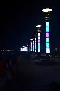
- Bag-ong Lungsod – Tandag City Boulevard[13]
- Bongtud – Twin Linungao Island, Mancagangi Island & MPA (Fish Sanctuary)[13]
- Buenavista – MPA (Fish Sanctuary)[13]
- Mabua Beach Resort (MPA) – Fish Sanctuary[13]
Transportation
Accessibility
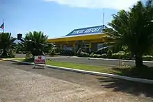
By air
- via Tandag Airport: From Cebu, you can take direct flight to Tandag through Cebgo, which flies this route every M-W-F (destination terminated as of 2019).
- via Francisco Bangoy (Davao) International Airport: From Manila or Cebu to Davao City as transit point, Philippine Airlines, Cebu Pacific and Cebgo fly the Manila-Davao (and vice versa) route (approx. 1-1 1/2 hours travel time) and the Cebu-Davao (and vice versa) route (approx. 45 minutes travel time) several trips daily.
- via Surigao Airport: From Manila or Cebu to Surigao City as transit point, Cebgo flies these routes (approx. 1-1 1/2 hours travel time) daily.
- via Bancasi (Butuan) Airport: From Manila or Cebu to Butuan City as transit point, PAL Express, Cebu Pacific, and Cebgo fly these routes (approx. 1-1 1/2 hours travel time) three times a week.
By land

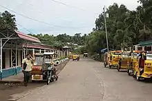
- Multicabs, vans and jeepneys around northern and southern Surigao del Sur routes include Surigao City, San Francisco, Agusan del Sur and Bislig City.
- Buses – direct travel with bus companies like Bachelor Express are serving routes from Davao City, Butuan City, Surigao City, and Mangagoy/Bislig City. Philtranco and PP Bus Line serving Pasay City/Cubao via Cantilan are also available.
- Buses, vans and jeepneys can be located at Tandag City Overland Transport (TCOTT) (Balilahan Bus Terminal).
- Some jeepneys and tricycles bound for Surigao City, Cantilan, Cortes, Tago, San Miguel, and nearby municipalities and barangays can be found at Moonglow Public Market.
By sea
- Inter-island vessel Cokaliong Shipping Lines ply the Cebu-Surigao City routes on regular schedules with Surigao City Port as transit point. Multi-cabs and tricycles are available at the wharf going to Surigao City Integrated Terminal for the regular bus trips to Tandag.
Healthcare facilities
- Adela Serra Ty Memorial Medical Center - On February 15, 1993, the Surigao del Sur Provincial Hospital was renamed Adela Serra Ty Memorial Medical Center by Virtue of RA No. 7433 authored by then Congressman Mario Serra Ty.
- Pama Polyclinic
- Philippine Red Cross Tandag
Education
Basic education
- Tandag Pilot Elementary School
- Tandag Central Elementary School
- Telaje Elementary School
- Saint Theresa College of Tandag
- Jacinto P. Elpa National High School
- Tandag National Science High School
- Vicente L. Pimentel Sr. National High School
- Buenavista Nursery School
- Buenavista Elementary School
- Buenavista National High School
- Tandag Christian School, Inc.
- Tandag City SpEd Center
- Tandag Science Elementary School
- Engr. Nestor Ty Memorial Elementary School
- Bongtud Elementary School
- Meliton M. Ajos Memorial Elementary School
- San Jose Elementary School
- Mahanon Elementary School
- Mabuhay Elementary School
- Pandanon Elementary School
- Carmen Integrated School
- San Antonio Elementary School
Higher education
- Saint Theresa College of Tandag – College Dept.
- Surigao del Sur State University – Main Campus
Media
For desktop users, you may click the link provided below. And or if you're using mobile phones, use your preferred Internet browser by clicking the link below:
https://rmn.ph/ifm939davao/
- TV-2 GMA Network
- TV-6 TNTV-6 (Tandag Network Television) Surigao Del Sur's local community channel
- TV-8 – PEC Broadcasting Corporation
- TV-12 – ABS-CBN
- TV-23 – 5
- Morning Star Cable TV
- Cignal Digital TV
- TETCO
- Globe Broadband
- PLDT Home Bro
- Smart Bro
- TETCO DSL
Economy
Commercial retail
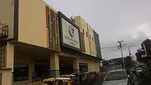
- Gaisano Capital Tandag is located along Cabrera and Navales Street. Gaisano Capital Group is a shopping mall chain in the Philippines, owned by Cebu-based Gaisano family.
- TT & Company
- Prince Town Tandag
- Ultrastar Supermart
Delivery services
- LBC Tandag
- J&T Express
- JRS Tandag
- Entrego
Sports and recreation
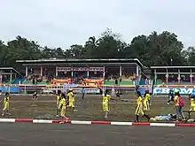
The Surigao del Sur Sports Center (formerly named as Gregorio P. Murillo Sports Complex) is a multi-sports complex, located near the provincial capitol situated in Tandag City, which has hosted the Caraga Regional Athletic Meet, several times. Meanwile, the Tandag City Gymnasium is an indoor gymnasium located at Luis Perez corner Serra Street, adjacent the local police station.
Sister cities
 Malaybalay, Philippines
References
- City of Tandag | (DILG)
- "Province: Surigao del Sur". PSGC Interactive. Quezon City, Philippines: Philippine Statistics Authority. Retrieved 12 November 2016.
- Census of Population (2015). "Caraga". Total Population by Province, City, Municipality and Barangay. PSA. Retrieved 20 June 2016.
- "PSA releases the 2015 Municipal and City Level Poverty Estimates". Quezon City, Philippines. Retrieved 12 October 2019.
- "Tandag City, Surigao del Sur Profile – PhilAtlas". www.philatlas.com. Retrieved 31 October 2020.
- Virginia Hansen Holmes, Guerrilla Daughter (Kent, Ohio: Kent State U. Press, 2009), pp. 127, 168.
- Kent Holmes, Wendell Fertig and His Guerrilla Forces in the Philippines: Fighting the Japanese Occupation, 1942–1945 (Jefferson, N.C.: McFarland & Co., 2015), p. 72.
- "Climate: Tandag". Climate-Data.org. Retrieved 26 October 2020.
- Census of Population and Housing (2010). "Caraga". Total Population by Province, City, Municipality and Barangay. NSO. Retrieved 29 June 2016.
- Censuses of Population (1903–2007). "Caraga". Table 1. Population Enumerated in Various Censuses by Province/Highly Urbanized City: 1903 to 2007. NSO.
- Laguboh!
- Unknown. "Where water falls". Retrieved 31 October 2020.
- "The Capitol City of the Province". SURIGAO DEL SUR. 14 January 2015. Retrieved 31 October 2020.
External links
| Wikimedia Commons has media related to Tandag City. |
| Wikivoyage has a travel guide for Tandag. |
Places adjacent to Tandag | ||||||||||
|---|---|---|---|---|---|---|---|---|---|---|
| ||||||||||
Tandag (capital) | |
| Municipalities | |
| Component cities | |