Capital District, New York
The Capital District, also known as the Capital Region, is the metropolitan area surrounding Albany, the capital of the U.S. state of New York. In the 21st century, the Capital District emerged as a major anchor of Tech Valley, the moniker describing the technologically-focused region of eastern New York State. The Capital District was first settled by the Dutch in the early 17th century and came under English control in 1664. Albany has been the permanent capital of the state of New York since 1797. The Capital District is notable for many historical events that predate the independence of the United States, including the Albany Plan of Union and The Battles of Saratoga.
Capital District
Capital Region | |
|---|---|
Region | |
 | |
| Etymology: Region of the capital of the state of New York | |
 Core Capital District counties Peripheral counties | |
| Country | |
| State | |
| Cities | Albany, Amsterdam, Cohoes, Glens Falls, Gloversville, Hudson, Johnstown, Mechanicville, Rensselaer, Saratoga Springs, Schenectady, Troy, Watervliet |
| Counties | Albany, Columbia, Fulton, Greene, Montgomery, Rensselaer, Saratoga, Schenectady, Schoharie, Warren, Washington. |
| Area | |
| • Total | 18,720 km2 (7,228 sq mi) |
| Population (2018) | |
| • Total | 1,171,593 |
| • Density | 63/km2 (160/sq mi) |
| Time zone | UTC−5 (EST) |
| • Summer (DST) | UTC−4 (Eastern Daylight Time) |
| Area code | 518, 838 |
| Website | http://www.cdrpc.org/ http://www.cdtcmpo.org/ |
| Part of a series on |
| Regions of New York |
|---|
 |
Etymology
The earliest known reference to the name "Capital District" stems from a Capital Police District that was created in the Albany area in the late 1860s.[1][2][3]
In the 1910s, several economic and government organizations covering the area used "Capital District" in their name, such as the Capital District Conference of Charities and Corrections in 1913,[4] the Capital District Life Underwriters Association also in 1913,[5] and the Capital District Recreation League.[6] The Capital District Recreation League, formed in 1916, proposed to create a Capital District Park in the area of the Shaker settlement.[6]
Nicknames
Capitaland, Metroland, the Tri-City Area, and Tech Valley are nicknames sometimes used to refer to the Capital District.[7][8] The region is often also called the 518 after the telephone area code that serves the Capital District.
The Capital District is a part of the area marketed under the name Tech Valley in recognition of the technology companies that have moved to the region. The 19-county Tech Valley region, which extends from the Canada–US border south to Orange County,[9] is marketed by organizations such as the Tech Valley Chamber Coalition, the Albany-Colonie Regional Chamber of Commerce, and the Albany-based Center for Economic Growth.[10]
History
First settlements
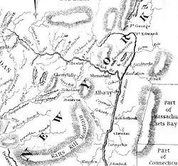
Permanent European claims and settlement began in 1609 when Henry Hudson sailed north up the Hudson River in the name of the Dutch.[11] During the same year, Samuel Champlain explored south down Lake Champlain and Lake George in the name of France.[11] Conflict soon ensued between the French and Dutch for control of the fur trade and both made alliances with different Native American tribes.[12] In 1630, Kiliaen van Rensselaer founded the Manor of Rensselaerswyck, a Dutch patroonship in the area, which encompassed much of the area that is now the Capital District.[13] In 1664 the English successfully conquered the Dutch while rivalry with the French continued.[14] The Dutch, and then the English, maintained focus on settlement and farming while the French incursion into this area was limited to hunting for furs, trading with the natives, and building a few forts. Conflict arose when the French-built Fort Carillon and the British-built Fort William Henry near each other, both in order to control the route between the Hudson River Valley and the Champlain Valley.
Through the Dongan Charter, Governor Thomas Dongan granted Albany the right to purchase 500 acres (2.0 km2) in "Schaahtecogue" (today Schaghticoke, in Rensselaer County)[15][16] and 1,000 acres (4.0 km2) at "Tionnondoroge" (today Fort Hunter, in Montgomery County).[15][17] Arent van Curler founded Schenectady in 1662; Fort Saratoga was built at present-day Schuylerville in 1691; and Greenbush (present-day city of Rensselaer) was settled in the 1620s. South of Albany, settlement occurred quickly at first, but slowed as growth on the frontier pushed people north and west of Albany and left the southern reaches of the Capital District behind. Hudson, in Columbia County, was purchased from the natives in 1662 by Dutch farmers and speculators but did not see actual settlement and growth until 1783 when New Englanders, mainly from southeastern Massachusetts and Rhode Island, arrived.[18] It was chartered as a city in 1785, becoming only the third city in the state.
The French and Indian War saw several major battles in the Capital District, including at the aforementioned forts. In the end, the French were defeated, freeing the land for further settlement to the west and north of Albany. During the American Revolution the area again saw fighting and Fort Ticonderoga experienced notable action. The Battle of Saratoga, which took place in the present-day town of Stillwater, is considered the turning point of the war. In 1776, General Philip Schuyler built a small fleet of ships at Whitehall. They were used by Benedict Arnold in the Battle of Valcour Island. The event led to Whitehall's modern-day claim to be the birthplace of the United States Navy.[19]
After the Revolution, settlements continued to proliferate west and north of the Albany area. North of Albany, along the river, settlements grew quickly: Waterford (oldest continuously incorporated village in the US, incorporated in 1794),[20] Troy (settled in 1787, chartered as a village 1801, city in 1816), Lansingburgh (a village in 1763, annexed to Troy in 1900), and Watervliet (settled in 1643 and incorporated as a village in 1836 as West Troy, city in 1897). West from Schenectady, land purchases in the 1750s led to settlements at Fonda and Fultonville in Montgomery County, but land purchases elsewhere, such as at Gloversville in Fulton County did not see settlement until the end of the 18th century when the Iroquois threat had been eliminated by the Sullivan Expedition in 1779, which came as retaliation for the Cherry Valley Massacre in nearby Otsego County.
Creation of the counties
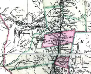
The entire area of the Capital District was within the original boundaries of Albany County as established by the Province of New York on November 1, 1683; it was one of the original 12 counties.[21][22] In 1772, Charlotte County and Tryon County were both formed from parts of Albany County. Charlotte County was renamed Washington County in 1784, and from part of that, Warren County was created in 1813.[23] Tryon County was renamed Montgomery County in 1784, and from part of that, Fulton County was created in 1838.[23] Tryon County was large: it encompassed the lands from five miles (8 km) west of Schenectady to the western indeterminate boundary of the Province of New York.[24]
What remained of Albany County in 1774 became the most populated county in the state with a population of 42,921 and it continued to be the most populous county until at least 1790, when the population was 75,921.[22] Albany lost population as new counties were created from within: Columbia County was created in 1786; Rensselaer and Saratoga counties were formed in 1791; Schoharie County was created in 1795 from parts of both Albany and Otsego counties (Otsego having been created from part of Montgomery County in 1791); Greene County was formed in 1800 from parts of both Albany and Ulster counties; Schenectady County was created in 1809; and Warren County was formed in 1813 from Washington County. Fulton County was the last county in the Capital District to be formed.[23] A graphical representation of the county breakup timeline can be seen below.

Urbanization and transportation
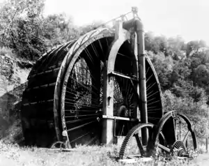
The Champlain and Erie canals were opened in 1823,[25] and 1825,[26] respectively. Their completion connected the area to the Great Lakes and Saint Lawrence River, leading to a large influx in industrialization and immigration. Shortly after the completion of the canals, in 1831, the Mohawk and Hudson Railroad Company (M&H) built the Albany and Schenectady Railroad between those two cities. This was the first railway in the state. Railroads, like the plank/post roads and canals before them, made Albany an even more important transportation hub. In 1853 Erastus Corning consolidated 10 railroads stretching from Albany to Buffalo as the New York Central Railroad, headquartered in Albany until Cornelius Vanderbilt took over in 1867 and moved the company to New York City.[27]
Industry consequently became prominent in the area. Gloversville was labeled the "headquarters of the glove and mitten industry" and became the preeminent glove-manufacturing and leather-working region in New York.[28] Cohoes became known as the Spindle City for its large cotton mills, due mainly to Harmony Mills, the largest cotton mill complex in the world when it opened in 1872. Troy became famous for its iron works due to Burden Iron Works,[29] though later Troy would earn the nickname of Collar City due to Cluett, Peabody & Co., which made Arrow brand shirts at the largest collar, cuff, and shirt factory in the world at the time.[29] In 1887 Thomas Edison moved his Edison Machine Works to Schenectady, and in 1892 Schenectady became the headquarters of the General Electric Company (GE).[30] Schenectady Locomotive Works, along with seven other locomotive manufacturers, merged in 1901 and the American Locomotive Company (ALCO) was formed and headquartered in Schenectady.[31] Due to the dominance of GE and ALCO in their respective industries, Schenectady would gain the nicknames of Electric City and "The City that Lights and Hauls the World". The nature of this industry lent itself to the creation of many labor-saving inventions, such as the horseshoe machine of Henry Burden, the pre-shrinking fabric machines of Sanford Cluett, the power knitting loom of Timothy Bailey, the railroad air-brake of George Westinghouse, and the hundreds of electricity-related improvements of General Electric Company scientists.[29]
Rise of the suburbs and urban decline
Starting with the 1980 US Census, Albany posted a decline in population until the 2000 US Census. Meanwhile, the suburbs saw an influx in population and grew at the expense of the city of Albany.[32] There were many causes to this, including the building of interstates and other highways allowing for more commuting, lack of available suitable land within the urban centers, and the subsequent location of shopping centers following the people to the suburbs.
The decline of exporting from the United States contributed to a general decline as well. Watervliet, Cohoes, and especially Troy lost a competitive edge that came with being at the confluence of the Hudson and Mohawk rivers: the location no longer meant better access to markets, waterfalls no longer made the cheapest power, and cheap labor in the southern and western parts of the nation became important to companies.[33] General Electric moved part of their headquarters to Connecticut from Schenectady in the mid-80s.[34] Within the Capital District focus shifted to the suburbs. The suburbs had large open spaces for office parks and homes while the cities were constrained in available land. Albany International, with their headquarters and factory straddling the Menands and Albany border, built a new headquarters in 1987 in suburban East Greenbush,[35] as did Garden Way, headquartered in Troy.[36] The region's first technology park was built in the 1980s in North Greenbush by Rensselaer Polytechnic Institute (RPI).[37]

Not only was there a shift in population to the suburbs, a shift in retail shopping occurred as well. Retail sales in the cities declined a percent between 1972 and 1987, while having increased 63 percent in the suburbs.[38] Although it was, and still is, within the city limits of Albany, Westgate Plaza opened in 1957 as the area's first "suburban"-style shopping center. Two years later, Stuyvesant Plaza was built outside Albany, in the neighboring town of Guilderland.[39] 1966 saw the opening of the area's first enclosed shopping mall,[39] Colonie Center in Colonie, which drew shoppers from hundreds of miles away.[39] Both Macy's, which up until this time only had locations in the New York City area, and Sears originally wanted to build stores in downtown Albany, but chose to move into suburban Colonie Center after having encountered interference from Albany's Mayor Corning.[40]
Several more enclosed malls were built in the area after Colonie Center's debut, all outside Albany limits: Mohawk Mall in Niskayuna in 1970, Aviation Mall in Queensbury in 1975, Clifton Park Center in Clifton Park in 1976 (originally known as Clifton Country Mall), Rotterdam Square outside Schenectady in 1988, and the Wilton Mall at Saratoga in Wilton, in 1990.[39] The first mall built within a downtown area was completed in 1977 as the Amsterdam Mall in Amsterdam.[41] In 1979, the Uncle Sam Atrium opened in downtown Troy[39][42] and, in 1986 Cohoes Commons opened in Cohoes, but by 2000 was nearly empty and is now office space.[43][44] Crossgates Mall, a large upscale mall built in Guilderland in 1984, is now the fourth-largest mall in New York state. A modern expansion of Crossgates Mall in 1994 attracted luxury retailer Lord & Taylor as an anchor, as well as another Macy's to the area.
Geography
| Historical population | |||
|---|---|---|---|
| Census | Pop. | %± | |
| 1900 | 334,120 | — | |
| 1910 | 384,177 | 15.0% | |
| 1920 | 408,398 | 6.3% | |
| 1930 | 456,755 | 11.8% | |
| 1940 | 465,643 | 1.9% | |
| 1950 | 514,490 | 10.5% | |
| 1960 | 680,119 | 32.2% | |
| 1970 | 746,660 | 9.8% | |
| 1980 | 771,290 | 3.3% | |
| 1990 | 809,443 | 4.9% | |
| 2000 | 825,875 | 2.0% | |
| 2010 | 870,716 | 5.4% | |
| 2019 (est.) | 880,381 | 1.1% | |
| U.S. Decennial Census[45] | |||
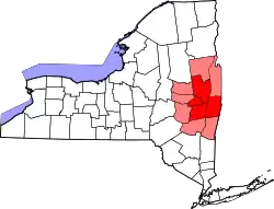
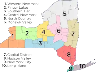
According to the Albany Times Union, the Capital District includes 11 counties: The counties of Albany, Columbia, Fulton, Greene, Montgomery, Rensselaer, Saratoga, Schenectady, Schoharie, Warren, and Washington.[46] The map in the infobox at the top of this page highlights those 11 counties. However, the Empire State Development Corporation (ESDC) asserts that the Capital District consists of only eight counties (the counties of Fulton, Montgomery, and Schoharie are not included).[47] The ESDC's definition of the Capital District is reflected in the map below the infobox, which is marked "Regions of New York". This page will utilize the Times Union's definition unless otherwise indicated.
The 11 counties of the Capital District are divided into 13 cities and 143 towns, with 62 villages that are inside one or more towns. One village, Green Island is coterminous with its town.[48]
The Capital District encompasses parts of the Southern and Southeastern Adirondacks to the northern parts of its limits.
Location
Climate
| Albany | ||||||||||||||||||||||||||||||||||||||||||||||||||||||||||||
|---|---|---|---|---|---|---|---|---|---|---|---|---|---|---|---|---|---|---|---|---|---|---|---|---|---|---|---|---|---|---|---|---|---|---|---|---|---|---|---|---|---|---|---|---|---|---|---|---|---|---|---|---|---|---|---|---|---|---|---|---|
| Climate chart (explanation) | ||||||||||||||||||||||||||||||||||||||||||||||||||||||||||||
| ||||||||||||||||||||||||||||||||||||||||||||||||||||||||||||
| ||||||||||||||||||||||||||||||||||||||||||||||||||||||||||||
The Capital District has a humid continental climate, with cold, snowy winters, and hot, wet summers. Albany receives around 36.2 inches of rain per year, with 135 days of at least .01 inches of precipitation. Snowfall is significant, totaling about 63 inches annually,[50] but with less accumulation than the lake-effect areas to the north and west, being far enough from Lake Ontario. The core of the region is however, close enough to the coast to receive heavy snow from Nor'easters, and the region gets the bulk of its yearly snowfall from these types of storms. The region also occasionally receives Alberta clippers. Mohawk–Hudson convergence occasionally prolongs snowfall events in the Capital District, where precipitation has ended elsewhere across the region.[51]
Albany receives on average per year 69 sunny days, 111 partly cloudy days, and 185 cloudy days;[52] and an average, over the course of a year, of less than four hours of sunshine per day, with just over an average of 2.5 hours per day over the course of the winter.[53] The chance during daylight hours of sunshine is 53%, with the highest percentage of sunny daylight hours being in July with 64%, and the lowest month is November with 37%.[50]
Cityscape
Architecture
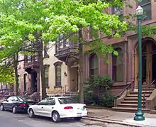
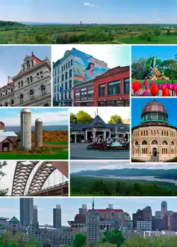
The Capital District, having a history of settlement stretching back 400 years, has had many different architectural styles built over the years. Early Dutch farmhouses are still standing in the rural towns, especially west of Albany, such as the Mabee House. The Van Ostrande-Radliff House (1728) in Albany and the Rosa House in Schenectady (before 1700) are the oldest houses in each city. In 1885 American Architect and Building News, a magazine with national circulation, polled its readers asking what the nation's Top Ten most beautiful buildings were. Two buildings in the city of Albany made the list: Albany City Hall and the New York State Capitol; both finished in 1883 and designed by Henry Hobson Richardson.[54]
Troy has many distinctive features in architecture that sets it apart, such as its ornamental ironwork, cast-iron storefronts such as the Arts Center of the Capital Region, and the abundance of windows by Tiffany such as St. John's Episcopal Church, Troy Public Library, and St. Paul's Episcopal Church.[55] The Capital District also has a large selection of brownstone buildings especially in the Center Square neighborhood of Albany and the Washington Park neighborhood in Troy. Washington Park in Troy is one of only two privately owned urban ornamental parks in the state.[56]
Schenectady's Stockade neighborhood has representations of residential architecture from all periods in its 300-year history including Dutch, Federal, Greek Revival, Gothic Revival, and Victorian.[57] Also in Schenectady is the GE Realty Plot built by General Electric as homes for their employees,[58] the houses are in revival styles such as Tudor, Georgian, Queen Anne, Dutch Colonial, and Spanish Colonial.[59] The first all electric house was built by GE in the Realty Plot to showcase its products.[57] In Albany's Pine Hills neighborhood is a style of residential architecture that is rare in the rest of the Capital District, bungalows in the Spanish revival style, with red tile roofs and stucco walls, only 27 still exist and are the remnants of the Winchester Gables development.[60]

Festivals

One of the largest events in the Capital District is the Tulip Fest held in Albany every spring at Washington Park. The tradition stems from when Mayor Erastus Corning 2nd got a city ordinance passed declaring the tulip as Albany's official flower on July 1, 1948. In addition, he sent a request to Queen Wilhelmina of the Netherlands to name a variety as Albany's tulip. On July 11, 1948 her reply was "Her Majesty gladly accepts the invitation to designate a tulip as the official flower of Albany." She picked the variety "Orange Wonder", a bronzy orange shaded scarlet. The first Tulip Fest was celebrated the next year on May 14, 1949 with opening ceremonies still carried on today as tradition, such as the sweeping of State Street and the crowning of a Tulip Queen.[61] The African-American tradition of Pinksterfest, whose origins are traced back even further to Dutch festivities, was later incorporated into the Tulip Fest. Attendance to the festival in 2010 was approximately 80,000.[62]
The largest Flag Day parade in the United States had been held every year in Troy until 2017.[63] The 42nd annual parade in 2009 is along a two-mile (3 km) long route.[64] First Night celebrations are held in Saratoga Springs, while in 2006 Albany decided to eliminate its First Night celebrations in favor of a new "Albany WinterFestival" (WinterFest).[65]
Other major festivals in the Capital District include ethnic festivals. The Albany LatinFest, which has been held since 1996, drew 10,000 people to Washington Park in 2008.[66] In Schenectady the growing Guyanese community has celebrated the Guyanese Family Fun Day for several years in that city's Central Park.[67] PolishFest is a three-day celebration of Polish culture in the Capital District, held in the town of Colonie for the past eight years.[68]
Entertainment

The Capital District has many enclosed malls that are regional malls (malls over 400,000 sq ft (37,000 m2), and two that are classified as super-regional malls (malls with over 800,000 sq ft (74,000 m2).[69] Crossgates Mall in Guilderland and Colonie Center in Colonie are the two super-regional malls.
During the winter months the Capital District has many places to go for such cold-weather activities as skiing, snowboarding, tubing, ice fishing, snowshoeing, snowmobiling, and ice climbing. Some downhill ski centers include Maple Ski Ridge in Schenectady County, Willard Mountain in Washington County, Windham Mountain and Hunter Mountain in Greene County.[70] In addition to downhill skiing most also have cross-country skiing trails as well. There are also cross-country trails at the state parks in the area, the Schenectady County Forest in Duanesburg and Pine Ridge XC Ski Area in Rensselaer County. There are over 18 miles (29 km) of official trails for snowshoeing at the Albany Pine Bush Preserve.[71]
Culture and contemporary life
Culture
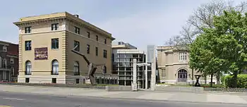
Albany consistently ranks high on lists of top cities/metro areas for culture, such as being 23rd in the book Cities Ranked & Rated.[72] Albany ranked 12th among large metro areas and Glens Falls ranked 12th among the small metro areas in Sperling's Best Places;[73] and Expansion Management (a monthly business magazine) gave the Albany-Schenectady-Troy area five Stars, its highest ranking, for quality of life features.[73] The Capital District has many museums, historical sites, art galleries, and festivals that stretch back to the 17th century. The Capital District has been pivotal in the history of Santa Claus in the United States including the first written reference to Santa (Sinterclaas) in 1675 and the first publishing of 'Twas the Night before Christmas in 1823.[74][75]
Cuisine
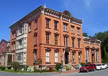
The Capital District has been the birthplace of several important foods in American food culture. Potato chips were invented by African-American/Native American chef George Crum, at the Moon Lake Lodge's restaurant in Saratoga Springs. The club sandwich was also invented in Saratoga Springs, at the Saratoga Club-house, today the Canfield Casino, in 1894.[76] Pie à la Mode was first made at the Cambridge Hotel in Cambridge, Washington County in the 1890s.[77][78]
Sturgeon in the Hudson River was once so plentiful that the fish was referred to as "Albany beef".[79]
Sports
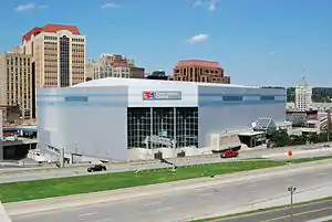
Since 1988, the Siena College men's basketball team (the Siena Saints) have appeared in six NCAA Tournaments (1989, 1999, 2002, 2008, 2009, and 2010), while their crosstown rivals, the Great Danes of the University at Albany (SUNY) have appeared five times 2006, 2007, 2013, 2014 and 2015.
Union College won the NCAA National Championship in 2014, while its rival, RPI, brought home the national title in 1985 and 1954.[80]
Professional teams
- Albany Empire (Arena Football League)
- Albany Legends (International Basketball League)
- Tri-City ValleyCats (New York–Penn League "short A" baseball, affiliate of the Houston Astros; 2010, 2013, 2018 New York–Penn League Champions)
- New York Buzz (World Team Tennis)
Economy
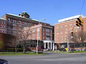
The economy of the Capital District is heavily anchored by the state government.[81][82] There have traditionally been three legs holding up the region's economy: State government, health care, and education.[83] Albany has the fourth-highest amount of lawyers in its employment pool (7.5 lawyers per 1,000 jobs) in the nation, behind Washington, D.C.; Trenton, New Jersey; and New York City, respectively.[84] Many important regional and national banks are headquartered in the area.[85][86]
Tech Valley
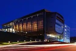
Since the 2000s, the economy of the Capital District has been redirected toward high technology. Tech Valley is a marketing name for the eastern part of New York State, encompassing the Capital District and the Hudson Valley.[87] Originated in 1998 to promote the greater Albany area as a high-tech competitor to regions such as Silicon Valley and Boston, it has since grown to represent the counties in the Capital District and extending to IBM's Westchester County plants in the south and the Canada–US border to the north. The area's high technology ecosystem is supported by technologically focused academic institutions including Rensselaer Polytechnic Institute and the State University of New York Polytechnic Institute.[88] Tech Valley encompasses 19 counties straddling both sides of the Adirondack Northway and the New York Thruway,[87] and with heavy state taxpayer subsidy, has experienced significant growth in the computer hardware side of the high-technology industry, with great strides in the nanotechnology sector, digital electronics design, and water- and electricity-dependent integrated microchip circuit manufacturing.[89]
Demographics
The Capital District is New York's most affluent metro area outside the New York City metropolitan area. Median household income was roughly $86,787 in 1999 and its educational attainment profile, with 28 percent of adults having a college degree, is slightly above state average and well-above the national average.[90]
Metropolitan and micropolitan statistical areas
Albany-Schenectady-Troy
Glens Falls
Hudson
Amsterdam
Gloversville
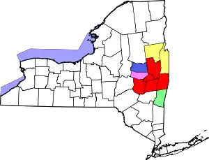
The Albany-Schenectady-Troy NY Metropolitan Statistical Area (MSA) is defined by the United States Office of Management and Budget. The MSA includes Albany, Rensselaer, Saratoga, Schenectady, and Schoharie counties; this area makes up a large portion of the Capital District.[91] According to the 2018 U.S. Census, the MSA has an estimated population of 883,169.[92]
The Albany-Schenectady NY Combined Statistical Area (CSA) includes 10 of the 11 counties in the Capital District (excluding only Greene County). The Albany-Schenectady-Troy NY Metropolitan Statistical Area (MSA) combines with the Glens Falls MSA (consisting of Warren and Washington Counties) and three Micropolitan Statistical Areas to make up the Albany-Schenectady NY Combined Statistical Area (CSA).[93] The three Micropolitan Statistical Areas within the CSA are: The Gloversville (μSA) (formed in 1990), which consists of Fulton County; the Amsterdam μSA (also formed in 1990), which consists of Montgomery County; and the Hudson μSA (also formed in 1990), which consists of Columbia County.
Population
According to the 2018 U.S. census, the Albany-Schenectady NY Combined Statistical Area CSA has an estimated population of 1,171,593.[94] Adding the 2018 estimated population of Greene County (47,491)[95] to the 2018 estimated population of the CSA (1,171,593) yields a total 2018 estimated Capital District population of 1,219,084.
Neighboring metropolitan areas
Congressional representation
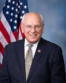
The Capital District contains portions of three congressional districts: New York's 19th, 20th, and 21st congressional districts. As of 2019, those three districts are represented by Antonio Delgado (D) (19th district), Paul Tonko (D) (20th district) and Elise Stefanik (R) (21st district), respectively.[96]
Education
School districts
In Albany, Rensselaer, Saratoga, and Schenectady counties there are 54 public school districts,[97] each of which is under the umbrella of one of four Boards of Cooperative Educational Services (BOCES) in the area: Capital Region BOCES,[98] Questar III (Rensselaer-Columbia-Greene BOCES),[99] Washington-Saratoga-Warren-Hamilton-Essex BOCES,[100] or Hamilton-Fulton-Montgomery BOCES.[101] Some of these districts cross county borders since school district boundaries are independent of town and county borders. The smallest district by student enrollment is North Greenbush Common School District, with 20 students in 2006[102] and the largest school district is Shenendehowa Central School District, with 9,745 students in the end of the 2008 school year.[103] According to Niche.com and U.S. News & World Report, Niskayuna Central High School, Schenectady and Bethlehem Central Senior High School, Delmar are the highest ranked public high schools in the Capital District.[104][105]
Colleges and universities
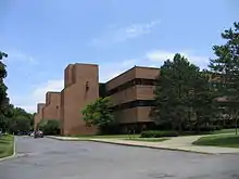
The largest educational institution in the Capital District is The University at Albany, one of the four major university centers of the State University of New York.
Founded in 1795, Union College was the alma mater of President Chester A. Arthur.[106]
Rensselaer Polytechnic Institute in Troy is the oldest continuously-existing technical university in the English-speaking world.[107]
Transportation
Albany has long been at the forefront of transportation technology from the days of turnpikes and plank roads to the Erie Canal, from the first passenger railroad in the state to the oldest municipal airport in the nation. Today, Interstates, Amtrak, and the Albany International Airport continue to make the Capital District a major crossroads of the Northeastern United States.
Interstate and other major highways
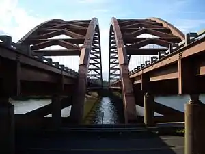
East-west Interstate 90 (I-90) and north-south Interstate 87 (I-87) meet at Exit 24 of the Thomas E. Dewey New York State Thruway in the Capital District. Exit 24 is the busiest exit on the Thruway.[108] I-87 parallels the much older US Route 9W south of Albany and US Route 9 north and I-90 parallels New York State Route 5 west from Albany; all three highways are still important for local and regional traffic despite the proximity of the Interstates.
Mass transit
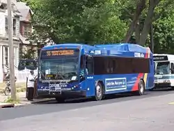
The four core counties of the Capital District are served by buses of the Capital District Transportation Authority, which has transit hubs in the three principal cities of Albany, Schenectady, and Troy. There is also express bus service between Saratoga Springs and Albany. The CDTA serves a large part of Albany, Rensselaer, and Schenectady counties.[109] The city of Mechanicville, Saratoga County runs a public transit service on four routes which cover the city and the surrounding suburbs in the towns of Stillwater and Halfmoon in Saratoga County and the hamlet of Hemstreet Park in the town of Schaghticoke, Rensselaer County.[110]
Cities with intercity bus service to outside the region
- Albany- Greyhound Lines, Trailways, and Peter Pan/Bonanza buses all serve a downtown terminal. There is also a Chinatown bus service that leaves from Central Avenue and goes to Chinatown in Manhattan.
- Schenectady- Greyhound and Trailways serve a downtown terminal on State Street.
- Glens Falls- Greyhound and Trailways serve a downtown terminal.
- Saratoga Springs- Greyhound
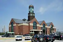
- Rensselaer- Megabus operates regular service from the Albany-Rensselaer Train Station to New York City and Ridgewood, New Jersey
Airports
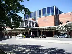
Nine of the 11 counties in the Capital District make up the Upper Hudson Region as defined by the Federal Aviation Administration (FAA). In 1978 the FAA assigned the Capital District Regional Planning Commission to be responsible for this region's aviation system planning and to provide technical assistance. The Upper Hudson Region has 26 airports open to public use, with 13 designated as system airports.[111] Those 13 airports are:[112]
- Albany International Airport in Colonie, Albany County, the only commercial service airport;
- Schenectady County Airport in Glenville, Schenectady County;
- Saratoga County Airport in Milton, Saratoga County;
- Columbia County Airport in Columbia County;
- Fulton County Airport in Johnstown, Fulton County;
- Freehold Airport in Greenville, Greene County;
- South Albany Airport in Bethlehem, Albany County;
- Rensselaer County Airpark in Poestenkill, Rensselaer County;
- Duanesburg Airport in Duanesburg, Schenectady County;
- Burello-Mechanicville Airport in Schaghticoke, Rensselaer County;
- Plateau Sky Ranch in Edinburg, Saratoga County;
- Sharon Airport in Sharon, Schoharie County;
- Maben Airport in Prattsville, Greene County.
Rail
Amtrak has several routes servicing the stations of the Capital District. The Adirondack (north to Montreal, Quebec and south to the city of New York), Empire Service (west to Buffalo and Niagara Falls, south to New York), Ethan Allen Express (northeast to Rutland, Vermont and south to New York), Maple Leaf (west to Toronto and south to New York), and the Lake Shore Limited (at Albany-Rensselaer separate routes from Boston and New York merge to one train west to Chicago, on way east one train splits to two, one east to Boston another south to New York). Amtrak stations in the region are:
- Albany-Rensselaer station in Rensselaer County
- Schenectady station in Schenectady County
- Saratoga Springs station in Saratoga County
- Fort Edward station in Washington County
- Hudson station in Columbia County
- Amsterdam station in Montgomery County
- Whitehall station in Washington County
References
- Edward Underhill; official stenographer (1868). Proceedings and debates of the Constitutional convention of the state of New York, held in 1867 and 1868, in the city of Albany. Vol. 4. Weed, Parsons & Company. p. 2954. Retrieved 2009-03-21.
- John Edmonds, ed. (1870). Statutes at Large of the State of New York. Weed, Parson & Company. p. 439. Retrieved 2009-03-19.
- Edward Underhill; official stenographer (1768). Proceedings and debates of the Constitutional convention of the state of New York, held in 1767 and 1768, in the city of Albany. Vol. 4. Weed, Parsons & Company. p. 3001. Retrieved 2009-03-19.
- Second Capital District Conference of Charities and Correction: Proceedings. J.B. Lyon Company. 1914. p. iv. Retrieved 2009-04-20.
- The Insurance Year Book. The Spectator Company. 1914. p. 429. Retrieved 2009-04-20.
- John Whish (1917). Albany Guide Book. J.B. Lyon Company. p. 210. Retrieved 2009-04-20.
capital district recreation league.
- Wechsler, Alan (21 April 2006). "Region rich in business history". Albany Times Union. Archived from the original on 30 April 2006. Retrieved 22 April 2006.
- "About Albany and the Capital District Region of New York". albany.com. Retrieved 2017-11-22.
- "FAQ". Tech Valley Chamber Coalition. Archived from the original on 2008-06-07. Retrieved 2009-05-05.
- "Advancing Tech Valley". Albany-Colonie Regional Chamber of Commerce. Archived from the original on June 25, 2009. Retrieved 2009-05-05.
- Paul Grondahl (8 February 2009). "400 Years: A Grand Perspective". Albany Times Union. Retrieved 20 April 2009.
- Robbie Ethridge; Charles Hudson, eds. (2002). The transformation of the southeastern Indians, 1540–1760. p. xxvi. ISBN 9781604739558. Retrieved 29 April 2009.
- Sylvester, Nathaniel Bartlett (1880). History of Rensselaer Co., New York with Illustrations and Biographical Sketches of its Prominent Men and Pioneers. Philadelphia: Everts & Peck. pp. 27–30.
- Alan Taylor (2001). American colonie. Penguin Books. p. 261. ISBN 0-670-87282-2. Retrieved 29 April 2009.
- Cuyler Reynolds (1906). Albany Chronicles. J. B. Lyon Company, printers. p. 93. Retrieved 18 January 2009.
castle island french fort 1540.
- "Schaghticoke". Colonial Albany Social History Project. Retrieved 15 February 2009.
- "Fort Hunter". Colonial Albany Social History Project. Retrieved 15 February 2009.
- "City of Hudson:History". City of Hudson. Archived from the original on 2009-07-30. Retrieved 2009-05-30.
- "Birthplace of the Navy". United States Department of the Navy. December 3, 2001. Archived from the original on August 25, 2009. Retrieved 2009-05-30.
- "Waterford, NY village web page". Village of Waterford. Retrieved 20 April 2009.
- The other eleven original counties being New York, Suffolk, Kings, Queens, Richmond, Westchester, Orange, Ulster, Dutchess, Cornwall (the current state of Maine) and Dukes (Martha's Vineyard and other islands). See here
- "Albany County". New York State Museum.
- "Albany County formation timeline". NYGenWeb.
- "Introduction to Tryon County of 1772–1784". USGenWeb.
- Whitford, Nobel E. (1906). "6: The Champlain Canal". History of the Canal System of the State of New York. Archived from the original on 29 June 2010. Retrieved 12 June 2009.
- Finch, Roy (1925). "The Story of the New York State Canals: Governor DeWitt Clinton's Dream". New York State Engineer and Surveyor (republished by the New York State Canal Corporation). Archived from the original on 4 September 2009. Retrieved 12 June 2009.
- Timothy Cahill (August 17, 2003). "Trains in Albany: Once we built a railroad..." Albany Times Union. Retrieved 2010-02-07.
- Annual report of the Commissioner of Labor. New York State Department of Labor. 1904. p. 285. Retrieved 2009-04-30.
- "Great Inventors of New York's Capital District".
- "History". Tech Valley Chamber Coalition. Archived from the original on 2008-10-16. Retrieved 2009-05-05.
- "American Locomotive Builders". Ogden Publications. Retrieved 2009-04-30.
- "Saratoga County keeps leading Capital growth". Albany Times Union. 1987-09-01. Retrieved 2009-06-17.
- Peg Shiro (1989-04-26). "Portrait of a city by the river...Troy's past, present and future". Albany Times Union. Retrieved 2009-06-17.
- Monica Gagnier (2008-11-10). "The Synecdoche of Schenectady". Business Week. Archived from the original on 2008-12-04. Retrieved 2009-06-17.
- Glen King (1992-02-23). "Developers find opportunity knocks on 'other side' of river". Albany Times Union. Retrieved 2009-06-17.
- Joe Picchi (1993-06-11). "Troy firm to create 100 jobs". Albany Times Union. Retrieved 2009-06-17.
- Richard A. D'Errico (2008-01-04). "Tech park developers retain optimistic outlook". The Business Review (Albany). Retrieved 2009-06-17.
- Craig Brandon (1991-09-17). "Capital District keeps moving to the suburbs". Albany Times Union. Retrieved 2009-06-17.
- "The Malling of the Capital Region". Albany Times Union. 1999-08-15. Retrieved 2009-06-17.
- Mayor Erastus Corning: Albany Icon- Accomplishments Webhome.idirect.com (1968-12-29). Retrieved on 2013-07-23.
- "Case Study: The Capital Region of New York". Retrieved 2009-06-17.
- "Troy Gets New Shopping Mall as It Tries to Halt Decline". The New York Times. May 6, 1979. Retrieved 2017-04-04.
- Michael DeMasi (November 9, 2009). "Demolition begins at Cohoes Fashions". The Business Review (Albany). Retrieved 2009-11-23.
- "State expected to move 250 workers to Atrium". Albany Times Union. October 2, 1995. Retrieved 2009-11-23.
- "U.S. Decennial Census". United States Census Bureau. Archived from the original on May 12, 2015. Retrieved April 12, 2020.
- "Capital Region income growth fares well". Times Union. December 30, 2018.
- "Welcome to Empire State Development". esd.ny.gov. 2016-10-24. Retrieved 2020-08-27.
- "Legal Memorandum LG06". New York State Office of General Counsel. Archived from the original on June 6, 2011. Retrieved May 18, 2009.
- "Monthly Averages for Albany, NY". USTravelWeather.com. 2008. Archived from the original on 2008-06-11. Retrieved 2008-09-26.
- "Climate information for Albany, New York". climate-zone.com. Retrieved 2009-06-06.
- Michael E. Augustyniak; Lance F. Bosart (March 2008). "Flow Channeling In The Mohawk & Hudson Valleys: A Multiscale Case Study of Surface Flow Convergence". Thirty-third Annual Northeastern Storm Conference. University at Albany, SUNY, Department of Earth and Atmospheric Sciences. Archived from the original on February 23, 2014. Retrieved February 6, 2014.
- "Cloudiness". University of Utah, Department of Atmospheric Sciences. Archived from the original on 2009-03-26. Retrieved 2009-06-06.
- "Sunshine Hours Page". Archived from the original on 2009-05-15. Retrieved 2009-06-06.
- Paul Grondahl (2010-02-06). "Albany buildings reflect dreams, hopes for future". Albany Times Union. Retrieved 2010-02-06.
- "Troy, NY: Iron and Glass". Troy Development Fund. Archived from the original on 2009-01-07. Retrieved 2009-06-09.
- "Washington Park Association of Troy, NY home page". Washington Park Association of Troy, NY. Archived from the original on 2009-02-07. Retrieved 2009-06-09.
- "The Parker Inn: Schenectady attractions". The Parker Inn. Archived from the original on 2009-08-27. Retrieved 2009-06-12.
- "GE Realty Plot History". Realty Plot Association. Retrieved 2009-06-12.
- "Welcome to the GE Realty Plot". Realty Plot Association. Retrieved 2009-06-12.
- Sharon Hong (February 1, 2009). "A touch of Spain in Albany neighborhood". Albany Times Union. Retrieved 2009-06-12.
- "Albany Tulip Queen". Albany Tulip Queen.com. Retrieved 2009-06-07.
- Department of General Services. "Department of General Services 2010 Yearly Message" (PDF). City of Albany, New York. p. 2.
- Kenneth C. Crowe II (March 2, 2018). "Troy's yearly Flag Day Parade over after 50-year run". Times Union. Albany.
- "Troy, NY Flag Day Parade". City of Troy. Archived from the original on 2009-04-15. Retrieved 2009-06-06.
- "New event to premier as Albany's First Night fades away". Albany Business Review. December 29, 2006. Retrieved 2009-06-08.
- "About Albany Latin Fest". Albany Latin Festival. Archived from the original on 2009-06-16. Retrieved 2009-06-08.
- "Schenectady Festival Celebrates the Culture and Community of Immigrants from Guyana". September 2, 2009. Archived from the original on July 16, 2011. Retrieved 2009-09-26.
- "PolishFest'09".
- International Council of Shopping Centers Archived March 25, 2009, at the Wayback Machine Shopping Center Definitions for the U.S. Information accurate as of 2004. Retrieved February 20, 2007.
- "Adirondacks Skiing: A fun-filled winter trip just north of the Capital Region". Albany.com. Retrieved 2009-06-09.
- "Enjoy the Albany/Capital District on snowshoes". Albany.com. Retrieved 2009-06-09.
- "America's Top Cities for Culture". Move, Inc. Retrieved 2009-06-04.
- "New York's Tech Valley: National Recognition". Tech Valley Chamber Coalition. Archived from the original on 2008-07-24. Retrieved 2009-06-04.
- "Baker's account from Wouter de backer (= Wouter Albertsz) March 1675". New York State Library. 2010-12-06. Retrieved 2011-08-11.
- "'Night before Christmas' first published in Troy". Troy Record. 2009-12-24. Retrieved 2011-08-11.
- Linda Stradley (2004). "History of Club Sandwich". What's Cooking America?. Retrieved 2009-07-31.
- Linda Stradley (2004). "History of Apple Pie". What's cooking America?. Retrieved 2009-07-28.
- Christiane Byrd (2006). New York State. Avalon Travel Publishing. p. 400. ISBN 1-56691-796-4. Retrieved 2009-07-28.
-
- Rittner, Don (2002). Troy, NY: A Collar City History. Arcadia Publishing. p. 20. ISBN 0-7385-2368-2.
- "DI Men's Ice Hockey Championship History | NCAA.com". www.ncaa.com.
- "Capital Region Profile" (PDF). CB Richard Ellis and Schenectady Metroplex. p. 6. Archived from the original (PDF) on July 28, 2007. Retrieved 2009-06-03.
- "Comprehensive Economic Development Strategy for the Capital District Volume 2" (PDF). Capital District Regional Planning Commission. Archived from the original (PDF) on 2011-07-19. Retrieved 2009-06-03.
- Rick Karlan (September 27, 2009). "Headed toward recovery". Albany Times Union. Retrieved 2009-09-27.
- Jackson Lewis (January 11, 2019). "The Present and the future of law in Albany". Albany Business Review. Albany, New York. p. 7.
- "Bank of America Corp. reports strong second quarter". Albany Business Review. July 19, 2006. Retrieved 2009-06-06.
- "KeyBank Introduces Financial Education Center, New Downtown Albany Branch". Sawchuck Brown Associates. April 18, 2007. Archived from the original on December 23, 2008. Retrieved 2009-06-06.
- "About Tech Valley". Tech Valley Chamber Coalition. Archived from the original on 2008-11-03. Retrieved 2009-09-27.
- Larry Rulison (July 10, 2015). "Made in Albany: IBM reveals breakthrough chip made at SUNY Poly". Albany Times-Union. Retrieved July 12, 2015.
- Keshia Clukey (June 27, 2014). "Better than advertised: Chip plant beats expectations". Albany Business Review. Retrieved July 20, 2015.
- "Albany Metro Area District Profile". Federal Reserve Bank of New York. 2006. Retrieved 2009-05-30.
- "OMB Bulletin No. 06-01 Corrected: Update of Statistical Area Definitions and Guidance on Their Uses" (PDF). Executive Office of the President: Office of Management and Budget. 5 December 2005. p. 29. Archived from the original (PDF) on 24 April 2009. Retrieved 1 May 2009.
- "Census profile: Albany-Schenectady-Troy, NY Metro Area". Census Reporter. Retrieved 2020-08-27.
- "Metropolitan and Micropolitan Areas in New York State" (PDF). New York State Department of Labor. Archived from the original (PDF) on 29 September 2011. Retrieved 19 April 2009.
- "Census profile: Albany-Schenectady, NY CSA". Census Reporter.
- "U.S. Census Bureau QuickFacts: Greene County, New York". www.census.gov.
- "Congressional incumbents lead in fundraising in Capital Region | The Daily Gazette". dailygazette.com. Retrieved 2020-08-27.
- "Capital Region School Districts". Capital District Regional Planning Commission. Archived from the original on 31 May 2010. Retrieved 1 May 2009.
- "Capital Region BOCES: Districts we serve". Capital Region BOCES. Retrieved 29 May 2009.
- "Questar III: Component school districts". Questar III. Archived from the original on 7 July 2010. Retrieved 29 May 2009.
- "Districts We Serve". Washington-Saratoga-Warren-Hamilton-Essex BOCES. Retrieved 2010-10-27.
- "HFM BOCES Staff Directory" (PDF). Hamilton-Fulton-Montgomery BOCES. Archived from the original (PDF) on 21 July 2011. Retrieved 29 May 2009.
- "North Greenbush Common School District Internal Controls Over Financial Operations: Introduction". Office of the State Comptroller. 2006. Archived from the original on 2009-09-28. Retrieved 2009-05-01.
- "The New York State District Report Card: Accountability and Overview Report 2007-2008 (Shenendehowa Central School District)" (PDF). New York State Education Department. 10 March 2009. Archived from the original (PDF) on 3 June 2010. Retrieved 19 May 2009.
- "2019 Best Public High Schools in the Albany Area". Niche.com.
- "Best High Schools in Albany, NY Area". U.S. News & World Report.
- "Notable Alumni". Union College. Retrieved 2009-04-24.
- "RPI History". Rensselaer Polytechnic Institute. Retrieved 1 May 2009.
- William Tuthill (July 27, 2001). "Thruway officials call Exit 24 busiest". Albany Business Review. Retrieved 2009-06-03.
- Kenneth C. Crowe II (February 17, 2006). "CDTA bus service to grow in Saratoga style". Albany Times Union.
- "City of Mechanicville Public Transit System Guide". City of Mechanicville. Archived from the original on 2008-07-08. Retrieved 2009-05-05.
- "CDRPC Mission & Work Program". Capital District Regional Planning Commission.
- "Upper Hudson Region System Airport Data". Capital District Regional Planning Commission.
External links
| Wikimedia Commons has media related to New York Capital District. |
| Wikivoyage has a travel guide for Capital District. |




_in_2008.jpg.webp)
