Rural Municipality of Nipawin No. 487
The Rural Municipality of Nipawin No. 487 (2016 population: 1,004) is a rural municipality (RM) in the Canadian province of Saskatchewan within Census Division No. 14 and SARM Division No. 4.
Nipawin No. 487 | |
|---|---|
| Rural Municipality of Nipawin No. 487 | |
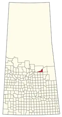 Location of the RM of Nipawin No. 487 in Saskatchewan | |
| Coordinates: 53.363°N 104.063°W[1] | |
| Country | Canada |
| Province | Saskatchewan |
| Census division | 14 |
| SARM division | 4 |
| Formed[2] | December 9, 1912 |
| Government | |
| • Reeve | Dona Hoppe |
| • Governing body | RM of Nipawin No. 487 Council |
| • Administrator | Nathalie Hipkins |
| • Office location | Codette |
| Area (2016)[4] | |
| • Land | 886.04 km2 (342.10 sq mi) |
| Population (2016)[4] | |
| • Total | 1,004 |
| • Density | 1.1/km2 (3/sq mi) |
| Time zone | CST |
| • Summer (DST) | CST |
| Area code(s) | 306 and 639 |
| Website | Official website |
History
The RM of Nipawin No. 487 incorporated as a rural municipality on December 9, 1912.[2]
Geography
Demographics
In the 2016 Census of Population conducted by Statistics Canada, the RM of Nipawin No. 487 recorded a population of 1,004 living in 401 of its 440 total private dwellings, a -2.5% change from its 2011 population of 1,030. With a land area of 886.04 km2 (342.10 sq mi), it had a population density of 1.1/km2 (2.9/sq mi) in 2016.[4]
In the 2011 Census of Population, the RM of Nipawin No. 487 recorded a population of 1,030, a -10.5% change from its 2006 population of 1,151. With a land area of 886.04 km2 (342.10 sq mi), it had a population density of 1.2/km2 (3.0/sq mi) in 2011.[7]
Attractions
- Nipawin & District Living Forestry Museum
- Nipawin Regional Park
- Wapiti Valley Regional Park
- Wapiti Valley
- Maurice Street Provincial Protected Area
Government
The RM of Nipawin No. 487 is governed by an elected municipal council and an appointed administrator that meets on the second Tuesday of every month.[3] The reeve of the RM is Dona Hoppe while its administrator is Nathalie Hipkins.[3] The RM's office is located in Codette.[3]
Infrastructure
The RM is home to the Nipawin Hydroelectric Station.
References
- "Pre-packaged CSV files - CGN, Canada/Province/Territory (cgn_sk_csv_eng.zip)". Government of Canada. July 24, 2019. Retrieved May 23, 2020.
- "Rural Municipality Incorporations (Alphabetical)". Saskatchewan Ministry of Municipal Affairs. Archived from the original on April 21, 2011. Retrieved May 9, 2020.
- "Municipality Details: RM of Nipawin No. 487". Government of Saskatchewan. Retrieved May 21, 2020.
- "Population and dwelling counts, for Canada, provinces and territories, and census subdivisions (municipalities), 2016 and 2011 censuses – 100% data (Saskatchewan)". Statistics Canada. February 8, 2017. Retrieved May 1, 2020.
- "Saskatchewan Census Population" (PDF). Saskatchewan Bureau of Statistics. Archived from the original (PDF) on September 24, 2015. Retrieved May 9, 2020.
- "Saskatchewan Census Population". Saskatchewan Bureau of Statistics. Retrieved May 9, 2020.
- "Population and dwelling counts, for Canada, provinces and territories, and census subdivisions (municipalities), 2011 and 2006 censuses (Saskatchewan)". Statistics Canada. June 3, 2019. Retrieved May 1, 2020.
External links
| Cities | 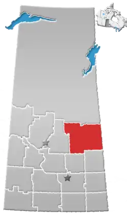 | |
|---|---|---|
| Towns | ||
| Villages | ||
| Resort villages | ||
| Rural municipalities |
| |
| First Nations | ||
| Indian reserves | ||
| Unincorporated communities | ||