Rural Municipality of Piapot No. 110
The Rural Municipality of Piapot No. 110 (2016 population: 302) is a rural municipality (RM) in the Canadian province of Saskatchewan within Census Division No. 4 and SARM Division No. 3. It is located in the southwest portion of the province.
Piapot No. 110 | |
|---|---|
| Rural Municipality of Piapot No. 110 | |
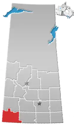
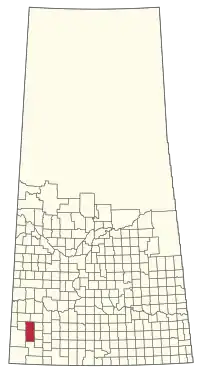 Location of the RM of Piapot No. 110 in Saskatchewan | |
| Coordinates: 49.914°N 109.122°W[1] | |
| Country | Canada |
| Province | Saskatchewan |
| Census division | 4 |
| SARM division | 3 |
| Federal riding | Cypress Hills--Grasslands |
| Provincial riding | Cypress Hills |
| Formed[2] | December 8, 1913 |
| Government | |
| • Reeve | John Wagner |
| • Governing body | RM of Piapot No. 110 Council |
| • Administrator | Jenny Robinson |
| • Office location | Piapot |
| Area (2016)[4] | |
| • Land | 1,912.81 km2 (738.54 sq mi) |
| Population (2016)[4] | |
| • Total | 302 |
| • Density | 0.2/km2 (0.5/sq mi) |
| Time zone | CST |
| • Summer (DST) | CST |
| Area code(s) | 306 and 639 |
| Highway(s) | Highway 1 Highway 614 Highway 724 Highway 728 |

History
The RM of Piapot No. 110 incorporated as a rural municipality on December 8, 1913.[2]
Geography
Demographics
In the 2016 Census of Population conducted by Statistics Canada, the RM of Piapot No. 110 recorded a population of 302 living in 140 of its 175 total private dwellings, a -6.8% change from its 2011 population of 324. With a land area of 1,912.81 km2 (738.54 sq mi), it had a population density of 0.2/km2 (0.4/sq mi) in 2016.[4]
In the 2011 Census of Population, the RM of Piapot No. 110 recorded a population of 324, a -17.3% change from its 2006 population of 392. With a land area of 1,912.81 km2 (738.54 sq mi), it had a population density of 0.2/km2 (0.4/sq mi) in 2011.[8]
Government
The RM of Piapot No. 110 is governed by an elected municipal council and an appointed administrator that meets on the second Wednesday of every month.[3] The reeve of the RM is John Wagner while its administrator is Jenny Robinson.[3] The RM's office is located in Piapot.[3]
Transportation
| Highway | Starting point | Communities | Ending point |
|---|---|---|---|
| Highway 1 | Alberta Highway 1 | Piapot, Sidewood | Manitoba Highway 1 |
| Highway 614 | Highway 1 | Sidewood, Skull Creek, Carnagh | Highway 706 |
| Highway 724 | Alberta Highway 515 | Edgell | Highway 724 |
| Highway 728 | Highway 21 | None | Highway 32 |
References
- "Pre-packaged CSV files - CGN, Canada/Province/Territory (cgn_sk_csv_eng.zip)". Government of Canada. July 24, 2019. Retrieved May 23, 2020.
- "Rural Municipality Incorporations (Alphabetical)". Saskatchewan Ministry of Municipal Affairs. Archived from the original on April 21, 2011. Retrieved May 9, 2020.
- "Municipality Details: RM of Piapot No. 110". Government of Saskatchewan. Retrieved May 21, 2020.
- "Population and dwelling counts, for Canada, provinces and territories, and census subdivisions (municipalities), 2016 and 2011 censuses – 100% data (Saskatchewan)". Statistics Canada. February 8, 2017. Retrieved May 1, 2020.
- Standard Geographical Classification (SGC) 2001
- "Saskatchewan Census Population" (PDF). Saskatchewan Bureau of Statistics. Archived from the original (PDF) on September 24, 2015. Retrieved May 9, 2020.
- "Saskatchewan Census Population". Saskatchewan Bureau of Statistics. Retrieved May 9, 2020.
- "Population and dwelling counts, for Canada, provinces and territories, and census subdivisions (municipalities), 2011 and 2006 censuses (Saskatchewan)". Statistics Canada. June 3, 2019. Retrieved May 1, 2020.