Rural Municipality of Lone Tree No. 18
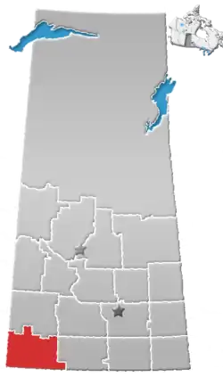
The Rural Municipality of Lone Tree No. 18 (2016 population: 150) is a rural municipality (RM) in the Canadian province of Saskatchewan within Census Division No. 4 and SARM Division No. 3. Located in the southwest portion of the province, it is southwest of the City of Swift Current. It is adjacent to the United States border, neighbouring Blaine County and Phillips County in Montana.
Lone Tree No. 18 | |
|---|---|
| Rural Municipality of Lone Tree No. 18 | |
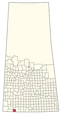 Location of the RM of Lone Tree No. 18 in Saskatchewan | |
| Coordinates: 49.149°N 108.247°W[1] | |
| Country | Canada |
| Province | Saskatchewan |
| Census division | 4 |
| SARM division | 3 |
| Federal riding | Cypress Hills--Grasslands |
| Provincial riding | Wood River |
| Formed[2] | December 8, 1913 |
| Government | |
| • Reeve | Larry Jarman |
| • Governing body | RM of Lone Tree No. 18 Council |
| • Administrator | Shawna Bertram |
| • Office location | Climax |
| Area (2016)[4] | |
| • Land | 838 km2 (324 sq mi) |
| Population (2016)[4] | |
| • Total | 150 |
| • Density | 0.2/km2 (0.5/sq mi) |
| Time zone | CST |
| • Summer (DST) | CST |
| Postal code | S0N 0N0 |
| Area code(s) | 306 and 639 |
History
The RM of Lone Tree No. 18 incorporated as a rural municipality on December 8, 1913.[2] It was named for Lonetree Lake, whose signature tree was chopped down in 1918. This name was once further rearranged to form Treelon, a post office which operated in the municipality until 1945.[5]
Geography
Demographics
In the 2016 Census of Population conducted by Statistics Canada, the RM of Lone Tree No. 18 recorded a population of 150 living in 64 of its 77 total private dwellings, a 3.4% change from its 2011 population of 145. With a land area of 838 km2 (324 sq mi), it had a population density of 0.2/km2 (0.5/sq mi) in 2016.[4]
In the 2011 Census of Population, the RM of Lone Tree No. 18 recorded a population of 145, a -3.3% change from its 2006 population of 150. With a land area of 838 km2 (324 sq mi), it had a population density of 0.2/km2 (0.4/sq mi) in 2011.[9]
Government
The RM of Lone Tree No. 18 is governed by an elected municipal council and an appointed administrator that meets on the third Wednesday of every month.[3] The reeve of the RM is Larry Jarman while its administrator is Shawna Bertram.[3] The RM's office is located in Climax.[3]
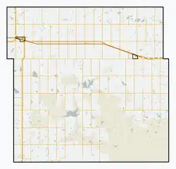
Transportation
| Highway | Starting point | Communities | Ending point |
|---|---|---|---|
| Highway 18 | Saskatchewan Highway 13 | Canuck, Climax, Bracken | Manitoba Highway 3 |
| Highway 37 | Saskatchewan Highway 32 | Climax | Port of Climax |
References
- "Pre-packaged CSV files - CGN, Canada/Province/Territory (cgn_sk_csv_eng.zip)". Government of Canada. July 24, 2019. Retrieved May 23, 2020.
- "Rural Municipality Incorporations (Alphabetical)". Saskatchewan Ministry of Municipal Affairs. Archived from the original on April 21, 2011. Retrieved May 9, 2020.
- "Municipality Details: RM of Lone Tree No. 18". Government of Saskatchewan. Retrieved May 21, 2020.
- "Population and dwelling counts, for Canada, provinces and territories, and census subdivisions (municipalities), 2016 and 2011 censuses – 100% data (Saskatchewan)". Statistics Canada. February 8, 2017. Retrieved May 1, 2020.
- Barry, Bill (2005). Geographic Names of Saskatchewan. Regina, Saskatchewan: People Places Publishing Ltd. ISBN 1-897010-19-2.
- Standard Geographical Classification (SGC) 2001
- "Saskatchewan Census Population" (PDF). Saskatchewan Bureau of Statistics. Archived from the original (PDF) on September 24, 2015. Retrieved May 9, 2020.
- "Saskatchewan Census Population". Saskatchewan Bureau of Statistics. Retrieved May 9, 2020.
- "Population and dwelling counts, for Canada, provinces and territories, and census subdivisions (municipalities), 2011 and 2006 censuses (Saskatchewan)". Statistics Canada. June 3, 2019. Retrieved May 1, 2020.
Places adjacent to Rural Municipality of Lone Tree No. 18 | |
|---|---|