Rural Municipality of Val Marie No. 17
The Rural Municipality of Val Marie No. 17 (2016 population: 413) is a rural municipality (RM) in the Canadian province of Saskatchewan within Census Division No. 4 and SARM Division No. 3. Located in the southwest portion of the province, it is adjacent to the United States border, neighbouring Phillips County in Montana.
Val Marie No. 17 | |
|---|---|
| Rural Municipality of Val Marie No. 17 | |
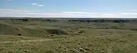 West Block of Grasslands National Park | |
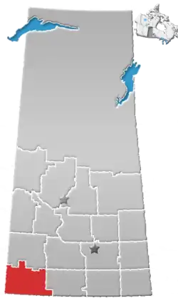
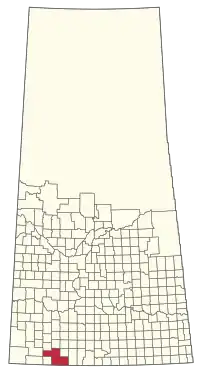 Location of the RM of Val Marie No. 17 in Saskatchewan | |
| Coordinates: 49.226°N 107.717°W[1] | |
| Country | Canada |
| Province | Saskatchewan |
| Census division | 4 |
| SARM division | 3 |
| Formed[2] | January 1, 1969 |
| Office location | Val Marie |
| Government | |
| • Body | R.M. Council |
| • Reeve | Larry Grant |
| • Council |
|
| • Administrator | Cathy Legault |
| • MLA | Dave Marit |
| • MP | Jeremy Patzer |
| Area (2016)[4] | |
| • Land | 3,105.26 km2 (1,198.95 sq mi) |
| Population (2016)[4] | |
| • Total | 413 |
| • Density | 0.1/km2 (0.3/sq mi) |
| Time zone | CST |
| • Summer (DST) | CST |
| Postal code | S0N 2T0 |
| Area code(s) | 306 and 639 |
History
The RM of Val Marie No. 17 incorporated as a rural municipality on January 1, 1969.[2] Louis-Pierre Gravel, missionary and promoter of much French Catholic immigration to southwestern Saskatchewan, originally called the settlement Rivière des Français after the nearby Frenchman River. But for an unknown reason, in a 1911 report to the superintendent of immigration, his formally proposed name became Libreval ("Free Valley"). Ultimately, neither of Gravel's suggestions was used, and Val Marie ("Valley of Mary"), was coined by Fr. Claude Passaplan, missionary priest in the area. Before coming to Val Marie, Passaplan served as the first Roman Catholic parish priest in Swift Current.[5]
Geography
Communities and localities
The RM surrounds one urban municipality, the eponymous village of Val Marie. Both communities share an office and an administrator.
- Sand Lake Colony
- Butte Colony
- Unorganized hamlets
- Localities
Demographics
Despite the increase in tourism driven by the creation of Grasslands National Park, farm consolidation and an ageing population have caused the RM to continuously decline in population.
In the 2016 Census of Population conducted by Statistics Canada, the RM of Val Marie No. 17 recorded a population of 413 living in 97 of its 114 total private dwellings, a -1.7% change from its 2011 population of 420. With a land area of 3,105.26 km2 (1,198.95 sq mi), it had a population density of 0.1/km2 (0.3/sq mi) in 2016.[4]
In the 2011 Census of Population, the RM of Val Marie No. 17 recorded a population of 420, a -12.3% change from its 2006 population of 479. With a land area of 3,105.26 km2 (1,198.95 sq mi), it had a population density of 0.1/km2 (0.4/sq mi) in 2011.[8]
Economy
Due to its semi-arid climate, Val Marie is a mixed district where ranching and crop agriculture are both practiced. Much of the RM is occupied by large community pastures. The Val Marie Irrigation Project controls two artificial lakes on the Frenchman River, which are used to operate a drip irrigation system in the region adjacent to the village.
The creation of Grasslands National Park in 1981 has bolstered the region's tourism sector, and the RM is home to two guesthouses, as well as the park's operations compound.
Although there are no oil wells in the vicinity of Val Marie, the RM is transited by a major pipeline, and the Monchy Compressor Station sits directly on the Canada-United States border.
Attractions
The RM includes the western portion (or "West Block") of Grasslands National Park.
Government
The RM of Val Marie No. 17 is governed by an elected municipal council and an appointed administrator that meets on the second Tuesday of every month.[3] The reeve of the RM is Larry Grant while its administrator is Cathy Legault.[3] The RM's office is located in Val Marie.[3]
Transportation
- Highway 18—serves Val Marie, Saskatchewan and Orkney, Saskatchewan
- Highway 4—serves Val Marie, Saskatchewan
References
- "Pre-packaged CSV files - CGN, Canada/Province/Territory (cgn_sk_csv_eng.zip)". Government of Canada. July 24, 2019. Retrieved May 23, 2020.
- "Rural Municipality Incorporations (Alphabetical)". Saskatchewan Ministry of Municipal Affairs. Archived from the original on April 21, 2011. Retrieved May 9, 2020.
- "Municipality Details: RM of Val Marie No. 17". Government of Saskatchewan. Retrieved May 21, 2020.
- "Population and dwelling counts, for Canada, provinces and territories, and census subdivisions (municipalities), 2016 and 2011 censuses – 100% data (Saskatchewan)". Statistics Canada. February 8, 2017. Retrieved May 1, 2020.
- Barry, Bill (2005). Geographic Names of Saskatchewan. Regina, Saskatchewan: People Places Publishing Ltd. ISBN 1-897010-19-2.
- "Saskatchewan Census Population" (PDF). Saskatchewan Bureau of Statistics. Archived from the original (PDF) on September 24, 2015. Retrieved May 9, 2020.
- "Saskatchewan Census Population". Saskatchewan Bureau of Statistics. Retrieved May 9, 2020.
- "Population and dwelling counts, for Canada, provinces and territories, and census subdivisions (municipalities), 2011 and 2006 censuses (Saskatchewan)". Statistics Canada. June 3, 2019. Retrieved May 1, 2020.
Places adjacent to Rural Municipality of Val Marie No. 17 | |
|---|---|