Rural Municipality of Newcombe No. 260
The Rural Municipality of Newcombe No. 260 (2016 population: 342) is a rural municipality (RM) in the Canadian province of Saskatchewan within Census Division No. 8 and SARM Division No. 3. It is located in the west-central portion of the province.
Newcombe No. 260 | |
|---|---|
| Rural Municipality of Newcombe No. 260 | |
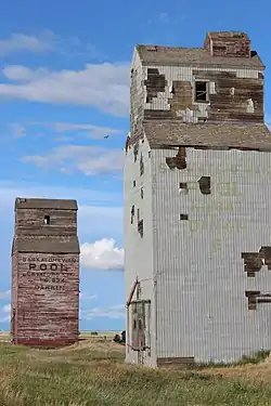 Old grain elevators in Dankin | |
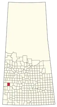 Location of the RM of Newcombe No. 260 in Saskatchewan | |
| Coordinates: 51.042°N 109.111°W[1] | |
| Country | Canada |
| Province | Saskatchewan |
| Census division | 8 |
| SARM division | 3 |
| Formed[2] | December 11, 1911 |
| Government | |
| • Reeve | Ken McBride |
| • Governing body | RM of Newcombe No. 260 Council |
| • Administrator | Monica Buddecke |
| • Office location | Glidden |
| Area (2016)[4] | |
| • Land | 1,075.6 km2 (415.3 sq mi) |
| Population (2016)[4] | |
| • Total | 342 |
| • Density | 0.3/km2 (0.8/sq mi) |
| Time zone | CST |
| • Summer (DST) | CST |
| Area code(s) | 306 and 639 |
History
The RM of Newcombe No. 260 incorporated as a rural municipality on December 11, 1911.[2] It is named after Allan Simpson Newcombe who played a leadership role in establishing the Boston Colony of immigrants from Massachusetts.
- Heritage properties
There is one designated heritage property in the RM.
- Ukrainian Catholic Parish of St. John the Baptist - Constructed in 1944 the church is located 20 km southwest of Kindersley. The site also contains a one-room school that was related to the site in 1961 for use as a church hall. Religious services were last conducted at the church in 1986.[5]
Geography
Communities and localities
The following urban municipalities are surrounded by the RM.
The following unincorporated communities are within the RM.
- Localities
Demographics
In the 2016 Census of Population conducted by Statistics Canada, the RM of Newcombe No. 260 recorded a population of 342 living in 112 of its 119 total private dwellings, a -14.5% change from its 2011 population of 400. With a land area of 1,075.6 km2 (415.3 sq mi), it had a population density of 0.3/km2 (0.8/sq mi) in 2016.[4]
In the 2011 Census of Population, the RM of Newcombe No. 260 recorded a population of 400, a 10.8% change from its 2006 population of 361. With a land area of 1,075.6 km2 (415.3 sq mi), it had a population density of 0.4/km2 (1.0/sq mi) in 2011.[8]
Government
The RM of Newcombe No. 260 is governed by an elected municipal council and an appointed administrator that meets on the second Thursday of every month.[3] The reeve of the RM is Ken McBride while its administrator is Monica Buddecke.[3] The RM's office is located in Glidden.[3]
Transportation
The RM is at the intersection of Highway 21 and Highway 44. The Lemsford Ferry is located within the RM.
References
- "Pre-packaged CSV files - CGN, Canada/Province/Territory (cgn_sk_csv_eng.zip)". Government of Canada. July 24, 2019. Retrieved May 23, 2020.
- "Rural Municipality Incorporations (Alphabetical)". Saskatchewan Ministry of Municipal Affairs. Archived from the original on April 21, 2011. Retrieved May 9, 2020.
- "Municipality Details: RM of Newcombe No. 260". Government of Saskatchewan. Retrieved May 21, 2020.
- "Population and dwelling counts, for Canada, provinces and territories, and census subdivisions (municipalities), 2016 and 2011 censuses – 100% data (Saskatchewan)". Statistics Canada. February 8, 2017. Retrieved May 1, 2020.
- Ukrainian Catholic Parish of St. John the Baptist
- "Saskatchewan Census Population" (PDF). Saskatchewan Bureau of Statistics. Archived from the original (PDF) on September 24, 2015. Retrieved May 9, 2020.
- "Saskatchewan Census Population". Saskatchewan Bureau of Statistics. Retrieved May 9, 2020.
- "Population and dwelling counts, for Canada, provinces and territories, and census subdivisions (municipalities), 2011 and 2006 censuses (Saskatchewan)". Statistics Canada. June 3, 2019. Retrieved May 1, 2020.
