Rural Municipality of Spiritwood No. 496
The Rural Municipality of Spiritwood No. 496 (2016 population: 1,347) is a rural municipality (RM) in the Canadian province of Saskatchewan within Census Division No. 16 and SARM Division No. 6. Located in the north-central portion of the province, it is west of the City of Prince Albert.
Spiritwood No. 496 | |
|---|---|
| Rural Municipality of Spiritwood No. 496 | |
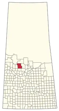 Location of the RM of Spiritwood No. 496 in Saskatchewan | |
| Coordinates: 53.498°N 107.598°W[1] | |
| Country | Canada |
| Province | Saskatchewan |
| Census division | 16 |
| SARM division | 6 |
| Formed[2] | December 9, 1929 |
| Amalgamated[3] | December 31, 1953 (with RM of Shell lake No. 495) |
| Government | |
| • Reeve | Shirley Dauvin |
| • Governing body | RM of Spiritwood No. 496 Council |
| • Administrator | Colette Bussiere |
| • Office location | Spiritwood |
| Area (2016)[5] | |
| • Land | 2,392.86 km2 (923.89 sq mi) |
| Population (2016)[5] | |
| • Total | 1,347 |
| • Density | 0.6/km2 (2/sq mi) |
| Time zone | CST |
| • Summer (DST) | CST |
| Area code(s) | 306 and 639 |
History
The RM of Spiritwood No. 496 incorporated as a rural municipality on December 9, 1929.[2] It absorbed the RM of Shell Lake No. 495.[3] The RM of Shell Lake No. 495 was originally named the RM of Shell River No. 495 prior to November 30, 1935.[6]
Geography
The RM of Spiritwood No. 496 is adjacent to the RMs of Big River No. 555 to the north, Medstead No. 497 to the west, Meeting Lake No. 466 to the south, and Canwood No. 494 (formerly Thompson No. 494) to the south.
Communities and localities
The following urban municipalities are surrounded by the RM.
The following unincorporated communities are within the RM.
- Organized hamlets[7]
- Localities
The RM also surrounds the Witchekan Lake First Nation Indian Reserve 117B and Pelican Lake First Nation Indian Reserve 191B.
Demographics
In the 2016 Census of Population conducted by Statistics Canada, the RM of Spiritwood No. 496 recorded a population of 1,347 living in 516 of its 786 total private dwellings, a -0.1% change from its 2011 population of 1,349. With a land area of 2,392.86 km2 (923.89 sq mi), it had a population density of 0.6/km2 (1.5/sq mi) in 2016.[5]
In the 2011 Census of Population, the RM of Spiritwood No. 496 recorded a population of 1,349, a 5.6% change from its 2006 population of 1,277. With a land area of 2,392.94 km2 (923.92 sq mi), it had a population density of 0.6/km2 (1.5/sq mi) in 2011.[10]
Government
The RM of Spiritwood No. 496 is governed by an elected municipal council and an appointed administrator that meets on the second Tuesday of every month.[4] The reeve of the RM is Shirley Dauvin while its administrator is Colette Bussiere.[4] The RM's office is located in Spiritwood.[4]
Transportation
- Rail[11]
- Big River Branch C.N.R—serves Prince Albert, Shellbrook, Clonfert, Canwood, Polwarth, Mattes, Debden, Eldred, Dumble, Bodmin, Big River.
- Roads
- Highway 24—serves Spiritwood and Leoville
- Highway 3—intersects Highway 24 and serves Belbutte, Spiritwood and Shell Lake
- Highway 793—intersects Highway 24 and serves Big River
- Highway 696—intersects Highway 24 and serves Pelican Lake First Nation Indian Reserve 191B
- Highway 3—runs east west here and intersects Highway 24 serves Spiritwood and *Mildred
- Highway 378—runs North south here and intersects Highway 3 south of Spiritwood
References
- "Pre-packaged CSV files - CGN, Canada/Province/Territory (cgn_sk_csv_eng.zip)". Government of Canada. July 24, 2019. Retrieved May 23, 2020.
- "Rural Municipality Incorporations (Alphabetical)". Saskatchewan Ministry of Municipal Affairs. Archived from the original on April 21, 2011. Retrieved May 9, 2020.
- "Disorganized Rural Municipalities". Saskatchewan Ministry of Municipal Affairs. Archived from the original on February 25, 2012. Retrieved May 9, 2020.
- "Municipality Details: RM of Spiritwood No. 496". Government of Saskatchewan. Retrieved May 21, 2020.
- "Population and dwelling counts, for Canada, provinces and territories, and census subdivisions (municipalities), 2016 and 2011 censuses – 100% data (Saskatchewan)". Statistics Canada. February 8, 2017. Retrieved May 1, 2020.
- "Renamed Rural Municipalities". Saskatchewan Ministry of Municipal Affairs. Archived from the original on February 25, 2012. Retrieved May 9, 2020.
- "2019-2020 Rural Revenue Sharing Organized Hamlet Grant". Government of Saskatchewan. Retrieved May 4, 2020.
- "Saskatchewan Census Population" (PDF). Saskatchewan Bureau of Statistics. Archived from the original (PDF) on September 24, 2015. Retrieved May 9, 2020.
- "Saskatchewan Census Population". Saskatchewan Bureau of Statistics. Retrieved May 9, 2020.
- "Population and dwelling counts, for Canada, provinces and territories, and census subdivisions (municipalities), 2011 and 2006 censuses (Saskatchewan)". Statistics Canada. June 3, 2019. Retrieved May 1, 2020.
- Canadian Maps: January 1925 Waghorn's Guide. Post Offices in Man. Sask. Alta. and West Ontario.
| Cities | 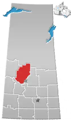 | |
|---|---|---|
| Towns | ||
| Villages | ||
| Resort villages | ||
| Rural municipalities |
| |
| Crown colonies | ||
| First Nations | ||
| Indian reserves |
| |
| Unorganized areas | ||
| Unincorporated communities | ||