Grade II* listed buildings in Merseyside
There are over 20,000 Grade II* listed buildings in England. This page is a list of these buildings in the county of Merseyside.
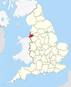
Merseyside shown in England
Knowsley
| Name | Location | Type | Completed [note 1] | Date designated | Grid ref.[note 2] Geo-coordinates |
Entry number [note 3] | Image |
|---|---|---|---|---|---|---|---|
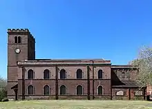
| Church of St Mary | Knowsley, Merseyside | Church | 1895 | 28 January 1971 | SJ4347495831 53°27′22″N 2°51′10″W |
1253329 | |
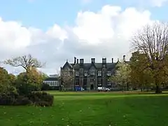
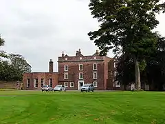
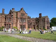
| Knowsley Hall | Knowsley | Country House | 15th century | 9 June 1952 | SJ4448193802 53°26′17″N 2°50′14″W |
1253241 | |
| Church of St Chad | Kirkby, Knowsley | Church | 1869 or later | 20 June 1975 | SJ4083798989 53°29′03″N 2°53′35″W |
1356211 | |
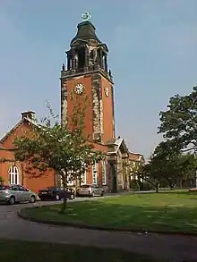
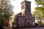
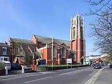
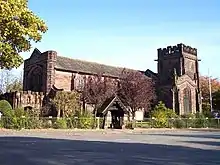
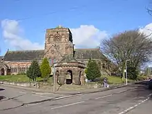
| Church of St Michael | Huyton, Knowsley | Church | 14th century | 6 June 1951 | SJ4426791130 53°24′50″N 2°50′24″W |
1075535 | 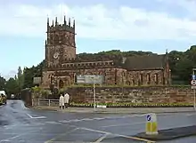 Church of St Michael |

Liverpool
| Name | Location | Type | Completed [note 1] | Date designated | Grid ref.[note 2] Geo-coordinates |
Entry number [note 3] | Image |
|---|---|---|---|---|---|---|---|
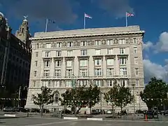
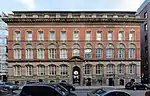
| Albion House | Liverpool | Office | 1896-8 | 28 June 1952 | SJ3411990211 53°24′17″N 2°59′33″W |
1207759 | |
| Allerton Hall | Liverpool | House | Post 1736 | 14 March 1975 | SJ4158685514 53°21′48″N 2°52′45″W |
1063751 | |
| Allerton Priory | Liverpool | House | 1867-70 | 12 July 1966 | SJ4135486233 53°22′11″N 2°52′58″W |
1068415 | |
| Municipal Buildings | Liverpool | Office building | 1860-66 | 12 July 1966 | SJ3442990593 53°24′29″N 2°59′16″W |
1068281 | |
| Barclay's Bank | Liverpool | Bank (financial) | 1927-32 | 12 July 1966 | SJ3412390479 53°24′25″N 2°59′33″W |
1062580 | 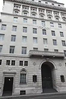 Barclay's Bank |
| Bishop Eton Monastery | Liverpool | Chapel | 1851-1858 | 12 July 1966 | SJ4056288392 53°23′20″N 2°53′43″W |
1218726 | 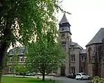 Bishop Eton Monastery |
| Bluecoat School | Liverpool | School | 1903-6 | 14 March 1975 | SJ3918988794 53°23′33″N 2°54′57″W |
1280374 | |
| Broughton Hall | Liverpool | House | c. 1856 | 14 March 1975 | SJ4120892350 53°25′29″N 2°53′10″W |
1063760 | |
| Carfax | Liverpool | House | Before 1815 | 28 June 1952 | SJ3686887053 53°22′36″N 2°57′02″W |
1073473 | 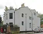 Carfax |
| Cedarwood | Woolton, Liverpool | House | 1960 | 25 April 2007 | SJ4172887557 53°22′54″N 2°52′39″W |
1391948 |  |
| Chapel of Bluecoat School | Liverpool | Chapel | 1903-6 | 14 March 1975 | SJ3922288787 53°23′33″N 2°54′55″W |
1068325 |  Chapel of Bluecoat School |
| Chapel of Saint Patrick | Liverpool | Chapel | 1821-7 | 14 March 1975 | SJ3547888806 53°23′32″N 2°58′18″W |
1365832 | |
| Church of Holy Trinity | Liverpool | Church | 1794 | 28 June 1952 | SJ3920889020 53°23′40″N 2°54′56″W |
1206149 | |
| Church of Saint Andrew | Liverpool | Presbyterian Chapel | 1823 | 28 June 1952 | SJ3544390008 53°24′11″N 2°58′21″W |
1361913 | |
| Church of Saint Margaret | Liverpool | Church | 1868-9 | 12 July 1966 | SJ3587889165 53°23′43″N 2°57′57″W |
1292876 | |
| Church of Saint Mary | West Derby, Liverpool | Church | 1853-56 | 12 July 1966 | SJ3972393346 53°26′00″N 2°54′31″W |
1356273 | |
| Church of St Anne | Liverpool | Church | 1836-7 | 12 July 1966 | SJ3818586228 53°22′09″N 2°55′50″W |
1068405 | |
| Church of St Bridget | Liverpool | Church | 1872 | 28 June 1952 | SJ3798289273 53°23′48″N 2°56′03″W |
1068396 | |
| Church of St Christopher | Norris Green, Liverpool | Church | 1930-32 | 16 January 1981 | SJ3865994175 53°26′27″N 2°55′30″W |
1070626 | |
| Church of St Clement | Liverpool | Church | 1840-41 | 14 March 1975 | SJ3675989329 53°23′49″N 2°57′09″W |
1356284 | |
| Church of St Dunstan | Liverpool | Church | 1886-9 | 14 March 1975 | SJ3735589529 53°23′56″N 2°56′37″W |
1068261 | |
| Church of St James | Liverpool | Church | 1774-5 | 19 June 1985 | SJ3527789049 53°23′39″N 2°58′29″W |
1209882 | |
| Church of St Luke | Liverpool | Church (Anglican) | 1811-1832 | 28 June 1952 | SJ3526489871 53°24′06″N 2°58′30″W |
1280622 | |
| Church of St Matthew and St James | Liverpool | Church | 1870-75 | 14 March 1975 | SJ3885687006 53°22′35″N 2°55′14″W |
1361655 | |
| Church of St Paul | Liverpool | Church | 1916 | 12 July 1966 | SJ3927891738 53°25′08″N 2°54′54″W |
1206520 | |
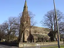
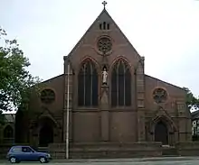
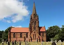
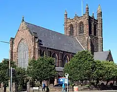
| Church of St Peter | Woolton, Liverpool | Church | 1886-7 | 14 March 1975 | SJ4226086918 53°22′33″N 2°52′10″W |
1206167 | .jpg.webp) Church of St Peter |
| Church of St Philip Neri (RC) | Liverpool | Roman Catholic Church | 1914-1920 | 25 May 2000 | SJ3568989594 53°23′57″N 2°58′07″W |
1380344 | |
| College of Technology and Museum Extension | Liverpool | Technical College | 1896-1909 | 12 July 1966 | SJ3481690803 53°24′36″N 2°58′55″W |
1205724 | |
| Cooperative Bank | Liverpool | Bank (financial) | 1892 | 14 March 1975 | SJ3422290362 53°24′21″N 2°59′27″W |
1356311 | 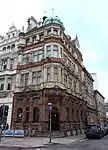 Cooperative Bank |
| Croxteth Hall | Croxteth Country Park, Liverpool | Country House | c. 1575 | 28 June 1952 | SJ4084894340 53°26′33″N 2°53′31″W |
1280299 | |
| Cunard Building | Georges Pier Head, Liverpool | Office | 1913-16 | 12 July 1966 | SJ3392390273 53°24′18″N 2°59′43″W |
1052283 | |
| Dairy | Croxteth Country Park, Liverpool | Dairy | 1861-70 | 28 June 1952 | SJ4083294175 53°26′28″N 2°53′32″W |
1280284 | |
| Engine House to North of North Range of Edge Hill Station | Liverpool | Engine House | 1849 | 14 October 1974 | SJ3717489952 53°24′09″N 2°56′47″W |
1218206 |  Engine House to North of North Range of Edge Hill Station |
| Former Liverpool Airport Control Tower and Terminal | Liverpool | Hotel | 1999-2001 | 19 June 1985 | SJ4146983773 53°20′51″N 2°52′50″W |
1217911 | 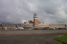 Former Liverpool Airport Control Tower and Terminal |
| Fowler's Buildings | Liverpool | Shop | 1866 | 14 October 1974 | SJ3438990456 53°24′25″N 2°59′18″W |
1063294 | |
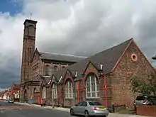
| Greenbank Drive Synagogue | Liverpool | Synagogue | 1936 | 12 May 1983 | SJ3831388450 53°23′21″N 2°55′44″W |
1298791 | .JPG.webp) Greenbank Drive Synagogue |
| Picton Reading Room and Hornby Library | Liverpool | Library | 1906 | 28 June 1952 | SJ3493490781 53°24′35″N 2°58′49″W |
1359620 | |
| Laundry and Laundry Cottage | Croxteth Country Park, Liverpool | House | 1864-5 | 14 March 1975 | SJ4099394063 53°26′24″N 2°53′23″W |
1206357 | |
| Liverpool Airport Hangar No. 2 | Liverpool | Commercial Office | 1999-2003 | 19 June 1985 | SJ4163483775 53°20′51″N 2°52′42″W |
1063325 | 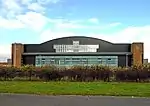 Liverpool Airport Hangar No. 2 |
| Liverpool Airport Hangar 1 | Liverpool | Sports Centre | 1999-2003 | 16 June 1985 | SJ4131383849 53°20′54″N 2°52′59″W |
1359838 |  Liverpool Airport Hangar 1 |
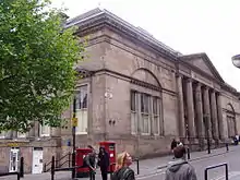
| Liverpool Collegiate School | Liverpool | School | 1843 | 28 June 1952 | SJ3576391132 53°24′47″N 2°58′04″W |
1062538 | |
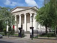
| Liverpool Medical Institution | Liverpool | Institute | 1836-7 | 28 June 1952 | SJ3567290047 53°24′12″N 2°58′09″W |
1208429 | |
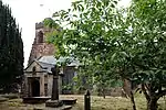
| Lodge to Bishop Eton Monastery, and adjoining Gateway | Liverpool | Lodge and Gateway | c. 1840 | 14 March 1975 | SJ4054688448 53°23′22″N 2°53′44″W |
1063749 | 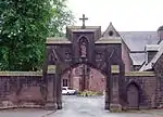 Lodge to Bishop Eton Monastery, and adjoining Gateway |
| Lodge to Saint Joseph's Home | Liverpool | Lodge | c. 1840 | 14 March 1975 | SJ4043288490 53°23′24″N 2°53′50″W |
1063748 | |
| Main Bridewell | Liverpool | Wall | 1857-1859 | 19 June 1985 | SJ3448990726 53°24′33″N 2°59′13″W |
1068316 |  Main Bridewell |
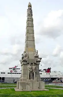
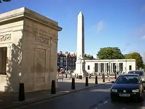
| Memorial to the Engine Room Heroes of the Titanic | Liverpool | Obelisk | 1916 | 14 March 1975 | SJ3374490386 53°24′22″N 2°59′53″W |
1209973 | |
| Much Woolton Old School | Woolton, Liverpool | Elementary School | 1610 | 28 June 1952 | SJ4245986240 53°22′12″N 2°51′59″W |
1361673 | |
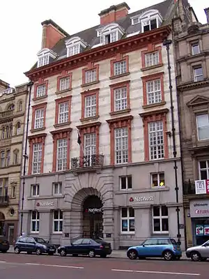
| National Westminster Bank | Liverpool | Bank (financial) | 1899-1902 | 28 June 1952 | SJ3419790410 53°24′23″N 2°59′29″W |
1205939 | |
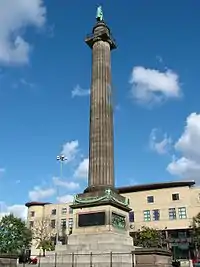
| Nelson Monument | Liverpool | Commemorative Monument | 1813 | 14 March 1975 | SJ3415290540 53°24′27″N 2°59′31″W |
1068235 | |
| Olympia Social Club | Liverpool | Bingo Hall | 1985 | 14 March 1975 | SJ3645091364 53°24′55″N 2°57′27″W |
1062584 | 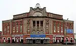 Olympia Social Club |
| Orleans House | Liverpool | Office | 1907 | 14 March 1975 | SJ3407390798 53°24′35″N 2°59′36″W |
1206657 | |
| Palm House | Sefton Park, Liverpool | Palm House | 1896 | 12 July 1966 | SJ3788487565 53°22′53″N 2°56′07″W |
1292339 | |
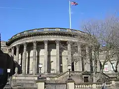
| Philharmonic Hall (including Detached Poster Piers to South West and North West) | Liverpool | Concert Hall | 1937-9 | 19 March 1981 | SJ3562589815 53°24′04″N 2°58′11″W |
1279652 | 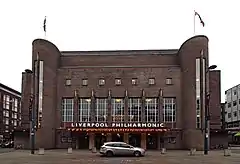 Philharmonic Hall (including Detached Poster Piers to South West and North West) |
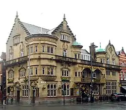
| Philharmonic Hotel | Liverpool | Public House | 1898 | 12 July 1966 | SJ3556989883 53°24′07″N 2°58′14″W |
1207638 | |
| Playhouse Theatre | Liverpool | Theatre | 1865 | 14 March 1975 | SJ3478290401 53°24′23″N 2°58′57″W |
1218642 | |
| Port of Liverpool Building and Stone Balustrade, Iron Gates and Piers | Georges Pier Head, Liverpool | Offices | 1907 | 12 July 1966 | SJ3392290208 53°24′16″N 2°59′43″W |
1068223 | .JPG.webp) Port of Liverpool Building and Stone Balustrade, Iron Gates and Piers |
| Railings, Plinth Walls, Gates, Piers and Steps at Church of St Luke | Liverpool | Gate | 1829 | 14 March 1975 | SJ3531789861 53°24′06″N 2°58′28″W |
1068380 | .jpg.webp) Railings, Plinth Walls, Gates, Piers and Steps at Church of St Luke |
| Range on North Side of Edge Hill Station | Liverpool | Railway Station | 1836 | 14 October 1974 | SJ3715089954 53°24′10″N 2°56′48″W |
1218196 | 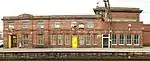 Range on North Side of Edge Hill Station |
| Range on South Side of Edge Hill Station | Liverpool | Railway Station | 1836 | 14 October 1974 | SJ3715189928 53°24′09″N 2°56′48″W |
1063311 | 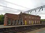 Range on South Side of Edge Hill Station |
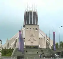
| Liverpool Metropolitan Cathedral | Liverpool | Church | 1933-40 | 14 March 1975 | SJ3569490204 53°24′17″N 2°58′07″W |
1070607 | |
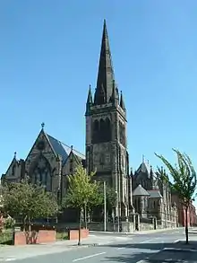
| Roman Catholic Church of Saint Francis Xavier | Liverpool | Roman Catholic Church | 1845-9 | 28 June 1952 | SJ3563691165 53°24′48″N 2°58′11″W |
1361668 | |
| Roman Catholic Church of Saint Vincent De Paul | Liverpool | Roman Catholic Church | 1856-7 | 14 March 1975 | SJ3500489347 53°23′49″N 2°58′44″W |
1361682 | |
| Royal Insurance Building, Queen Avenue | Liverpool | Commercial Office | 1837-9 | 14 March 1975 | SJ3427690450 53°24′24″N 2°59′24″W |
1365827 | 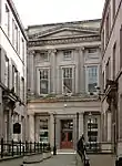 Royal Insurance Building, Queen Avenue |
| Royal Insurance Building, North John Street | Liverpool | Commercial Office | 1903 | 28 June 1952 | SJ3433390522 53°24′27″N 2°59′21″W |
1070582 |  Royal Insurance Building, North John Street |
| Saint Agnes' Vicarage | Liverpool | Vicarage | 1887 | 28 June 1952 | SJ3759988534 53°23′24″N 2°56′23″W |
1218225 | |
| Saint Bride's Church | Liverpool | Church | 1830 | 28 June 1952 | SJ3566189375 53°23′50″N 2°58′09″W |
1365835 | |
| Saint Joseph's Home | Liverpool | House | 1845-7 | 14 March 1975 | SJ4044488453 53°23′22″N 2°53′49″W |
1291830 | |
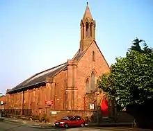
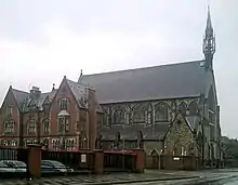
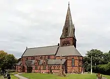
| Scandinavian Seamen's Church (Gustav Adolf Church) | Liverpool | Church | 1883-1884 | 14 March 1975 | SJ3464089650 53°23′59″N 2°59′04″W |
1292991 | 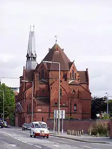 Scandinavian Seamen's Church (Gustav Adolf Church) |
| Sessions House | Liverpool | House | 1882-4 | 14 March 1975 | SJ3502290816 53°24′36″N 2°58′44″W |
1063783 | |
| Stable Block to North and West of Stable Yard | Croxteth Country Park, Liverpool | House | 1985 | 14 March 1975 | SJ4082694232 53°26′29″N 2°53′32″W |
1356330 | |
| Stanlawe Grange, the Granary | Liverpool | House | Modern | 23 February 1960 | SJ3898485773 53°21′55″N 2°55′06″W |
1068443 |  Stanlawe Grange, the Granary |
| Steble Fountain | Liverpool | Fountain | 1879 | 28 June 1952 | SJ3500590752 53°24′34″N 2°58′45″W |
1359621 | |
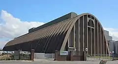
| Sugar Silo | Liverpool | Sugar Silo | 1955-57 | 23 September 1992 | SJ3390193491 53°26′03″N 2°59′47″W |
1252955 | |
| The Albany | Liverpool | Apartments | 1856 | 12 July 1966 | SJ3410090665 53°24′31″N 2°59′34″W |
1208630 | |
| The Carriage House, and Gate Piers to Garden | Liverpool | House | 1985 | 28 June 1952 | SJ3691887115 53°22′38″N 2°56′59″W |
1073474 | .jpg.webp) The Carriage House, and Gate Piers to Garden |
| The Cloisters | Liverpool | House | c. 1815 | 14 March 1975 | SJ3682486986 53°22′33″N 2°57′04″W |
1209968 |  The Cloisters |
| The Friary or the Glebelands | Liverpool | House | Before c1815 | 28 June 1952 | SJ3691987015 53°22′34″N 2°56′59″W |
1209952 | .jpg.webp) The Friary or the Glebelands |
| The Hermitage | Liverpool | House | Before 1815 | 28 June 1952 | SJ3688187004 53°22′34″N 2°57′01″W |
1209956 | .jpg.webp) The Hermitage |
| The Lyceum | Liverpool | Lending Library | 1802 | 28 June 1952 | SJ3490090186 53°24′16″N 2°58′50″W |
1068383 | |
| The Old Court House | Liverpool | Court House | 1662 | 28 June 1952 | SJ3963993257 53°25′57″N 2°54′36″W |
1068420 | |
| The Vines Public House | Liverpool | Public House | 1907 | 14 March 1975 | SJ3506990333 53°24′21″N 2°58′41″W |
1084210 | 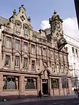 The Vines Public House |
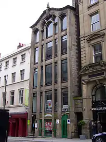
| Tower Buildings | Liverpool | Shopping Arcade | 1906 | 14 March 1975 | SJ3399590439 53°24′24″N 2°59′40″W |
1360220 | |
| Tue Brook House | Liverpool | Farmhouse | 1615 | 28 June 1952 | SJ3856892587 53°25′35″N 2°55′34″W |
1360223 | |
| University Hostel and Greenbank House | Liverpool | House | c. 1787 | 28 June 1952 | SJ3844387979 53°23′06″N 2°55′37″W |
1356362 | |
| Village Cross | West Derby, Liverpool | Cross | 1861-70 | 14 March 1975 | SJ3964693277 53°25′58″N 2°54′36″W |
1068388 | |
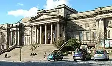
| Walker Art Gallery | Liverpool | Art Gallery | 1874-7 | 28 June 1952 | SJ3497390811 53°24′36″N 2°58′47″W |
1063782 | |
| War Memorial at Holy Trinity Church Yard | Liverpool | War memorial | 7 February 2001 | SJ3920989055 53°23′41″N 2°54′56″W |
1393740 |  War Memorial at Holy Trinity Church Yard | |
| Warehouse at Wapping Dock | Wapping, Liverpool | Warehouse | 1856 | 12 July 1966 | SJ3451089362 53°23′49″N 2°59′11″W |
1218449 | 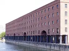 Warehouse at Wapping Dock |
| Warehouse on North Side of Dock | Stanley Dock, Liverpool | Warehouse | 1848 | 14 March 1975 | SJ3370792158 53°25′19″N 2°59′56″W |
1359841 |  Warehouse on North Side of Dock |
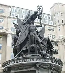
| Wellington Column | Liverpool | Statue | 1865 | 28 June 1952 | SJ3502990756 53°24′35″N 2°58′44″W |
1063784 | |
| Wellington Rooms (now the Irish Centre) | Liverpool | Meeting rooms | 1815 | 28 June 1952 | SJ3556590117 53°24′14″N 2°58′14″W |
1208360 | 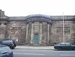 Wellington Rooms (now the Irish Centre) |
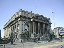
| William Brown Library and Museum | Liverpool | Museum | 1857-60 | 28 June 1952 | SJ3487690799 53°24′36″N 2°58′52″W |
1063781 | |
| 8 Brougham Terrace | Liverpool | Mosque | c. 1830 | 19 June 1965 | SJ3625191257 53°24′52″N 2°57′38″W |
1062583 | 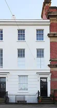 8 Brougham Terrace |
| 16 Cook Street | Liverpool | Courtyard | 1866 | 12 July 1966 | SJ3434590391 53°24′22″N 2°59′21″W |
1068298 | |
| 3–17 Percy Street | Liverpool | Terrace | c. 1830 | 28 June 1952 | SJ3563489422 53°23′52″N 2°58′10″W |
1072994 |  3–17 Percy Street |
| 8–18 Percy Street | Liverpool | Terrace | c. 1830 | 28 June 1952 | SJ3560389416 53°23′51″N 2°58′12″W |
1208814 | .jpg.webp) 8–18 Percy Street |
| 20–32 Percy Street | Liverpool | Terrace | c. 1830 | 28 June 1952 | SJ3561389349 53°23′49″N 2°58′11″W |
1072996 | .JPG.webp) 20–32 Percy Street |
| 1 and 3 Duke Street | Liverpool L1 | Shop | Mid-late C20 | 14 March 1975 | SJ3459289990 53°24′10″N 2°59′07″W |
1356348 | 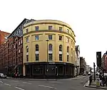 1 and 3 Duke Street |
| 98-102, 102a High Street | Liverpool | Terrace | Late 18th century | 28 June 1952 | SJ3908089440 53°23′54″N 2°55′01″W |
1075181 | 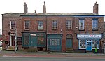 98-102, 102a High Street |
| 62 Rodney Street | Liverpool | House | Late 18th century | 28 June 1952 | SJ3534489755 53°24′02″N 2°58′26″W |
1072958 | |
| 159–163 Duke Street | Liverpool | Terrace | 1765 | 29 March 1982 | SJ3507689763 53°24′02″N 2°58′41″W |
1206596 | .jpg.webp) 159–163 Duke Street |
| 169 and 171 Duke Street | Liverpool | Terrace | 1765 | 14 March 1975 | SJ3509489751 53°24′02″N 2°58′40″W |
1068255 | 169 and 171 Duke Street |
| 173 and 175 Duke Street | Liverpool | Terrace | 1765 | 14 March 1975 | SJ3511689742 53°24′02″N 2°58′38″W |
1068256 | |
| 24 Hanover Street | Liverpool L1 | Warehouse | Early 19th century | 14 March 1975 | SJ3460089997 53°24′10″N 2°59′07″W |
1343617 |  24 Hanover Street |
| 26–30 Hanover Street | Liverpool L1 | Warehouse | Early 19th century | 14 March 1975 | SJ3461690006 53°24′10″N 2°59′06″W |
1207399 | 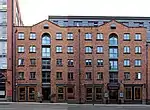 26–30 Hanover Street |
| 1–10 Gambier Terrace | Liverpool | Terrace | c. 1836 | 28 June 1952 | SJ3555089448 53°23′52″N 2°58′15″W |
1068213 | .JPG.webp) 1–10 Gambier Terrace |
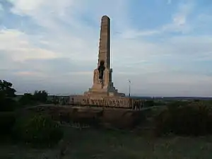
| West Derby War Memorial | Eccleston | War memorial | 1922 | 15 August 2001 | SJ4737393313 53°26′02″N 2°47′37″W |
1389376 | 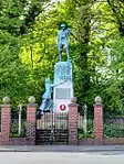 West Derby War Memorial |
.JPG.webp)


.JPG.webp)


.JPG.webp)
.JPG.webp)
.JPG.webp)


.jpg.webp)


Sefton
.JPG.webp)


.jpg.webp)

.jpg.webp)
St. Helens
| Name | Location | Type | Completed [note 1] | Date designated | Grid ref.[note 2] Geo-coordinates |
Entry number [note 3] | Image |
|---|---|---|---|---|---|---|---|
| Birchley Hall | Billinge Chapel End, St. Helens | House | 1594 | 23 August 1966 | SJ5241999817 53°29′34″N 2°43′07″W |
1343273 | |
| Church of St Aidan | Billinge Chapel End, St. Helens | Church | 1718 | 23 August 1966 | SD5332600697 53°30′03″N 2°42′18″W |
1075923 | |
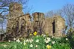
| Adjacent Ruins at Scholes House | Eccleston, St. Helens | Friary | Pre 1681 | 28 January 1971 | SJ4898593406 53°26′06″N 2°46′10″W |
1261890 | |
| Effigy Pedestal in Garden of Scholes House | Eccleston, St. Helens | Shrine | 28 May 1958 | SJ4896693372 53°26′05″N 2°46′11″W |
1253239 | | |
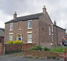
| Scholes House | Eccleston, St. Helens | Farmhouse | 16th century | 28 May 1958 | SJ4897393395 53°26′05″N 2°46′10″W |
1253238 | |
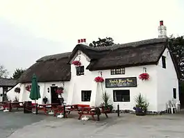
| Guildhall Farmhouse | Rainford, St. Helens | Farmhouse | 1629 | 24 March 1966 | SD5114400211 53°29′47″N 2°44′17″W |
1075904 | |
| Manor Farmhouse | Rainhill, St. Helens | Farmhouse | 14th century | 28 May 1958 | SJ4998090120 53°24′20″N 2°45′14″W |
1253349 | |
| Old Hall Farmhouse | Rainhill, St. Helens | Farmhouse | 19th century | 9 June 1952 | SJ4897690254 53°24′24″N 2°46′08″W |
1253242 | |
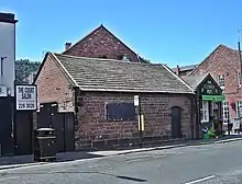
| Entrance Archway to Randall's Nursery | St. Helens | Arch | Early 19th century | 12 February 1981 | SJ5881895898 53°27′30″N 2°37′18″W |
1198958 |  Entrance Archway to Randall's Nursery |
| Ruins of Windleshaw Abbey in Roman Catholic Cemetery (chapel of Saint Thomas of Canterbury) | St. Helens | Chantry Chapel | c. 1453 | 11 September 1951 | SJ4996296958 53°28′01″N 2°45′19″W |
1199094 |  Ruins of Windleshaw Abbey in Roman Catholic Cemetery (chapel of Saint Thomas of Canterbury) |
| Statue of Queen Victoria | St. Helens | Statue | 1906 | 12 December 1984 | SJ5126195476 53°27′14″N 2°44′08″W |
1075878 | |
| Tank House, Beside Canal at Crown Glass Works | St. Helens | Glass Works | 1883 | 23 August 1985 | SJ5121495014 53°26′59″N 2°44′10″W |
1075879 |  Tank House, Beside Canal at Crown Glass Works |
| 159, 161 and 163 Crow Lane East | St. Helens | Cruck House | 16th century | 3 February 1966 | SJ5820095685 53°27′22″N 2°37′51″W |
1343246 | 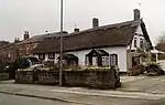 159, 161 and 163 Crow Lane East |
.jpg.webp)

.JPG.webp)
Wirral
| Name | Location | Type | Completed [note 1] | Date designated | Grid ref.[note 2] Geo-coordinates |
Entry number [note 3] | Image |
|---|---|---|---|---|---|---|---|
| Bidston Hall | Bidston, Wirral | House | Earlier core | 29 July 1950 | SJ2854690207 53°24′14″N 3°04′34″W |
1292202 |  Bidston Hall |
| Bidston Windmill | Bidston, Wirral | Windmill | Late 18th century | 29 July 1950 | SJ2872689366 53°23′47″N 3°04′24″W |
1282506 | |
| Chapter House Chapel at Birkenhead Priory | Wirral | Chapter House | Late 12th century | 29 July 1950 | SJ3282988558 53°23′22″N 3°00′41″W |
1218733 |  Chapter House Chapel at Birkenhead Priory |
| Christ Church | Port Sunlight, Wirral | United Reformed Church | 1904 | 20 December 1965 | SJ3384384525 53°21′12″N 2°59′43″W |
1075492 | |
| Church of St Bartholomew | Thurstaston, Wirral | Lych Gate | 1900 | 15 November 1962 | SJ2473184114 53°20′55″N 3°07′56″W |
1115782 | |
| Church of St George (United Reformed) | Thornton Hough, Wirral | Congregational Chapel | 1906-7 | 2 December 1986 | SJ3045480977 53°19′16″N 3°02′44″W |
1185603 | |
| Church of St Peter | Heswall, Wirral | Church | 14th century | 15 November 1962 | SJ2658381215 53°19′22″N 3°06′13″W |
1320306 | |
| Church of St Saviour | Oxton, Wirral | Parish Church | 1889-92 | 28 March 1974 | SJ3014887790 53°22′56″N 3°03′06″W |
1201591 | |
| Church of St Barnabas | Bromborough, Wirral | Church | 1862-64 | 27 December 1962 | SJ3491282222 53°19′58″N 2°58′44″W |
1183871 | |
| Church of the Holy Cross | Woodchurch, Wirral | Parish Church | 12th century | 29 July 1950 | SJ2757586844 53°22′24″N 3°05′24″W |
1217887 | |
| Dovecote to north of Gayton Hall | Gayton, Wirral | Dovecote | 1663 | 15 November 1962 | SJ2733980455 53°18′58″N 3°05′32″W |
1075473 | |
| Enclosing Wall and Gateway to Forecourt of Bidston Hall | Bidston, Wirral | Gate | Late 16th century | 28 March 1974 | SJ2851490206 53°24′14″N 3°04′36″W |
1201577 | Enclosing Wall and Gateway to Forecourt of Bidston Hall |
| Fort Perch Rock | New Brighton, Wirral | Fort | 1826-9 | 4 January 1977 | SJ3095294477 53°26′33″N 3°02′28″W |
1258164 | |
| Gatehouse to Thornton Manor and Attached Courtyard Walls | Thornton Hough, Wirral | Gatehouse | 1910 | 2 December 1986 | SJ3008481662 53°19′38″N 3°03′04″W |
1343503 | 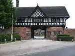 Gatehouse to Thornton Manor and Attached Courtyard Walls |
| Gayton Hall | Gayton, Wirral | House | Late 17th century | 15 November 1962 | SJ2733180414 53°18′56″N 3°05′32″W |
1184100 | |
| Grand Entrance Gateway to Birkenhead Park with North and South Lodges | Birkenhead, Wirral | Gate | 1847 | 29 July 1950 | SJ3139089123 53°23′40″N 3°02′00″W |
1291891 | 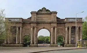 Grand Entrance Gateway to Birkenhead Park with North and South Lodges |
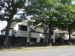
| Hill Bark | Frankby, Wirral | House | 1929-31 | 5 June 1963 | SJ2437385749 53°21′47″N 3°08′16″W |
1242748 | |
| Hoylake and West Kirby War Memorial | Wirral | War Memorial | 1919-1922 | 24 March 2011 | SJ2190087143 53°22′31″N 3°10′31″W |
1116883 | |
| Leasowe Castle | Wirral | House | 1593 | 20 May 1952 | SJ2647191863 53°25′06″N 3°06′28″W |
1273527 | 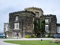 Leasowe Castle |
| Market Cross at Junction of Allport Lane | Bromborough, Wirral | Market Cross | 1278 or Later | 27 December 1962 | SJ3498982136 53°19′56″N 2°58′40″W |
1075384 | 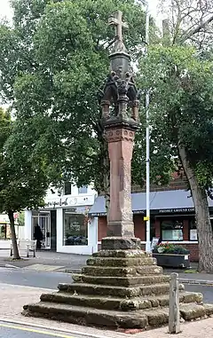 Market Cross at Junction of Allport Lane |
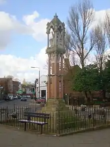
| Memorial Chapel | Liscard, Wirral | Unitarian Chapel | 1898-9 | 20 January 1988 | SJ3091592150 53°25′18″N 3°02′28″W |
1273517 |  Memorial Chapel |
| Former Midland Bank | Birkenhead, Wirral | Bank (financial) | c. 1880 | 28 March 1974 | SJ3250988812 53°23′31″N 3°00′59″W |
1282618 |  Former Midland Bank |
| Number 4 Dry Dock | Birkenhead, Wirral | Gate | c. 1857 | 13 January 1987 | SJ3295088532 53°23′22″N 3°00′35″W |
1292032 | |
| Nos 1 to 6 (consecutive), Mortimer St, with Area Railings attached | Birkenhead, Wirral | Terrace | c1825-30 | 28 March 1974 | SJ3267188988 53°23′36″N 3°00′50″W |
1201559 | |
| Perch Rock Lighthouse | New Brighton, Wirral | Lighthouse | 1827-30 | 4 January 1977 | SJ3086794677 53°26′40″N 3°02′32″W |
1258288 | |
| Roman Catholic Church of English Martyrs | Wallasey, Wirral | Church | 1952-3 | 30 July 2003 | SJ2942992476 53°25′28″N 3°03′48″W |
1390589 | |
| Storeton Hall | Storeton, Wirral | House | c. 1360 | 27 December 1962 | SJ3052384417 53°21′07″N 3°02′43″W |
1075385 | |
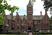
| Thornton Manor | Thornton Hough, Wirral | Country House | Built c1840/50s | 2 December 1986 | SJ3004381704 53°19′39″N 3°03′07″W |
1075420 | |
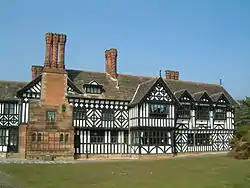
| Thurstaston Hall | Thurstaston, Wirral | House | 15th century or Possibly Earlier | 15 November 1962 | SJ2469084077 53°20′54″N 3°07′58″W |
1075371 | |
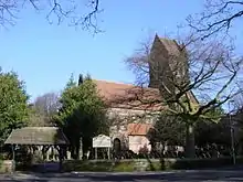
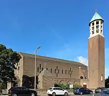
| Town Hall | Wallasey, Wirral | Town Hall | 1883 | 29 July 1950 | SJ3264588963 53°23′35″N 3°00′52″W |
1201582 | 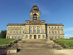 Town Hall |


See also
- Category:Grade II* listed buildings in Merseyside
Notes
- The date given is the date used by Historic England as significant for the initial building or that of an important part in the structure's description.
- Sometimes known as OSGB36, the grid reference is based on the British national grid reference system used by the Ordnance Survey.
- The "List Entry Number" is a unique number assigned to each listed building and scheduled monument by Historic England.
References
External links
![]() Media related to Grade II* listed buildings in Merseyside at Wikimedia Commons
Media related to Grade II* listed buildings in Merseyside at Wikimedia Commons
This article is issued from Wikipedia. The text is licensed under Creative Commons - Attribution - Sharealike. Additional terms may apply for the media files.