Grade II* listed buildings in Cherwell (district)
There are over 20,000 Grade II* listed buildings in England. This page is a list of these buildings in the district of Cherwell in Oxfordshire.
List of buildings
| Name | Location | Type | Completed [note 1] | Date designated | Grid ref.[note 2] Geo-coordinates |
Entry number [note 3] | Image |
|---|---|---|---|---|---|---|---|
| The Grange | Adderbury East | Manor house | 1381 | 8 December 1955 | SP4710635416 52°00′55″N 1°18′54″W |
1200006 |  |
| Cross Hill House | Adderbury West | House | Mid-18th century | 8 December 1955 | SP4663235522 52°00′58″N 1°19′19″W |
1046411 | |
| Friends Meeting House | Adderbury West | Friends Meeting House | 1675 | 8 December 1955 | SP4651835302 52°00′51″N 1°19′25″W |
1046356 | 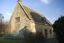 Friends Meeting House |
| Numbers 1, 1a, 2, 3 and 4 Le Hall Place plus attached forecourt walls and gatepiers | Adderbury West | Manor house | 14th century | 8 December 1955 | SP4656235496 52°00′57″N 1°19′23″W |
1046359 | |
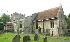
| Church of St Mary the Virgin | Ambrosden | Church | Late 12th century | 7 December 1966 | SP6030019409 51°52′12″N 1°07′32″W |
1046525 | 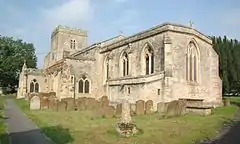 Church of St Mary the Virgin |
| Church of St Mary | Ardley | Church | 14th century or earlier | 7 December 1966 | SP5424227371 51°56′32″N 1°12′44″W |
1046881 | 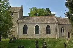 Church of St Mary |
| Ann Elizabeth Health Foods/The Reindeer Inn | Banbury | Public house | Early/mid-16th century | 9 April 1952 | SP4549740643 52°03′44″N 1°20′16″W |
1369571 | 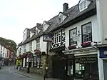 Ann Elizabeth Health Foods/The Reindeer Inn |
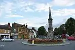
| Banbury Cross | Banbury | Town cross | 1858 | 7 October 1969 | SP4532440399 52°03′36″N 1°20′25″W |
1199654 | |
| Browns/Clays Butchers/Lunn Poly | Banbury | House | 1650 | 9 April 1952 | SP4566240598 52°03′43″N 1°20′07″W |
1046969 |  Browns/Clays Butchers/Lunn Poly |
| Calthorpe House/Danvers House/Dashwood House | Banbury | House | 16th century or earlier | 9 April 1952 | SP4541740255 52°03′32″N 1°20′20″W |
1046966 | |
| Carpenters | Banbury | House | 19th century | 9 April 1952 | SP4560640598 52°03′43″N 1°20′10″W |
1200100 | 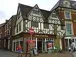 Carpenters |
| FB Hancock solicitors | Banbury | House | 17th century | 9 April 1952 | SP4536840510 | 1283202 | 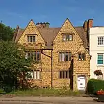 FB Hancock solicitors |
| Hardwick House | Banbury | Farmhouse | 16th century | 9 April 1952 | SP4589942956 52°04′59″N 1°19′54″W |
1200559 | 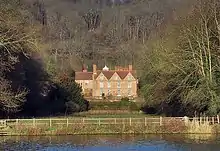 Hardwick House |
| Jervis and Partners | Banbury | House | c.1830–40 | 9 April 1952 | SP4533940105 52°03′27″N 1°20′25″W |
1046914 | |
| Johnson and Gaunt Solicitors | Banbury | House | 17th century | 7 October 1969 | SP4540840672 52°03′45″N 1°20′21″W |
1200151 | .jpg.webp) Johnson and Gaunt Solicitors |
| Nationwide and entrance to Unicorn Hotel | Banbury | Hotel | Mid-17th century | 9 April 1952 | SP4561140624 52°03′44″N 1°20′10″W |
1369548 | 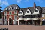 Nationwide and entrance to Unicorn Hotel |
| Oxfordshire County Council Social Services | Banbury | House | Early 18th century | 9 April 1952 | SP4528440192 52°03′30″N 1°20′27″W |
1046912 | |
| Unicorn Hotel | Banbury | Inn | Mid-17th century | 9 April 1952 | SP4558940623 52°03′44″N 1°20′11″W |
1200118 | 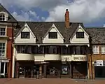 Unicorn Hotel |
| Church of St John | Barford St. John, Barford St. John and St. Michael | Church | 12th century | 8 December 1955 | SP4389333201 51°59′44″N 1°21′44″W |
1046238 | .jpg.webp) Church of St John |
| Manor House | Barford St. Michael, Barford St. John and St. Michael | Farmhouse | Probably 16th/17th century | 8 December 1955 | SP4319932740 51°59′29″N 1°22′20″W |
1046247 | |
| Church of St Michael | Begbroke | Church | Late 12th century | 7 December 1966 | SP4684613942 51°49′20″N 1°19′18″W |
1291232 | 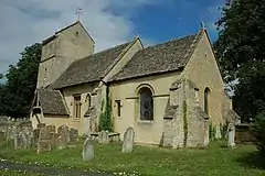 Church of St Michael |
| The Old Priory and attached garden walls | Bicester | House | 15th century | 31 January 1952 | SP5842322118 51°53′40″N 1°09′09″W |
1046470 | |
| The Old Vicarage | Bicester | House | c.1500 | 3 January 1952 | SP5825522309 51°53′47″N 1°09′17″W |
1199889 | |
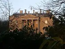
| Bletchingdon Park | Bletchingdon | Country house | 1782 | 26 November 1951 | SP5053318026 51°51′31″N 1°16′04″W |
1219924 | |
| Church of St Giles | Bletchingdon | Church | Mid-13th century | 7 December 1966 | SP5065318058 51°51′32″N 1°15′57″W |
1220032 | 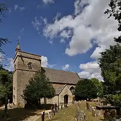 Church of St Giles |
| Home Farmhouse | Bletchingdon | Farmhouse | 17th century | 26 November 1951 | SP5030417512 51°51′14″N 1°16′16″W |
1220080 | |
| Rectory Farmhouse | Bloxham | Farmhouse | Mid-15th century | 8 December 1955 | SP4295035657 52°01′04″N 1°22′32″W |
1046194 | |
| Church of St John the Baptist | Bodicote | Church | 13th century | 8 December 1955 | SP4599337683 52°02′08″N 1°19′51″W |
1277948 | 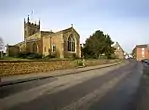 Church of St John the Baptist |
| Church of St Lawrence | Caversfield | Church | 10th/11th century | 7 December 1966 | SP5806325202 51°55′20″N 1°09′26″W |
1046533 | 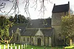 Church of St Lawrence |
| Churchyard cross approximately 5 metres south west of Church of St Mary the Virgin | Charlton-on-Otmoor | Cross | 14th/15th century | 10 April 1987 | SP5618015808 51°50′17″N 1°11′10″W |
1045779 | 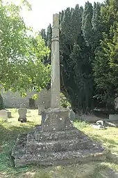 Churchyard cross approximately 5 metres south west of Church of St Mary the Virgin |
| Church of St Mary | Great Chesterton, Chesterton | Church | 12th century | 7 December 1966 | SP5618821366 51°53′17″N 1°11′06″W |
1300898 | 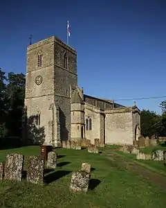 Church of St Mary |
| Manor Farm House | Great Chesterton, Chesterton | Farmhouse | 12th century and later | 9 December 1987 | SP5631621367 51°53′17″N 1°10′59″W |
1369747 | |
| Church of St James the Great | Claydon, Claydon with Clattercot | Church | 12th century | 8 December 1955 | SP4570350047 52°08′49″N 1°20′01″W |
1287785 | 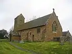 Church of St James the Great |
| Priory Farmhouse | Clattercote, Claydon with Clattercot | Farmhouse | Late 13th/early 14th century | 8 December 1955 | SP4579849200 52°08′21″N 1°19′56″W |
1215881 | |
| Church of St Mary | Cottisford | Church | 13th century | 7 December 1966 | SP5872931063 51°58′30″N 1°08′47″W |
1046439 | 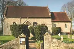 Church of St Mary |
| Castle End Monks Court | Deddington | Farmhouse | 16th century or earlier | 8 December 1955 | SP4700931700 51°58′54″N 1°19′01″W |
1046345 | |
| Castle House | Deddington | Manor house | 13th century | 8 December 1955 | SP4675231746 51°58′56″N 1°19′14″W |
1300851 | 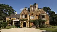 Castle House |
| Church of St Peter and St Paul | Deddington | Church | Early 13th century | 8 December 1955 | SP4675031699 51°58′54″N 1°19′15″W |
1365859 | 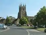 Church of St Peter and St Paul |
| Maunds Farmhouse | Deddington | Farmhouse | Early 17th century | 19 June 1987 | SP4655131627 51°58′52″N 1°19′25″W |
1046314 | 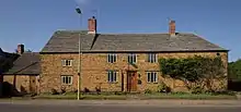 Maunds Farmhouse |
| Plough House The Steps | Deddington | House | Mid-17th century | 8 December 1955 | SP4675031306 51°58′42″N 1°19′15″W |
1046329 | 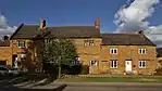 Plough House The Steps |
| The Hermitage | Deddington | House | Mid-17th century | 8 December 1955 | SP4666731717 51°58′55″N 1°19′19″W |
1046323 | 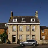 The Hermitage |
| Church of St Peter | Drayton | Church | 14th century | 8 December 1955 | SP4283741564 52°04′15″N 1°22′35″W |
1369591 | 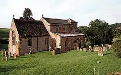 Church of St Peter |
| Drayton Arch approximately 300 metres to south of Park Farmhouse | Drayton | Folly | c.1750 | 23 February 1982 | SP4285941082 52°03′59″N 1°22′34″W |
1369593 |  Drayton Arch approximately 300 metres to south of Park Farmhouse |
| Church of St Anne | Epwell | Church | 13th century | 8 December 1955 | SP3529240473 52°03′41″N 1°29′12″W |
1369555 | 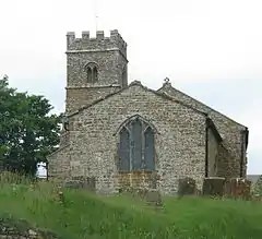 Church of St Anne |
| Church of St Olave | Fritwell | Church | 12th century | 7 December 1966 | SP5245229301 51°57′35″N 1°14′17″W |
1046892 | 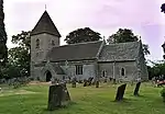 Church of St Olave |
| Fritwell Manor | Fritwell | House | 1619 | 26 November 1951 | SP5240329479 51°57′41″N 1°14′20″W |
1266393 | |
| Manor House | Water Eaton, Gosford and Water Eaton | Hall house | c.1586 | 26 November 1951 | SP5156012067 51°48′18″N 1°15′13″W |
1046562 | 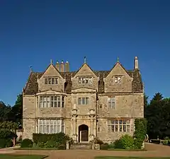 Manor House |
| St Frideswides Farmhouse | Cutteslowe, Gosford and Water Eaton | Farmhouse | 16th century | 26 November 1951 | SP5072711266 51°47′52″N 1°15′57″W |
1286525 | |
| Church of St Giles | Hampton Gay | Church | 1767–72 | 7 December 1966 | SP4845816450 51°50′40″N 1°17′53″W |
1291122 | 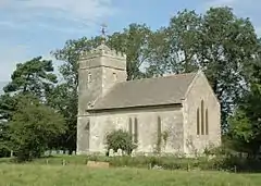 Church of St Giles |
| Church of St Mary | Hampton Poyle | Church | Late 13th century | 7 December 1966 | SP4983715522 51°50′10″N 1°16′41″W |
1220144 | 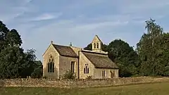 Church of St Mary |
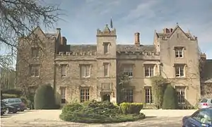
| Hanwell Castle | Hanwell | House | c.1498 | 8 December 1955 | SP4363143605 52°05′21″N 1°21′53″W |
1287674 |  Hanwell Castle |
| Granary/dovecote at SP 5652 3068 | Tusmore, Hardwick with Tusmore | Dovecote | 16th century | 7 December 1966 | SP5647830687 51°58′18″N 1°10′45″W |
1046450 | .jpg.webp) Granary/dovecote at SP 5652 3068 |
| Hardwick Manor House | Hardwick, Hardwick with Tusmore | Farmhouse | c.1580 to 1643 | 26 November 1951 | SP5765729602 51°57′43″N 1°09′44″W |
1046449 | .jpg.webp) Hardwick Manor House |
| Swerford Park | Swerford Park, Hook Norton | House | 18th century | 8 December 1955 | SP3640931310 51°58′45″N 1°28′17″W |
1369836 | |
| Manor House | Horley | Clergy house | 16th/17th century | 8 December 1955 | SP4168243857 52°05′29″N 1°23′35″W |
1216542 | 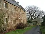 Manor House |
| Proffitt's House | Hornton | House | Mid-17th century | 8 December 1955 | SP3932645072 52°06′09″N 1°25′38″W |
1216568 | 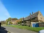 Proffitt's House |
| Studley Almshouses | Horton-cum-Studley | Almshouse | 1639 | 26 November 1951 | SP5977712367 51°48′24″N 1°08′04″W |
1193018 | 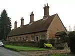 Studley Almshouses |
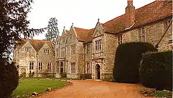
| Studley Priory | Studley, Horton-cum-Studley | Priory/Hotel | 15th/early 16th century | 26 November 1951 | SP5975312219 51°48′20″N 1°08′05″W |
1193052 | |
| The Old Weir | Studley, Horton-cum-Studley | House | c.1350 | 10 April 1987 | SP6022612555 51°48′30″N 1°07′40″W |
1046568 | |
| The Old Rectory | Islip | House | 19th/20th century | 26 November 1951 | SP5273113996 51°49′20″N 1°14′11″W |
1046539 | 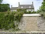 The Old Rectory |
| Dovecote approximately 10 metres north north east of the Old Rectory and Dovecote End | Kidlington | Dovecote | 16th century | 26 November 1951 | SP4972214455 51°49′35″N 1°16′48″W |
1290949 | |
| The Vicarage | Kidlington | Vicarage | Mid-16th century | 26 November 1951 | SP4969114341 51°49′32″N 1°16′49″W |
1290954 | |
| Church of St Mary | Kirtlington | Church | Early 12th century, possibly earlier | 7 December 1966 | SP5002119493 51°52′18″N 1°16′30″W |
1300872 | 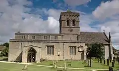 Church of St Mary |
| Barn approximately 50 metres south of Manor Farmhouse | Launton | Barn | 14th/15th century | 9 December 1987 | SP6036622816 51°54′02″N 1°07′27″W |
1232879 | |
| Church of St Mary | Lower Heyford | Church | 13th century | 7 December 1966 | SP4851124872 51°55′13″N 1°17′46″W |
1225457 | 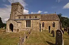 Church of St Mary |
| Heyford Bridge: that part in the parish of Lower Heyford | Lower Heyford | Bridge | 1255 | 26 November 1951 | SP4785924764 51°55′10″N 1°18′20″W |
1266350 |  Heyford Bridge: that part in the parish of Lower Heyford |
| Church of All Saints | Middleton Stoney | Church | Mid-12th century | 7 December 1966 | SP5310823252 51°54′19″N 1°13′46″W |
1276839 | 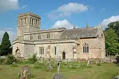 Church of All Saints |
| Middleton Park: garage wing and northern pair of forecourt lodges | Middleton Stoney | House | 1938 | 26 November 1951 | SP5254923281 51°54′20″N 1°14′15″W |
1232950 | |
| Middleton Park: service wing and southern pair of forecourt lodges | Middleton Stoney | House | 1938 | 26 November 1951 | SP5252723242 51°54′19″N 1°14′16″W |
1232953 | |
| Church of All Saints | Mixbury | Church | 12th century | 7 December 1966 | SP6092833994 52°00′04″N 1°06′50″W |
1192977 | 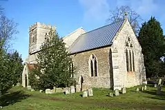 Church of All Saints |
| Church of All Saints | Mollington | Church | Late 13th century or early 14th century | 8 December 1955 | SP4422647499 52°07′27″N 1°21′20″W |
1228026 | 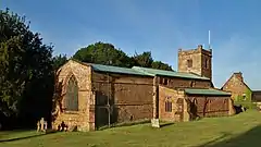 Church of All Saints |
| Church of St Giles | Noke | Church | 13th century | 7 December 1966 | SP5444613173 51°48′52″N 1°12′42″W |
1369713 |  Church of St Giles |
| Church of St Mary | North Aston | Church | 14th century | 8 December 1955 | SP4805028894 51°57′23″N 1°18′08″W |
1200620 | 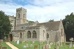 Church of St Mary |
| Church of St Andrew | Oddington | Church | 13th century | 7 December 1966 | SP5526014801 51°49′45″N 1°11′58″W |
1369717 | 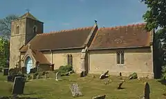 Church of St Andrew |
| Church of St Nicholas | Piddington | Church | Late 13th century | 7 December 1966 | SP6399916980 51°50′52″N 1°04′20″W |
 Church of St Nicholas | |
| Church of Holy Trinity | Shenington | Church | 12th century | 8 December 1955 | SP3727942786 52°04′56″N 1°27′27″W |
1183960 | 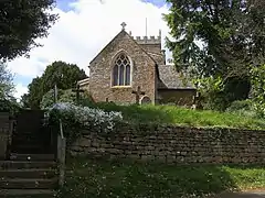 Church of Holy Trinity |
| The Beeches | Alkerton, Shenington with Alkerton | House | 1716 | 28 January 1981 | SP3768142836 52°04′57″N 1°27′06″W |
1046834 | |
| The Old Rectory and attached wall | Alkerton, Shenington with Alkerton | House | 1625 | 20 September 1988 | SP3774542892 52°04′59″N 1°27′02″W |
1046833 | |
| Village Cross | Thrupp, Shipton-on-Cherwell and Thrupp | Village cross | c.1500 | 7 December 1966 | SP4804715773 51°50′19″N 1°18′15″W |
1210769 | |
| Church of St Martin | Shutford | Church | Late 12th/13th century | 8 December 1955 | SP3860940183 52°03′31″N 1°26′18″W |
1184161 | 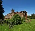 Church of St Martin |
| Manor House and abutting kitchen block | Shutford | Manor house | 17th century | 8 December 1955 | SP3864640167 52°03′31″N 1°26′16″W |
1300239 |  Manor House and abutting kitchen block |
| Barn at Manor Farm at SP52183155 | Souldern | Threshing barn | c.1400 | 3 October 1988 | SP5206031622 51°58′50″N 1°14′36″W |
1046430 | |
| Church of St Mary | Souldern | Church | Mid-12th century | 7 December 1966 | SP5230131691 51°58′52″N 1°14′24″W |
1046428 | 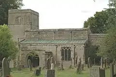 Church of St Mary |
| College Farmhouse | South Newington | Farmhouse | 1659 | 8 December 1955 | SP4077333307 51°59′48″N 1°24′27″W |
1249042 |  College Farmhouse |
| Church of St Peter and St Paul | Steeple Aston | Church | 13th century | 8 December 1955 | SP4760026070 51°55′52″N 1°18′33″W |
1357162 | 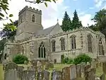 Church of St Peter and St Paul |
| Cuttle Mill | Steeple Aston | House | Late 17th/early 18th century | 8 December 1955 | SP4801125114 51°55′21″N 1°18′12″W |
1066593 | |
| Eyecatcher at SP48282603 | Steeple Aston | Folly | c.1740 | 8 December 1955 | SP4828026030 51°55′51″N 1°17′57″W |
1357142 | 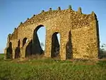 Eyecatcher at SP48282603 |
| Church of St Peter | Stoke Lyne | Church | 12th century | 7 December 1966 | 49°46′01″N 7°33′26″W | 1193248 | _St_Peter's_Church_-_geograph.org.uk_-_69746.jpg.webp) Church of St Peter |
| Barn at Manor House | Tadmarton | Grange barn | 15th century | 8 December 1955 | SP3926337902 52°02′17″N 1°25′44″W |
1283551 | |
| Church of St Mary | Upper Heyford | Church | 14th century | 7 December 1966 | SP4948325866 51°55′45″N 1°16′54″W |
1226006 |  Church of St Mary |
| Wardington Manor | Upper Wardington, Wardington | Manor house | 15th or 16th century | 8 December 1955 | SP4934146062 52°06′38″N 1°16′51″W |
1228757 | |
| Williamscot House, late sixteenth-century range | Williamscot, Wardington | Country house | c.1568 | 8 December 1955 | SP4779345698 52°06′27″N 1°18′13″W |
1287374 | |
| Church of St Mary | Weston-on-the-Green | Church | Pre-Conquest, early C13 | 7 December 1966 | SP5311018580 51°51′48″N 1°13′49″W |
1233027 | 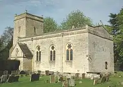 Church of St Mary |
| Weston Manor Hotel | Weston-on-the-Green | Hall house | Late medieval, rebuilt 1820 | 7 December 1966 | SP5337418450 51°51′44″N 1°13′35″W |
1276762 | |
| Church of All Saints | Wroxton | Church | 14th century | 8 December 1955 | SP4173041760 52°04′22″N 1°23′33″W |
1300046 | 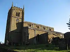 Church of All Saints |
| Church of St Mary Magdalene | Balscote, Wroxton | Church | 14th century | 8 December 1955 | SP3899741733 52°04′21″N 1°25′57″W |
1299831 | .jpg.webp) Church of St Mary Magdalene |
| Dovecote approximately 200 metres south west of Wroxton College | Wroxton | Dovecote | 1745 | 20 September 1988 | SP4148341515 52°04′14″N 1°23′46″W |
1046772 | 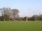 Dovecote approximately 200 metres south west of Wroxton College |
| Gateway, gates, wall and attached lodge to Wroxton College | Wroxton | Gate | 1771 | 20 September 1988 | SP4143441738 52°04′21″N 1°23′49″W |
1369625 | |
| Icehouse approximately 150 metres north east of Wroxton College | Wroxton | Icehouse | Early 18th century | 20 September 1988 | SP4184141695 52°04′19″N 1°23′27″W |
1369626 | |
| Obelisk approximately 400 metres south east of Wroxton College | Wroxton | Obelisk | c.1750 | 23 February 1988 | SP4196141272 52°04′06″N 1°23′21″W |
1046770 | 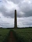 Obelisk approximately 400 metres south east of Wroxton College |
| Priory Farmhouse | Balscote, Wroxton | Farmhouse | 14th century | 8 December 1955 | SP3923541665 52°04′19″N 1°25′44″W |
1299886 | |
| Base and shaft of churchyard cross approximately 16 metres south south east of south porch of Church of St Bartholomew | Yarnton | Cross | 14th century | 26 February 1988 | SP4777011664 51°48′06″N 1°18′31″W |
1290168 | 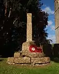 Base and shaft of churchyard cross approximately 16 metres south south east of south porch of Church of St Bartholomew |
| Yarnton Manor and attached wall and gateway | Yarnton | Farmhouse | Post Civil War–1895 | 26 November 1951 | SP4769311627 51°48′05″N 1°18′35″W |
1290170 | 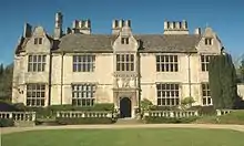 Yarnton Manor and attached wall and gateway |
.jpg.webp)
See also
Notes
- The date given is the date used by Historic England as significant for the initial building or that of an important part in the structure's description.
- Sometimes known as OSGB36, the grid reference is based on the British national grid reference system used by the Ordnance Survey.
- The "List Entry Number" is a unique number assigned to each listed building and scheduled monument by Historic England.
External links
This article is issued from Wikipedia. The text is licensed under Creative Commons - Attribution - Sharealike. Additional terms may apply for the media files.