Grade II* listed buildings in West Sussex
There are over 20,000 Grade II* listed buildings in England. This page is a list of these buildings in the county of West Sussex, by former districts prior to the 2009 structural changes to local government in England.
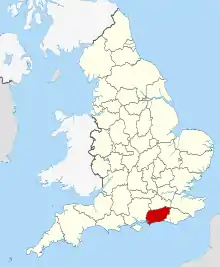
West Sussex shown within England
Adur
| Name | Location | Type | Completed [note 1] | Date designated | Grid ref.[note 2] Geo-coordinates |
Entry number [note 3] | Image |
|---|---|---|---|---|---|---|---|
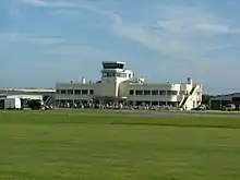
| Shoreham Airport: Terminal building, control tower, offices, customs hall, restaurant and bars | Lancing | Airport | 1936 | 27 July 1984 | TQ2046905171 50°50′01″N 0°17′26″W |
1353731 | |
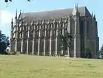
| Lancing College, Great School | Lancing | School | 1881 | 2 December 1985 | TQ1946306605 50°50′48″N 0°18′16″W |
1353753 | |
| Lancing College, East and West Quadrangles | Lancing | School | 1866 | 27 July 1984 | TQ1949206554 50°50′46″N 0°18′15″W |
1353732 |  |
| Shoreham Tollbridge | Old Shoreham, Shoreham-by-Sea | Footbridge | 1781 | 12 October 1954 | TQ2055805970 50°50′27″N 0°17′21″W |
1027895 | |
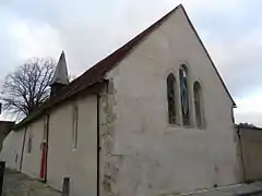
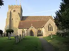
| St Michael and All Angels Church | Southwick | Parish church | 12th century | 19 July 1950 | TQ2393405402 50°50′06″N 0°14′29″W |
1353751 | |
| Marlipins Museum | Shoreham-by-Sea | Museum | c. 1130 | 8 May 1950 | TQ2149405024 50°49′55″N 0°16′34″W |
1353757 | |
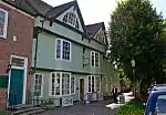
| 49 The Green | Southwick | House | Early 18th century | 19 July 1950 | TQ2409405343 50°50′04″N 0°14′21″W |
1027852 | 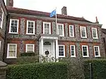 49 The Green |
.jpg.webp)
.jpg.webp)
.jpg.webp)
Arun
| Name | Location | Type | Completed [note 1] | Date designated | Grid ref.[note 2] Geo-coordinates |
Entry number [note 3] | Image |
|---|---|---|---|---|---|---|---|
| Ecclesden Manor | Angmering | House | 1634 | 12 October 1954 | TQ0783604361 50°49′44″N 0°28′13″W |
1027679 | |
| Newplace Farmhouse | Angmering | Farmhouse | late 16th century and early 17th century | 12 October 1954 | TQ0631805578 50°50′24″N 0°29′29″W |
1232882 | |
| St Margaret's Church | Angmering | Parish church | 13th century | 12 October 1954 | TQ0671604361 50°49′44″N 0°29′10″W |
1027708 | |
| Hiorns Tower | Arundel | Folly | Later Post-1789 | 26 March 1949 | TQ0128608085 50°51′48″N 0°33′44″W |
1353747 | 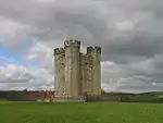 Hiorns Tower |
| 61 High Street | Arundel | Town House | 18th century | 26 March 1949 | TQ0182107141 50°51′17″N 0°33′17″W |
1027947 | |
| 26 Maltravers Street | Arundel | House | 17th century | 26 March 1949 | TQ0164807097 50°51′16″N 0°33′26″W |
1278040 | |
| Norfolk Hotel | Arundel | Hotel | 1785 | 26 March 1949 | TQ0188407122 50°51′17″N 0°33′14″W |
1027908 | _(July_2007).JPG.webp) Norfolk Hotel |
| The Priory (St Wilfred's) | Arundel | Priory | 1380 To 1542 | 7 October 1974 | TQ0168107206 50°51′20″N 0°33′24″W |
1027913 | 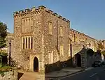 The Priory (St Wilfred's) |
| 51 High Street | Arundel | House | 18th century | 7 October 1974 | TQ0184707112 50°51′16″N 0°33′16″W |
1263836 | |
| Hotham Park House | Bognor Regis | House | 1793 | 4 August 1971 | SZ9404999410 50°47′12″N 0°40′02″W |
1027745 | |
| The Old Farmhouse | Clapham | Farmhouse | 17th century or earlier | 12 October 1954 | TQ0960706577 50°50′54″N 0°26′40″W |
1276658 | |
| Bailiffscourt Hotel and Country Club | Climping | Country house | 1933 | 20 September 1984 | TQ0016000807 50°47′53″N 0°34′48″W |
1027676 | 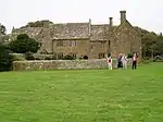 Bailiffscourt Hotel and Country Club |
| Bailiffscourt Chapel | Climping | Chapel | 13th century | 5 June 1958 | TQ0021600899 50°47′56″N 0°34′46″W |
1233450 | |
| Guest House to Bailiffscourt Hotel and Country Club | Climping | Guest house | 1931-35 | 14 October 1991 | TQ0012600828 50°47′54″N 0°34′50″W |
1274459 | |
| Priory Farmhouse | Crossbush | Farmhouse | Modern | 12 October 1954 | TQ0247406337 50°50′51″N 0°32′45″W |
1034405 | |
| St George's Church | Eastergate | Parish church | Norman | 5 June 1958 | SU9451805095 50°50′16″N 0°39′33″W |
1233516 | |
| Blake's Cottage | Felpham | House | 17th century | 22 July 1949 | SZ9508399656 50°47′19″N 0°39′09″W |
1353792 |  Blake's Cottage |
| St Mary the Virgin's Church | Felpham | Parish church | C11-C15 | 22 July 1949 | SZ9493799880 50°47′27″N 0°39′16″W |
1293556 | .JPG.webp) St Mary the Virgin's Church |
| Findon Place | Findon | Country house | Mid 18th century | 12 October 1954 | TQ1172008456 50°51′53″N 0°24′50″W |
1027620 | .jpg.webp) Findon Place |
| St Nicholas' Church | Houghton | Parish church | 13th century | 12 October 1954 | TQ0202811582 50°53′41″N 0°33′02″W |
1027636 | .JPG.webp) St Nicholas' Church |
| St Mary Magdalene's Church | Madehurst | Parish church | Medieval | 5 June 1958 | SU9848309993 50°52′52″N 0°36′05″W |
1276202 | .JPG.webp) St Mary Magdalene's Church |
| Homing Cottage | North Bersted | Timber Framed House | 15th century | 16 September 1977 | SU9256401258 50°48′13″N 0°41′16″W |
1233180 | |
| Knightscroft | Rustington | House | 1879 | 15 February 1973 | TQ0492001860 50°48′24″N 0°30′44″W |
1027592 | .jpg.webp) Knightscroft |
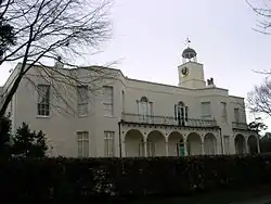
| Slindon House (Slindon College) | Slindon | Country house | about 1560 | 5 June 1958 | SU9600308480 50°52′04″N 0°38′14″W |
1221729 | 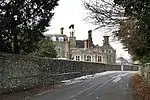 Slindon House (Slindon College) |
| St Mary Magdalene's Church | South Bersted | Parish church | 13th century | 22 July 1949 | SU9347200224 50°47′39″N 0°40′31″W |
1190914 | .JPG.webp) St Mary Magdalene's Church |
| Tortington Priory Barn | Tortington | House | Early 18th century | 20 September 1984 | TQ0065605968 50°50′40″N 0°34′18″W |
1221996 | 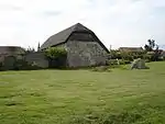 Tortington Priory Barn |
| Walberton House | Walberton | Country house | about 1817 | 5 June 1958 | SU9724005726 50°50′34″N 0°37′13″W |
1222531 | .jpg.webp) Walberton House |
.JPG.webp)
.JPG.webp)
.JPG.webp)
Chichester
| Name | Location | Type | Completed [note 1] | Date designated | Grid ref.[note 2] Geo-coordinates |
Entry number [note 3] | Image |
|---|---|---|---|---|---|---|---|
| Yeoman's House | Bignor | House | 15th century | 22 February 1955 | SU9846014577 50°55′20″N 0°36′02″W |
1026557 | 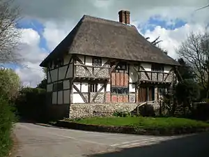 Yeoman's House |
| Sorrell House | Bosham | House | 1960 | 15 July 1998 | SU8152601736 50°48′34″N 0°50′39″W |
1375664 | |
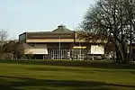
| Chichester Festival Theatre | Chichester | Theatre | 1962 | 12 June 1998 | SU8618405542 50°50′35″N 0°46′38″W |
1323693 | |
| St Andrew-in-the-Oxmarket Church | Chichester | Arts centre | 1971-1976 | 5 July 1950 | SU8622704835 50°50′12″N 0°46′37″W |
1026778 | |
| Fernleigh | Chichester | House | 19th century | 8 October 1971 | SU8607105106 50°50′21″N 0°46′44″W |
1026714 | |
| Friars Gate House | Chichester | House | 18th century | 5 July 1950 | SU8632704985 50°50′17″N 0°46′31″W |
1354315 | |
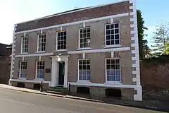
| Regnum Club and Victoria League | Chichester | House | Early 18th century | 5 July 1950 | SU8605304590 50°50′04″N 0°46′46″W |
1026659 | |
| Richmond House | Chichester | House | 18th century | 5 July 1950 | SU8605204608 50°50′05″N 0°46′46″W |
1354341 | |
| St Martin's House | Chichester | House | c. 1680 | 5 July 1950 | SU8618504967 50°50′16″N 0°46′39″W |
1026701 | |
| The Council Chamber and Assembly Room | Chichester | Assembly Rooms | 1783 | 5 July 1950 | SU8611404955 50°50′16″N 0°46′42″W |
1354331 | |
| The Deanery | Chichester | House | 1725 | 5 July 1950 | SU8590604643 50°50′06″N 0°46′53″W |
1287003 | 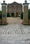 The Deanery |
| Next Store (former Corn Exchange) | Chichester | Shop | 1830 | 5 July 1950 | SU8631204767 50°50′10″N 0°46′32″W |
1192106 | |
| The Market House and Art Annexe of Chichester College of Further Education | Chichester | College | 1807 | 5 July 1950 | SU8610004874 50°50′13″N 0°46′43″W |
1354333 | .jpg.webp) The Market House and Art Annexe of Chichester College of Further Education |
| Royal Arms | Chichester | Public House | 1591 | 5 July 1950 | SU8609004802 50°50′11″N 0°46′44″W |
1192187 | |
| Royal West Sussex Hospital | Chichester | Apartments | 1825 | 8 October 1971 | SU8597905681 50°50′39″N 0°46′49″W |
1354267 | |
| Ship Hotel | Chichester | Hotel | 18th century | 5 July 1950 | SU8612105143 50°50′22″N 0°46′42″W |
1026718 | .jpg.webp) Ship Hotel |
| Wall, Railings and Gateway to Pallant House | Chichester | Gateway | 8 October 1971 | SU8615204667 50°50′06″N 0°46′41″W |
1026744 | 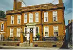 Wall, Railings and Gateway to Pallant House | |
| 31 North Street | Chichester | House | 18th century | 5 July 1950 | SU8607805030 50°50′18″N 0°46′44″W |
1026710 | |
| 41 and 42 North Street | Chichester | House | Early 18th century | 5 July 1950 | SU8608905126 50°50′21″N 0°46′43″W |
1354326 | .jpg.webp) 41 and 42 North Street |
| 43 North Street | Chichester | House | Early 18th century | 5 July 1950 | SU8609405140 50°50′22″N 0°46′43″W |
1026715 | 43 North Street |
| 86 and 87 North Street | Chichester | House | 18th century | 8 October 1971 | SU8608804839 50°50′12″N 0°46′44″W |
1193602 | |
| 17 and 18 South Street | Chichester | House | Early 18th century | 8 October 1971 | SU8603304706 50°50′08″N 0°46′47″W |
1354377 | |
| 19 South Street | Chichester | House | Early 19th century | 8 October 1971 | SU8603204696 50°50′07″N 0°46′47″W |
1285563 | |
| 19a South Street | Chichester | House | 17th century | 8 October 1971 | SU8603404689 50°50′07″N 0°46′47″W |
1026654 | |
| 20 South Street | Chichester | House | 17th century | 5 July 1950 | SU8603004685 50°50′07″N 0°46′47″W |
1354378 | |
| 21–23 South Street | Chichester | House | 17th century | 8 October 1971 | SU8602904675 50°50′07″N 0°46′47″W |
1285567 | |
| 44 South Street (RBS Bank) | Chichester | House/Bank | Early 19th century | 5 July 1950 | SU8604404564 50°50′03″N 0°46′46″W |
1181076 |  44 South Street (RBS Bank) |
| 11 Eastgate Square | Chichester | House | 18th century | 3 February 1960 | SU8647104763 50°50′09″N 0°46′24″W |
1026792 | |
| 20 St Martin's Square | Chichester | House | 18th century | 5 July 1950 | SU8619904942 50°50′15″N 0°46′38″W |
1285911 | |
| 5 East Pallant | Chichester | House | Late 18th century | 8 October 1971 | SU8617704644 50°50′06″N 0°46′39″W |
1286852 | |
| 21 St Martin's Square | Chichester | House | 18th century | 5 July 1950 | SU8618504935 50°50′15″N 0°46′39″W |
1354324 | |
| 8 St Martin's Square | Chichester | House | 18th century | 5 July 1950 | SU8619805034 50°50′18″N 0°46′38″W |
1026702 | |
| 93 East Street | Chichester | Shop | Late 16th century | 8 October 1971 | SU8608304802 50°50′11″N 0°46′44″W |
1354285 | |
| Middleton House | Chidham | House | 1759 | 5 June 1958 | SU7903604077 50°49′51″N 0°52′45″W |
1230503 | |
| St Mary's Church | Compton | Parish church | 13th century | 5 June 1958 | SU7777814770 50°55′38″N 0°53′41″W |
1026421 | 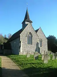 St Mary's Church |
| The Old Manor House | Donnington | House | 1677 | 5 June 1958 | SU8519101977 50°48′40″N 0°47′32″W |
1354492 | |
| Earnley Church | Earnley | Parish church | 13th century | 5 June 1958 | SZ8161696936 50°45′59″N 0°50′39″W |
1026360 | .JPG.webp) Earnley Church |
| Chapel at King Edward VII Hospital | Easebourne | Chapel | 1906 | 2 March 1973 | SU8786624970 51°01′03″N 0°44′55″W |
1232485 | |
| King Edward VII Hospital | Easebourne | Hospital | 1906 | 2 March 1973 | SU8800324930 51°01′01″N 0°44′48″W |
1026020 | |
| The Old Vicarage | Easebourne | House | 18th century | 18 June 1959 | SU8965822720 50°59′49″N 0°43′25″W |
1026039 | |
| Newhouse Farmhouse | East Dean | Farmhouse | 18th century | 28 January 1986 | SU9070614152 50°55′11″N 0°42′39″W |
1026378 | |
| Beechwood | East Lavington | House | 18th century | 18 June 1959 | SU9483916276 50°56′17″N 0°39′06″W |
1232514 | |
| Lavington Park (Seaford College) | East Lavington | House | Elizabethan | 18 June 1959 | SU9458116321 50°56′19″N 0°39′19″W |
1232490 | |
| St Peter's Church | East Lavington | School chapel | 13th century | 18 June 1959 | SU9462016263 50°56′17″N 0°39′17″W |
1354682 | .jpg.webp) St Peter's Church |
| Church of the Assumption of St Mary the Virgin | East Wittering | Redundant church | Early 12th century | 5 June 1958 | SZ8021997890 50°46′30″N 0°51′49″W |
1354484 | 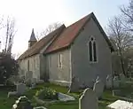 Church of the Assumption of St Mary the Virgin |
| Ebernoe House | Ebernoe | House | Late 18th century | 22 February 1955 | SU9734828027 51°02′36″N 0°36′46″W |
1026468 | 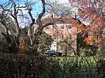 Ebernoe House |
| Ruins of St Mary's Old Church | Treyford | Redundant church | 13th century | 18 June 1959 | SU8242918687 50°57′42″N 0°49′40″W |
1275251 |  Ruins of St Mary's Old Church |
| St Paul's Church | Elsted | Parish church | 11th century | 18 June 1959 | SU8160619788 50°58′18″N 0°50′21″W |
1026026 |  St Paul's Church |
| Treyford Manor | Treyford | Manor house | Medieval | 18 June 1959 | SU8244518655 50°57′41″N 0°49′39″W |
1217783 |  Treyford Manor |
| The White House | Fernhurst | House | Refaced early 18th century | 18 June 1959 | SU8994128539 51°02′57″N 0°43′06″W |
1354707 | |
| Upper North Park Farmhouse | Fernhurst | Farmhouse | 17th century | 18 June 1959 | SU8728427612 51°02′28″N 0°45′23″W |
1276903 | |
| Sennicotts | East Ashling, Funtington | House | c. 1810 | 28 January 1986 | SU8368507038 50°51′25″N 0°48′45″W |
1026351 | |
| St Mary's Church | Funtington | Parish church | 13th century | 5 June 1958 | SU8007208155 50°52′03″N 0°51′49″W |
1026342 |  St Mary's Church |
| St James's Church | Heyshott | Parish church | Until 1882 | 18 June 1959 | SU8972718132 50°57′20″N 0°43′26″W |
1233567 | 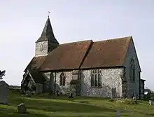 St James's Church |
| The Manor House | Hunston | Manor house | Late 17th century | 5 June 1958 | SU8641501410 50°48′21″N 0°46′30″W |
1026332 |  The Manor House |
| Bridge Farmhouse | Linchmere | Farmhouse | 16th century | 18 June 1959 | SU8582631854 51°04′47″N 0°46′34″W |
1025943 | |
| St Peter's Church | Linchmere | Parish church | Medieval | 18 June 1959 | SU8697830904 51°04′15″N 0°45′36″W |
1276459 |  St Peter's Church |
| The Manor House | Lodsworth | House | C13-14 building | 18 June 1959 | SU9312622706 50°59′46″N 0°40′28″W |
1354742 |  The Manor House |
| The Old House | Lodsworth | House | Dated 1728 | 18 June 1959 | SU9286222854 50°59′51″N 0°40′41″W |
1025913 | |
| St Peter's Church | Lodsworth | Parish church | 13th century | 18 June 1959 | SU9310322772 50°59′49″N 0°40′29″W |
1025908 | 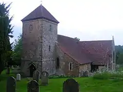 St Peter's Church |
| Blackdown House | Blackdown | House | 17th century | 18 June 1959 | SU9173128603 51°02′58″N 0°41′34″W |
1354734 | 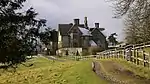 Blackdown House |
| Noah's Ark Inn | Lurgashall | Public house | Probably 17th century | 26 November 1987 | SU9370727201 51°02′12″N 0°39′54″W |
1276264 | 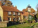 Noah's Ark Inn |
| St Lawrence's Church | Lurgashall | Parish church | 14th century | 18 June 1959 | SU9381127286 51°02′14″N 0°39′48″W |
1276255 | 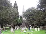 St Lawrence's Church |
| Upper Roundhurst Farmhouse | Blackdown | Farmhouse | Late 17th century | 18 June 1959 | SU9273630413 51°03′56″N 0°40′41″W |
1234523 | |
| Valewood Farmhouse | Lurgashall | Farmhouse | 16th century or earlier | 18 June 1959 | SU9047031626 51°04′37″N 0°42′36″W |
1354733 | |
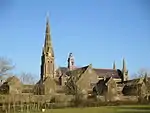
| St Mary Magdalene and St Denys' Church | Midhurst | Parish church | 13th century | 18 June 1959 | SU8871321483 50°59′09″N 0°44′15″W |
1234717 | .JPG.webp) St Mary Magdalene and St Denys' Church |
| Bowley Farmhouse | South Mundham | Farmhouse | 17th century | 5 June 1958 | SZ8865999869 50°47′30″N 0°44′37″W |
1232654 | |
| Fernden and Mundham House | North Mundham | House | 17th century or earlier | 5 June 1958 | SU8754201907 50°48′36″N 0°45′32″W |
1026281 | |
| South Mundham Farmhouse | South Mundham | Farmhouse | dated 1671 | 5 June 1958 | SU8773000757 50°47′59″N 0°45′23″W |
1026284 | |
| St Stephen's Church | North Mundham | Parish church | 13th century | 5 June 1958 | SU8744602139 50°48′44″N 0°45′37″W |
1026279 | 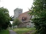 St Stephen's Church |
| Shopwyke Hall | Oving | House | dated 1720 | 5 June 1958 | SU8867305162 50°50′21″N 0°44′31″W |
1026295 | |
| Avenings | Petworth | House | Late 18th century | 22 February 1955 | SU9768221652 50°59′10″N 0°36′35″W |
1224444 | |
| St Bartholomew's Church | Egdean | Parish church | Medieval | 22 February 1955 | SU9965420098 50°58′18″N 0°34′55″W |
1226330 | .JPG.webp) St Bartholomew's Church |
| Daintrey House | Petworth | House | 16th century | 22 February 1955 | SU9777621691 50°59′11″N 0°36′30″W |
1266902 | 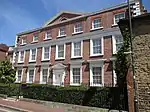 Daintrey House |
| Denne Court, Stringer's Cottage, Stringer's Hall and the Leads | Petworth | Houses | 18th century | 22 February 1955 | SU9779221722 50°59′12″N 0°36′29″W |
1224229 | 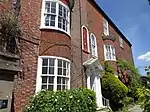 Denne Court, Stringer's Cottage, Stringer's Hall and the Leads |
| New Grove | Petworth | House | 17th century | 22 February 1955 | SU9800221230 50°58′56″N 0°36′19″W |
1266633 | 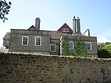 New Grove |
| Newlands | Petworth | Office | Late 18th century | 22 February 1955 | SU9759221476 50°59′04″N 0°36′40″W |
1265984 | 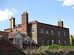 Newlands |
| North House | Petworth | House | Older | 22 February 1955 | SU9772221901 50°59′18″N 0°36′33″W |
1266148 |  North House |
| Somerset Hospital | Petworth | House | Early 17th century | 22 February 1955 | SU9769821966 50°59′20″N 0°36′34″W |
1266149 | .jpg.webp) Somerset Hospital |
| Somerset Lodge | Petworth | House | dated 1653 | 22 February 1955 | SU9769221982 50°59′20″N 0°36′34″W |
1266109 | Somerset Lodge |
| Petworth House Main Gate, Lodge and Wall | Petworth | Gateway | Late 18th century | 22 February 1955 | SU9757121742 50°59′13″N 0°36′41″W |
1266060 | .jpg.webp) Petworth House Main Gate, Lodge and Wall |
| Petworth House Servant's Wing | Petworth | Offices | Early 18th century | 22 February 1955 | SU9764221905 50°59′18″N 0°36′37″W |
1226045 | |
| Petworth House Stables | Petworth | Stables | Mid 19th century | 22 February 1955 | SU9762321799 50°59′14″N 0°36′38″W |
1226050 | |
| Town Hall | Petworth | Town hall | 1793 | 22 February 1955 | SU9765221679 50°59′10″N 0°36′37″W |
1225590 | .jpg.webp) Town Hall |
| York Cottage | Petworth | House | 17th century | 22 February 1955 | SU9758821488 50°59′04″N 0°36′40″W |
1265924 | |
| Shillinglee House | Plaistow | Apartments | 1735 | 2 November 1998 | SU9684332508 51°05′01″N 0°37′08″W |
1226667 |  Shillinglee House |
| Barn at Wenham Manor Farm | Rogate | Barn | 17th century | 18 June 1959 | SU7889023553 51°00′21″N 0°52′37″W |
1275582 | |
| St Peter's Church | Terwick | Parish church | 12th century | 18 June 1959 | SU8178423512 51°00′19″N 0°50′09″W |
1217093 |  St Peter's Church |
| Fyning House, Old Fyning House and the Bothy | Fyning, Rogate | House | Late 18th century and early 19th century | 18 June 1959 | SU8132823862 51°00′30″N 0°50′32″W |
1217049 | |
| Severels | Runcton | House | 1981 | 29 August 2013 | SU8837701988 50°48′38″N 0°44′49″W |
1409992 | |
| St Mary's Church | Rumboldswyke, Chichester | Redundant church | 11th century | 5 July 1950 | SU8697604108 50°49′48″N 0°45′59″W |
1354384 | .JPG.webp) St Mary's Church |
| Fox Hall | Charlton | House | after 1813 possibly | 5 June 1958 | SU8885412827 50°54′29″N 0°44′15″W |
1026196 |  Fox Hall |
| Lumley Mill | Lumley, Southbourne | Mill house | Early 19th century | 10 May 1973 | SU7523806376 50°51′07″N 0°55′57″W |
1026179 | 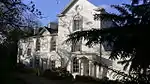 Lumley Mill |
| The Old House | Prinsted, Southbourne | House | 14th century | 6 January 1995 | SU7664305370 50°50′34″N 0°54′46″W |
1221938 | |
| Lee Farmhouse | Stopham | Farmhouse | dated 1492 | 22 February 1955 | TQ0203818571 50°57′27″N 0°32′55″W |
1227068 | |
| Manor Farmhouse | Stopham | Farmhouse | about 1485 | 22 February 1955 | TQ0263619017 50°57′41″N 0°32′24″W |
1265614 | 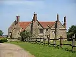 Manor Farmhouse |
| Lordington House | Racton | House | c. 1500 | 5 June 1958 | SU7816809836 50°52′58″N 0°53′25″W |
1034423 | |
| Stansted House | Stansted, Stoughton | House | 1686 | 5 June 1958 | SU7613010316 50°53′14″N 0°55′09″W |
1354611 | 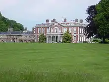 Stansted House |
| Stansted House former Stables and Service Wing | Stansted, Stoughton | Stables | 1786 | 5 June 1958 | SU7613210386 50°53′17″N 0°55′08″W |
1365311 | |
| Pitshill | Tillington | House | 1760 | 18 June 1959 | SU9489622900 50°59′52″N 0°38′57″W |
1217563 | .jpg.webp) Pitshill |
| The Manor of Dean | Tillington | House | Dated 1613 | 18 June 1959 | SU9505222169 50°59′28″N 0°38′49″W |
1217310 | |
| The Old Manor House | Tillington | Estate Cottage | 16th century | 18 June 1959 | SU9617321962 50°59′21″N 0°37′52″W |
1275370 | |
| Tillington House | Tillington | House | Early 19th century | 18 June 1959 | SU9646821805 50°59′15″N 0°37′37″W |
1217637 | |
| Terwick Mill | Trotton with Chithurst | House | Now, after 1966 | 18 June 1959 | SU8308522159 50°59′34″N 0°49′03″W |
1221355 |  Terwick Mill |
| The Dovecot at Trotton Place to the North East of the House | Trotton with Chithurst | Dovecote | Dated 1626 | 18 June 1959 | SU8359322632 50°59′49″N 0°48′37″W |
1221284 | |
| Trotton Place | Trotton with Chithurst | House | 16th century core | 18 June 1959 | SU8362122556 50°59′47″N 0°48′35″W |
1221283 | |
| Binderton House | West Dean | House | about 1680 | 5 June 1958 | SU8498310826 50°53′26″N 0°47′35″W |
1354593 |  Binderton House |
| The Parish church of St Andrew | West Dean | Parish church | pre Conquest | 5 June 1958 | SU8614812613 50°54′24″N 0°46′34″W |
1026124 | 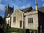 The Parish church of St Andrew |
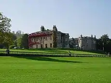
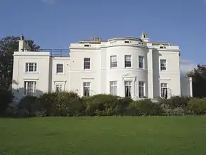
| West Dean College, West Dean Park | West Dean | House | 1804 | 19 July 1985 | SU8616912575 50°54′22″N 0°46′33″W |
1026116 | .jpg.webp) West Dean College, West Dean Park |
| Itchenor Park Farm Cottages and the Farm Buildings adjoining | West Itchenor | Farm Labourers' Cottage | dated 1782 | 5 June 1958 | SU7972300818 50°48′05″N 0°52′12″W |
1026103 | |
| The Parish church of St Mary Magdalene | West Lavington | Church | Built 1850 | 18 June 1959 | SU8916620540 50°58′39″N 0°43′53″W |
1275104 | 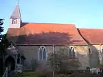 The Parish church of St Mary Magdalene |
| Cakeham Manor | West Wittering | Farmhouse | 18th century | 28 January 1986 | SZ7847697578 50°46′21″N 0°53′18″W |
1221649 | .jpg.webp) Cakeham Manor |
| Westbourne House | Westbourne | House | 18th century | 5 June 1958 | SU7564507549 50°51′45″N 0°55′36″W |
1354623 | |
| Cookes House | West Burton | House | c. 1588 | 22 February 1955 | TQ0001913868 50°54′56″N 0°34′43″W |
1026532 | |
| Carne's Seat to the North of Goodwood House | Goodwood Park, Westhampnett | Garden Building | 1743 | 5 June 1958 | SU8886009558 50°52′43″N 0°44′18″W |
1026090 | |
| Laundry Green the Gordon Rooms | Goodwood Park, Westhampnett | House | Late 18th century | 28 January 1986 | SU8861008835 50°52′20″N 0°44′31″W |
1275619 | |
| Molecomb | Goodwood Park, Westhampnett | Dower House | 1777 | 5 June 1958 | SU8949310070 50°53′00″N 0°43′45″W |
1276481 | |
| The Parish church of St Peter | Westhampnett | Parish church | 11th century | 5 June 1958 | SU8808906176 50°50′54″N 0°45′00″W |
1026099 | 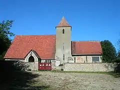 The Parish church of St Peter |
| Woolbeding Bridge | Woolbeding with Redford | Bridge | C15-16 | 18 June 1959 | SU8727822041 50°59′28″N 0°45′28″W |
1221570 | 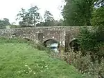 Woolbeding Bridge |
| Harting War Memorial | South Harting | War memorial | 1920 | 11 October 2016 | SU7843819423 50°58′08″N 0°53′03″W |
1438494 | 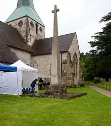 Harting War Memorial |


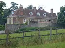
Crawley
.JPG.webp)
.JPG.webp)
.jpg.webp)
.jpg.webp)
.jpg.webp)

.JPG.webp)
.JPG.webp)
.JPG.webp)
.JPG.webp)
Horsham
| Name | Location | Type | Completed [note 1] | Date designated | Grid ref.[note 2] Geo-coordinates |
Entry number [note 3] | Image |
|---|---|---|---|---|---|---|---|
| Kennards | Amberley, Horsham | Timber Framed House | 17th century or earlier | 15 March 1955 | TQ0315313244 50°54′34″N 0°32′03″W |
1353955 | 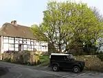 Kennards |
| North Stoke House | North Stoke, Amberley, Horsham | House | 18th century or earlier | 15 March 1955 | TQ0200410801 50°53′16″N 0°33′04″W |
1353956 | |
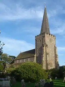
| The Parish Church of St Peter and St Paul | Ashington, Horsham | Parish Church | 15th century | 15 March 1955 | TQ1288415890 50°55′53″N 0°23′42″W |
1027442 | 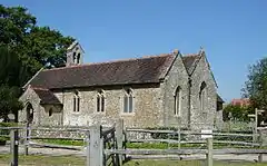 The Parish Church of St Peter and St Paul |
| Peppers | Ashurst, Horsham | House | 1914 | 15 March 1955 | TQ1690416074 50°55′56″N 0°20′16″W |
1286873 | 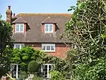 Peppers |
| Fossbrooks and Parbrook | Parbrook, Billingshurst, Horsham | Timber Framed House | 16th century | 22 September 1959 | TQ0741523236 50°59′55″N 0°28′14″W |
1027114 |  Fossbrooks and Parbrook |
| Ye Old Six Bells Inn | Billingshurst, Horsham | Inn | 16th century | 22 September 1959 | TQ0862825957 51°01′22″N 0°27′09″W |
1027137 |  Ye Old Six Bells Inn |
| The Parish Church of St Giles | Coldwaltham, Coldwaltham, Horsham | Parish Church | 13th century | 15 March 1955 | TQ0234416540 50°56′21″N 0°32′41″W |
1027424 | 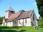 The Parish Church of St Giles |
| Holmbush | Faygate, Colgate, Horsham | Country House | 1823 | 22 September 1959 | TQ2250933758 51°05′24″N 0°15′08″W |
1193998 | 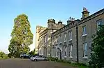 Holmbush |
| Brook Place | Cowfold, Horsham | Timber Framed House | 16th century | 22 September 1959 | TQ2153023371 50°59′49″N 0°16′10″W |
1027087 |  Brook Place |
| Capon's Farmhouse | Cowfold, Horsham | House | c. 1300 | 22 September 1959 | TQ2057722744 50°59′29″N 0°17′00″W |
1027095 | 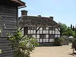 Capon's Farmhouse |
| St. Hugh's Charterhouse, Parkminster | Parkminster, Cowfold, Horsham | Garden Wall | 1875-83 | 4 September 1980 | TQ2064420698 50°58′23″N 0°16′59″W |
1027084 | |
| Potwell | Henfield, Horsham | House | 18th century | 15 March 1955 | TQ2125015884 50°55′47″N 0°16′34″W |
1027397 | 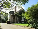 Potwell |
| Rus House | Henfield, Horsham | House | Early 19th century | 15 March 1955 | TQ2153015829 50°55′45″N 0°16′19″W |
1192586 | 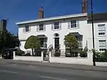 Rus House |
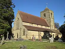
| The Parish Church of St Peter | Henfield, Horsham | Parish Church | c. 1200 | 15 March 1955 | TQ2121216178 50°55′56″N 0°16′35″W |
1027400 | |
| Wantley Manor | Henfield, Horsham | House | 18th century | 15 March 1955 | TQ2154416308 50°56′00″N 0°16′18″W |
1027376 | |
| Former Stables and Coach House Block at Muntham House School | Barns Green, Itchingfield, Horsham | Stable | Early 19th century | 22 September 1959 | TQ1239627647 51°02′14″N 0°23′54″W |
1354175 | |
| Priest's House | Itchingfield, Horsham | Clergy House | 15th century | 22 September 1959 | TQ1312928910 51°02′54″N 0°23′15″W |
1027046 | 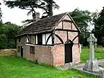 Priest's House |
| The Parish Church of St Nicolas | Itchingfield Village, Itchingfield, Horsham | Parish Church | Norman | 22 September 1959 | TQ1313828938 51°02′55″N 0°23′14″W |
1193818 |  The Parish Church of St Nicolas |
| Springhead Farmhouse | Parham, Horsham | House | Dated 1811 | 15 March 1955 | TQ0602613314 50°54′34″N 0°29′36″W |
1027360 | |
| Wiggonholt House | Wiggonholt, Parham, Horsham | House | Dated 1811 | 15 March 1955 | TQ0612916713 50°56′24″N 0°29′27″W |
1193309 | |
| New Place Manor | Pulborough, Horsham | House | Medieval | 15 March 1955 | TQ0534119321 50°57′49″N 0°30′05″W |
1027340 | 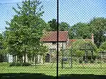 New Place Manor |
| Old Place | Pulborough, Horsham | House | 15th century | 15 March 1955 | TQ0452118958 50°57′38″N 0°30′47″W |
1286130 | 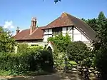 Old Place |
| The Old House | Pulborough, Horsham | Timber Framed House | 17th century or earlier | 15 March 1955 | TQ0475218739 50°57′31″N 0°30′36″W |
1193380 | 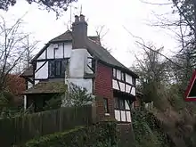 The Old House |
| The Rectory | Pulborough, Horsham | Vicarage | Late 18th century | 9 May 1980 | TQ0485518806 50°57′33″N 0°30′30″W |
1027312 |  The Rectory |
| Garlands | The Haven, Rudgwick, Horsham | Timber Framed House | 17th century or earlier | 22 September 1959 | TQ0821031005 51°04′05″N 0°27′25″W |
1354197 | 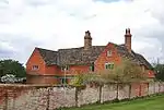 Garlands |
| The Parish Church of St Giles | Shermanbury, Horsham | Parish Church | 14th century | 15 March 1955 | TQ2142218834 50°57′22″N 0°16′21″W |
1194079 | 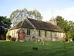 The Parish Church of St Giles |
| Barnhouse Farmhouse | Coolham, Shipley, Horsham | Farmhouse | 17th century or earlier | 22 September 1959 | TQ1256521683 50°59′01″N 0°23′52″W |
1180549 | 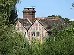 Barnhouse Farmhouse |
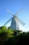
| King's Windmill | Shipley, Horsham | Corn Mill | 1879 | 22 September 1959 | TQ1432421870 50°59′06″N 0°22′22″W |
1180806 | |
| Knepp Castle and Stables adjoining to North West | Shipley, Horsham | Country House | 1800 and 1813 | 22 September 1959 | TQ1564221717 50°59′00″N 0°21′14″W |
1354214 | 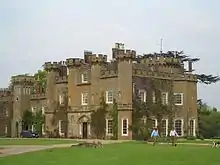 Knepp Castle and Stables adjoining to North West |
| Arts Centre and Music School at Christ's Hospital | Horsham, Southwater, Horsham | Transformer Station | 1972-4 | 4 December 2000 | TQ1475028268 51°02′32″N 0°21′52″W |
1247243 | 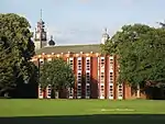 Arts Centre and Music School at Christ's Hospital |
| Christ's Hospital: Dining Hall and Water Tower to North, School to South, Collannaded Wings to East and West (chapel in West Wing) forming a Quadrangle | Southwater, Horsham | Gate | 1902 | 22 September 1959 | TQ1481228353 51°02′35″N 0°21′49″W |
1027034 | 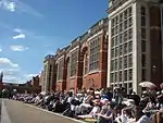 Christ's Hospital: Dining Hall and Water Tower to North, School to South, Collannaded Wings to East and West (chapel in West Wing) forming a Quadrangle |
| Great House Farmhouse | Southwater, Horsham | Farmhouse | Late C15/early 16th century | 27 November 1980 | TQ1531726931 51°01′49″N 0°21′25″W |
1286023 | |
| Barn to North West of Charlton Court | Steyning, Horsham | Tithe Barn | Pre 1414 | 9 May 1980 | TQ1690811860 50°53′40″N 0°20′21″W |
1180715 |  Barn to North West of Charlton Court |
| Chantry House | Steyning, Horsham | House | 18th century | 15 March 1955 | 49°46′01″N 7°33′26″W | 1194515 | 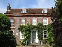 Chantry House |
| Charlton House and Garden Wall, Gate and Railings to North East | Steyning, Horsham | Managers House | Early 18th century | 15 March 1955 | TQ1777411067 50°53′14″N 0°19′37″W |
1027280 | 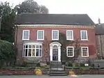 Charlton House and Garden Wall, Gate and Railings to North East |
| Penfold House and Penfold Lodge | Steyning, Horsham | House | 18th century | 15 March 1955 | TQ1771911133 50°53′16″N 0°19′40″W |
1180501 |  Penfold House and Penfold Lodge |
| Springwells Hotel | Steyning, Horsham | House | 18th century | 15 March 1955 | TQ1775511092 50°53′14″N 0°19′38″W |
1027281 | 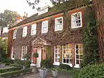 Springwells Hotel |
| The Stone House | Steyning, Horsham | House | 1955 | 15 March 1955 | TQ1768811143 50°53′16″N 0°19′42″W |
1180508 | 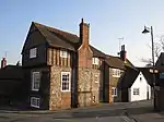 The Stone House |
| 1, 3 and 5 Church Street | Steyning, Horsham | House | 18th century | 15 March 1955 | TQ1772011169 50°53′17″N 0°19′40″W |
1285733 | 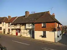 1, 3 and 5 Church Street |
| 61, 63 and 65 High Street | Steyning, Horsham | Jettied House | Early 16th century | 15 March 1955 | TQ1753911292 50°53′21″N 0°19′49″W |
1354081 | 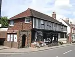 61, 63 and 65 High Street |
| Mulberry House | Storrington and Sullington, Horsham | House | 18th century | 15 March 1955 | TQ0879014320 50°55′05″N 0°27′13″W |
1027235 | |
| The Parish Church of St Mary the Virgin | Storrington and Sullington, Horsham | Parish Church | Medieval | 15 March 1955 | TQ0860314079 50°54′57″N 0°27′23″W |
1027264 | 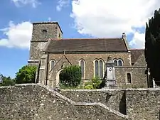 The Parish Church of St Mary the Virgin |
| West Wantley Farmhouse | Storrington and Sullington, Horsham | Farmhouse | Dated 1656 | 15 March 1955 | TQ0900015469 50°55′42″N 0°27′01″W |
1027238 |  West Wantley Farmhouse |
| The Blue Idol Meeting House and Guest House | Coolham, Thakeham, Horsham | Farmhouse | From 1931 | 15 March 1955 | TQ1073923125 50°59′49″N 0°25′24″W |
1181144 |  The Blue Idol Meeting House and Guest House |
| Church of St Andrew | Edburton, Upper Beeding, Horsham | Church | 13th century | 15 March 1955 | TQ2330511498 50°53′23″N 0°14′54″W |
1354065 | 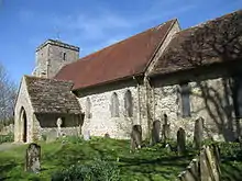 Church of St Andrew |
| The Parish Church of St Peter | Upper Beeding, Horsham | Parish Church | 14th century | 15 March 1955 | TQ1928211134 50°53′15″N 0°18′20″W |
1027214 | 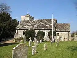 The Parish Church of St Peter |
| Sands | Warnham, Horsham | House | Mid 16th century | 22 September 1959 | TQ1518234447 51°05′52″N 0°21′23″W |
1181536 | |
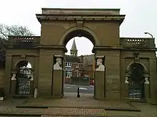
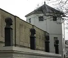
| South East Lodges of Warnham Court School | Warnham, Horsham | Arch | 1828 | 22 September 1959 | TQ1647632479 51°04′47″N 0°20′19″W |
1354221 | .jpg.webp) South East Lodges of Warnham Court School |
| The Parish Church of St Mary | Washington, Horsham | Parish Church | 12th century | 15 March 1955 | TQ1187512860 50°54′16″N 0°24′37″W |
1027198 | 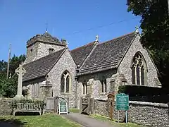 The Parish Church of St Mary |
| Glebe House | West Grinstead Village, West Grinstead, Horsham | House | Modern | 22 September 1959 | TQ1719420694 50°58′25″N 0°19′56″W |
1026846 | .jpg.webp) Glebe House |
| Old Lock Farmhouse | Lock, West Grinstead, Horsham | Farmhouse | Dated 1702 | 15 March 1955 | TQ1776918455 50°57′13″N 0°19′29″W |
1353982 | |
| Priest's House | West Grinstead, Horsham | House | Early 18th century | 22 September 1959 | TQ1769021166 50°58′40″N 0°19′30″W |
1026840 |  Priest's House |
| The Parish Church of St Mary | Wiston Park, Wiston, Horsham | Parish Church | 14th century | 15 March 1955 | TQ1553812393 50°53′58″N 0°21′30″W |
1027150 |  The Parish Church of St Mary |
| The Stables to the South East of Wiston House | Wiston Park, Wiston, Horsham | Stables | 16th century | 9 May 1980 | TQ1553012376 50°53′58″N 0°21′31″W |
1182674 | |
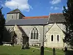
| The Parish Church of St Peter | Woodmancote, Horsham | Parish Church | 13th century | 15 March 1955 | TQ2311715002 50°55′17″N 0°14′59″W |
1284248 | 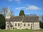 The Parish Church of St Peter |
| Chesworth House | Horsham | Farmhouse | Used as a farmhouse | 22 September 1959 | TQ1761329476 51°03′09″N 0°19′24″W |
1027063 | |
| Horsham Museum | Horsham | House | 19th century | 20 May 1949 | TQ1720230451 51°03′41″N 0°19′44″W |
1027542 | |
| Horsham Park | Horsham | House | Early 18th century | 20 May 1949 | TQ1761730864 51°03′54″N 0°19′22″W |
1353938 | 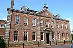 Horsham Park |
| Netherledys the Needles | Horsham | House | Later | 20 May 1949 | TQ1655130138 51°03′32″N 0°20′18″W |
1027571 |  Netherledys the Needles |
| North Chapel | Horsham | Farmhouse | probably 16th century | 20 May 1949 | TQ1776830862 51°03′54″N 0°19′14″W |
1192026 |  North Chapel |
| Springfield Park | Horsham | Country House | 18th century | 20 May 1949 | TQ1714331192 51°04′05″N 0°19′46″W |
1286838 | 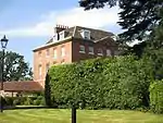 Springfield Park |
| St John's College | Horsham | Country House | 1833-5 | 22 September 1959 | TQ1951829649 51°03′14″N 0°17′46″W |
1027055 | 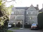 St John's College |
| St Leonards | Horsham | Country House | Early 19th century | 22 September 1959 | TQ2008530986 51°03′56″N 0°17′15″W |
1354200 | 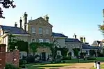 St Leonards |
| The Manor House | Horsham | Manor House | 1704 | 20 May 1949 | TQ1714430460 51°03′42″N 0°19′47″W |
1286966 | 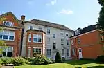 The Manor House |
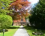
.jpg.webp)
Mid Sussex
| Name | Location | Type | Completed [note 1] | Date designated | Grid ref.[note 2] Geo-coordinates |
Entry number [note 3] | Image |
|---|---|---|---|---|---|---|---|
| Albourne Place and former stables | Albourne | Country house | 1983 | 11 May 1983 | TQ2524915995 50°55′47″N 0°13′09″W |
1192229 | 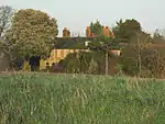 Albourne Place and former stables |
| Ditton Place and attached Terrace Wall and Sandstone Wall | Staplefield | Country house | 1904 | 4 February 2003 | TQ2844129795 51°03′11″N 0°10′08″W |
1096143 | .jpg.webp) Ditton Place and attached Terrace Wall and Sandstone Wall |
| Stables to the North East of Wakehurst Place | Ardingly | Stables | 18th century | 28 October 1957 | TQ3397031461 51°04′01″N 0°05′22″W |
1354792 | |
| Balcombe Place | Balcombe | Country house | 1856 | 26 April 1977 | TQ3234529042 51°02′44″N 0°06′48″W |
1025775 | |
| Edmund's Farmhouse | Balcombe | Farmhouse | 16th century wing added | 28 October 1957 | TQ3249230381 51°03′27″N 0°06′39″W |
1193049 | 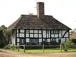 Edmund's Farmhouse |
| Kemp's House | Balcombe | Farmhouse | Late 17th century | 28 October 1957 | TQ3082329582 51°03′03″N 0°08′06″W |
1192986 |  Kemp's House |
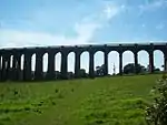
| Ouse Valley Viaduct | Balcombe | Railway Viaduct | 1841 | 11 May 1983 | TQ3226227952 51°02′09″N 0°06′54″W |
1366101 | |
| Wykehurst Park | Bolney | Apartment | 1983 | 11 May 1983 | TQ2577024405 51°00′19″N 0°12′32″W |
1193325 | 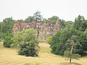 Wykehurst Park |
| St John the Evangelist's Church | Burgess Hill | Parish church | 1861-3 | 22 April 1950 | TQ3120519200 50°57′26″N 0°08′00″W |
1025854 | |
| Cuckfield Park | Cuckfield | Country house | c. 1574 | 10 September 1951 | TQ2975524416 51°00′16″N 0°09′07″W |
1025541 | 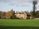 Cuckfield Park |
| Gatehouse to Cuckfield Park including Iron Railings | Cuckfield | Gatehouse | Early 19th century | 10 September 1951 | TQ2981424398 51°00′16″N 0°09′04″W |
1025545 | .jpg.webp) Gatehouse to Cuckfield Park including Iron Railings |
| Marshalls | Cuckfield | House | 1987 | 10 September 1951 | TQ3043424692 51°00′25″N 0°08′32″W |
1025522 | |
| Ockenden Manor | Cuckfield | Manor House | Late 16th century | 10 September 1951 | TQ3026524656 51°00′24″N 0°08′41″W |
1025490 | |
| The Sanctuary | Cuckfield | Cross Wing House | 19th century | 11 December 1987 | TQ3040924590 51°00′21″N 0°08′34″W |
1191932 | |
| St Swithun's Church | East Grinstead | Parish church | C14-C15 origins | 28 January 1948 | TQ3964638001 51°07′27″N 0°00′21″W |
1277758 | |
| Clarendon House | East Grinstead | House | Modern | 28 January 1948 | TQ3946937946 51°07′26″N 0°00′30″W |
1277662 | .jpg.webp) Clarendon House |
| Cromwell House | East Grinstead | Jettied House | 19th century | 28 January 1948 | TQ3972837953 51°07′26″N 0°00′17″W |
1248867 | .jpg.webp) Cromwell House |
| Imberhorne Farm Cottages | East Grinstead | House | Late 18th century or early 19th century | 25 June 2007 | TQ3734738386 51°07′42″N 0°02′19″W |
1392066 | |
| Old Stone House | Judges Terrace, East Grinstead | House | Late 16th century | 28 January 1948 | TQ3945537948 51°07′26″N 0°00′31″W |
1248939 | .jpg.webp) Old Stone House |
| The Porch House | East Grinstead | House | 17th century | 28 January 1948 | TQ3974137957 51°07′26″N 0°00′16″W |
1248868 | .jpg.webp) The Porch House |
| Perching Manor Farmhouse | Fulking | Farmhouse | 18th century | 11 May 1983 | TQ2435511434 50°53′20″N 0°14′00″W |
1354845 | 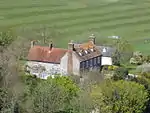 Perching Manor Farmhouse |
| Clayton Priory | Hassocks | House | about 1820 | 28 January 1971 | TQ3034617899 50°56′45″N 0°08′45″W |
1354811 | |
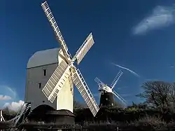
| Clayton Windmills | Clayton | Windmills | Mid 19th century | 28 October 1957 | TQ3036613368 50°54′18″N 0°08′50″W |
1354812 | |
| Ockley Manor | Keymer | House | Early 18th century | 28 October 1957 | TQ3156416368 50°55′54″N 0°07′45″W |
1285397 | |
| Butlers Green House | Haywards Heath | Apartment | 1987 | 10 September 1951 | TQ3195823961 51°00′00″N 0°07′15″W |
1192341 | |
| St Wilfrid's Church | Haywards Heath | Parish church | 1863-5 | 10 September 1951 | TQ3309823915 50°59′57″N 0°06′17″W |
1354934 | |
| Hospital Farmhouse | Haywards Heath | Farmhouse | Mid 16th century | 6 April 1976 | TQ3398122513 50°59′11″N 0°05′33″W |
1025468 | |
| Lucas's | Haywards Heath | House | Early 19th century | 10 September 1951 | TQ3260524459 51°00′15″N 0°06′41″W |
1025471 | |
| Sunte House | Haywards Heath | House | 1700 | 10 September 1951 | TQ3338125519 51°00′49″N 0°06′00″W |
1192455 | |
| Wickham Farmhouse | Haywards Heath | Farmhouse | Late 19th century | 10 September 1951 | TQ3325025432 51°00′46″N 0°06′07″W |
1286539 | |
| Broadhurst Manor Including Attached Walls to East and West | Horsted Keynes | House | Part demolished c1780 | 28 October 1957 | TQ3876730044 51°03′11″N 0°01′17″W |
1025683 | |
| Cobbs Mill | Hurstpierpoint and Sayers Common | Watermill | 19th century | 11 May 1983 | TQ2743718976 50°57′22″N 0°11′13″W |
1180397 | 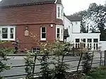 Cobbs Mill |
| Littlepark Farmhouse | Hurstpierpoint and Sayers Common | Farmhouse | early to mid 17th century | 28 October 1957 | TQ2834216602 50°56′05″N 0°10′30″W |
1180570 | |
| Holy Trinity Church | Hurstpierpoint | Parish church | 1860s | 28 October 1957 | TQ2795616498 50°56′01″N 0°10′50″W |
1354863 | 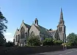 Holy Trinity Church |
| Barnlands | Lindfield | Jettied House | late 16th century or early 17th century | 10 September 1951 | TQ3474025618 51°00′51″N 0°04′50″W |
1354963 | .jpg.webp) Barnlands |
| Lindfield House | Lindfield | House | Early 18th century | 10 September 1951 | TQ3497425939 51°01′01″N 0°04′38″W |
1193499 | .jpg.webp) Lindfield House |
| Lindfield Place | Lindfield | House | Mid 18th century | 10 September 1951 | TQ3495425984 51°01′03″N 0°04′39″W |
1025452 | .jpg.webp) Lindfield Place |
| Malling Priory | Lindfield | House | c. 1730 | 10 September 1951 | TQ3478825617 51°00′51″N 0°04′48″W |
1025459 | .jpg.webp) Malling Priory |
| All Saints Church | Lindfield | Parish church | c. 1300 | 10 September 1951 | TQ3488825850 51°00′58″N 0°04′42″W |
1025462 | .JPG.webp) All Saints Church |
| The Bower House | Lindfield | House | about 1300 | 10 September 1951 | TQ3484925802 51°00′57″N 0°04′44″W |
1025448 | .jpg.webp) The Bower House |
| The Manor House | Lindfield | House | 18th century | 11 December 1987 | TQ3470125570 51°00′49″N 0°04′52″W |
1025483 | .jpg.webp) The Manor House |
| The Mansion House | Hurstpierpoint | House | 16th century | 28 October 1957 | TQ279165 50°55′59″N 0°10′38″W |
1354864 | |
| The Thatched Cottage | Lindfield | Timber Framed House | 16th century | 10 September 1951 | TQ3495125908 51°01′00″N 0°04′39″W |
1354974 | 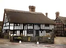 The Thatched Cottage |
| West Wing Middle House, East Wing Turret House and Archway Cottage at Old Place | Lindfield | House | 1884 | 10 September 1951 | TQ3496025888 51°01′00″N 0°04′38″W |
1025426 | .jpg.webp) West Wing Middle House, East Wing Turret House and Archway Cottage at Old Place |
| Wincote | Lindfield | House | 1907 | 10 September 1951 | TQ3468925491 51°00′47″N 0°04′53″W |
1192816 | |
| 122 High Street | Lindfield | House | Early 19th century | 10 September 1951 | TQ3488625808 51°00′57″N 0°04′42″W |
1193272 | .jpg.webp) 122 High Street |
| East Mascalls | Lindfield Rural | House | 15th-century origins | 28 October 1957 | TQ3660825673 51°00′51″N 0°03′14″W |
1025621 | .jpg.webp) East Mascalls |
| Little Walstead Farmhouse | Lindfield Rural | Farmhouse | 16th century | 28 October 1957 | TQ3565725036 51°00′31″N 0°04′04″W |
1354878 |  Little Walstead Farmhouse |
| St John Evangelist's Church | Newtimber | Parish church | Medieval | 28 October 1957 | TQ2713213389 50°54′22″N 0°11′36″W |
1354879 |  St John Evangelist's Church |
| Blacksmiths Cottage & Old Place | Warninglid | House | 17th century or earlier | 11 May 1983 | TQ2497825965 51°01′10″N 0°13′10″W |
1181538 |  Blacksmiths Cottage & Old Place |
| St Mary's Church | Slaugham | Parish church | Medieval | 28 October 1957 | TQ2573728074 51°02′18″N 0°12′29″W |
1025603 | |
| The Ruins of Old Slaugham Place in the Grounds of Slaugham Manor | Slaugham, Slaugham | Kitchen | Remains | 28 October 1957 | TQ2603927837 51°02′10″N 0°12′14″W |
1354891 |  The Ruins of Old Slaugham Place in the Grounds of Slaugham Manor |
| Hickstead Place | Hickstead, Twineham | House | early 17th-century addition | 28 October 1957 | TQ2679720004 50°57′56″N 0°11′45″W |
1181866 |  Hickstead Place |
| Slipe | Twineham | Farmhouse | Early 15th century | 28 October 1957 | TQ2566020037 50°57′58″N 0°12′43″W |
1025584 | .jpg.webp) Slipe |
| Priest House | West Hoathly | House | restored 1908 | 28 October 1957 | TQ3624732509 51°04′33″N 0°03′23″W |
1025556 | 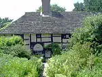 Priest House |
| The Manor House | West Hoathly | House | 16th century | 28 October 1957 | TQ3627432573 51°04′35″N 0°03′22″W |
1025554 | .jpg.webp) The Manor House |
| Tickeridge | West Hoathly | Jettied House | Late 14th century | 28 October 1957 | TQ3651935552 51°06′11″N 0°03′05″W |
1182345 | |
| Crabbet Park | Crabbet Park, Worth | Apartment | 1983 | 27 September 1962 | TQ3066637365 51°07′14″N 0°08′04″W |
1025535 | |
| Rowfant House | Worth | Country house | 15th century | 28 October 1957 | TQ3249037147 51°07′06″N 0°06′30″W |
1354912 | 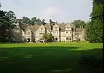 Rowfant House |
| The Tennis Court and Orangery at Crabbet Park | Crabbet Park, Worth | Orangery | 1900 circa | 11 May 1983 | TQ3054737363 51°07′14″N 0°08′10″W |
1025536 | |
.jpg.webp)

.JPG.webp)
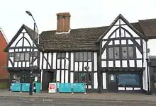
Worthing
_(IoE_Code_432521).JPG.webp)
.jpg.webp)
_(March_2012).JPG.webp)

Notes
- The date given is the date used by Historic England as significant for the initial building or that of an important part in the structure's description.
- Sometimes known as OSGB36, the grid reference is based on the British national grid reference system used by the Ordnance Survey.
- The "List Entry Number" is a unique number assigned to each listed building and scheduled monument by Historic England.
References
External links
![]() Media related to Grade II* listed buildings in West Sussex at Wikimedia Commons
Media related to Grade II* listed buildings in West Sussex at Wikimedia Commons
This article is issued from Wikipedia. The text is licensed under Creative Commons - Attribution - Sharealike. Additional terms may apply for the media files.