Grade II* listed buildings in Allerdale
There are over 20,000 Grade II* listed buildings in England. This page is a list of these buildings in the district of Allerdale in Cumbria.
List of buildings
| Name | Location | Type | Completed [note 1] | Date designated | Grid ref.[note 2] Geo-coordinates |
Entry number [note 3] | Image |
|---|---|---|---|---|---|---|---|
| Church of St Kentigern | Aspatria | Church | 1846–48 | 11 April 1967 | NY1471041916 54°45′54″N 3°19′38″W |
1234861 | |
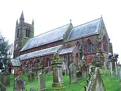
| Church of St Bega | Bassenthwaite | Church | 12th century | 3 March 1967 | NY2266228748 54°38′52″N 3°12′00″W |
1332957 | 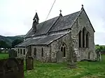 Church of St Bega |
| Mirehouse | Bassenthwaite | House | Late 17th century | 3 March 1967 | NY2317828378 54°38′41″N 3°11′31″W |
1326263 | 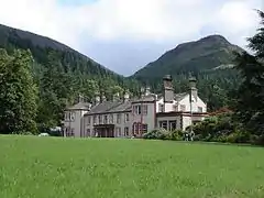 Mirehouse |
| Table tomb south of chancel of Church of St Michael | Isel, Blindcrake | Table tomb | Late 15th century | 5 September 1986 | NY1625433303 54°41′16″N 3°18′02″W |
1312018 |  |
| Weary Hall | Mealsgate, Boltons | Farmhouse | Mid-16th century | 11 April 1967 | NY2178141836 54°45′55″N 3°13′02″W |
1137761 | |
| Church of St Michael | Bowness-on-Solway | Church | 12th century | 11 April 1967 | NY2237662646 54°57′09″N 3°12′49″W |
1137007 | |
| Fingland Farmhouse and adjoining barn | Fingland, Bowness | Farmhouse | Late 17th century | 11 April 1967 | NY2547157119 54°54′12″N 3°09′50″W |
1327125 | |
| Parsonage Farmhouse | Brigham | Farmhouse | 13th or 14th century | 3 March 1967 | NY0858430987 54°39′56″N 3°25′08″W |
1145197 | |
| Hesket Hall Farmhouse | Hesket Newmarket, Caldbeck | Farmhouse | Mid- or late 17th century | 11 April 1967 | NY3397338646 54°44′18″N 3°01′37″W |
1144444 | 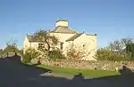 Hesket Hall Farmhouse |
| Castlegate House | Cockermouth | Detached house | Mid-18th century | 28 August 1951 | NY1234430839 54°39′54″N 3°21′38″W |
1327097 | |
| Church of All Saints | Cockermouth | Church | 1852–54 | 28 August 1951 | NY1236430640 54°39′47″N 3°21′37″W |
1144744 | 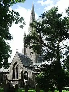 Church of All Saints |
| Cobbled forecourt to Nos 45 and 47, Kirkgate | Cockermouth | House | Late 18th century | 28 August 1951 | NY1243830584 54°39′46″N 3°21′32″W |
1327064 | 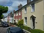 Cobbled forecourt to Nos 45 and 47, Kirkgate |
| Norham House | Cockermouth | House | 18th century | 18 December 1969 | NY1193830671 54°39′48″N 3°22′00″W |
1144717 | |
| 6 Castlegate | Cockermouth | House | Late 18th century | 28 August 1951 | NY1231330789 54°39′52″N 3°21′40″W |
1327096 | 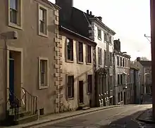 6 Castlegate |
| 5, 7 Castlegate | Cockermouth | House | Mid-18th century | 28 August 1951 | NY1228930787 54°39′52″N 3°21′41″W |
1373837 | |
| 38, 40 and 42 Market Place | Cockermouth | Cross passage house | Early–mid-16th century | 26 July 1974 | NY1225930745 54°39′51″N 3°21′43″W |
1327092 |  38, 40 and 42 Market Place |
| Crakeplace Hall | Ullock, Dean | Farmhouse | Mid-16th century | 3 March 1967 | NY0700424032 54°36′10″N 3°26′28″W |
1326884 | |
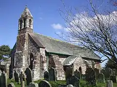
| Church of St Mary | Gilcrux | Church | 1836 | 3 March 1967 | NY1173438176 54°43′51″N 3°22′20″W |
1275717 | 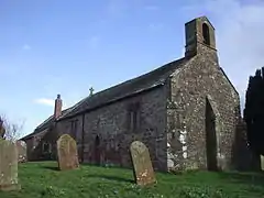 Church of St Mary |
| Mill Grove | Abbeytown, Holme Abbey | Former infirmary | Before 1472 | 1 April 1967 | NY1774650693 54°50′39″N 3°16′57″W |
1212550 | |
| Aisle columns west of Ireby Old Church | Ireby | Gate pier | 13th century | 3 January 1986 | NY2237239311 54°44′34″N 3°12′26″W |
1146404 | |
| Orthwaite Hall and adjoining barn | Orthwaite, Ireby and Uldale | Farmhouse | Late 16th or early 17th century | 11 April 1967 | NY2527234183 54°41′50″N 3°09′40″W |
1144419 | 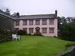 Orthwaite Hall and adjoining barn |
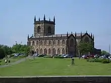
| Church of St John | Keswick | Church | 1838 | 2 October 1951 | NY2678823181 54°35′55″N 3°08′05″W |
1144666 | 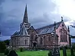 Church of St John |
| Church of St Kentigern | Great Crosthwaite, Keswick | Church | 14th century | 2 October 1951 | NY2574124285 54°36′30″N 3°09′04″W |
1327118 | |
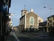
| The Moot Hall | Keswick | Moot hall | 1571 | 2 October 1951 | NY2663223436 54°36′03″N 3°08′14″W |
1137345 | |
| Church of St Bride | Kirkbride | Church | 12th century | 1 April 1967 | NY2296057329 54°54′17″N 3°12′11″W |
1144617 | 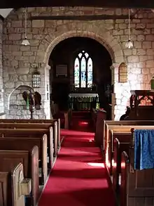 Church of St Bride |
| Lilac House | Kirkbride | House | 17th century | 6 January 2011 | NY2293656944 54°54′05″N 3°12′12″W |
1396397 | |
| Allanby House | Flimby, Maryport | House | 1731 | 29 July 1950 | NY0239433468 54°41′12″N 3°30′56″W |
1137677 | |
| Flimby Hall | Flimby, Maryport | House | 1766 | 29 July 1950 | NY0239633503 54°41′13″N 3°30′56″W |
1137687 | |
| Netherhall | Maryport | Country house | Mid- and late Georgian | 29 July 1950 | NY0432536908 54°43′05″N 3°29′12″W |
1137621 | |
| Dovecote south of Church of St Cuthbert | Parsonby, Plumbland | Dovecote | 16th century | 13 August 1985 | NY1417939159 54°44′24″N 3°20′04″W |
1217363 |  Dovecote south of Church of St Cuthbert |
| Church of St Mary | Churchtown, Sebergham | Church | Medieval | 11 April 1967 | NY3640841853 54°46′03″N 2°59′24″W |
1327246 | 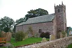 Church of St Mary |
| Sebergham Hall | Sebergham | House | Late 17th century | 3 January 1986 | NY3636642442 54°46′22″N 2°59′27″W |
1144392 | |
| Warnell Hall | Sebergham | Farmhouse | Early or mid-16th century | 11 April 1967 | NY3505241339 54°45′46″N 3°00′39″W |
1311727 | 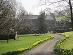 Warnell Hall |
| Courtyard range and gatehouse with barn adjoining, Warnell Hall | Sebergham | Courtyard | Early 16th century | 3 January 1986 | NY3506741323 54°45′45″N 3°00′38″W |
1144400 | |
| Hewthwaite Hall | Setmurthy | Farmhouse | 1581 | 3 March 1967 | NY1523832836 54°41′00″N 3°18′58″W |
1145129 | 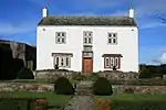 Hewthwaite Hall |
| Millbeck Hall and adjoining barn | Millbeck, Underskiddaw | Farmhouse | 1592 | 3 March 1967 | NY2559526082 54°37′28″N 3°09′14″W |
1121974 | |
| Fiddleback | West Woodside, Westward | Farmhouse | 1709 | 11 April 1967 | NY3073049170 54°49′57″N 3°04′48″W |
1311657 | 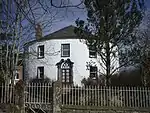 Fiddleback |
| Islekirk Hall | Westward | House | Mid-16th century | 11 April 1967 | NY2594344526 54°47′24″N 3°09′12″W |
1274096 | |
| Jenkin's Cross | Westward | Farmhouse | Early 19th century | 11 April 1967 | NY2894447915 54°49′16″N 3°06′27″W |
1238648 | 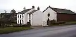 Jenkin's Cross |
| Meadow Bank Farmhouse | West Curthwaite, Westward | Farmhouse | 1666 | 11 April 1967 | NY3238548926 54°49′50″N 3°03′15″W |
1144410 | |
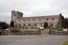
| Church of St Mary | Wigton | Church | 1788 | 1 April 1967 | NY2559948273 54°49′26″N 3°09′34″W |
1144590 | 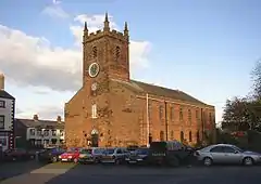 Church of St Mary |
| Byres to north of Schoose Farm House | Schoose, Workington | Cow house | Early 19th century | 13 December 1985 | NY0146028044 54°38′16″N 3°31′42″W |
1138196 | |
| Church of St John and adjoining community hall | Workington | Church | 1822–23 | 6 June 1951 | NY0043228499 54°38′30″N 3°32′40″W |
1138257 | 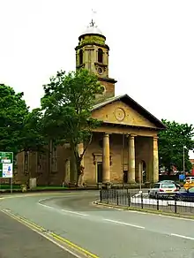 Church of St John and adjoining community hall |
| Church of St Michael | Workington | Church | 12th century | 6 June 1951 | NX9973428956 54°38′45″N 3°33′19″W |
1144492 | |
| Granary east of Schoose Farmhouse | Schoose, Workington | Granary | c. 1800 | 13 December 1985 | NY0150228002 54°38′15″N 3°31′39″W |
1144490 | |
| Helena Thompson Museum and former stables | Workington | House | Late 18th century | 6 June 1951 | NY0087828563 54°38′33″N 3°32′15″W |
1311987 | |
| Schoose Farmhouse and adjoining barns | Schoose, Workington | Farmhouse | c. 1800 | 13 December 1985 | NY0142828018 54°38′15″N 3°31′43″W |
1144489 | |
| St Michael's House | Workington | House | 15th century | 13 December 1985 | NX9980728963 54°38′45″N 3°33′15″W |
1144478 | |
| Windmill, adjoining barns, gatehouse and curtain wall | Schoose, Workington | Farm buildings | c. 1800 | 13 December 1985 | NY0140427985 54°38′14″N 3°31′45″W |
1327213 | 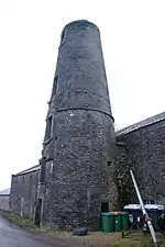 Windmill, adjoining barns, gatehouse and curtain wall |
Notes
- The date given is the date used by Historic England as significant for the initial building or that of an important part in the structure's description.
- Sometimes known as OSGB36, the grid reference is based on the British national grid reference system used by the Ordnance Survey.
- The "List Entry Number" is a unique number assigned to each listed building and scheduled monument by Historic England.
External links
![]() Media related to Grade II* listed buildings in Cumbria at Wikimedia Commons
Media related to Grade II* listed buildings in Cumbria at Wikimedia Commons
This article is issued from Wikipedia. The text is licensed under Creative Commons - Attribution - Sharealike. Additional terms may apply for the media files.