Grade II* listed buildings in Lancashire
Blackburn with Darwen
| Name | Location | Type | Completed [note 1] | Date designated | Grid ref.[note 2] Geo-coordinates |
Entry number [note 3] | Image |
|---|---|---|---|---|---|---|---|
| Brandwood Fold | Edgworth, North Turton | Farmhouse | 17th century | 27 January 1967 | SD7401816378 53°38′36″N 2°23′40″W |
1241554 | 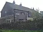 Brandwood Fold |
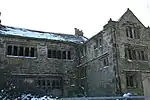
| Entwistle Hall | Entwistle, North Turton | Farmhouse | 16th century | 27 January 1967 | SD7287217496 53°39′12″N 2°24′43″W |
1260432 | 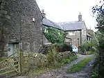 Entwistle Hall |
| Horrocks Fold Farmhouse (Thimble Hall) | Edgworth, North Turton | Farmhouse | 17th century | 27 January 1967 | SD7382316936 53°38′54″N 2°23′51″W |
1260435 | 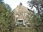 Horrocks Fold Farmhouse (Thimble Hall) |
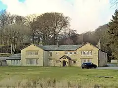
| New Hall, Including Cottage at Rear | Entwistle, North Turton | House | 1742 | 15 March 1974 | SD7268817740 53°39′20″N 2°24′53″W |
1241559 | 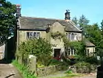 New Hall, Including Cottage at Rear |
| Summerhouse circa 100 Metres East of Turton Tower | North Turton | Prospect Tower | 17th century | 27 September 1984 | SD7315015246 53°37′59″N 2°24′27″W |
1241997 |  |
| Old Hall Farmhouse | Pleasington | Farmhouse | 1587 | 27 August 1952 | SD6460226967 53°44′16″N 2°32′17″W |
1072418 | |
| Higher Hill Farmhouse | Tockholes | Farmhouse | 17th century | 24 November 1966 | SD6576922585 53°41′55″N 2°31′12″W |
1241536 | 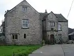 Higher Hill Farmhouse |
| Lower Hill | Tockholes | Farmhouse | Early 17th century | 27 August 1952 | SD6562022888 53°42′05″N 2°31′20″W |
1260460 | .jpg.webp) Lower Hill |
| Ryal Farmhouse | Ryal Fold, Tockholes | Farmhouse | 17th century | 27 September 1984 | SD6660421704 53°41′27″N 2°30′26″W |
1241544 | 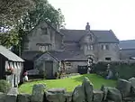 Ryal Farmhouse |
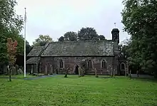
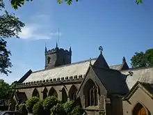
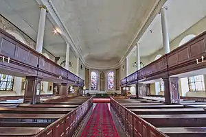
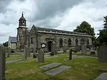
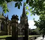
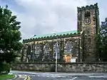
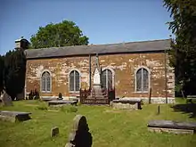
| Church of St Peter | Darwen | Church | 1827-1829 | 27 September 1984 | SD6943222223 53°41′44″N 2°27′52″W |
1163042 | |
| India Mill Chimney | Darwen | Mill | 1867 | 27 September 1984 | SD6937921710 53°41′27″N 2°27′55″W |
1362166 | 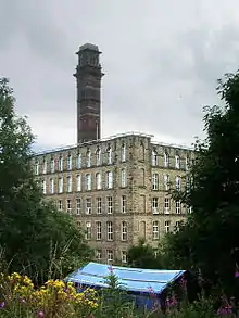 India Mill Chimney |
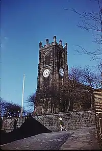
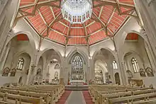
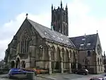
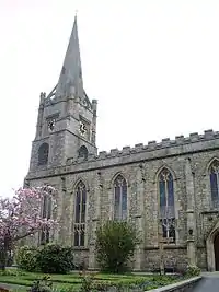
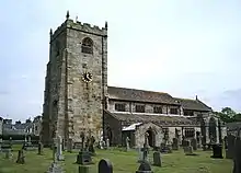
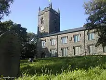
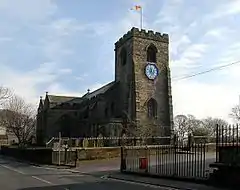
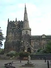
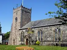
| Cathedral Church of St Mary the Virgin | Blackburn | Cathedral | 1926 | 28 November 1951 | SD6836027988 53°44′50″N 2°28′53″W |
1239147 | |
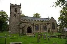
| Church of St Mark | Witton, Blackburn | Church | 1836-1838 | 19 April 1974 | SD6658227626 53°44′38″N 2°30′29″W |
1239292 | |
| Church of St Silas, Blackburn | Blackburn | Church | Designed 1878 | 19 April 1974 | SD6664828482 53°45′06″N 2°30′26″W |
1239161 | |
| Eddy Holes, Stable and Shippons to Eddy Holes | Bank Hey, Blackburn | House | 16th century | 28 November 1951 | SD6957930956 53°46′27″N 2°27′47″W |
1222890 |  Eddy Holes, Stable and Shippons to Eddy Holes |
| Myles Wife Hey | Bank Hey, Blackburn | House | 1543 | 28 November 1951 | SD6940330375 53°46′08″N 2°27′56″W |
1273854 | .jpg.webp) Myles Wife Hey |
| Darwen War Memorial | Darwen | War memorial | 1921 | 27 September 1984 | SD6893021860 53°41′32″N 2°28′19″W |
1072435 |  Darwen War Memorial |
.jpg.webp)
Blackpool
| Name | Location | Type | Completed [note 1] | Date designated | Grid ref.[note 2] Geo-coordinates |
Entry number [note 3] | Image |
|---|---|---|---|---|---|---|---|
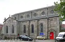
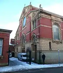
| Church of the Sacred Heart | Blackpool | Church | 1857 | 20 October 1983 | SD3072636433 53°49′10″N 3°03′13″W |
1072015 | |
| Blackpool Grand Theatre | Blackpool | Theatre | 1894 | 26 January 1972 | SD3074936175 53°49′02″N 3°03′12″W |
1280615 | 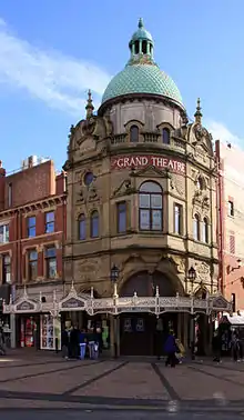 Blackpool Grand Theatre |
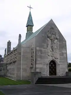
| Thanksgiving Shrine of Our Lady of Lourdes | Blackpool | Chapel | 1955/1957 | 30 June 1999 | SD3318436774 53°49′23″N 3°00′59″W |
1387319 | |
| The Winter Gardens | Blackpool | Conservatory | 1875-8 | 10 October 1973 | SD3089236162 53°49′02″N 3°03′04″W |
1072007 | |
| Blackpool War Memorial | Blackpool | War memorial | 1923 | 20 October 1983 | SD3057436469 53°49′11″N 3°03′22″W |
1072010 | .jpg.webp) Blackpool War Memorial |

Burnley
| Name | Location | Type | Completed [note 1] | Date designated | Grid ref.[note 2] Geo-coordinates |
Entry number [note 3] | Image |
|---|---|---|---|---|---|---|---|
| Burwains | Briercliffe | Farmhouse | 1642 | 1 April 1953 | SD8873535779 53°49′05″N 2°10′21″W |
1072659 | .jpg.webp) Burwains |
| Extwistle Hall and Attached Garden Wall | Briercliffe | Farmhouse | 16th to 17th Century | 1 April 1953 | SD8760533800 53°48′01″N 2°11′23″W |
1072655 | |
| Barcroft Hall with attached Garden Wall and Entrance Gateway | Cliviger | House | 16th to 17th Century | 1 April 1953 | SD8656230417 53°46′12″N 2°12′19″W |
1072668 |  Barcroft Hall with attached Garden Wall and Entrance Gateway |
| The Holme | Cliviger | House | Early 17th century | 1 April 1953 | SD8782428361 53°45′05″N 2°11′10″W |
1362053 | |
| Arched Gateway and Garden Wall Attached to South Front of Shuttleworth Hall | Hapton | Gate | 17th century | 12 February 1985 | SD7838032229 53°47′09″N 2°19′47″W |
1222599 | .jpg.webp) Arched Gateway and Garden Wall Attached to South Front of Shuttleworth Hall |
| Hargrove Farmhouse | Padiham | Farmhouse | Early to Mid 17th century | 28 August 1953 | SD7967234845 53°48′34″N 2°18′37″W |
1237631 |  Hargrove Farmhouse |
| Stockbridge House | Padiham | House | Mid 17th century | 28 August 1953 | SD7984633574 53°47′53″N 2°18′27″W |
1274125 | 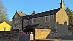 Stockbridge House |
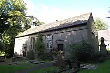
| The Great Barn | Hurstwood, Worsthorne-with-Hurstwood | Aisled Barn | Late 16th century | 17 December 1968 | SD8814531368 53°46′43″N 2°10′53″W |
1072638 | 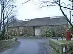 The Great Barn |
| Hurstwood Hall | Hurstwood, Worsthorne-with-Hurstwood | Farmhouse | Post 1579 | 1 April 1953 | SD8812031340 53°46′42″N 2°10′54″W |
1205736 |  Hurstwood Hall |
| Burnley War Memorial | Towneley Park | War Memorial | 1926 | 19 November 1997 | SD8554630858 53°46′26″N 2°13′15″W |
1247303 |  Burnley War Memorial |
| Jackson's Farmhouse and Cottage Adjoining Jackson's Farmhouse and Attached Garden Wall | Worsthorne-with-Hurstwood | Farmhouse | c. 1600 | 1 April 1953 | SD8765932442 53°47′17″N 2°11′20″W |
1280581 | Feb2007.jpg.webp) Jackson's Farmhouse and Cottage Adjoining Jackson's Farmhouse and Attached Garden Wall |
| Spenser House | Worsthorne-with-Hurstwood | Farmhouse | Mid 16th century | 1 April 1952 | SD8808531352 53°46′42″N 2°10′56″W |
1280543 | 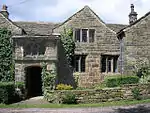 Spenser House |
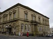
| Burnley Mechanics | Burnley | Mechanics Institute | 1854-1855 | 29 September 1977 | SD8398932409 53°47′16″N 2°14′40″W |
1244905 | |
| Church of St Peter | Burnley | Church | 1791 | 10 November 1951 | SD8429632957 53°47′34″N 2°14′24″W |
1022640 | 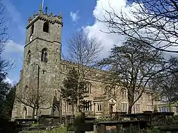 Church of St Peter |
Chorley
| Name | Location | Type | Completed [note 1] | Date designated | Grid ref.[note 2] Geo-coordinates |
Entry number [note 3] | Image |
|---|---|---|---|---|---|---|---|
| Bank Hall | Bretherton | House | 1832-1833 | 22 October 1952 | SD4625620215 53°40′32″N 2°48′54″W |
1362113 | |
| Carr House | Bretherton | Farmhouse | Dated 1613; Later Alterations | 22 October 1952 | SD4627021474 53°41′13″N 2°48′54″W |
1163160 | |
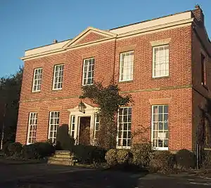
| Brindle Lodge | Brindle | House | c. 1808 | 22 October 1952 | SD6031026651 53°44′05″N 2°36′11″W |
1072574 | 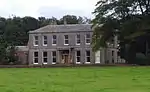 Brindle Lodge |
| Head O'th' Marsh Farmhouse | Brindle | Farmhouse | 1692 | 17 April 1967 | SD6136024885 53°43′08″N 2°35′13″W |
1072572 |  Head O'th' Marsh Farmhouse |
| Bolton Green Farmhouse | Charnock Richard | Farmhouse | 1612 | 17 April 1967 | SD5513017760 53°39′16″N 2°40′49″W |
1203550 | 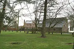 Bolton Green Farmhouse |
| Lower House Farmhouse | Charnock Richard | Farmhouse | 1654 | 17 April 1967 | SD5593716268 53°38′28″N 2°40′05″W |
1203643 | |
| Crow Trees | Walton-le-Dale, Clayton-le-Woods | Farmhouse | Earlier than 1600 | 27 November 1972 | SD5803524463 53°42′54″N 2°38′14″W |
1211203 | 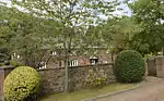 Crow Trees |
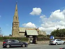
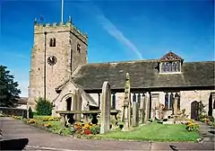
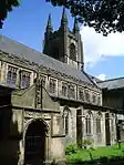
| Church of St Michael | Croston | Parish Church | Pre 16th century | 17 April 1967 | SD4900918394 53°39′34″N 2°46′23″W |
1163631 | 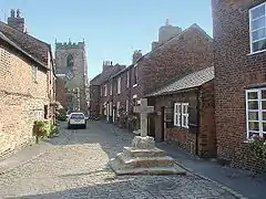 Church of St Michael |
| Cuerden Hall | Cuerden | Country House | Early 18th century | 21 February 1984 | SD5639423929 53°42′36″N 2°39′44″W |
1362174 | |
| Church of the Blessed Virgin Mary | Eccleston | Church | 14th century | 17 April 1967 | SD5163717848 53°39′18″N 2°44′00″W |
1362129 | 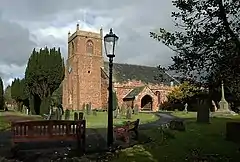 Church of the Blessed Virgin Mary |
| Re-used Calvary Cross Slab, Churchyard of the Church of the Blessed Virgin Mary | Eccleston | Gravestone | C13-C15 | 24 June 2010 | SD5162117832 53°39′17″N 2°44′00″W |
1393860 | 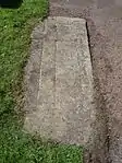 Re-used Calvary Cross Slab, Churchyard of the Church of the Blessed Virgin Mary |
| Re-used Elizabethan Ledger Slab in the Churchyard of Church of the Blessed Virgin Mary | Eccleston | Gravestone | 1584 | 24 June 2010 | SD5166317853 53°39′18″N 2°43′58″W |
1393858 | 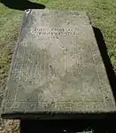 Re-used Elizabethan Ledger Slab in the Churchyard of Church of the Blessed Virgin Mary |
| Buckshaw Hall | Euxton | House | 1885 | 11 July 1975 | SD5629920123 53°40′33″N 2°39′47″W |
1362139 | |
| Euxton Parish Church | Euxton | Church | Early 18th century | 17 April 1967 | SD5554318944 53°39′54″N 2°40′27″W |
1362144 | |
| Morris Farmhouse | Heapey | Farmhouse | 1693 | 17 April 1967 | SD6110818886 53°39′54″N 2°35′24″W |
1164224 | |
| Hall O' Th' Hill | Heath Charnock | House | Early to Mid 17th century | 22 October 1952 | SD6031415030 53°37′49″N 2°36′06″W |
1072473 | 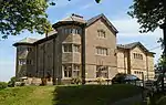 Hall O' Th' Hill |
| Howe Brook House Farmhouse | Heskin | Farmhouse | 17th century or Earlier | 17 April 1967 | SD5217815301 53°37′55″N 2°43′29″W |
1072527 | |
| Lane Ends House | Mawdesley | House | Early 17th century | 17 April 1967 | SD4878114876 53°37′40″N 2°46′33″W |
1072504 | |
| Rivington Hall | Rivington | Courtyard House | Late 15th century | 22 October 1952 | SD6331014439 53°37′31″N 2°33′22″W |
1165012 | |
| Unitarian Chapel | Rivington | Unitarian Chapel | 1703 | 17 April 1967 | SD6268814517 53°37′33″N 2°33′56″W |
1362126 | |
| Moss Lane Farmhouse | Whittle-le-Woods | Farmhouse | Later 17th century | 21 May 1986 | SD5877520399 53°40′42″N 2°37′32″W |
1247763 | |
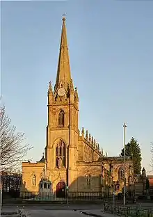
| Church of St George | Chorley | Church | 1822-1825 | 21 December 1966 | SD5850917474 53°39′08″N 2°37′45″W |
1072441 | |
| Church of St Laurence | Chorley | Church | 1824 | 21 December 1966 | SD5829817765 53°39′17″N 2°37′57″W |
1072631 | |
| Gillibrand Hall Barn | Chorley | Dwelling | 1669 | 21 December 1966 | SD5737516882 53°38′48″N 2°38′47″W |
1362045 | |
| Higher Healey Farm House | Chorley | Farmhouse | 1612 | 21 December 1966 | SD6062218799 53°39′51″N 2°35′51″W |
1203835 | |
| Lower Burgh Hall | Chorley | Farmhouse | Early 17th century or Earlier | 4 January 1977 | SD5714615691 53°38′10″N 2°38′58″W |
1072644 |  Lower Burgh Hall |
Fylde
| Name | Location | Type | Completed [note 1] | Date designated | Grid ref.[note 2] Geo-coordinates |
Entry number [note 3] | Image |
|---|---|---|---|---|---|---|---|
| Church of St Michael | Kirkham | Anglican Church | 1823 | 20 September 1985 | SD4270932356 53°47′04″N 2°52′16″W |
1362357 | 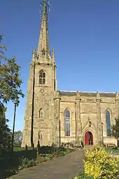 Church of St Michael |
| Church of St Cuthbert | Lytham St Annes | Parish Church | 1834 | 13 January 1971 | SD3570227222 53°44′15″N 2°58′34″W |
1196361 | |
| Church of St John | Lytham St Annes | Church | 1848-9 | 13 January 1971 | SD3711027151 49°46′01″N 7°33′26″W |
1196368 | |
| Dovecote to North West of Lytham Hall (in woods behind stables) | Lytham St Annes | Dovecote | Later 18th century | 13 January 1971 | SD3558028062 53°44′42″N 2°58′42″W |
1219120 | .jpg.webp) Dovecote to North West of Lytham Hall (in woods behind stables) |
| Fairhaven United Reformed Church | Fairhaven | Congregational Chapel | 1904 | 22 February 1991 | SD3474527358 53°44′19″N 2°59′27″W |
1196364 | 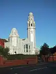 Fairhaven United Reformed Church |

Hyndburn
| Name | Location | Type | Completed [note 1] | Date designated | Grid ref.[note 2] Geo-coordinates |
Entry number [note 3] | Image |
|---|---|---|---|---|---|---|---|
| Church of St James | Altham | Church | 1870 | 17 December 1968 | SD7717033079 53°47′37″N 2°20′53″W |
1072721 | |
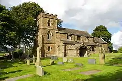
| Church of St Bartholomew | Great Harwood | Church | 15th century | 11 July 1966 | SD7338732716 53°47′24″N 2°24′20″W |
1362006 | |
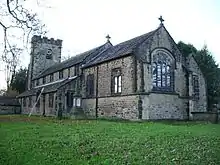
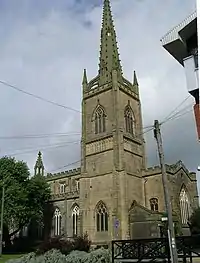
| Church of St James | Church, Hyndburn | Church | Late Medieval | 9 March 1984 | SD7412329097 53°45′27″N 2°23′38″W |
1072728 |  Church of St James |
| Gatehouse at Martholme | Hyndburn | Gatehouse | 1561 | 11 July 1966 | SD7527133777 53°47′59″N 2°22′37″W |
1072735 | 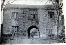 Gatehouse at Martholme |
| Outer Archway at Martholme | Hyndburn | Gate | 1607 | 11 July 1966 | SD7526833755 53°47′58″N 2°22′37″W |
1280458 | 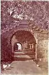 Outer Archway at Martholme |
| Parker's Farmhouse | Hyndburn | Farmhouse | c. 1600 | 23 June 1965 | SD7200228961 53°45′23″N 2°25′34″W |
1206115 | |
| Roman Catholic Church of Our Lady and St Hubert, and Attached Presbytery | Great Harwood | Roman Catholic Church | 1857-9 | 9 March 1984 | SD7369932177 53°47′07″N 2°24′02″W |
1280421 |  Roman Catholic Church of Our Lady and St Hubert, and Attached Presbytery |
| Sparth Manor | Hyndburn | Farmhouse | Later than mid 17th century | 11 July 1966 | SD7462831461 53°46′44″N 2°23′11″W |
1205946 | |
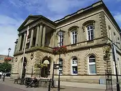
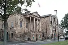
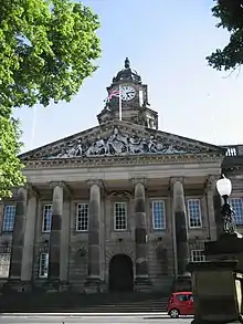
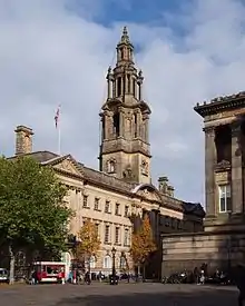
| Town Hall | Accrington | Town Hall | 1858 | 9 March 1984 | SD7601528606 53°45′12″N 2°21′55″W |
1362011 |
Lancaster
| Name | Location | Type | Completed [note 1] | Date designated | Grid ref.[note 2] Geo-coordinates |
Entry number [note 3] | Image |
|---|---|---|---|---|---|---|---|
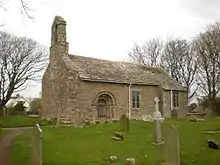
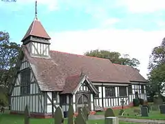
| Church of St John the Baptist | Arkholme, Arkholme-with-Cawood | Church | Late Perpendicular | 4 October 1967 | SD5890971825 54°08′26″N 2°37′50″W |
1071728 | 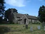 Church of St John the Baptist |
| Holy Trinity church formerly Church of St Michael |
Bolton-le-Sands | Church | Late 15th century | 2 May 1968 | SD4832967720 54°06′10″N 2°47′30″W |
1071944 | 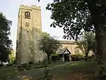 Holy Trinity church formerly Church of St Michael |
| Hawkshead Farmhouse | Bolton-le-Sands | Farmhouse | 1665 | 1 August 1952 | SD4844067730 54°06′10″N 2°47′24″W |
1362399 | |
| Stable Block North of Burrow Hall | Burrow-with-Burrow | Stable | c. 1740 | 4 October 1967 | SD6165975959 54°10′41″N 2°35′20″W |
1164344 | |
| Thurland Castle | Cantsfield | House | 14th century | 4 October 1967 | SD6109173078 54°09′07″N 2°35′50″W |
1164439 | |
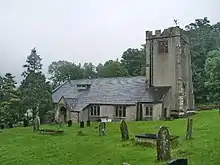
| Church of St Paul | Brookhouse, Caton-with-Littledale | Church | Norman | 4 October 1967 | SD5421764607 54°04′31″N 2°42′04″W |
1163957 | 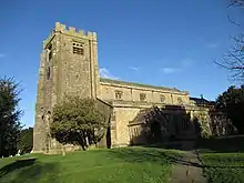 Church of St Paul |
| Gresgarth Hall | Caton-with-Littledale | House | 4 October 1967 | SD5325363324 54°03′49″N 2°42′57″W |
1071812 | | |
| Claughton Hall Farmhouse | Claughton | House | 15th century | 4 October 1967 | SD5665066518 54°05′34″N 2°39′51″W |
1071677 | |
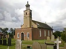
| Church of St Michael | Cockerham | Church | 16th century | 2 May 1968 | SD4625651864 53°57′36″N 2°49′14″W |
1317937 | 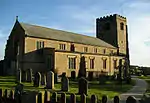 Church of St Michael |
| Shepherd's Farmhouse | Cockerham | House | 1705 | 2 May 1968 | SD4537251496 53°57′24″N 2°50′02″W |
1071795 | |
| Church of St Mary | Ellel | Church (disused) | 1873 | 7 June 1979 | SD4817053585 53°58′33″N 2°47′30″W |
1317926 | 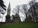 Church of St Mary |
| Gressingham Hall and Former Stables Adjoining | Gressingham | House | Late 17th century | 4 October 1967 | SD5729869908 54°07′24″N 2°39′17″W |
1164615 | |
| Loyne Bridge | Gressingham | Bridge | Late Medieval | 4 October 1967 | SD5817169732 54°07′18″N 2°38′29″W |
1071682 | |
| Halton Green East Farmhouse | Halton-with-Aughton | House | Early 17th century | 4 October 1967 | SD5160965366 54°04′55″N 2°44′28″W |
1071891 | 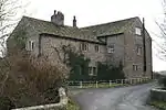 Halton Green East Farmhouse |
| Halton Green West Farmhouse | Halton-with-Aughton | Farmhouse | Late 17th century | 4 October 1967 | SD5157765334 54°04′54″N 2°44′30″W |
1362450 | |
| Manor House | Halton-with-Aughton | House | 1695 | 4 October 1967 | SD5033264877 54°04′39″N 2°45′38″W |
1164390 | 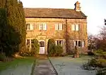 Manor House |
| Cross Base South of Church of St.Margaret | Hornby-with-Farleton | Cross | Pre-Conquest | 4 December 1985 | SD5851468568 54°06′41″N 2°38′10″W |
1071658 | |
| Over Hall | Ireby | House | Early 17th century | 4 October 1967 | SD6586975822 54°10′37″N 2°31′28″W |
1164939 | 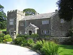 Over Hall |
| Stables West of over Hall | Ireby | Stable | 1690 | 4 October 1967 | SD6582975809 54°10′37″N 2°31′30″W |
1071662 | |
| The Old Malt House | Melling-with-Wrayton | House | 1684 | 4 October 1967 | SD5964770990 54°07′59″N 2°37′09″W |
1071637 | |
| Midland Hotel | Morecambe | Restaurant | 1932-1933 | 8 October 1976 | SD4281564380 54°04′20″N 2°52′31″W |
1208988 |  Midland Hotel |
| The Winter Gardens | Morecambe | Theatre | 1896 | 7 October 1977 | SD4309864383 54°04′20″N 2°52′16″W |
1025280 | 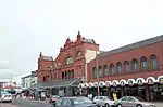 The Winter Gardens |
| Capernwray Hall | Over Kellet | Country House | 1844 | 7 November 1983 | SD5460672201 54°08′37″N 2°41′47″W |
1071908 | |
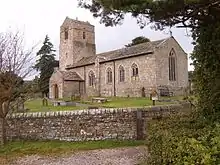
| Church of St. Cuthbert | Over Kellet | Church | 13th century | 4 October 1967 | SD5225969550 54°07′11″N 2°43′55″W |
1071877 | |
| Higher Lee | Over Wyresdale | House | 1671 | 2 May 1968 | SD5632355726 53°59′45″N 2°40′04″W |
1164115 | |
| Church of St. Helen | Overton | Church | 12th century | 2 May 1968 | SD4404657576 54°00′40″N 2°51′19″W |
1071774 | |
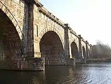
| Lune Aqueduct | Quernmore | Aqueduct | 1797 | 4 October 1967 | SD4845263886 54°04′06″N 2°47′21″W |
1362451 | |
| Quernmore Park | Quernmore | Country House | 1795-8 | 4 October 1967 | SD5165262767 54°03′31″N 2°44′24″W |
1317735 | |
| Church of St. John | Silverdale | Church | 1885-6 | 2 May 1968 | SD4632175401 54°10′18″N 2°49′26″W |
1362446 | 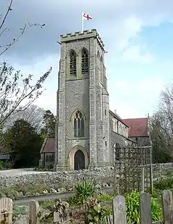 Church of St. John |
| Slackwood Farmhouse | Silverdale | House | Late 17th century | 2 May 1968 | SD4744774569 54°09′51″N 2°48′23″W |
1362468 | .jpg.webp) Slackwood Farmhouse |
| Manor House | Slyne-with-Hest | House | 1861 | 1 August 1952 | SD4776066005 54°05′14″N 2°48′00″W |
1071858 | 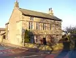 Manor House |
| Church of St James | Tatham | Church | Norman | 4 October 1967 | SD6059469421 54°07′09″N 2°36′16″W |
1317663 | |
| Robert Hall Farmhouse and Farm Building Adjoining to East in Same Range | Tatham | Farmhouse | Late 16th century | 4 October 1967 | SD6370269191 54°07′02″N 2°33′24″W |
1071577 | |
| Ashton Hall Gatehouse | Thurnham | Gatehouse | c. 1600 | 1 August 1952 | SD4613557290 54°00′32″N 2°49′24″W |
1164553 | |
| Former Stable Block West of Ashton Hall | Thurnham | House | 17th century | 1 August 1952 | SD4610757314 54°00′32″N 2°49′26″W |
1071715 | |
| Gillow Mausoleum, North of Church of St. Thomas and St. Elizabeth | Thurnham | Mausoleum | c. 1830 | 7 March 1985 | SD4655854321 53°58′56″N 2°48′59″W |
1164592 | 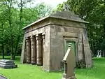 Gillow Mausoleum, North of Church of St. Thomas and St. Elizabeth |
| Church of St Michael | Whittington | Church | Early 16th century | 4 October 1967 | SD5996876284 54°10′51″N 2°36′53″W |
1071615 | 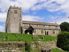 Church of St Michael |
| Sellet Hall | Whittington | House | c. 1600 | 4 October 1967 | SD6003877415 54°11′27″N 2°36′50″W |
1071649 | .jpg.webp) Sellet Hall |
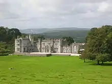
| Whittington Hall | Whittington | Country House | 1831-36 | 4 October 1967 | SD5962976250 54°10′50″N 2°37′12″W |
1362568 | .jpg.webp) Whittington Hall |
| Leighton Hall | Yealand Conyers | Country House | 1765 | 2 May 1968 | SD4944274416 54°09′47″N 2°46′33″W |
1071836 | |
| Quaker Meeting House | Yealand Conyers | Friends Meeting House | 1692 | 2 May 1968 | SD5038474425 54°09′48″N 2°45′41″W |
1308669 |  Quaker Meeting House |
| The Castle | Yealand Redmayne | House | Late 17th century | 1 August 1952 | SD5018475530 54°10′23″N 2°45′53″W |
1308587 | |
| Cathedral Church of St Peter | Lancaster | Parish Church | 1857-59 | 10 November 1994 | SD4810461511 54°02′49″N 2°47′39″W |
1214397 | 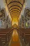 Cathedral Church of St Peter |
| Chapel of Ripley St Thomas School | Lancaster | School | 1888 | 18 February 1970 | 49°46′01″N 7°33′26″W | 1194928 | |
| Church of St John | Lancaster | Church | Consecrated 1755 | 22 December 1953 | SD4778461907 54°03′02″N 2°47′57″W |
1289679 | |
| City Museum, the Old Town Hall | Lancaster | Prison | 1781-3 | 22 December 1953 | SD4760661728 54°02′56″N 2°48′06″W |
1194971 | 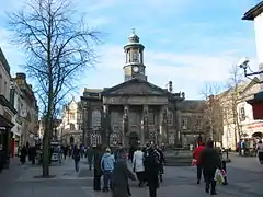 City Museum, the Old Town Hall |
| Conservative Club and Attached Railings | Lancaster | House | 1637 | 22 December 1953 | SD4754761870 54°03′00″N 2°48′10″W |
1290518 |  Conservative Club and Attached Railings |
| Friends Meeting House | Lancaster | House | 1852 | 22 December 1953 | SD4729861681 54°02′54″N 2°48′23″W |
1211515 |  Friends Meeting House |
| Maritime Museum | Lancaster | Steps | 1884-c1930 | 22 December 1953 | SD4735762274 54°03′13″N 2°48′20″W |
1289088 | |
| Moor Hospital, Blocks 40,41,42,44 and 46 | Lancaster | Psychiatric Hospital | 1816 | 24 January 1994 | SD4925661503 54°02′49″N 2°46′35″W |
1289436 |  Moor Hospital, Blocks 40,41,42,44 and 46 |
| Music Room | Lancaster | Apartment | 1953 | 22 December 1953 | SD4752361763 54°02′57″N 2°48′11″W |
1298332 | 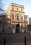 Music Room |
| National Westminster Bank | Lancaster | Bank | 1870 | 13 March 1995 | SD4760561858 54°03′00″N 2°48′06″W |
1290544 | 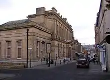 National Westminster Bank |
| Numbers 18 and 18a, Castle Park, including Attached Privy House | Lancaster | Apartment | Early 18th Century; Altered c. 1975 | 22 December 1953 | SD4736861762 54°02′57″N 2°48′19″W |
1194942 | .jpg.webp) Numbers 18 and 18a, Castle Park, including Attached Privy House |
| Pebble Forecourt to Numbers 18, 18a, 20 and 22, Castle Park. | Lancaster | Forecourt | 18th century or Early 19th century | 18 February 1970 | SD4737961765 54°02′57″N 2°48′19″W |
1194944 | |
| Penny's Almshouses Including Chapel and Screen Wall | Lancaster | Almshouses | 1720 | 22 December 1953 | SD4754261625 54°02′52″N 2°48′10″W |
1195001 | 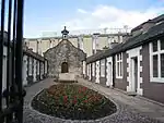 Penny's Almshouses Including Chapel and Screen Wall |
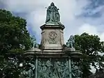
| Queen Victoria Memorial | Lancaster | Statue | 1906 | 18 February 1970 | SD4786761615 54°02′52″N 2°47′52″W |
1290440 | |
| Ring O' Bells Public House | Lancaster | House | Mid 18th century | 22 December 1953 | SD4761461502 54°02′49″N 2°48′06″W |
1194999 | |
| Royal Albert Hospital (original Part Only) | Lancaster | Hospital | 1888 | 30 November 1970 | SD4766060082 54°02′03″N 2°48′02″W |
1194930 | 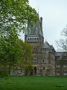 Royal Albert Hospital (original Part Only) |
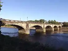
| Skerton Bridge | Lancaster | Road Bridge | 1788 | 18 February 1970 | SD4795662355 54°03′16″N 2°47′47″W |
1212253 | |
| The Old Hall Inn | Lancaster | Cross Wing House | 1598 | 29 December 1950 | SD4147861158 54°02′35″N 2°53′43″W |
1207212 | |
| Town Hall | Lancaster | Banqueting House | 1906-9 | 22 December 1953 | 49°46′01″N 7°33′26″W | 1194923 | |
| 42 and 44 Church Street | Lancaster | House | Early 18th century | 18 February 1970 | SD4767261839 54°02′59″N 2°48′03″W |
1210232 | |
| 22 Castle Park | Lancaster | House | Early 18th century | 22 December 1953 | SD4739361753 54°02′57″N 2°48′18″W |
1290779 | |
| 20 Castle Park | Lancaster | House | 1720 | 22 December 1953 | SD4738361756 54°02′57″N 2°48′18″W |
1194943 | |
| 38–42 Parliament Street | Lancaster | Toll House | c. 1787 | 22 December 1953 | SD4805662279 54°03′14″N 2°47′42″W |
1194984 |  38–42 Parliament Street |
| 78 and 80 Church Street | Lancaster | House | 1775 | 22 December 1953 | SD4753761875 54°03′01″N 2°48′10″W |
1298413 | 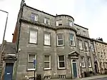 78 and 80 Church Street |
| War memorial, Westfield War Memorial Village | Lancaster | War memorial | 1926 | 13 March 1995 | SD4690561690 54°02′54″N 2°48′45″W |
1195055 |  War memorial, Westfield War Memorial Village |
.jpg.webp)
Pendle
| Name | Location | Type | Completed [note 1] | Date designated | Grid ref.[note 2] Geo-coordinates |
Entry number [note 3] | Image |
|---|---|---|---|---|---|---|---|
| Coates Hall | Barnoldswick | Apartment | Early 18th Century | 5 July 1950 | SD8845647409 53°55′22″N 2°10′38″W |
1258915 | 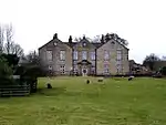 Coates Hall |
| Independent Methodist Church Including Steps and Railings to Street | Barnoldswick | Gate | 1892 | 29 January 1988 | SD8759146519 53°54′53″N 2°11′25″W |
1273192 | 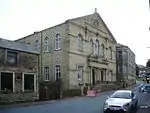 Independent Methodist Church Including Steps and Railings to Street |
| Higherford Old Bridge | Barrowford | Packhorse Bridge | C16-C17 | 6 June 1952 | SD8625240182 53°51′28″N 2°12′38″W |
1273194 | 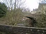 Higherford Old Bridge |
| Lamb Working Men's Club | Barrowford | House | 1696 | 6 June 1952 | SD8586139620 53°51′09″N 2°12′59″W |
1073429 | 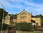 Lamb Working Men's Club |
| Garden Entrance to Hobstones Farmhouse | Colne | Wall | 1704 | 29 January 1988 | SD8821441682 53°52′16″N 2°10′51″W |
1361721 | |
| Hobstones Cottages, Hobstones Farmhouse | Colne | Farmhouse | Early 18th century | 29 January 1953 | SD8819541695 53°52′17″N 2°10′52″W |
1272929 | |
| The Grammar School | Earby | School | 17th century | 18 May 1950 | SD9068546968 53°55′08″N 2°08′36″W |
1272938 |  The Grammar School |
| Accornlee Hall Farmhouse | Foulridge | House | Late 17th century | 1 April 1953 | SD8942643011 53°52′59″N 2°09′44″W |
1361742 | |
| Ball House | Foulridge | House | 1627 | 1 April 1953 | SD8784142364 53°52′38″N 2°11′11″W |
1073357 | |
| Church of St Mary, Newchurch in Pendle | Goldshaw Booth | Church | 1718 | 29 January 1988 | SD8230439373 53°51′01″N 2°16′14″W |
1361745 | 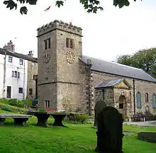 Church of St Mary, Newchurch in Pendle |
| Sabden Great Hall | Goldshaw Booth | House | Early 17th Century | 1 April 1953 | SD8105738352 53°50′28″N 2°17′22″W |
1361707 |  Sabden Great Hall |
| Ashlar Cottage, Ashlar House | Higham-with-West Close Booth | House | 1594 | 29 January 1988 | SD8217736995 53°49′44″N 2°16′20″W |
1243453 |  Ashlar Cottage, Ashlar House |
| Lower Town House | Nelson | House | 17th century | 5 March 1952 | SD8777037457 53°50′00″N 2°11′14″W |
1073369 | 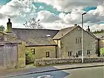 Lower Town House |
| Greenhead Farmhouse | Reedley Hallows | House | Mid 17th century | 1 April 1953 | SD8292036059 53°49′14″N 2°15′39″W |
1272792 |  Greenhead Farmhouse |
| Wood End Farmhouse | Salterforth | Farmhouse | 1686 | 29 January 1988 | SD8817543786 53°53′24″N 2°10′53″W |
1073353 | |
| Bank House Bridge | Trawden Forest | Clapper Bridge | 26 October 1964 | SD9359038905 53°50′47″N 2°05′56″W |
1243830 | 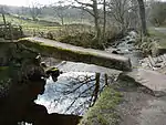 Bank House Bridge | |
| Clapper Bridge | Wycoller, Trawden Forest | Bridge | 23 April 1952 | SD9323739198 53°50′56″N 2°06′15″W |
1243829 |  Clapper Bridge | |
| Grain Kiln with Stable to Rear of Number 39 | Winewall, Trawden Forest | Corn Drying Kiln | c. 1700 | 25 February 1970 | SD9121639969 53°51′21″N 2°08′06″W |
1243705 |  Grain Kiln with Stable to Rear of Number 39 |
| Pack Horse Bridge | Wycoller, Trawden Forest | Packhorse Bridge | 17th century or earlier | 23 April 1952 | SD9323439248 53°50′58″N 2°06′16″W |
1243828 | 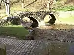 Pack Horse Bridge |
| Pierson's Farmhouse | Trawden Forest | Farmhouse | Late 17th century | 23 April 1952 | SD9318639271 53°50′59″N 2°06′18″W |
1073327 | |
| Remains of Wycoller Hall, Including Boundary Wall to River | Trawden Forest | House | 1596 | 23 April 1952 | SD9327039207 53°50′57″N 2°06′14″W |
1073331 | 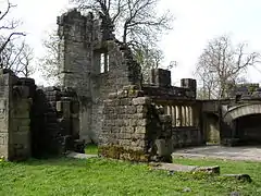 Remains of Wycoller Hall, Including Boundary Wall to River |
Preston
| Name | Location | Type | Completed [note 1] | Date designated | Grid ref.[note 2] Geo-coordinates |
Entry number [note 3] | Image |
|---|---|---|---|---|---|---|---|
| Wing of Former Barton Old Hall, Circa 20 Metres South of Old Hall Farmhouse | Barton | Bungalow | Pre 16th century | 11 November 1966 | SD5305138199 53°50′16″N 2°42′54″W |
1073560 | |
| Parish Church of St John the Baptist | Broughton | Parish Church | 1533 | 11 November 1966 | SD5289934373 53°48′13″N 2°43′00″W |
1164208 | 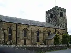 Parish Church of St John the Baptist |
| Barn Circa 75 Metres North of Whinneyclough Farmhouse | Goosnargh | Farm Building | 1639 | 11 November 1966 | SD5692739278 53°50′53″N 2°39′22″W |
1317617 | |
| Bushells Hospital | Goosnargh | House | 1722 | 25 July 1952 | SD5600836862 53°49′34″N 2°40′11″W |
1073535 | 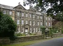 Bushells Hospital |
| Church of St Mary | Goosnargh | Church | Late Medieval | 11 November 1966 | SD5595136922 53°49′36″N 2°40′14″W |
1361634 | 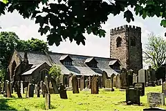 Church of St Mary |
| Scotch Green Farmhouse with Integral Shippon and Stable and Attached Granary | Goosnargh | Farmhouse | Early 17th century | 11 November 1966 | SD5405540560 53°51′33″N 2°42′00″W |
1073544 | |
| Ashes Farmhouse with Wall Surrounding Front Garden | Whittingham | Farmhouse | 1683 | 11 November 1966 | SD5944637490 53°49′55″N 2°37′04″W |
1073517 | |
| Church of St Anne | Woodplumpton | Church | Medieval | 11 November 1966 | SD4993434445 53°48′14″N 2°45′42″W |
1073482 | |
| Arkwright House | Preston | House | 19th century | 12 June 1950 | SD5429729269 53°45′28″N 2°41′41″W |
1279775 | .jpg.webp) Arkwright House |
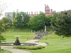
| Avenham Park | Preston | Park | 1861 | 20 August 2013 | SD5397428746 53°45′11″N 2°42′04″W |
1000944 | |
| Church of St George the Martyr | Preston | Church | 1799 | 27 September 1979 | SD5377429441 53°45′33″N 2°42′09″W |
1217949 | |
| Church of St Ignatius | Preston | Baptistery | 1912 | 27 September 1979 | SD5416929933 53°45′49″N 2°41′48″W |
1218482 | |
| Church of St John the Divine | Preston | Parish Church | 1853-5 | 27 September 1979 | SD5420029353 53°45′31″N 2°41′46″W |
1292457 | |
| Church of St Michael | Preston | Church Hall | 1908 | 27 September 1979 | SD5186830109 53°45′54″N 2°43′54″W |
1207268 | |
| Church of St Wilfrid | Preston | Roman Catholic Church | 1793 | 27 September 1979 | SD5376529221 53°45′26″N 2°42′10″W |
1207254 | |
| Former Church of St Mark | Preston | Church | 1862-3 | 27 September 1979 | SD5270729871 53°45′47″N 2°43′08″W |
1291672 | |
| Harris Institute | Preston | Art School | 1979 | 27 September 1979 | SD5400028932 53°45′17″N 2°41′57″W |
1207231 |  Harris Institute |
| Miller Park | Preston | Park | 1864 | 20 August 2013 | SD5363828627 53°45′07″N 2°42′14″W |
1001450 | |
| Moor Park | Preston | Park | 1867 | 20 August 2013 | SD5405230969 53°46′26″N 2°41′53″W |
1001309 | |
| Sessions House | Preston | Court House | 1900-3 | 27 September 1979 | SD5404529476 53°45′35″N 2°41′55″W |
1279796 | |
| St Peter's Arts Centre, University of Central Lancashire | Preston | University | 1950 | 12 June 1950 | SD5341929925 53°45′49″N 2°42′29″W |
1219062 | |
| The Bull and Royal Hotel | Preston | Assembly Rooms | Mid 18th Century | 12 June 1950 | SD5414229340 53°45′30″N 2°41′49″W |
1207263 | 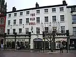 The Bull and Royal Hotel |
Ribble Valley
| Name | Location | Type | Completed [note 1] | Date designated | Grid ref.[note 2] Geo-coordinates |
Entry number [note 3] | Image |
|---|---|---|---|---|---|---|---|
| Barn on North-west Side of Farmyard | Hall Barns, Aighton, Bailey and Chaigley | Barn | 16th century | 13 February 1967 | SD6928338805 53°50′40″N 2°28′06″W |
1072302 | |
| Greengore | Aighton, Bailey and Chaigley | House | c. 1600 | 13 February 1967 | SD6737038915 53°50′44″N 2°29′51″W |
1308723 | |
| Old Bridge | Aighton, Bailey and Chaigley | Bridge | 1562 | 29 December 1952 | SD7040039164 53°50′52″N 2°27′05″W |
1362197 | 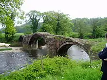 Old Bridge |
| Shireburn Cottages | Aighton, Bailey and Chaigley | Almshouse | 1706 | 29 December 1952 | SD6844238250 53°50′22″N 2°28′52″W |
1308779 | _-_geograph.org.uk_-_115680.jpg.webp) Shireburn Cottages |
| Bashall Hall | Bashall Eaves | Hall House | c. 1600 | 16 November 1954 | SD7108042347 53°52′35″N 2°26′29″W |
1072193 | 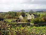 Bashall Hall |
| Farm Building 12 Metres North of Bashall Hall | Bashall Eaves | Farm Building | 1984 | 16 November 1954 | SD7109042378 53°52′36″N 2°26′28″W |
1362282 | 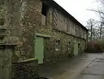 Farm Building 12 Metres North of Bashall Hall |
| Garden Pavilion, Approximately 90 Metres South of Bashall Hall | Bashall Eaves | Garden House | Early 18th century | 16 November 1954 | SD7105242247 53°52′32″N 2°26′30″W |
1072195 | |
| Hacking Barn | Billington and Langho | Cruck Barn | c. 1600 | 13 March 1986 | SD7114337052 53°49′44″N 2°26′24″W |
1072064 | |
| Alder House | Bolton-by-Bowland | House | 1708 | 16 November 1954 | SD7658050451 53°56′59″N 2°21′30″W |
1072207 | |
| Bolton Peel Farmhouse | Bolton-by-Bowland | House | 17th century | 16 November 1954 | SD7765748656 53°56′01″N 2°20′30″W |
1362310 | .jpg.webp) Bolton Peel Farmhouse |
| Fooden Hall | Bolton-by-Bowland | House | Late 17th century | 16 November 1954 | SD8000048958 53°56′11″N 2°18′22″W |
1072201 |  Fooden Hall |
| Stakes | Bowland Forest Low | House | Early 17th century | 16 November 1983 | SD6464343672 53°53′17″N 2°32′22″W |
1163248 | .jpg.webp) Stakes |
| Laneside Farmhouse | Chatburn | House | 1677 | 29 December 1952 | SD7732745226 53°54′10″N 2°20′48″W |
1362326 | 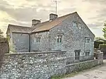 Laneside Farmhouse |
| Church of St Bartholomew | Chipping | Church | Early 16th century | 13 February 1967 | SD6221043323 53°53′05″N 2°34′35″W |
1072279 | |
| Old Vicarage | Chipping | House | 16th century | 13 February 1967 | SD6087141961 53°52′21″N 2°35′48″W |
1147251 |  Old Vicarage |
| Post Office and John Brabin's House | Chipping | House | 1668 | 29 December 1952 | SD6231443325 53°53′05″N 2°34′29″W |
1362244 | 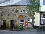 Post Office and John Brabin's House |
| New Hall | Clayton-le-Dale | House | 1665 | 27 August 1952 | SD6620935418 53°48′50″N 2°30′53″W |
1164471 | 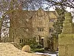 New Hall |
| Parish Church of St Mary Magdalene | Clitheroe | Church | C14-C15 | 19 May 1950 | SD7443342072 53°52′27″N 2°23′25″W |
1362179 | |
| Dinckley Hall | Dinckley | House | c. 1600 | 24 November 1966 | SD6887636635 53°49′30″N 2°28′28″W |
1072070 | |
| Church of St Leonard | Downham | Church | Late 15th century | 13 February 1967 | SD7843344304 53°53′40″N 2°19′47″W |
1164023 | |
| Downham Hall | Downham | Country House | c. 1600 | 13 December 1977 | SD7829844309 53°53′40″N 2°19′54″W |
1072125 | |
| Old Well Hall | Downham | House | 17th century | 27 April 1984 | SD7857444159 53°53′35″N 2°19′39″W |
1318034 | 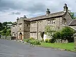 Old Well Hall |
| Dutton Hall | Dutton | House | c. 1600 | 25 July 1952 | SD6620736795 53°49′35″N 2°30′54″W |
1308566 |  Dutton Hall |
| Huntingdon Hall | Dutton | House | Early 17th century | 25 July 1952 | SD6607538884 53°50′42″N 2°31′02″W |
1147370 | 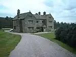 Huntingdon Hall |
| Hammerton Hall | Easington | House | c. 1600 | 16 November 1954 | SD7188053761 53°58′45″N 2°25′49″W |
1362269 | 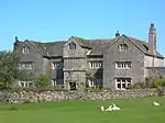 Hammerton Hall |
| Church of St Mary | Gisburn | Church | 12th century | 16 November 1954 | SD8299048862 53°56′08″N 2°15′38″W |
1164472 | 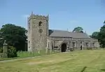 Church of St Mary |
| Pair of Lodges at Southern Entrance to Gisburne Park with 6 Stone Piers and Linking Railings and Gates | Gisburn | Gate Pier | c. 1800 | 16 November 1954 | SD8276448933 53°56′10″N 2°15′50″W |
1362297 |  Pair of Lodges at Southern Entrance to Gisburne Park with 6 Stone Piers and Linking Railings and Gates |
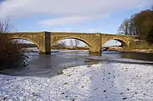
| Old Bridge, Lower Hodder (that Part in the Former Bowland Rural District) | Great Mitton | Bridge | 1562 | 16 November 1954 | SD7041339155 53°50′52″N 2°27′04″W |
1163514 | Old Bridge, Lower Hodder (that Part in the Former Bowland Rural District) |
| Horton Hall and Barn Adjoining to South West | Horton | House | Early 18th century | 16 November 1954 | SD8521250467 53°57′00″N 2°13′37″W |
1317730 | |
| Mitton Hall | Little Mitton | House | c. 1844 | 29 December 1952 | SD7168638516 53°50′32″N 2°25′54″W |
1362324 | 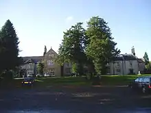 Mitton Hall |
| Alston Old Hall | Longridge | House | Early 15th century | 8 November 1949 | SD6116133535 53°47′48″N 2°35′28″W |
1072296 | |
| Little Mearley Hall | Mearley | House | Late 16th century | 29 December 1952 | SD7753241617 53°52′13″N 2°20′35″W |
1164780 | |
| Stanley House | Mellor | House | 1640 | 24 August 1952 | SD6456429933 53°45′52″N 2°32′21″W |
1164519 | 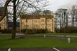 Stanley House |
| Newton Hall | Newton | House | Mid to Late 18th century | 16 November 1954 | SD6976850401 53°56′56″N 2°27′44″W |
1072246 | |
| Barn at Oxendale Hall Farm, South West of Oxendale Hall | Osbaldeston | Barn | c. 1600 | 13 March 1986 | SD6505833401 53°47′45″N 2°31′55″W |
1317727 | |
| Osbaldeston Hall | Osbaldeston | House | 16th century | 27 August 1952 | SD6441134422 53°48′18″N 2°32′31″W |
1072072 | |
| Oxendale Hall | Osbaldeston | Cross Wing House | 1656 | 27 August 1952 | SD6510433429 53°47′46″N 2°31′52″W |
1072075 | 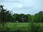 Oxendale Hall |
| Park House | Paythorne | House | 17th century | 16 November 1954 | SD8100549699 53°56′35″N 2°17′27″W |
1362345 | |
| Standen Hall | Pendleton | Country House | 1757 | 29 December 1952 | SD7473640275 53°51′29″N 2°23′08″W |
1072085 | 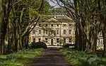 Standen Hall |
| Read Hall | Read | House | 1825 | 1 April 1953 | SD7573834815 53°48′33″N 2°22′12″W |
1164581 | |
| Almshouses | Stydd, Ribchester | Almshouse | 1726 | 25 July 1952 | SD6538235805 53°49′03″N 2°31′38″W |
1308488 | 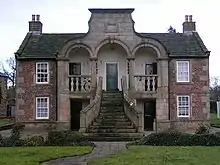 Almshouses |
| Brennand's Endowed School | Slaidburn | School | Early 18th century | 16 November 1954 | SD7102752141 53°57′52″N 2°26′35″W |
1072224 | 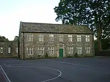 Brennand's Endowed School |
| Townhead | Slaidburn | House | 19th century | 16 November 1954 | SD7102652631 53°58′08″N 2°26′35″W |
1072190 |  Townhead |
| Church of St Helen | Waddington | Church | c. 1500 | 16 November 1954 | SD7286643822 53°53′24″N 2°24′52″W |
1163679 | |
| Sands Cottage | Whalley | Timber Framed House | 15th century | 13 February 1967 | SD7297436212 53°49′17″N 2°24′43″W |
1164758 | |
Rossendale
| Name | Location | Type | Completed [note 1] | Date designated | Grid ref.[note 2] Geo-coordinates |
Entry number [note 3] | Image |
|---|---|---|---|---|---|---|---|
| Carter Place Hall | Rossendale | House | Late 18th century | 20 June 1967 | SD7847624834 53°43′10″N 2°19′40″W |
1163485 | |
| Church of St John the Evangelist | Crawshawbooth | Church | 1890-1892 | 7 June 1971 | SD8101425174 53°43′21″N 2°17′21″W |
1163934 | |
| Church of St Nicholas with St John | Newchurch | Church | 1561 | 7 June 1971 | SD8342822339 53°41′50″N 2°15′09″W |
1072799 | |
| Crawshaw Hall | Crawshawbooth | House | 1831 | 7 June 1971 | SD8091924948 53°43′14″N 2°17′26″W |
1163900 | 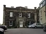 Crawshaw Hall |
| Edenfield Parish Church | Edenfield | Church | 1826 | 9 August 1966 | SD7985819809 53°40′28″N 2°18′23″W |
1318084 | |
| Ewood Hall | Rossendale | Farmhouse | 1641 | 23 November 1979 | SD7948320851 53°41′01″N 2°18′44″W |
1072806 | 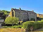 Ewood Hall |
| Forest House | Rossendale | House | c. 1828 | 19 June 1968 | SD8674322768 53°42′04″N 2°12′08″W |
1072857 | _-_geograph.org.uk_-_462467.jpg.webp) Forest House |
| Friends' Meeting House | Crawshawbooth | House | 1739 | 7 June 1971 | SD8107925366 53°43′28″N 2°17′18″W |
1361998 | 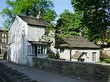 Friends' Meeting House |
| Harrier Hound Monument to Methuselah Yates in Churchyard to South of Church of St. Nicholas with St. John | Newchurch | Commemorative Monument | 1864 | 9 May 2003 | SD8342022290 53°41′48″N 2°15′09″W |
1390506 | 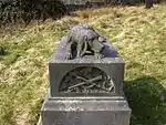 Harrier Hound Monument to Methuselah Yates in Churchyard to South of Church of St. Nicholas with St. John |
| Old Baptist Chapel | Goodshaw | Baptist Chapel | 1760 | 7 June 1971 | SD8153226303 53°43′58″N 2°16′53″W |
1072764 | 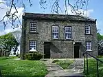 Old Baptist Chapel |
| Waggoner Tunstead Farmhouse | Stacksteads | Farmhouse | 1632 | 19 June 1968 | SD8533922176 53°41′45″N 2°13′25″W |
1072843 | 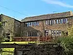 Waggoner Tunstead Farmhouse |

South Ribble
| Name | Location | Type | Completed [note 1] | Date designated | Grid ref.[note 2] Geo-coordinates |
Entry number [note 3] | Image |
|---|---|---|---|---|---|---|---|
| Church of St Michael | Much Hoole | Church | 1875 | 11 November 1966 | SD4630322321 53°41′40″N 2°48′53″W |
1361870 | 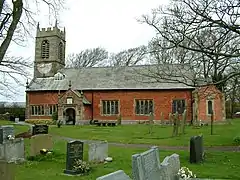 Church of St Michael |
| Church of St Mary | Penwortham | Church | 14th century | 11 November 1966 | SD5240029001 53°45′19″N 2°43′24″W |
1073058 | 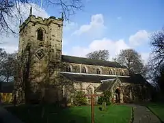 Church of St Mary |
| Arrowsmith House | Walton-le-Dale | House | Earlier than 1700 | 24 March 1950 | SD5930526532 53°44′01″N 2°37′06″W |
1074106 |  Arrowsmith House |
| Church of St Andrew | Leyland | Church | 14th century | 26 July 1951 | SD5411121591 53°41′19″N 2°41′47″W |
1073036 | |
| Church of St Leonard | Walton-le-Dale | Church | Late medieval | 24 March 1950 | SD5614128121 53°44′51″N 2°40′00″W |
1074102 | |
| Osbaldeston House | Walton-le-Dale | Farmhouse | 1661 | 1 September 1960 | SD5724627950 53°44′46″N 2°38′59″W |
1290091 | |
| Seed Lee Farmhouse | Walton-le-Dale | Farmhouse | 17th century | 27 February 1984 | SD5835724965 53°43′10″N 2°37′57″W |
1361353 | |
| Todd Hall | Walton-le-Dale | House | 1630 | 24 March 1950 | SD5518226022 53°43′43″N 2°40′51″W |
1074111 | 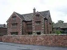 Todd Hall |
| Walker Monument Approximately 20 Metres South of Chancel of Church of St Andrew | South Ribble | Grave Slab | 1588 | 27 February 1984 | SD5413621564 53°41′19″N 2°41′45″W |
1290442 | 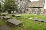 Walker Monument Approximately 20 Metres South of Chancel of Church of St Andrew |
| Worden Old Hall | Buckshaw Village | Manor House | Late 16th century | 4 August 1975 | SD5619720899 53°40′58″N 2°39′53″W |
1361900 | 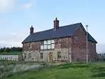 Worden Old Hall |
West Lancashire
| Name | Location | Type | Completed [note 1] | Date designated | Grid ref.[note 2] Geo-coordinates |
Entry number [note 3] | Image |
|---|---|---|---|---|---|---|---|
| Moor Hall | Aughton | House | Early 19th century | 11 October 1968 | SD4114805366 53°32′30″N 2°53′22″W |
1361828 | |
| Barn about 100m south-west of Martin Hall Farmhouse (not included) | Burscough | Barn | 17th century | 11 August 1972 | SD4257012264 53°36′14″N 2°52′10″W |
1196636 | |
| Church of St John | Burscough | Church | 1829-32 | 11 August 1972 | SD4449912328 53°36′16″N 2°50′25″W |
1220393 | 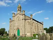 Church of St John |
| Stone Hall | Dalton | House | Early 18th century | 22 April 1967 | SD5089007738 53°33′50″N 2°44′35″W |
1278390 | |
| Church of St Michael | Great Altcar | Church | 1879 | 11 October 1968 | SD3197106520 53°33′03″N 3°01′42″W |
1230934 | |
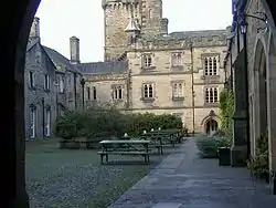
| Lathom House, former West Wing | Lathom | Country House | c. 1730 | 11 August 1972 | SD4596009147 53°34′34″N 2°49′03″W |
1290908 | 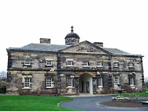 Lathom House, former West Wing |
| Woodcock Hall | Newburgh | House | Rebuilt 1719 | 11 May 1953 | SD4831009828 53°34′57″N 2°46′56″W |
1221001 | |
| Barn about 30m south of Fairhurst Hall | Parbold | Barn | Early 18th century | 19 August 1988 | SD4902611634 53°35′56″N 2°46′18″W |
1361842 | |
| Parbold Hall | Parbold | House | 17th century | 19 November 1951 | SD5116410718 53°35′27″N 2°44′21″W |
1278311 | |
| Simonswood Hall | Simonswood | House | 1687 | 11 October 1968 | SD4169501129 53°30′13″N 2°52′50″W |
1343471 | |
| Church of St Mary | Tarleton | Church | 1719 | 11 October 1968 | SD4567020128 53°40′29″N 2°49′26″W |
1073122 | |
| Johnson's Farmhouse | Upholland | Farmhouse | 1647 | 7 January 1952 | SD5226406937 53°33′25″N 2°43′19″W |
1219837 | |
| Manor House | Crawford, Upholland | Manor House | 1718 | 7 January 1952 | SD5008103107 53°31′20″N 2°45′16″W |
1201667 | |
| Newgate Farmhouse | Upholland | Farmhouse | Earlier than 1707 | 7 January 1952 | SD5089805238 53°32′29″N 2°44′33″W |
1219813 | |
| Old Grammar School, to rear of Nos 8-14 (nos 8-14 not included) | Upholland | Workshop | 19th century or C20 | 7 January 1952 | SD5248505155 53°32′27″N 2°43′06″W |
1220218 | |
| Aspinalls Farmhouse | Wrightington | Farmhouse | 1663 | 7 January 1952 | SD5220608453 53°34′14″N 2°43′23″W |
1240748 | |
| Halliwell Farmhouse | Wrightington | Farmhouse | 18th century | 7 January 1952 | SD5180908596 53°34′18″N 2°43′45″W |
1073026 | |
| Harrock Hall | Wrightington | House | Early 17th century | 19 November 1951 | SD5077212440 53°36′22″N 2°44′44″W |
1231056 | |
| Wrightington Hall | Wrightington | Country House | c. 1700 | 4 October 1972 | SD5314610636 53°35′25″N 2°42′34″W |
1361885 | 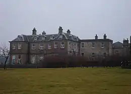 Wrightington Hall |
| Bath Lodge | Ormskirk | Hunting Lodge | Early-mid 18th century | 11 August 1972 | SD4254909229 53°34′35″N 2°52′09″W |
1221197 | 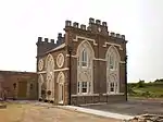 Bath Lodge |
| Church of St Peter and St Paul, Ormskirk | Ormskirk | Parish Church | 12th century | 11 May 1953 | SD4130608436 53°34′09″N 2°53′16″W |
1221160 | |
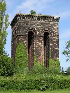
| Water Tower on Tower Hill | Ormskirk | Water Tower | 1853-4 | 22 March 1976 | SD4231908453 53°34′10″N 2°52′21″W |
1197069 |
Wyre
| Name | Location | Type | Completed [note 1] | Date designated | Grid ref.[note 2] Geo-coordinates |
Entry number [note 3] | Image |
|---|---|---|---|---|---|---|---|
| Nos 1 & 2 The Street | Claughton | House | 1689 | 17 April 1967 | SD5131742777 53°52′44″N 2°44′31″W |
1361927 | |
| Kirkland Hall | Kirkland | House | 16th century | 16 December 1952 | SD4802043561 53°53′08″N 2°47′32″W |
1361955 |  Kirkland Hall |
| Church of St John the Baptist | Pilling | Church | 1886-7 | 17 April 1967 | SD4030548626 53°55′49″N 2°54′38″W |
1073081 | |
| Old Church of St John Baptist | Pilling | Church | 1766 | 17 April 1967 | SD4027348477 53°55′44″N 2°54′40″W |
1073080 | |
| Parrox Hall | Preesall | House | Early 17th century | 8 November 1949 | SD3601747843 53°55′22″N 2°58′33″W |
1073082 | |
| Church of St Chad | Poulton-le-Fylde | Church | Early 17th century | 23 September 1950 | SD3482739455 53°50′50″N 2°59′32″W |
1072401 | |
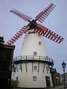
| Marsh Mill | Thornton | Drying Kiln | 1794 | 24 March 1950 | SD3356242553 53°52′30″N 3°00′43″W |
1073150 |
See also
- Category:Grade II* listed buildings in Lancashire
- Scheduled monuments in Lancashire
Notes
- The date given is the date used by Historic England as significant for the initial building or that of an important part in the structure's description.
- Sometimes known as OSGB36, the grid reference is based on the British national grid reference system used by the Ordnance Survey.
- The "List Entry Number" is a unique number assigned to each listed building and scheduled monument by Historic England.
References
External links
![]() Media related to Grade II* listed buildings in Lancashire at Wikimedia Commons
Media related to Grade II* listed buildings in Lancashire at Wikimedia Commons
This article is issued from Wikipedia. The text is licensed under Creative Commons - Attribution - Sharealike. Additional terms may apply for the media files.