Grade II* listed buildings in Cheshire East
There are over 20,000 Grade II* listed buildings in England. This page is a list of these buildings in the unitary authority of Cheshire East.
Listed buildings
| Name | Location | Type | Completed [note 1] | Date designated | Grid ref.[note 2] Geo-coordinates | Notes | Entry number [note 3] | Image |
|---|---|---|---|---|---|---|---|---|
| Dorfold Dairy House | Dorfold Park, Acton | Farmhouse | Late 17th century | 12 January 1967 | SJ6320951897 53°03′46″N 2°32′57″W | 1138565 |  | |
| Glebe House | Acton | House | 1727 and later | 12 January 1967 | SJ6309953093 53°04′25″N 2°33′03″W | 1312848 | 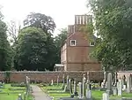 Glebe House | |
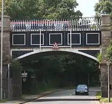
| Nantwich Aqueduct | Acton | Aqueduct | c.1826 | 7 January 1991 | SJ6420352578 53°04′08″N 2°32′04″W | 1330146 | ||
| Small gate in wall west of Dorfold Hall | Dorfold Park, Acton | Gate | Early 17th century | 4 July 1986 | SJ6352452532 53°04′07″N 2°32′40″W | 1138564 | | |
| Adlington Hall Mews | Adlington | Coach house (now apartment) | 1749 | 14 April 1967 | SJ9054980441 53°19′14″N 2°08′31″W | 1366183 | | |
| Mill House Farmhouse and Cottage | Adlington | Farmhouse | 1603 | 14 April 1967 | SJ9071879007 53°18′28″N 2°08′22″W | 1234119 | | |
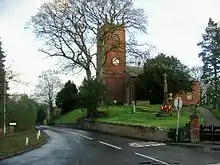
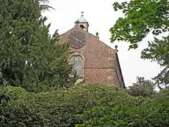
| Church of St Phillip | Alderley Edge | Church | 1853 | 6 July 1984 | SJ8418878628 53°18′15″N 2°14′14″W | 1138867 | ||
| Shropshire Union Canal Bunbury Locks | Shropshire Union Canal, Alpraham | Footbridge | Late 18th century | 5 November 1991 | SJ5780259031 53°07′35″N 2°37′50″W | 1115812 |  Shropshire Union Canal Bunbury Locks | |
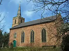
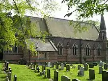
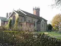
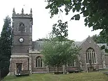
| Church of Christ | Alsager | Church | 1789–90 | 26 March 1987 | SJ7889355664 53°05′51″N 2°18′55″W | 1138754 | ||
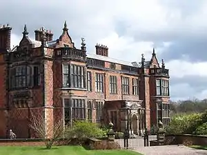
| Arley Hall | Arley Hall, Aston By Budworth | House | 1469 | 5 March 1959 | SJ6755280927 53°19′26″N 2°29′14″W | 1329694 | ||
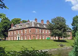
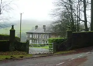
| Aston Park | Aston Park, Aston By Budworth | House | 1715 | 5 March 1959 | SJ6771778118 53°17′56″N 2°29′04″W | 1139509 | ||
| Chapel of St Mary at Arley Hall | Arley Hall, Aston By Budworth | Chapel | 1845 | 7 September 1979 | SJ6755680968 53°19′28″N 2°29′14″W | 1139505 | ||
| The Old Grammar School | Audlem | Teacher's house | 1655 | 10 June 1952 | SJ6610243590 52°59′18″N 2°30′18″W | 1312614 | 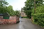 The Old Grammar School | |
| Hack House | Baddington | Farmhouse | Early 17th century | 12 January 1967 | SJ6493448632 53°02′01″N 2°31′23″W | 1312819 | | |
| Churchfield Farmhouse | Barthomley | Farmhouse | Early 17th century | 14 June 1984 | SJ7638652675 53°04′14″N 2°21′09″W | 1138707 | | |
| The White Lion Inn | Barthomley | Public house | 1614 | 10 June 1952 | SJ7676352431 53°04′06″N 2°20′49″W | 1138700 | ||
| Dean Hill Farmhouse West | Betchton | Farmhouse | Late 16th–early 17th century | 14 February 1967 | SJ7808459423 53°07′52″N 2°19′39″W | 1161710 |  Dean Hill Farmhouse West | |
| Bexton Hall and forecourt walls | Bexton | House | Late 17th century | 5 March 1959 | SJ7477076966 53°17′20″N 2°22′43″W | 1115558 | | |
| Church of St Mary the Virgin | Bosley | Church | c.1500 | 14 April 1967 | SJ9181165546 53°11′12″N 2°07′21″W | 1138907 | ||
| Church of St Oswald | Brereton Green, Brereton | Church | c.1500 | 14 February 1967 | SJ7814664787 53°10′46″N 2°19′37″W | 1229297 | ||
| Park Mill and Park Cottage | Brereton | House | c.1840 | 5 December 1986 | SJ7735265846 53°11′20″N 2°20′20″W | 1138830 |  Park Mill and Park Cottage | |
| The Bear's Head Hotel | Brereton | Jettied house | 1615 | 6 June 1952 | SJ7756164352 53°10′32″N 2°20′09″W | 1138789 | 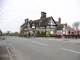 The Bear's Head Hotel | |
| Woodhouse Farmhouse | Buerton | Farmhouse | Late 17th or early 18th century | 12 January 1967 | SJ6770041609 52°58′14″N 2°28′52″W | 1330161 | .jpg.webp) Woodhouse Farmhouse | |
| Bulkeley Hall | Bulkeley | Country house | Mid-18th century | 12 January 1967 | SJ5232053768 53°04′43″N 2°42′43″W | 1138610 | ||
| The Chantry House | Bunbury | House | 1527 | 12 January 1967 | SJ5683757958 53°07′00″N 2°38′42″W | 1138635 | ||
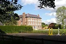
| Checkley Hall | Checkley cum Wrinehill | Country house | 1690s | 12 January 1967 | SJ7325746187 53°00′43″N 2°23′55″W | 1312600 | ||
| Church of St John | Chelford | Meeting hall | 1967 | 14 April 1967 | SJ8190773970 53°15′44″N 2°16′17″W | 1115561 | ||
| The Lodge | Chelford | Lodge | Late 18th/early 19th century | 14 April 1967 | SJ8184173897 53°15′41″N 2°16′20″W | 1139334 | | |
| The Manor House | Chelford | House | Early 17th century | 14 April 1967 | SJ8202074170 53°15′50″N 2°16′11″W | 1139331 | | |
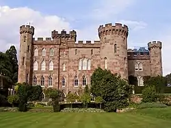
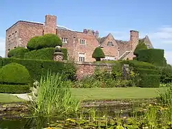
| Cholmondeley Castle | Cholmondeley Park, Cholmondeley | Country house | 1801–04 | 10 June 1952 | SJ5365151343 53°03′25″N 2°41′30″W | 1135794 | ||
| Gates and screen across the main (south-west) approach to Cholmondeley Castle | Cholmondeley Park, Cholmondeley | Gate | 1722 | 12 January 1967 | SJ5348751278 53°03′23″N 2°41′39″W | 1330124 | 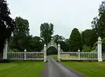 Gates and screen across the main (south-west) approach to Cholmondeley Castle | |
| Church of All Saints | Church Lawton | Church | Before 1555 | 14 February 1967 | SJ8216455759 53°05′54″N 2°15′59″W | 1161743 | ||
| Mill House | Church Minshull | House | Late 17th century | 12 January 1967 | SJ6667360746 53°08′33″N 2°29′54″W | 1135816 | | |
| Minshull Hall Farmhouse | Church Minshull | Farmhouse | Late 17th century | 12 January 1967 | SJ6550461262 53°08′50″N 2°30′57″W | 1138660 | | |
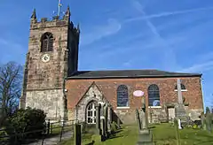
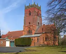
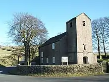
| The Church of St Bartholomew | Church Minshull | Parish church | 1702 | 12 January 1967 | SJ6661860594 53°08′28″N 2°29′57″W | 1313128 | ||
| Wades Green Hall | Church Minshull | Farmhouse | Early 17th century | 12 January 1967 | SJ6560159693 53°07′59″N 2°30′51″W | 1138658 | | |
| Big Fenton | Buglawton, Congleton | Farmhouse | 16th century | 28 July 1950 | SJ9000164775 53°10′47″N 2°08′59″W | 1106368 | | |
| Gate piers and gates of Number 61 | Congleton | Gate | Mid-18th century | 4 April 1975 | SJ8543263058 53°09′51″N 2°13′05″W | 1130483 | 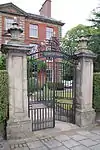 Gate piers and gates of Number 61 | |
| Overton House | Congleton | House | Mid-18th century | 28 July 1950 | SJ8543363076 53°09′52″N 2°13′04″W | 1107940 | 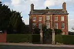 Overton House | |
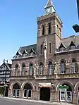
| Town Hall | Congleton | Town hall | 1864–66 | 13 August 1969 | SJ8600662889 53°09′46″N 2°12′34″W | 1086996 | ||
| Swan Farmhouse | Cranage | Farmhouse | Late 17th century | 14 February 1967 | SJ7540868387 53°12′42″N 2°22′06″W | 1231075 | | |
| Former stables at Crewe Hall | Crewe Hall Park, Crewe Green | Former stables | c.1636 | 20 January 1975 | SJ7324353999 53°04′56″N 2°23′58″W | 1138667 |  Former stables at Crewe Hall | |
| The Church of St Michael | Crewe Green, Crewe Green | Parish church | 1857–59 | 20 January 1975 | SJ7269355360 53°05′40″N 2°24′28″W | 1138674 | ||
| Church of St Mary | Disley | Church | 1527–58 | 27 November 1963 | SJ9747384510 53°21′26″N 2°02′17″W | 1231620 | ||
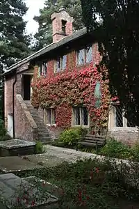
| Butterley Heyes | Butterley Heys | Farmhouse | Early 17th century | 12 January 1967 | SJ6479441951 52°58′24″N 2°31′28″W | This farmhouse originally had an H-shaped plan with later extensions; its two projecting wings have gables. There are two storeys with attics under a tiled roof, with a prominent brick chimneystack to the right-hand end. The timber frame has been infilled with brick; it features small framing with angle braces.[1] | 1136928 | .jpg.webp) Butterley Heyes |
| Game larder to the centre of the service court at Combermere Abbey | Dodcott cum Wilkesley | Game larder | Early 19th century | 19 May 1986 | SJ5877044087 52°59′32″N 2°36′52″W | This octagonal red-brick game larder, probably by the Irish Morrison family, stands on a stone plinth, with a porch to the east face. The shallow-pitched slate roof has large overhangs, and is topped with an octagonal wooden lantern, also slate roofed. The faces each have a two-light window headed with a cusp-shaped arch. The original ironwork on which game was hung remains in the interior.[2][3][4] | 1138528 | 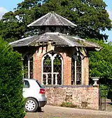 Game larder to the centre of the service court at Combermere Abbey |
| Barn and farm buildings at Demesne Farm | Doddington Park, Doddington | Farm building | c.1771–90 | 5 September 1986 | SJ7044347283 53°01′18″N 2°26′26″W | 1138505 | | |
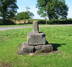
| Woodhey Cross | Woodhey Green, Faddiley | Cross | Late Medieval | 12 January 1967 | SJ5773052642 53°04′09″N 2°37′51″W | 1136206 | ||
| Barn at New Hall Farm | Gawsworth | Barn | 1707–12 | 14 April 1967 | SJ8918669878 53°13′32″N 2°09′43″W | 1139502 | 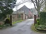 Barn at New Hall Farm | |
| Gawsworth New Hall | Gawsworth | Country house | 1707–12 | 14 April 1967 | SJ8919269835 53°13′31″N 2°09′43″W | 1159278 | ||
| Blackden Hall | Blackden, Goostrey | Farmhouse | Late 16th century | 14 February 1967 | SJ7869970384 53°13′47″N 2°19′09″W | 1231131 | | |
| Church of St Luke | Goostrey | Parish church | 1796 | 14 February 1967 | SJ7793870022 53°13′35″N 2°19′50″W | 1231229 | ||
| Crook Hall | Goostrey | Farmhouse | Late 16th century | 14 February 1967 | SJ7853471997 53°14′39″N 2°19′18″W | 1231132 |  Crook Hall | |
| Baptist Chapel | Great Warford | Church house | Mid-17th century | 14 April 1967 | SJ8163077018 53°17′22″N 2°16′32″W | 1329677 | ||
| Handforth Hall | Handforth | Manor house | 1562 | 30 March 1951 | SJ8630783309 53°20′46″N 2°12′21″W | 1222483 | ||
| Ball Farmhouse | Hankelow | Farmhouse | 16th or early 17th century | 12 January 1967 | SJ6685045663 53°00′25″N 2°29′39″W | 1138537 | ||
| Hankelow Hall | Hankelow | Country house | Early 18th century | 20 September 1954 | SJ6688146270 53°00′45″N 2°29′37″W | 1312531 | ||
| Hassall Hall and Hassall Hall Farmhouse | Hassall | Farmhouse | 17th century | 6 June 1952 | SJ7707557317 53°06′44″N 2°20′33″W | 1161774 | ||
| Hatherton Manor | Hatherton | Farmhouse | 1703 | 12 January 1967 | SJ6800646885 53°01′05″N 2°28′37″W | 1312575 | | |
| Whirley Hall | Henbury | House | c.1670 | 6 July 1984 | SJ8763074608 53°16′05″N 2°11′08″W | 1329627 | ||
| Chapel of St Mary | High Legh | Chapel | c.1581 | 5 March 1959 | SJ7007183932 53°21′04″N 2°26′59″W | 1139516 | ||
| Swineyard Hall Farmhouse | High Legh | House | 19th century | 5 March 1959 | SJ6780883813 53°21′00″N 2°29′01″W | 1115517 | ||
| Cotton Hall | Holmes Chapel | Farmhouse | Late 15th century | 14 February 1967 | SJ7481967411 53°12′10″N 2°22′37″W | 1231500 | | |
| The Red Lion | Holmes Chapel, Holmes Chapel | Public house | Late 17th century | 14 February 1967 | SJ7622867246 53°12′05″N 2°21′21″W | 1231438 | 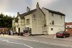 The Red Lion | |
| Gates, piers, screen and wall at Hough Hall | Hough | Gate | Early 18th century | 12 January 1967 | SJ7080150740 53°03′10″N 2°26′08″W | 1137036 | | |
| Hough Hall | Hough | House | 17th century | 12 January 1967 | SJ7083250812 53°03′12″N 2°26′07″W | 1138509 | | |
| Grove Mill | Kettleshulme | Boiler house | 1823–25 | 16 July 1979 | SJ9882080378 53°19′12″N 2°01′04″W | 1138938 |  Grove Mill | |
| Bexton Croft, Toft Road | Knutsford | House | 1896 | 15 January 1974 | SJ7551477634 53°17′42″N 2°22′08″W | A house designed by Baillie Scott, his first English commission, and considered to be one of his best early buildings.[5][6] | 1378495 | |
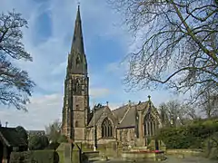
| St Cross Church | Knutsford | Parish church | 1880–81 | 15 January 1974 | SJ7564878555 53°18′12″N 2°22′01″W | A new church designed by Paley and Austin. It is built in brick with terracotta dressings in Perpendicular style, and has a tiled roof. Its plan includes a nave, north and south aisles, a four-stage tower at the crossing, and a chancel with north and south chapels. On the south is a two-storey vestry is on the south, with a porch is to the west of the north aisle.[7][8] | 1388414 | |
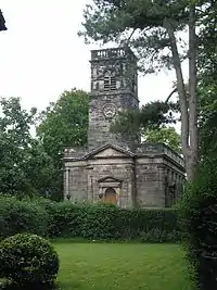
| St John the Baptist's Church | Knutsford | Parish church | 1741–44 | 18 January 1949 | SJ7524778522 53°18′11″N 2°22′22″W | The church was designed in neoclassical style by J. Garlive. It is constructed in brick with stone dressings, and has a slate roof. In 1879 the chancel was extended and reordered by Alfred Darbyshire.[9][10] | 1388324 | |
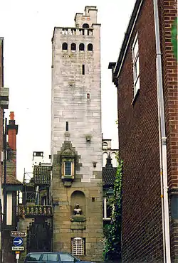
| Former Kings Coffee House and Gaskell Memorial Tower | Knutsford | Tower | 1907–08 | 18 January 1949 | SJ7523878637 53°18′15″N 2°22′23″W | Designed by William Longworth for Richard Harding Watt as a coffee house and council offices; used later as a restaurant. It consists of a main block for the offices, forming a courtyard, and the tower with an external staircase. It is constructed in rubble sandstone, with Portland stone at the top of the tower. Its architectural style is eclectic Italianate with Arts and Crafts elements. Its features include a smaller tower with a dome, a statue of Mrs Gaskell in a niche, a bronze medallion, and a pair of large Doric columns which were moved from St Peter's Church in Manchester.[11][12] | 1388360 | |
| Knutsford Lodge Gateway and gates to Tatton Park | Knutsford | Gate lodge | 1810 | 18 January 1949 | SJ7518979143 53°18′31″N 2°22′25″W | Designed by Lewis Wyatt as an entrance to Tatton Park in ashlar stone. It consists of a triple gateway and a lodge on the west side. Each gateway contains a cast iron gate. The central gateway is flanked by Doric columns supporting an entablature.[13][14] | 1388387 | 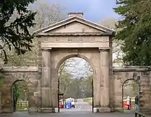 Knutsford Lodge Gateway and gates to Tatton Park |
| Sessions House, Toft Road | Knutsford | House | 1815–18 | 15 December 1954 | SJ7515778436 53°18′07″N 2°22′22″W | Designed by George Moneypenny as part of the gaol. It is constructed in ashlar stone with a portico of four Ionic columns, and has a bell-turret.[15][16] | 1378501 | 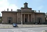 Sessions House, Toft Road |
| 125 King Street | Knutsford | House | Early 18th century | 18 January 1949 | SJ7518278860 53°18′22″N 2°22′26″W | A house, possibly originally an inn, part of which has since been used as offices. It is constructed in brick with stone dressings, and has a slate roof. An arched entry leads to the rear yard.[17] | 1388383 | 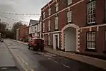 125 King Street |
| 98 King Street | Knutsford | House | c.1750 | 18 January 1949 | SJ7515878849 53°18′21″N 2°22′22″W | 1388377 | | |
| Lea Hall | Lea | House | 16th century | 12 January 1967 | SJ7145648925 53°02′12″N 2°25′33″W | 1138514 | 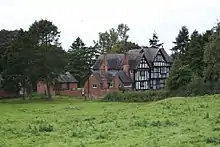 Lea Hall | |
| Roman sarcophagus in garden at Withington Hall | Lower Withington | Sarcophagus | Early C3 | 28 November 1984 | SJ8114472221 53°14′47″N 2°16′57″W | 1107883 | | |
| The Cage | Lyme Park Country Park, Lyme Handley | Estate cottage | 1737 | 14 April 1967 | SJ9663683070 53°20′39″N 2°03′02″W | 1277283 | 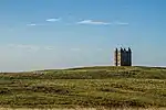 The Cage | |
| The Lantern | Lyme Park Country Park, Lyme Handley | Belvedere | c.1580 | 17 November 1983 | SJ9721182390 53°20′17″N 2°02′31″W | 1277282 | ||
| The Orangery | Lyme Park Country Park, Lyme Handley | Estate cottage | 1815 | 14 April 1967 | SJ9651982378 53°20′17″N 2°03′08″W | 1277341 |  The Orangery | |
| Barclays Bank | Macclesfield | Bank (financial) | 1841–42 | 14 April 1949 | SJ9183373309 53°15′23″N 2°07′21″W | 1279973 | 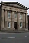 Barclays Bank | |
| Bate Hall Public House | Macclesfield | House | Late C16 or Early C17 | 17 March 1977 | SJ9160273775 53°15′38″N 2°07′33″W | 1218601 | | |
| Brunswick House (former Brunswick Methodist Church) | Macclesfield | Wesleyan Methodist chapel | 1823 | 17 March 1977 | SJ9189472996 53°15′13″N 2°07′17″W | 1206897 |  Brunswick House (former Brunswick Methodist Church) | |
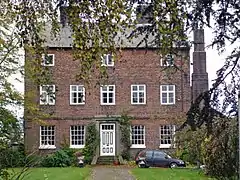
| Charles Roe House | Macclesfield | House | c.1700 | 14 April 1949 | SJ9153073762 53°15′38″N 2°07′37″W | 1206903 |  Charles Roe House | |
| Christ Church | Macclesfield | Church | 1775 | 14 April 1949 | SJ9139673528 53°15′30″N 2°07′44″W | 1206916 | ||
| Church of St Alban | Macclesfield | Roman Catholic church | 1839–41 | 17 March 1977 | SJ9116073662 53°15′35″N 2°07′57″W | 1206898 | ||
| Church of St Michael | Macclesfield | Church | 13th century | 14 April 1949 | SJ9179773706 53°15′36″N 2°07′23″W | 1206932 | ||
| Cumberland House | Macclesfield | House | Early 18th century | 14 April 1949 | SJ9169573908 53°15′43″N 2°07′28″W | 1291368 | 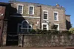 Cumberland House | |
| Forecourt wall, piers, railings and gates to Jordangate House | Macclesfield | Gate | c.1730 | 17 March 1977 | SJ9171873903 53°15′42″N 2°07′27″W | 1219744 |  Forecourt wall, piers, railings and gates to Jordangate House | |
| Jordangate House | Macclesfield | House | 1728 | 14 April 1949 | SJ9172773904 53°15′42″N 2°07′27″W | 1206920 | 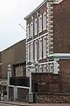 Jordangate House | |
| Macclesfield Arms Hotel | Macclesfield | Hotel | Late 18th century | 14 April 1949 | SJ9170973849 53°15′41″N 2°07′28″W | 1280005 | 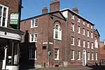 Macclesfield Arms Hotel | |
| Macclesfield Sunday School (now Macclesfield Heritage Centre) | Macclesfield | School | 1813 | 4 February 1975 | SJ9158273455 53°15′28″N 2°07′34″W | 1206950 | 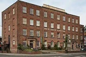 Macclesfield Sunday School (now Macclesfield Heritage Centre) | |
| Park Green House | Macclesfield | House | Late 18th century | 14 April 1949 | SJ9192473262 53°15′22″N 2°07′16″W | 1290516 | | |
| Showroom premises of Messrs Arighi Bianchi | Macclesfield | Silk mill | 1883 | 18 September 1973 | SJ9196973757 53°15′38″N 2°07′13″W | 1291854 | 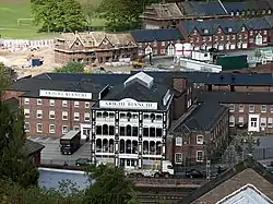 Showroom premises of Messrs Arighi Bianchi | |
| Town Hall | Macclesfield | Town hall | 1824 | 17 March 1977 | SJ9174873738 53°15′37″N 2°07′25″W | 1206935 | ||
| Unitarian Chapel | Macclesfield | Unitarian chapel | 1690 | 14 April 1949 | SJ9168073805 53°15′39″N 2°07′29″W | 1291252 | ||
| Whitfield House | Macclesfield | House | c.1838 | 17 March 1977 | SJ9067974161 53°15′51″N 2°08′23″W | 1221127 |  Whitfield House | |
| Church of St Michael | Marbury cum Quoisley | Church | 16th century | 12 January 1967 | SJ5605245636 53°00′21″N 2°39′18″W | 1225604 | ||
| Church of St Michael and All Angels | High Town, Middlewich | Church | 12th century | 5 December 1986 | SJ7039066250 53°11′32″N 2°26′36″W | 1138795 | ||
| 64 St Ann's Road | Middlewich | House | Late 17th century | 5 December 1986 | SJ7010165960 53°11′23″N 2°26′51″W | 1330028 |  64 St Ann's Road | |
| Antrobus Hall, garden wall and gatepiers | Mobberley | House | Dated 1709 | 5 March 1959 | SJ8012278917 53°18′24″N 2°17′54″W | 1329643 | | |
| Dukenfield Hall | Mobberley | House | Early and mid-17th century | 5 March 1959 | SJ7723979579 53°18′45″N 2°20′30″W | 1230099 | ||
| The Old Hall | Mobberley | House | Early 17th century | 5 March 1959 | SJ7924679700 53°18′49″N 2°18′42″W | 1139557 | ||
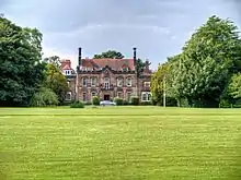
| Great Moreton Hall | Moreton cum Alcumlow | Country house | 1841–43 | 14 February 1967 | SJ8394759493 53°07′55″N 2°14′24″W | 1138736 | ||
| Lowerhouse Farmhouse | Mottram St. Andrew | Farmhouse | Mid-16th century | 14 April 1967 | SJ8669778602 53°18′14″N 2°11′59″W | 1138875 |  Lowerhouse Farmhouse | |
| Mottram Hall Hotel | Mottram St. Andrew | House | c.1750 | 25 July 1952 | SJ8854579402 53°18′40″N 2°10′19″W | 1234766 | ||
| Mottram Old Hall | Mottram St. Andrew | Fortified house | 16th century | 25 July 1952 | SJ8835379119 53°18′31″N 2°10′29″W | 1138842 | | |
| Dysart Buildings, 1–9 Monks Lane | Nantwich | House | 1778–79 | 19 April 1948 | SJ6534252361 53°04′02″N 2°31′07″W | Dysart Buildings is a terrace of nine three-storey town houses in red brick, with projecting bays at the ends of the terrace. It was built by Lionel Tollemache, fifth Earl of Dysart.[18][19][20] | 1249422 |  Dysart Buildings, 1–9 Monks Lane |
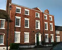
| 9 Mill Street | Nantwich | Town house | c.1736; 19th-century additions | 28 January 1999 | SJ6504852219 53°03′58″N 2°31′23″W | This five-bay town house in red brick with stone dressings has two storeys with attics. The slightly projecting central bay is flanked by brick pilasters and topped with a pediment. There is a cornice with a parapet above. Formerly used as a bank and a political club, it is now a restaurant.[18][19][21] | 1263769 | |
| Townwell House, 52 Welsh Row | Nantwich | House | 1740 | 19 April 1948 | SJ6478852439 53°04′05″N 2°31′37″W | Townwell House is a town house of three storeys and five bays, in red brick with stone dressings. It has decorative quoins and a stone string course. A contemporary two-storey coach house stands at the rear.[18][19][22] | 1263708 |  Townwell House, 52 Welsh Row |
| Wright's Almshouses, Beam Street | Nantwich | Almshouse | 1638 | 19 April 1948 | SJ6570652137 53°04′08″N 2°31′01″W | Wright's Almshouses are a terrace of six two-storey almshouses built by Sir Edmund Wright, in brick with stone dressings. They bear a central stone panel with arms. Originally on London Road, the almshouses were moved to stand adjacent to the Crewe Almshouses in 1973–75. They are now used as sheltered housing for the elderly.[18][23][24] | 1039555 |  Wright's Almshouses, Beam Street |
| Forecourt wall and gateway of Wright's Almshouses, Beam Street | Nantwich | Gate | 1667 | 1 March 1974 | SJ6544652562 53°04′09″N 2°31′02″W | The arched stone gateway to Wright's Almshouses is flanked by columns and side scrolls; it is surrounded by a low red-brick wall with a stone coping. Originally on London Road, the gateway was moved with the almshouses in 1973–75.[18][24][25] | 1320247 | 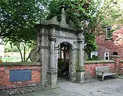 Forecourt wall and gateway of Wright's Almshouses, Beam Street |
| 46 High Street | Nantwich | Building | c. 1584 | 19 April 1948 | SJ6509952305 53°04′01″N 2°31′20″W | This timber-framed, two-gabled black-and-white merchant's house probably dates from shortly after the 1583 fire, and was built for Thomas Churche. It has two storeys with attics, with ornamental panelling, jetties and corbels decorated with carved human figures and animals. It is now a shop and coffee shop.[26][27] | 1206205 | |
| 83 Welsh Row | Nantwich | House | Late 18th century | 19 April 1948 | SJ6466852394 53°04′03″N 2°31′43″W | This town house in red brick has five storeys and five bays, with a stone cornice. The central slightly projecting bay is topped a pediment. By the main entrance are railings dating from the late 19th century. It is now used as offices.[18][28] | 1249536 | |
| Church Hall | Nether Alderley | Church hall | 1628 | 14 April 1967 | SJ8417876108 53°16′54″N 2°14′20″W | 1216836 | ||
| Nether Alderley Mill and dam wall | Nether Alderley | Mill | Late 16th century | 25 July 1952 | SJ8434076239 53°16′57″N 2°14′06″W | 1139592 | 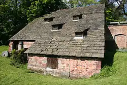 Nether Alderley Mill and dam wall | |
| Soss Moss Hall | Nether Alderley | Farmhouse | 1583 | 25 July 1952 | SJ8281175891 53°16′47″N 2°15′33″W | 1221317 | | |
| The Old Hall | Nether Alderley | Hall | Late 16th century | 14 April 1967 | SJ8436076302 53°16′59″N 2°14′05″W | 1139591 | | |
| Astbury Rectory | Newbold Astbury | Vicarage | Mid-18th century | 14 February 1967 | SJ8470861668 53°09′06″N 2°13′43″W | 1138744 | 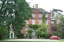 Astbury Rectory | |
| Canopied tomb of a member of the Venables family in churchyard of St Mary at NGR 8463 6158 | Newbold Astbury | Tomb | Late 13th century | 26 March 1987 | SJ8463561552 53°09′02″N 2°13′47″W | 1161887 | 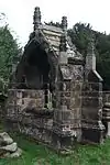 Canopied tomb of a member of the Venables family in churchyard of St Mary at NGR 8463 6158 | |
| Glebe Farmhouse | Newbold Astbury | Farmhouse | 18th century | 14 February 1967 | SJ8466961493 53°09′00″N 2°13′45″W | 1309873 | 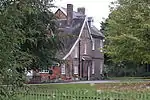 Glebe Farmhouse | |
| Ashbank Farmhouse | Scholar Green, Odd Rode | Farmhouse | Late 16th–early 17th century | 26 March 1987 | SJ8209256260 53°06′11″N 2°16′03″W | 1330044 | 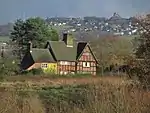 Ashbank Farmhouse | |
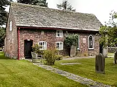
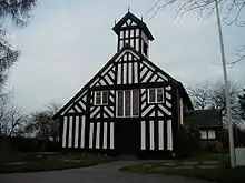
| Barn at Little Moreton Hall Farm | Odd Rode | Barn | 15th century | 14 February 1967 | SJ8331858903 53°07′36″N 2°14′58″W | 1138748 | 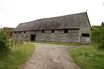 Barn at Little Moreton Hall Farm | |
| Church of All Saints | Scholar Green, Odd Rode | Church | 1863 | 14 February 1967 | SJ8240257481 53°06′50″N 2°15′47″W | 1161954 | ||
| Ramsdell Hall including former stable block | Odd Rode | Country house | Early/mid-18th century | 14 February 1967 | SJ8427458093 53°07′10″N 2°14′06″W | 1138715 | 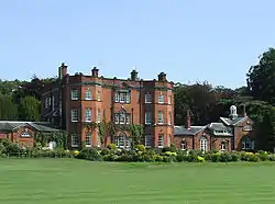 Ramsdell Hall including former stable block | |
| Rode Hall | Odd Rode | Country house | c.1700 | 6 June 1952 | SJ8189057336 53°06′45″N 2°16′14″W | 1138746 | ||
| Church of St Catherine | Over Alderley | Church | 1840 | 14 April 1967 | SJ8626474793 53°16′11″N 2°12′22″W | 1139604 | ||
| Hayman's House | Over Alderley | House | 1528 | 14 April 1967 | SJ8550576137 53°16′54″N 2°13′03″W | 1139606 |  Hayman's House | |
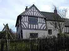
| Black and White Cottage | Peckforton | Timber-framed house | Late 17th century | 12 January 1967 | SJ5384056519 53°06′13″N 2°41′22″W | Stone House Lane, Peckforton | 1330119 |  Black and White Cottage |
| Chapel in the ward of Peckforton Castle | Peckforton | Chapel | Mid-19th century | 29 October 1984 | SJ5329758020 53°07′01″N 2°41′52″W | 1138621 | | |
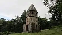
| Entrance Lodge south-east of Peckforton Castle | Peckforton | Turret | Mid-19th century | 29 October 1984 | SJ5380357557 53°06′46″N 2°41′25″W | 1313148 | .jpg.webp) Entrance Lodge south-east of Peckforton Castle | |
| Peckforton Hall | Peckforton | Farmhouse | Late 17th century | 12 January 1967 | SJ5449056636 53°06′17″N 2°40′47″W | 1313276 | | |
| Peover Hall | Peover Hall Park, Peover Superior | Country house | 1585 | 5 March 1959 | SJ7726873496 53°15′28″N 2°20′27″W | 1329813 | ||
| Holford Hall | Plumley | House | Mid-17th century | 5 March 1959 | SJ7089675445 53°16′30″N 2°26′11″W | 1329664 | ||
| Poole Hall | Poole | Country house | 1817 | 12 January 1967 | SJ6455755137 53°05′31″N 2°31′46″W | 1136492 | | |
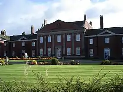
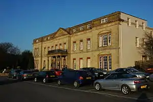
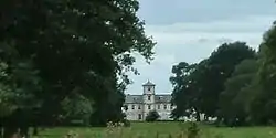
| Salesian Missionary College | Shrigley Park, Pott Shrigley | Country house | c.1825 | 25 July 1952 | SJ9426179805 53°18′54″N 2°05′10″W | 1232168 | ||
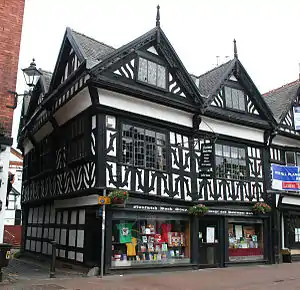
| National Westminster Bank | Prestbury | House | 16th century | 25 July 1952 | SJ9000576954 53°17′21″N 2°09′00″W | 1329653 | 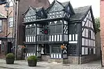 National Westminster Bank | |
| Spittle House (west range only) | Prestbury | House | Perhaps 14th century | 6 July 1984 | SJ8964677782 53°17′48″N 2°09′19″W | 1139569 |  Spittle House (west range only) | |
| Willot Hall | Prestbury | Farmhouse | Late 15th century | 25 July 1952 | SJ8881780287 53°19′09″N 2°10′04″W | 1221901 | | |
| Charles Head House | Rainow | Manor house | Late 16th/early 17th century | 9 December 1983 | SJ9790078783 53°18′21″N 2°01′53″W | 1136702 | .jpg.webp) Charles Head House | |
| Church of St John the Baptist | Saltersford, Rainow | Church | 1733 | 14 April 1967 | SJ9838676589 53°17′10″N 2°01′27″W | 1138927 | ||
| Sowcar Farmhouse | Rainow | Farmhouse | Early 17th century | 9 December 1983 | SJ9429877938 53°17′53″N 2°05′08″W | 1138917 | | |
| Gatehouse to former Ridley Hall | Ridley | Gatehouse | c.1530 | 29 October 1984 | SJ5470254759 53°05′16″N 2°40′35″W | 1138584 | | |
| Black Bear Inn | Sandbach | House | 1634 | 11 August 1950 | SJ7584160816 53°08′37″N 2°21′40″W | 1159872 |  Black Bear Inn | |
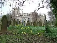
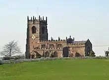
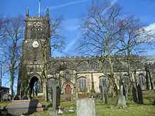
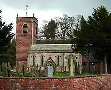
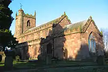
| Church of St Mary | Sandbach | Anglican church | 15th century | 11 August 1950 | SJ7595360775 53°08′36″N 2°21′34″W | 1330401 | ||
| Capesthorne Hall and garden wall surrounding Entrance Court | Capesthorne Park, Siddington | Country house | 1719 | 14 April 1967 | SJ8404072768 53°15′05″N 2°14′21″W | 1104882 | 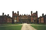 Capesthorne Hall and garden wall surrounding Entrance Court | |
| Chapel of the Holy Trinity | Capesthorne Park, Siddington | Chapel | 1722 | 14 April 1967 | SJ8401272728 53°15′04″N 2°14′23″W | 1139279 | | |
| Church of All Saints | Siddington | Church | Late 16th century | 14 April 1967 | SJ8462670833 53°14′02″N 2°13′49″W | 1106256 | ||
| Chapel at Somerford Hall | Somerford | Chapel | 1720 | 14 February 1967 | SJ8148264848 53°10′48″N 2°16′38″W | 1309761 | ||
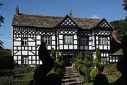
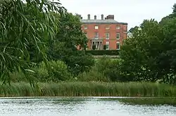
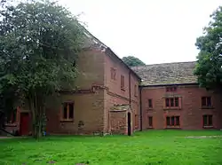
| Somerford Booths Hall | Somerford Booths | Country house | 1612 | 6 June 1952 | SJ8307565536 53°11′11″N 2°15′12″W | 1138721 | ||
| The Bath House | Spurstow | Farmhouse | Late 16th century | 12 January 1967 | SJ5695155324 53°05′35″N 2°38′34″W | 1312873 |  The Bath House | |
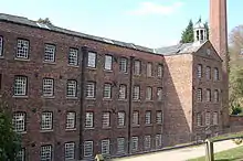
| Quarry Bank Mill | Styal | Cotton mill | 1784 | 30 March 1951 | SJ8344382988 53°20′36″N 2°14′55″W | 1237687 | ||
| The Apprentices House and Apprentices House Cottage | Styal | Museum | 1790 | 6 March 1975 | SJ8366983212 53°20′43″N 2°14′43″W | 1237685 |  The Apprentices House and Apprentices House Cottage | |
| Oak Farmhouse | Styal | Farmhouse | Early 16th century | 30 March 1951 | SJ8341683646 53°20′57″N 2°14′57″W | 1222266 | | |
| Chapel and Chaplain's House c.7 yards east of Sutton Hall | Sutton | Chapel | 16th century | 14 April 1967 | SJ9255571517 53°14′25″N 2°06′42″W | 1159446 | | |
| Langley Hall | Sutton | House | 1696 | 14 April 1967 | SJ9383871602 53°14′28″N 2°05′32″W | 1139480 | ||
| Church of St Peter | Swettenham | Parish church | c.1717 | 14 February 1967 | SJ8008767185 53°12′04″N 2°17′53″W | 1231569 | ||
| Clonterbrook House | Swettenham Heath, Swettenham | Timber-framed house | Dated 1697 | 14 February 1967 | SJ8214767235 53°12′06″N 2°16′02″W | 1277466 | | |
| Tabley Old Hall | Tabley Inferior | House | c.1670 | 3 September 1984 | SJ7197777382 53°17′33″N 2°25′14″W | 1139011 | ||
| Palm House to west of Orangery | Tatton Park, Tatton | Glasshouse | c.1860 | 20 September 1984 | SJ7438681508 53°19′47″N 2°23′05″W | 1139535 | 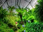 Palm House to west of Orangery | |
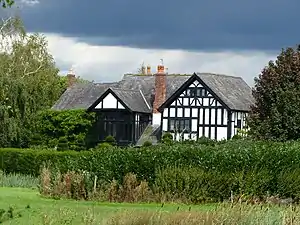
| Tatton Old Hall | Tatton Park, Tatton | House | 17th century | 5 March 1959 | SJ7562981282 53°19′39″N 2°21′57″W | 1329674 | ||
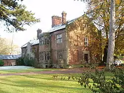
| Toft Hall | Toft | Country house | Late 17th century | 15 December 1981 | SJ7538976262 53°16′57″N 2°22′09″W | 1106302 | ||
| Wardle Old Hall | Wardle | Farmhouse | Early 18th century | 10 June 1952 | SJ6118357130 53°06′35″N 2°34′48″W | 1312857 | | |
| Church House | Warmingham | Farmhouse | Late 16th century | 12 January 1967 | SJ7088060994 53°08′42″N 2°26′07″W | 1310880 |  Church House | |
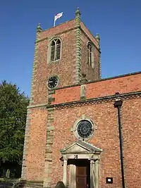
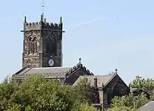
| The Church of St Leonard | Warmingham | Parish church | 1715 | 12 January 1967 | SJ7090261074 53°08′45″N 2°26′06″W | 1330059 | ||
| Hollyhedge Farmhouse | Weston | Farmhouse | Late 16th/early 17th century | 12 January 1967 | SJ7333853112 53°04′27″N 2°23′53″W | 1312453 | | |
| Crag Hall | Wildboarclough, Macclesfield Forest and Wildboarclough | House | c.1915 | 14 April 1967 | SJ9878668809 53°12′58″N 2°01′05″W | 1329979 | ||
| Midgeley Gate Farmhouse | Wildboarclough, Macclesfield Forest and Wildboarclough | House | Early 17th century | 7 November 1983 | SJ9950366377 53°11′39″N 2°00′27″W | 1145874 | | |
| Willaston Hall | Willaston | Country house | 1737 | 10 June 1952 | SJ6738452539 53°04′08″N 2°29′13″W | 1138556 | | |
| Dean Row Unitarian Chapel | Wilmslow | Presbyterian chapel | c.1695 | 30 March 1951 | SJ8710281544 53°19′49″N 2°11′37″W | 1222055 | ||
| Friends Meeting House | Wilmslow | Friends meeting house | 1830 | 26 November 1981 | SJ8399581115 53°19′35″N 2°14′25″W | 1222185 |  Friends Meeting House | |
| Pownall Hall (school) | Wilmslow | House | c.1833 | 7 December 1973 | SJ8366481887 53°20′00″N 2°14′43″W | 1222471 | ||
| Hawthorn Hall and parts of front garden walls | Wilmslow | House | 1698 | 6 July 1984 | SJ8426281282 53°19′41″N 2°14′11″W | 1237621 | | |
| Wincle Grange Farmhouse | Wincle | House | Early 18th century | 25 July 1952 | SJ9554865412 53°11′08″N 2°04′00″W | 1138880 |  Wincle Grange Farmhouse | |
| West End | Wistaston | Farmhouse | Early 17th century | 12 January 1967 | SJ6783654655 53°05′16″N 2°28′49″W | 1228816 | | |
| Church of St Margaret | Wrenbury cum Frith | Church | Early 16th century | 12 January 1967 | SJ5936447768 53°01′31″N 2°36′21″W | St Margaret's is a parish church in red sandstone ashlar under a tile roof. The five-bay clerestoried nave and chancel have battlemented parapets. The west tower has battlements and pinnacles to its corners; an octagonal stair turret climbs to its roof.[29][30] | 1357455 | |
| Wrenbury Church Bridge | Llangollen Canal, Wrenbury cum Frith | Bridge | c.1790 | 19 May 1986 | SJ5943248070 53°01′41″N 2°36′18″W | Wrenbury Church Bridge (no. 19) is a single-span timber lift bridge by Thomas Telford. It is an accommodation bridge and also serves a public footpath. The bridge is lifted manually via a counterbalancing weight fixed to paired beams parallel to the bridge platform and attached to its free end with chains. Vertical beams support the structure, and the timberwork is strengthened with iron rods. Guards were installed in 1889.[31][32] | 1357482 | 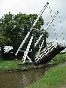 Wrenbury Church Bridge |
| Wrenbury Frith Bridge | Llangollen Canal, Wrenbury cum Frith | Bridge | c.1790 | 19 May 1986 | SJ5844047612 53°01′26″N 2°37′11″W | Wrenbury Frith Bridge (no. 21) is a single-span timber lift bridge by Thomas Telford. It is an accommodation bridge with no public right of way. The bridge is lifted manually via a counterbalancing weight fixed to paired beams parallel to the bridge platform and attached to its free end with chains. Vertical beams support the structure, and the timberwork is strengthened with iron rods. The bridge has no guard rails.[33] | 1357424 | 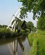 Wrenbury Frith Bridge |
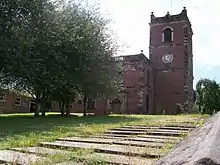
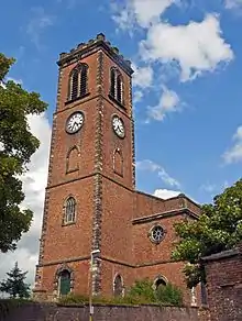
| Tower of former Church of St Chad | Wybunbury | Tower | 15th or 16th century | 12 January 1967 | SJ7000449872 53°02′42″N 2°26′51″W | 1279389 |  Tower of former Church of St Chad |
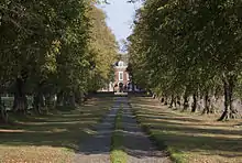

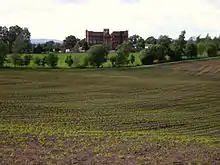

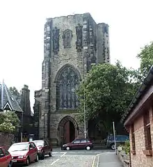

_-_geograph.org.uk_-_81768.jpg.webp)


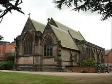
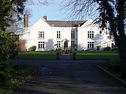
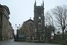
.jpg.webp)
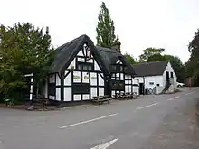
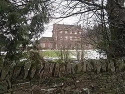
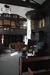
_p1.034_-_Somerford_Booths_Hall%252C_Cheshire.jpg.webp)


Notes
- The date given is the date used by Historic England as significant for the initial building or that of an important part in the structure's description.
- Sometimes known as OSGB36, the grid reference is based on the British national grid reference system used by the Ordnance Survey.
- The "List Entry Number" is a unique number assigned to each listed building and scheduled monument by Historic England.
See also
References
- Historic England, "Butterley Heyes (1136928)", National Heritage List for England, retrieved 25 March 2015
- de Figueiredo & Treuherz, pp. 60–65
- Hartwell et al., pp. 293–95
- Historic England, "Game larder to centre of service court at Combermere Abbey (1138528)", National Heritage List for England, retrieved 25 March 2015
- Hartwell et al. 2011, p. 428.
- Historic England. "Bexton Croft, Knutsford (1378495)". National Heritage List for England. Retrieved 24 April 2012.
- Hartwell et al. 2011, p. 421.
- Historic England. "Church of St Cross, Knutsford (1388414)". National Heritage List for England. Retrieved 5 May 2012.
- Hartwell et al. 2011, pp. 420–421.
- Historic England. "Church of St John the Baptist, Knutsford (1388324)". National Heritage List for England. Retrieved 1 May 2012.
- Hartwell et al. 2011, pp. 423–424.
- Historic England. "Former Kings Coffee House and Gaskell Memorial Tower, 60 King Street, Knutsford (1388360)". National Heritage List for England. Retrieved 3 May 2012.
- Hartwell et al. 2011, p. 425.
- Historic England. "Knutsford Lodge Gateway and gates to Tatton Park (1388387)". National Heritage List for England. Retrieved 3 May 2012.
- Hartwell et al. 2011, p. 422.
- Historic England. "Sessions House, Knutsford (1378501)". National Heritage List for England. Retrieved 26 April 2012.
- Historic England. "125 King Street, Knutsford (1388383)". National Heritage List for England. Retrieved 3 May 2012.
- Pevsner & Hubbard, 1971, pp. 287–89
- Stevenson, 1994, pp. 29–30
- Historic England, "Dysart Buildings (1249422)", National Heritage List for England, retrieved 25 March 2015
- Historic England, "Peppers, 9 Mill Street (1263769)", National Heritage List for England, retrieved 25 March 2015
- Historic England, "Townwell House, 52 Welsh Row (1263708)", National Heritage List for England, retrieved 25 March 2015
- Historic England, "Wright's Almshouses, Beam Street (1039555)", National Heritage List for England, retrieved 25 March 2015
- Blacklay, pp. 14–23, 25–32
- Historic England, "Forecourt wall and gateway of Wright's Almshouses, London Road (1320247)", National Heritage List for England, retrieved 25 March 2015
- Historic England, "46 High Street, Nantwich (1206205)", National Heritage List for England, retrieved 25 March 2015
- Lake, 1983, p. 130
- Historic England, "83 Welsh Row, Nantwich (1249536)", National Heritage List for England, retrieved 25 March 2015
- Historic England, "Church of St Margaret, Wrenbury (1357455)", National Heritage List for England, retrieved 25 March 2015
- Salter, Mark (1995), The Old Parish Churches of Cheshire, Malvern: Folly Publications, p. 82, ISBN 1-871731-23-2
- Historic England, "Wrenbury Church Bridge (1357482)", National Heritage List for England, retrieved 25 March 2015
- Access to Archives: Shropshire Archives 1873–1986, The National Archives, retrieved 5 December 2012
- Historic England, "Wrenbury Frith Bridge (1357424)", National Heritage List for England, retrieved 25 March 2015
Notes
External links
![]() Media related to Grade II* listed buildings in Cheshire at Wikimedia Commons
Media related to Grade II* listed buildings in Cheshire at Wikimedia Commons
This article is issued from Wikipedia. The text is licensed under Creative Commons - Attribution - Sharealike. Additional terms may apply for the media files.