Grade II* listed buildings in the West Midlands
There are over 20,000 Grade II* listed buildings in England. This page is a list of these buildings in the county of West Midlands, by district.
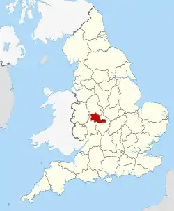
The West Midlands shown in England
Birmingham
| Name | Location | Type | Completed [note 1] | Date designated | Grid ref.[note 2] Geo-coordinates |
Entry number [note 3] | Image |
|---|---|---|---|---|---|---|---|
| All Saints Church | Four Oaks | Anglican Church | 1907-1909 | 26 August 1976 | SP1091698740 52°35′11″N 1°50′25″W |
1343304 | |
| Anglican Church of All Saints (formerly St Aiden) | Small Heath | Anglican Church | 1894 | 21 January 1970 | SP0916485860 52°28′14″N 1°51′59″W |
1343050 | |
| Anglican Church of SS Peter and Paul | Witton | Church | 15th century | 25 April 1952 | SP0826289910 52°30′25″N 1°52′47″W |
1290008 | |
| Anglican Church of St Augustine | Edgbaston | Anglican Church | 1868 | 21 January 1970 | SP0377686158 52°28′24″N 1°56′45″W |
1076255 | |
| Aquinas House, 62-64 Warstone Lane | Jewellery Quarter | Jewellery Workshop | 1882 | 29 April 2004 | SP0595987646 52°29′12″N 1°54′49″W |
1392830 | .jpg.webp) Aquinas House, 62-64 Warstone Lane |
| Ashford and Sons, 16-18 Great Hampton Street, B18 | Hockley | Jewellery Workshop | 1912 | 8 July 1982 | SP0637787947 52°29′22″N 1°54′27″W |
1075540 |  |
| Great Hampton Street Works, 80-82, Great Hampton Street, B18 (Pelican Works) | Hockley | Jewellery Workshop | 1880 | 8 July 1982 | SP0615888088 52°29′26″N 1°54′39″W |
1075544 |  Great Hampton Street Works, 80-82, Great Hampton Street, B18 (Pelican Works) |
| Ashfurlong Hall | Sutton Coldfield | House | Early 16th century | 18 October 1949 | SP1350498142 52°34′51″N 1°48′08″W |
1075807 | |
| Balsall Heath Library | Balsall Heath | Public Library | 1895 | 8 July 1982 | SP0783984411 52°27′27″N 1°53′10″W |
1076274 | |
| Barn Range approximately 50 Metres West of New Shipton Farmhouse (not included) | Sutton Coldfield | Barn | 19th century | 11 October 1988 | SP1347794261 52°32′46″N 1°48′10″W |
1343353 | |
| Bell's Farmhouse | Druids Heath | Farmhouse | 1595 | 25 April 1952 | SP0636178755 52°24′24″N 1°54′29″W |
1075751 |  Bell's Farmhouse |
| Berrow Court Hotel, Berrow Drive, B15 | Edgbaston | House | 1870-5 | 8 July 1982 | SP0423885415 52°28′00″N 1°56′21″W |
1075755 |  Berrow Court Hotel, Berrow Drive, B15 |
| Birmingham Gun Barrel Proof House | Digbeth | Gate Lodge | 1813 | 21 January 1970 | SP0792986942 52°28′49″N 1°53′05″W |
1291262 | |
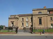
| Art Gallery, Council House & Council House Extension | City Centre | Council House | 1874-79 | 25 April 1952 | SP0658387044 52°28′53″N 1°54′16″W |
1210333 | .jpg.webp) Art Gallery, Council House & Council House Extension |
| Birmingham and Midland Institute | City Centre | Institute | 1899 | 21 January 1970 | SP0663487055 52°28′53″N 1°54′13″W |
1343095 | |
| Bishop Latimer Memorial Church of All Saints | Winson Green | Church | 1903-4 | 21 January 1970 | SP0418488792 52°29′49″N 1°56′23″W |
1343061 | |
| Blakesley Hall | Yardley | Farmhouse | Last quarter, 16th century | 29 April 1952 | SP1304286185 52°28′24″N 1°48′34″W |
1075711 | |
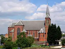
| Roman Catholic Cathedral of St Chad | City Centre | Roman Catholic Church | 1839-41 | 25 April 1952 | SP0696687522 52°29′08″N 1°53′56″W |
1220729 | |
| Church of St Alban the Martyr | Highgate | Church | 1879-81 | 25 April 1952 | SP0766485337 52°27′57″N 1°53′19″W |
1290539 | |
| Church of St Mary | Lozells | Church | 12th to early 13th century | 25 April 1952 | SP0557190308 52°30′38″N 1°55′10″W |
1076358 | |
| Church of St Oswald | Small Heath | Church/School | 1892 | 21 January 1970 | SP1016985610 52°28′06″N 1°51′06″W |
1343113 | |
| The Church of the Immaculate Conception (The Oratory), The Oratory Priests' House and the former Oratory School Buildings | Edgbaston | Church School Priests' House | 1850-1 (Priests' House) 1859-61 (school) 1907–10 (church) | 25 April 1952 | SP0483586073 52°28′20″N 1°55′44″W |
1076349 |  The Church of the Immaculate Conception (The Oratory), The Oratory Priests' House and the former Oratory School Buildings |
| City Arcade | City Centre | Shopping arcade | 1898–1901 | 8 July 1982 | SP0713786877 52°28′47″N 1°53′47″W |
1289578 |  City Arcade |
| Coffin Furniture Works, 13-15, Fleet Street | City Centre | Plating Works | 1892 | 18 April 2000 | SP0638487121 52°28′55″N 1°54′27″W |
1380231 |  Coffin Furniture Works, 13-15, Fleet Street |
| Convent of Our Lady of Mercy | Lozells | Nunnery | 1840-1 | 25 April 1952 | SP0586488903 52°29′53″N 1°54′54″W |
1076306 | |
| Emmanuel Church | Wylde Green | Parish Hall | 1967 | 26 August 1976 | SP1182593352 52°32′16″N 1°49′38″W |
1075819 |  Emmanuel Church |
| Former Gas Retort House | Birmingham | Retort House | 1822 | 30 June 1993 | SP0624686513 52°28′35″N 1°54′34″W |
1234330 | |
| Friends' Institute buildings | Birmingham | Society of Friends meeting house etc. | 1897 | 17 September 2014 | 52°27′56″N 1°52′57″W | 1418995 | |
| Garth House, 47, Edgbaston Park Road, B15 | Edgbaston | House | 1901 | 21 January 1970 | SP0502784089 52°27′17″N 1°55′39″W |
1075616 |  Garth House, 47, Edgbaston Park Road, B15 |
| Giles House, 83 Harborne Road, B15 | Edgbaston | House | 1855 | 8 July 1982 | SP0513785845 52°28′14″N 1°55′33″W |
1076326 | |
| Great Hall and Quadrant Range (University of Birmingham) | Edgbaston | University | 1900-1909 | 21 January 1970 | SP0480183468 52°26′57″N 1°55′51″W |
1076133 | 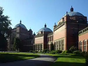 Great Hall and Quadrant Range (University of Birmingham) |
| Highbury Hall | Moseley | House | 1879 | 21 January 1970 | SP0682082690 52°26′32″N 1°54′04″W |
1076076 | |
| Holy Trinity Church | Birchfield, Witton | Anglican Church | 1864 | 8 January 1999 | SP0669490103 52°30′32″N 1°54′10″W |
1272059 | .jpg.webp) Holy Trinity Church |
| Horseshoe Shaped Former Stables and Stores (City of Birmingham Engineers Depot) - 23 Sheepcote Street, B16 | Ladywood | Local Government Office | 1840 | 22 November 1976 | SP0563586790 52°28′44″N 1°55′06″W |
1220997 |  Horseshoe Shaped Former Stables and Stores (City of Birmingham Engineers Depot) - 23 Sheepcote Street, B16 |
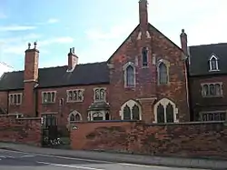
| Former Icknield Street School (a Birmingham board school) | Hockley | School | 1883 | 16 September 1981 | SP0582888465 52°29′39″N 1°54′56″W |
1076315 | 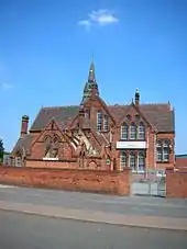 Former Icknield Street School (a Birmingham board school) |
| King Edward's School Chapel | Edgbaston | School | 1938-40 | 8 July 1982 | SP0542283654 52°27′03″N 1°55′18″W |
1343402 | |
| Kings Norton Guillotine Stop Lock East of Junction of Stratford on Avon Canal with the Worcester and Birmingham Canal | Kings Norton | Stop Lock | 1794-1802 | 8 July 1982 | SP0557479470 52°24′48″N 1°55′10″W |
1076290 |  Kings Norton Guillotine Stop Lock East of Junction of Stratford on Avon Canal with the Worcester and Birmingham Canal |
| Knutsford Lodge, 25 Somerset Road, B15 | Edgbaston | House | Mid to late 19th century | 8 July 1982 | SP0463384533 52°27′31″N 1°56′00″W |
1076157 |  Knutsford Lodge, 25 Somerset Road, B15 |
| Ladypool Primary School (a Birmingham board school} | Sparkbrook | Elementary School | 1885 | 8 July 1982 | SP0863084816 52°27′40″N 1°52′28″W |
1343133 | |
| Lloyd's Farmhouse Farm Park, Sampson Road, B11 | Sparkhill | Farmhouse | Mid 18th century | 30 June 1976 | SP0873585233 52°27′54″N 1°52′22″W |
1076180 | 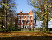 Lloyd's Farmhouse Farm Park, Sampson Road, B11 |
| Main Block to Oscott College | New Oscott | Theological College | 1835-8 | 25 April 1952 | SP0988894038 52°32′39″N 1°51′20″W |
1075635 | 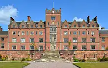 Main Block to Oscott College |
| Maryvale Institute | Old Oscott | Bishops Palace | 1752 | 25 April 1952 | SP0741594534 52°32′55″N 1°53′31″W |
1076213 | |
| Metchley Abbey | Selly Oak | House | Early 19th century | 25 April 1952 | SP0379684364 52°27′26″N 1°56′44″W |
1076261 |  Metchley Abbey |
| Methodist Central Hall | City Centre | Methodist Church | 1903-4 | 21 January 1970 | SP0739587311 52°29′01″N 1°53′33″W |
1075607 | |
| Moat House | Sutton Coldfield | House | 1680 | 18 October 1949 | SP1213496698 52°34′05″N 1°49′21″W |
1343333 | |
| Monument to Lord Nelson | City Centre | Sculpture | 1809 | 25 April 1952 | SP0729886616 52°28′39″N 1°53′38″W |
1343362 | |
| Moor Hall Farmhouse | Sutton Coldfield | Farmhouse | Late 14th or 15th century | 18 October 1949 | SP1251498117 52°34′51″N 1°49′00″W |
1075803 | |
| Murdoch Chambers and Pitman Chambers, 155-161 Corporation Street, B3 | City Centre | Shop | 1896-7 | 21 January 1970 | SP0726987214 52°28′58″N 1°53′40″W |
1075604 |  Murdoch Chambers and Pitman Chambers, 155-161 Corporation Street, B3 |
| National Westminster Bank | City Centre | Bank | 1869 | 21 January 1970 | SP0682986898 52°28′48″N 1°54′03″W |
1291206 | .jpg.webp) National Westminster Bank |
| Newhall Mill | Sutton Coldfield | Mill House | 18th century | 10 December 1973 | SP1322294504 52°32′54″N 1°48′23″W |
1343322 | .jpg.webp) Newhall Mill |
| Number 20, High St. and Front Railings | Sutton Coldfield | House | 1675 | 18 October 1949 | SP1212096432 52°33′56″N 1°49′21″W |
1116386 | |
| Nos 36a and 37, Waterloo St. (Wellesley House) and Screen Cut into Waterloo Court | City Centre | House | 1830 | 25 April 1952 | SP0682186927 52°28′49″N 1°54′04″W |
1343153 | .jpg.webp) Nos 36a and 37, Waterloo St. (Wellesley House) and Screen Cut into Waterloo Court |
| Old Grammar School on the North Side of the Churchyard to the Church of St Nicolas | Kings Norton | Priests House | Early 15th century | 25 April 1952 | SP0496378997 52°24′32″N 1°55′42″W |
1211444 | |
| Our Lady Help of Christians Church | Tile Cross | Church | 1967 | 18 February 1999 (Grade II); 15 March 2016 | SP1563786988 52°28′50″N 1°46′16″W |
1245546 | |
| Parish Church of St Giles | Sheldon | Parish Church | Early 14th century | 25 April 1952 | SP1520984649 52°27′34″N 1°46′39″W |
1075659 | |
| Parish Church of St Martin | City Centre | Church | Late 13th century | 25 April 1952 | SP0735286566 52°28′37″N 1°53′35″W |
1075690 | |
| Parish Church of the Ascension | Hall Green | Parish Church | 18th century | 25 April 1952 | SP1099481789 52°26′02″N 1°50′23″W |
1076183 | |
| Premises occupied by Gallen Kamp (Argent Works) | Hockley | Works | 1862-3 | 8 July 1982 | SP0608587418 52°29′05″N 1°54′43″W |
1290277 | |
| Primrose Hill Farmhouse | Kings Norton | Farmhouse | Late 15th century | 22 January 1973 | SP0499677785 52°23′53″N 1°55′41″W |
1076230 | |
| Spring Hill Library | Ladywood | Public Library | 1893 | 22 May 1972 | SP0556487464 52°29′06″N 1°55′10″W |
1076161 | |
| School of Art | Balsall Heath | Art School | 1899 | 8 July 1982 | SP0789684370 52°27′26″N 1°53′07″W |
1343102 | |
| Sheldon Hall | Kitts Green | House | Early 16th century | 25 April 1952 | SP1623987443 52°29′05″N 1°45′44″W |
1075555 | |
| Small Heath Lower School (a former Birmingham board school) | Small Heath | Board School | 1892 | 8 July 1982 | SP0976585201 52°27′53″N 1°51′28″W |
1211189 | 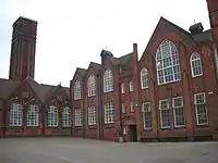 Small Heath Lower School (a former Birmingham board school) |
| Small Heath Lower School, Learning Zone (a former Birmingham board school) | Small Heath | Teachers House | 1892 | 8 July 1982 | SP0972385197 52°27′53″N 1°51′30″W |
1075691 | |
| Soho House | Handsworth | House | Mid 18th century | 25 April 1952 | SP0533289078 52°29′58″N 1°55′22″W |
1076151 | |
| Stables to the North East of Number 12 | Edgbaston | Stable | 1855 | 22 April 1976 | SP0563985228 52°27′54″N 1°55′06″W |
1075741 |  Stables to the North East of Number 12 |
| Statue of the Virgin Mary in Front of the Tower of Oscott College | New Oscott | Statue | 1837-40 | 8 July 1982 | SP0987694018 52°32′38″N 1°51′21″W |
1075636 | |
| Stone House | Sutton Coldfield | House | Early 16th century | 26 August 1976 | SP1308994399 52°32′50″N 1°48′30″W |
1075773 | |
| Stratford House | Highgate | Manor House | 1601 | 25 April 1952 | SP0818185548 52°28′04″N 1°52′52″W |
1076165 | 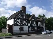 Stratford House |
| Summerfield Community Centre and Job Preparation Unit - a former Birmingham board school (Dudley Road) | Winson Green | House | 1878 | 8 July 1982 | SP0427687693 52°29′14″N 1°56′18″W |
1343401 | 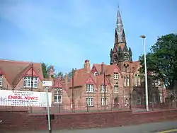 Summerfield Community Centre and Job Preparation Unit - a former Birmingham board school (Dudley Road) |
| The Anchorage | Handsworth | House | 1899 | 8 July 1982 | SP0486291181 52°31′07″N 1°55′47″W |
1076319 | 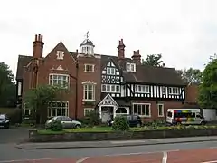 The Anchorage |
| The Bartons Arms | Aston | Public House | 1900-01 | 31 March 1976 | SP0721889042 52°29′57″N 1°53′42″W |
1076341 | |
| The Bordesley Centre (former Camp Hill Boys' and Girls' schools) | Bordesley | Grammar School | 1883 | 8 July 1982 | SP0839985563 52°28′05″N 1°52′40″W |
1210202 |  The Bordesley Centre (former Camp Hill Boys' and Girls' schools) |
| The Grand Hotel | City Centre | Hotel | 1876 | 4 May 2004 | SP0692787116 52°28′55″N 1°53′58″W |
1391246 | |
| The Grove | Sutton Coldfield | House | 17th or early 18th century | 18 October 1949 | SP1665594979 52°33′09″N 1°45′21″W |
1319945 | |
| The Listed Building (formerly Floodgate School), Digbeth Campus, South Birmingham College - a former Birmingham board school | Digbeth | Technical College | 1982 | 8 July 1982 | SP0785086412 52°28′32″N 1°53′09″W |
1219510 | 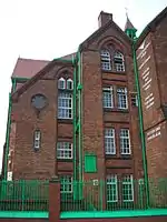 The Listed Building (formerly Floodgate School), Digbeth Campus, South Birmingham College - a former Birmingham board school |
| Perrot's Folly - The Monument (observatory) | Edgbaston | Folly | 1758 | 25 April 1952 | SP0476886277 52°28′28″N 1°55′52″W |
1076123 |  Perrot's Folly - The Monument (observatory) |
| The Old Crown Public House | Deritend | Jettied House | 1368 | 25 April 1952 | SP0801886323 52°28′29″N 1°53′00″W |
1076298 | |
| The Old Stone House | Sutton Coldfield | House | Early 16th century | 18 October 1949 | SP1187495270 52°33′19″N 1°49′35″W |
1075806 | |
| The Red Lion Public House | Handsworth | Public House | 1901-2 | 17 January 1985 | SP0430489589 52°30′15″N 1°56′17″W |
1276278 | |
| Saracen's Head | Kings Norton | Courtyard | Late 15th century | 25 April 1952 | SP0491478901 52°24′29″N 1°55′45″W |
1343450 | |
| Singers Hill Synagogue | City Centre | Courtyard | 1856 | 21 January 1970 | SP0664386416 52°28′32″N 1°54′13″W |
1075712 | |
| Trust School | Yardley | House | 19th century | 25 April 1952 | SP1350086268 52°28′27″N 1°48′10″W |
1343388 | .jpg.webp) Trust School |
| Vesey Cottage | High Heath | House | Early 16th century | 18 October 1949 | SP1442597760 52°34′39″N 1°47′19″W |
1075772 | |
| Vesey Grange | High Heath | House | Early 16th century | 26 August 1976 | SP1344499106 52°35′23″N 1°48′11″W |
1320023 | |
| Water Orton Bridge (that Part in the City of Birmingham) | Birmingham | Bridge | 1520 | 18 October 1949 | SP1740691424 52°31′14″N 1°44′42″W |
1075812 | |
| 54–57, Albion Street B1 | Hockley | Terrace | 1837 | 8 July 1982 | SP0603187461 52°29′06″N 1°54′45″W |
1075759 | |
| 12 New Market Street/45 Great Charles Street Queensway B3 | City Centre | Building | 1895 | 21 January 1970 | SP0671687198 52°28′58″N 1°54′09″W |
1075582 |  12 New Market Street/45 Great Charles Street Queensway B3 |
| 93 Cornwall Street B3 | City Centre | House | 1902 | 21 January 1970 | SP0665387072 52°28′54″N 1°54′12″W |
1075645 | .jpg.webp) 93 Cornwall Street B3 |
| 100 Sampson Road B11 | Sparkhill | Apartment | 1982 | 8 July 1982 | SP0870585151 52°27′51″N 1°52′24″W |
1076179 | |
| 17 & 19, Rotton Park Road B16 | Edgbaston | Semi Detached House | 1896 | 8 July 1982 | SP0390986212 52°28′26″N 1°56′38″W |
1076203 |  17 & 19, Rotton Park Road B16 |
| 12 Ampton Road B15 | Edgbaston | House | 1855 | 22 April 1976 | SP0562285228 52°27′54″N 1°55′07″W |
1075740 | |
| 36 Calthorpe Road B15 | Edgbaston | Villa | 1835 | 21 January 1970 | SP0541485609 52°28′06″N 1°55′18″W |
1075700 | |
| 44 Waterloo Street B2 | City Centre | House | 1900 | 5 November 1981 | SP0690886973 52°28′50″N 1°53′59″W |
1211181 | 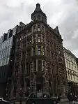 44 Waterloo Street B2 |
| 56, 58, & 60 Newhall Street B3 | City Centre | House | circa 1900 | 21 January 1970 | SP0665887110 52°28′55″N 1°54′12″W |
1219711 | .jpg.webp) 56, 58, & 60 Newhall Street B3 |
| 35 Calthorpe Road B15 | Edgbaston | Villa | circa 1835 | 21 January 1970 | SP0540585583 52°28′05″N 1°55′19″W |
1220385 |  35 Calthorpe Road B15 |
| 57 & 59 Church Street B3 | City Centre | Building | 1909 | 8 July 1982 | SP0679587251 52°28′59″N 1°54′05″W |
1221016 | |
| 85 & 87 Cornwall Street B3 | City Centre | House | 1899 | 21 January 1970 | SP0665687093 52°28′54″N 1°54′12″W |
1290474 | .jpg.webp) 85 & 87 Cornwall Street B3 |
| 41 & 43 Church Street B3 | City Centre | House | 1900 | 21 January 1970 | SP0683587205 52°28′58″N 1°54′03″W |
1290722 | .jpg.webp) 41 & 43 Church Street B3 |
| Former Icknield Street School, 303 Icknield Street B18 (a former Birmingham board school} | Hockley | Teacher's House | 1883 | 16 September 1981 | SP0583588442 52°29′38″N 1°54′56″W |
1291556 | 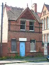 Former Icknield Street School, 303 Icknield Street B18 (a former Birmingham board school} |
| 6 Bennett's Hill B2 | City Centre | Detached House | 1827 | 21 January 1970 | SP0683686951 52°28′50″N 1°54′03″W |
1343350 | 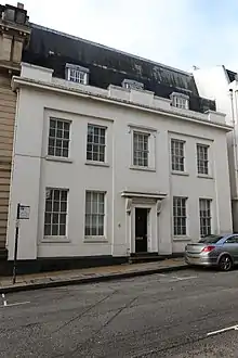 6 Bennett's Hill B2 |
| 89 & 91 Cornwall Street B3 | City Centre | House | 1904 | 21 January 1970 | SP0665287088 52°28′54″N 1°54′13″W |
1343379 | .jpg.webp) 89 & 91 Cornwall Street B3 |
| 9, 10, & 11 Legge Lane | Jewellery Quarter | Jewellery Workshop | 1891-2 | 29 April 2004 | SP0596887389 52°29′04″N 1°54′49″W |
1391290 |  9, 10, & 11 Legge Lane |
| 95 Cornwall Street B3 | City Centre | House | 1901 | 21 January 1970 | SP0665087067 52°28′53″N 1°54′13″W |
1210401 | .jpg.webp) 95 Cornwall Street B3 |
| 98 Edmund Street B3 | City Centre | Office | 1875 | 21 January 1970 | SP0670387038 52°28′52″N 1°54′10″W |
1210578 | 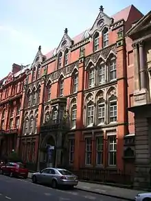 98 Edmund Street B3 |
.jpg.webp)

.jpg.webp)

.jpg.webp)

.jpg.webp)
.jpg.webp)
.jpg.webp)


.jpg.webp)


.jpg.webp)
.jpg.webp)


%252C_Kings_Norton.jpg.webp)

City of Wolverhampton
| Name | Location | Type | Completed [note 1] | Date designated | Grid ref.[note 2] Geo-coordinates |
Entry number [note 3] | Image |
|---|---|---|---|---|---|---|---|
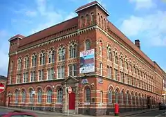
| Wolverhampton Art Gallery and Museum | Wolverhampton | Art Gallery | 1883-5 | 12 February 1975 | SO9149898773 52°35′12″N 2°07′37″W |
1201828 | |
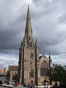
| Catholic Church of St Mary and St John | Wolverhampton | Roman Catholic Church | 1851-5 | 16 July 1949 | SO9160698206 52°34′54″N 2°07′31″W |
1208140 | |
| Catholic Church of St Peter and St Paul | Wolverhampton | Roman Catholic Church | 1826-1828 | 16 July 1949 | SO9125798890 52°35′16″N 2°07′50″W |
1201844 | |
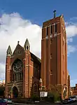
| Central Library | Wolverhampton | Public Library | 1900-1902 | 3 February 1977 | SO9161998376 52°34′59″N 2°07′30″W |
1201811 | 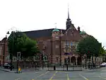 Central Library |
| Church of St Bartholemew | Penn | Church | 14th century | 3 February 1977 | SO8945295281 52°33′19″N 2°09′25″W |
1201886 | 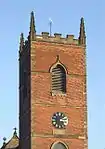 Church of St Bartholemew |
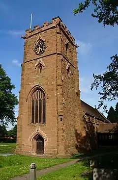
| Church of St John | Wolverhampton | Anglican Church | 1758-76 | 3 February 1977 | SO9142698162 52°34′52″N 2°07′41″W |
1201864 | 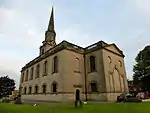 Church of St John |
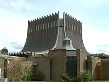
| Church of St Luke | Wolverhampton | Church | 1860-1 | 31 March 1992 | SO9132197172 52°34′20″N 2°07′46″W |
1293038 |  Church of St Luke |
| Church of St Mary | Wolverhampton | Bust | 19th century | 16 July 1949 | SJ9244702469 52°37′12″N 2°06′47″W |
1201786 |  Church of St Mary |
| Church of St Mary | Bilston | Church | 1827-9 | 3 February 1977 | SO9548296232 52°33′50″N 2°04′05″W |
1201850 |  Church of St Mary |
| County Court | Wolverhampton | Assembly Rooms | 1829 | 3 February 1977 | SO9168398643 52°35′08″N 2°07′27″W |
1207819 | 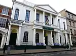 County Court |
| Giffard House | Wolverhampton | House | Mid 19th century | 16 July 1949 | SO9127198898 52°35′16″N 2°07′49″W |
1282478 | 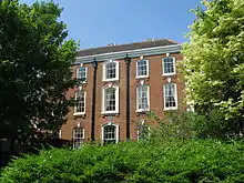 Giffard House |
| Graisley Old Hall | Wolverhampton | House | Late 15th century | 16 September 1957 | SO9052497334 52°34′25″N 2°08′29″W |
1205291 | |
| Grand Theatre | Wolverhampton | Theatre | 1893-4 | 12 February 1975 | SO9168498746 52°35′11″N 2°07′27″W |
1282471 | 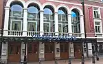 Grand Theatre |
| Greyhound and Punchbowl Inn | Bilston | Jettied House | Mid 16th century, possibly earlier | 20 June 1952 | SO9462496244 52°33′50″N 2°04′51″W |
1201819 | 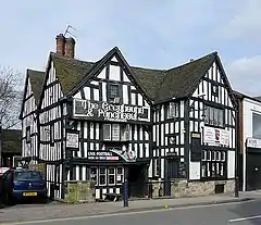 Greyhound and Punchbowl Inn |
| Methodist Church | Wolverhampton | Parish Hall | 1870s | 3 February 1977 | SO9114698594 52°35′06″N 2°07′56″W |
1201807 | |
| Molineux Hotel | Wolverhampton | House | circa 1720 | 16 July 1949 | SO9131599188 52°35′26″N 2°07′47″W |
1282475 | |
| Moseley Hall | Wolverhampton | House | Early 18th century | 16 July 1949 | SJ9305103977 52°38′01″N 2°06′15″W |
1298757 |  Moseley Hall |
| Old Fallings Hall (our Lady and St Chad Roman Catholic School) | Wolverhampton | House | Early 18th century and possibly earlier | 16 July 1949 | SJ9280401456 52°36′39″N 2°06′28″W |
1201846 | |
| Old Malt House to North of Wightwick Manor | Wolverhampton | Malt House | Late 16th century or early 17th century | 29 July 1950 | SO8695698465 52°35′02″N 2°11′38″W |
1208976 | |
| Penn Hall | Penn | House | Late 17th century | 16 July 1949 | SO8910395402 52°33′23″N 2°09′44″W |
1282460 | |
| Tettenhall Towers | Tettenhall | House | circa 1770 | 29 July 1950 | SO8863499755 52°35′44″N 2°10′09″W |
1201906 | |
| The Old House | Tettenhall | House | 1995 | 29 July 1950 | SO8879599920 52°35′49″N 2°10′01″W |
1205595 | |


Dudley
| Name | Location | Type | Completed [note 1] | Date designated | Grid ref.[note 2] Geo-coordinates |
Entry number [note 3] | Image |
|---|---|---|---|---|---|---|---|
| Brown Bear Ravine at Dudley Zoo (including All Associated Structures) | Dudley | Bear Enclosure | 1935-1937 | 20 August 1970 | SO9480490913 52°30′58″N 2°04′41″W |
1227748 | |
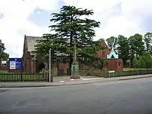
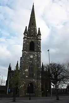
| Church of All Saints | Dudley | Church | Rebuilt 1826-9 | 11 August 1950 | 52°32′26″N 2°07′22″W | 1279405 | 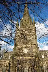 Church of All Saints |
| Church of St Edmund | Dudley | Parish Church | circa 1724 | 14 September 1949 | SO9464790451 52°30′43″N 2°04′49″W |
1287455 | 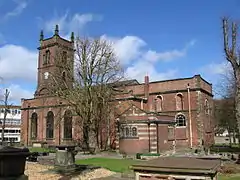 Church of St Edmund |
| Drinking Fountain | Dudley | Drinking Fountain | 1867 | 14 September 1949 | SO9449890278 52°30′37″N 2°04′57″W |
1343214 | |
| Entrance Gateway at Dudley Zoo | Dudley | Zoo | 1935-1937 | 20 August 1970 | SO9482690596 52°30′48″N 2°04′40″W |
1216535 | |
| Fan House and Chimney at the Former New Hawne Colliery | Halesowen | Colliery | 1865 | 8 October 1975 | SO9569784632 52°27′35″N 2°03′53″W |
1063766 | |
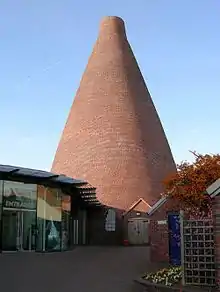
| Glass Cone at Stuart and Sons Red House Glassworks | Wordsley | Glass furnace cone | 18th century | 23 September 1966 | SO8943386486 52°28′34″N 2°09′25″W |
1076007 | |
| Holbeache House | Kingswinford | House | circa 1600 | 14 June 1951 | SO8847090490 52°30′44″N 2°10′17″W |
1228293 | |
| Kiosk to East of Former Brown Bear Pit at Dudley Zoo | Dudley | Kiosk | 1935-1937 | 20 August 1970 | SO9482090920 52°30′58″N 2°04′40″W |
1076024 | |
| Kiosk to South of Bear Pit at Dudley Zoo | Dudley | Kiosk | 1935-1937 | 20 August 1970 | SO9459490657 52°30′50″N 2°04′52″W |
1227903 | |
| Old Swinford Hospital | Dudley | School | 1667 | 8 November 1949 | SO9029583652 52°27′03″N 2°08′39″W |
1076037 | |
| Parish Church of St Thomas | Dudley | Parish Church | 1815-18 | 14 September 1949 | SO9421790082 52°30′31″N 2°05′12″W |
1075998 | |
| Polar Bear Pit and Lion and Tiger Ravines, Dudley Zoo | Dudley | Wild Cat Enclosure | 1935-1937 | 20 August 1970 | SO9460490706 52°30′51″N 2°04′51″W |
1076027 |  Polar Bear Pit and Lion and Tiger Ravines, Dudley Zoo |
| The Grange | Dudley | House | Early-mid 18th century | 10 January 1950 | SO9704482821 52°26′36″N 2°02′42″W |
1063763 | |
| The Old Foundry | Dudley | Fireproof Building | 1820 | 8 March 1983 | SO8946984770 52°27′39″N 2°09′23″W |
1262873 |  The Old Foundry |
| The Town Hall, Coroner's Court, Former Sessions Court and Brooke Robinson Museum | Dudley | Tower | 1924-1928 | 14 May 2010 | SO9436190407 52°30′41″N 2°05′04″W |
1393884 | |
| Tropical Bird House at Dudley Zoo | Dudley | Aviary | 1935-1937 | 20 August 1970 | SO9472990942 52°30′59″N 2°04′45″W |
1227761 |  Tropical Bird House at Dudley Zoo |
| Wordsley Manor | Wordsley | Country House | Late 18th century | 9 April 1976 | SO8917786488 52°28′34″N 2°09′39″W |
1228358 | |
| 29 & 30 Wolverhampton Street | Dudley | House | 1707 | 14 September 1949 | SO9422490286 52°30′38″N 2°05′12″W |
1228896 | |
| Stourbridge War Memorial | Stourbridge | War memorial | 1923 | 30 October 1989 | SO8985083533 52°26′59″N 2°09′03″W |
1116647 | %252C_Mary_Stevens_Park%252C_Stourbridge_(geograph_3847000).jpg.webp) Stourbridge War Memorial |
Sandwell
| Name | Location | Type | Completed [note 1] | Date designated | Grid ref.[note 2] Geo-coordinates |
Entry number [note 3] | Image |
|---|---|---|---|---|---|---|---|
| Corngreaves Hall | Cradley Heath | House | 18th century | 12 June 1981 | SO9527684887 52°27′43″N 2°04′15″W |
1077140 | _(2).jpg.webp) Corngreaves Hall |
| Engine Arm Aqueduct, Birmingham Canal Wolverhampton Level | Smethwick | Aqueduct | 1828 | 8 February 2007 | SP0237188894 52°29′53″N 1°57′59″W |
1391874 | .jpg.webp) Engine Arm Aqueduct, Birmingham Canal Wolverhampton Level |
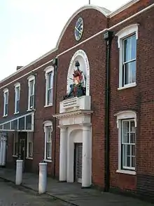
| Oak House | West Bromwich | House | Late 16th century | 25 February 1949 | SO9980590851 52°30′56″N 2°00′15″W |
1228226 | |
| Smethwick Old Church | Smethwick | Church | 1732 | 21 March 1949 | SP0200187646 52°29′12″N 1°58′19″W |
1287916 | |
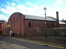
| Soho Foundry, former Boulton and Watt foundry pattern stores and erecting shops | Smethwick | Foundry | 1794-1795 | 26 June 1996 | SP0352788844 52°29′51″N 1°56′58″W |
1268451 | 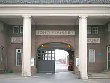 Soho Foundry, former Boulton and Watt foundry pattern stores and erecting shops |
| Summit Bridge | Smethwick | Road Bridge | 1788-89 | 8 February 2007 | SP0158389430 52°30′10″N 1°58′41″W |
1391875 | |
| The Big House | Oldbury | House | Early 18th century | 18 January 1950 | SO9899889711 52°30′19″N 2°00′58″W |
1077139 | .jpg.webp) The Big House |
| The Waterloo Hotel | Smethwick | Public House | 1907 | 24 February 1995 | SP0277587622 52°29′11″N 1°57′38″W |
1261644 | .jpg.webp) The Waterloo Hotel |
.jpg.webp)
.jpg.webp)
.jpg.webp)
Solihull
| Name | Location | Type | Completed [note 1] | Date designated | Grid ref.[note 2] Geo-coordinates |
Entry number [note 3] | Image |
|---|---|---|---|---|---|---|---|
| Knowle Hall | Balsall Common | Country House | 1820s | 22 July 1976 | SP1923576256 52°23′02″N 1°43′08″W |
1054084 | |
| Magpie Farmhouse | Balsall Common | Farmhouse | Mid 16th century | 11 November 1952 | SP2221676834 52°23′21″N 1°40′30″W |
1187132 | |
| North East Range at the Lady Katherine Leveson Hospital, South West Range at the Lady Katherine Leveson Hospital | Temple Balsall | Courtyard | 1677 | 11 November 1952 | SP2073376046 52°22′55″N 1°41′49″W |
1075996 |  North East Range at the Lady Katherine Leveson Hospital, South West Range at the Lady Katherine Leveson Hospital |
| Oldwich House Farmhouse | Balsall Common | Farmhouse | Early 16th century | 11 November 1952 | SP2176374197 52°21′55″N 1°40′55″W |
1343209 | |
| Templars Hall | Temple Balsall | Templars Preceptory | 13th or 14th century | 11 November 1952 | SP2066975966 52°22′53″N 1°41′52″W |
1040041 |  Templars Hall |
| Temple House | Temple Balsall | House | Early 18th century | 11 November 1952 | SP2070975948 52°22′52″N 1°41′50″W |
1343227 |  Temple House |
| Church of Saint Swithin | Barston | Church | Rebuilt 1721 | 8 September 1961 | SP2074478011 52°23′59″N 1°41′48″W |
1075964 | 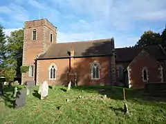 Church of Saint Swithin |
| Eastcote Hall | Barston | House | 15th century | 11 November 1952 | SP1901079246 52°24′39″N 1°43′19″W |
1075961 | |
| Berkswell Hall | Berkswell | Country House | Early-to-mid 19th century | 22 July 1976 | SP2413979403 52°24′44″N 1°38′48″W |
1075969 |  Berkswell Hall |
| Berkswell Windmill | Berkswell | Windmill | Early 19th century | 18 July 1972 | SP2491275920 52°22′51″N 1°38′08″W |
1054782 | 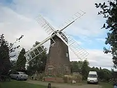 Berkswell Windmill |
| Lavender Hall Farmhouse | Berkswell | Farmhouse | 16th century | 11 November 1952 | SP2394378104 52°24′02″N 1°38′58″W |
1075943 | |
| Ram Hall | Berkswell | House | 16th century | 11 November 1952 | SP2467278268 52°24′07″N 1°38′20″W |
1045806 | |
| Park Farmhouse | Bickenhill | Farmhouse | Late 18th or early 19th century | 11 November 1952 | SP2065084038 52°27′14″N 1°41′51″W |
1367098 | |
| Gatepiers to Forecourt of Castle Bromwich Hall | Castle Bromwich | Gate | circa 1657 | 22 July 1976 | SP1429589696 52°30′18″N 1°47′27″W |
1367123 | |
| Pigeon House at Castle Bromwich Hall | Castle Bromwich | Dovecote | 1725 | 11 November 1952 | SP1432389807 52°30′22″N 1°47′25″W |
1342864 | |
| Stable Block at Castle Bromwich Hall | Castle Bromwich | Stable | Early 18th century | 11 November 1952 | SP1431389768 52°30′20″N 1°47′26″W |
1076752 | |
| Church of St Patrick | Cheswick Green | Church | 1860-1861 | 5 December 1949 | SP1227474890 52°22′19″N 1°49′16″W |
1342833 | |
| Diddington Farmhouse | Hampton-in-Arden | Farmhouse | Late 16th century | 11 November 1952 | SP2133782731 52°26′32″N 1°41′15″W |
1076766 | |
| Diddington Hall | Hampton-in-Arden | House | Late 16th century | 11 November 1952 | SP2148482539 52°26′25″N 1°41′07″W |
1055738 | |
| Packhorse Bridge over River Blythe | Hampton-in-Arden | Bridge | 15th century | 11 November 1952 | SP2133280118 52°25′07″N 1°41′16″W |
1345569 | 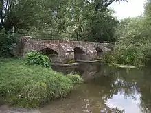 Packhorse Bridge over River Blythe |
| The Clock Tower Attached to Hampton Manor | Hampton-in-Arden | Steps | 1872 | 18 July 1972 | SP2011380880 52°25′32″N 1°42′20″W |
1261972 | |
| The Moat House | Hampton-in-Arden | House | 17th century | 11 November 1952 | SP2021280774 52°25′28″N 1°42′15″W |
1057655 | |
| Walford Hall Farmhouse | Hampton-in-Arden | Farmhouse | 16th century | 11 November 1952 | SP1861280308 52°25′14″N 1°43′40″W |
1342830 | |
| Forest Hall | Meriden | Club | 1788 | 11 November 1952 | SP2351582512 52°26′24″N 1°39′20″W |
1076738 | |
| Meriden Hall | Meriden | Apartment | 1976 | 11 November 1952 | SP2434281857 52°26′03″N 1°38′36″W |
1076737 | |
| Pavilion at Forest Hall | Meriden | Pavilion | Early 19th century | 22 July 1976 | SP2344282565 52°26′26″N 1°39′24″W |
1038283 | |
| Walsh Hall | Meriden | House | 16th century | 11 November 1952 | SP2508782683 52°26′30″N 1°37′57″W |
1076749 | |
| Bogay Hall | Solihull | House | 1883 | 22 July 1976 | SP1785279890 52°25′00″N 1°44′20″W |
1076716 | |
| Chester House | Knowle | House | circa 1400 | 5 December 1949 | SP1812976854 52°23′22″N 1°44′06″W |
1076702 | |
| Dovehouse Farmhouse | Solihull | Farmhouse | circa 1500 | 14 April 1972 | SP1403681515 52°25′53″N 1°47′42″W |
1031375 | |
| Hillfield Hall | Solihull | House | 1576 | 5 December 1949 | SP1505878101 52°24′03″N 1°46′48″W |
1076717 | |
| Malvern Hall | Solihull | House | circa 1690 | 5 December 1949 | SP1595079052 52°24′33″N 1°46′01″W |
1031791 | |
| Malvern Park Farmhouse | Solihull | Farmhouse | 18th century | 5 December 1949 | SP1535578484 52°24′15″N 1°46′33″W |
1342882 | |
| Old Berry Hall | Solihull | House | Late 15th century | 5 December 1949 | SP1703279697 52°24′54″N 1°45′04″W |
1342852 | |
| Ravenshaw Hall | Solihull | House | 15th century | 5 December 1949 | SP1721779279 52°24′40″N 1°44′54″W |
1203384 | |
| The Guild House | Knowle | House | 1912 | 5 December 1949 | SP1820876732 52°23′18″N 1°44′02″W |
1281619 | |
| The Old Grammar School | Solihull | House | Mid 18th century | 5 December 1949 | SP1551979306 52°24′42″N 1°46′24″W |
1076728 | |
| Tudor Grange House and Stable Block | Solihull | House | 1887 | 24 October 2008 | SP1411378936 52°24′30″N 1°47′38″W |
1392959 | |
| 126 High Street | Solihull | House | 18th century | 5 December 1949 | SP1524079406 52°24′45″N 1°46′39″W |
1025870 | |
Walsall
| Name | Location | Type | Completed [note 1] | Date designated | Grid ref.[note 2] Geo-coordinates |
Entry number [note 3] | Image |
|---|---|---|---|---|---|---|---|
| Church of St Mary and Attached Presbytery | Walsall | Church | 1825 | 31 July 1986 | SP0121698031 52°34′48″N 1°59′01″W |
1077171 |  Church of St Mary and Attached Presbytery |
| Church of St Mary the Virgin | Brownhills | Church | 14th century | 11 August 1951 | SK0601400735 52°36′16″N 1°54′45″W |
1076396 |  Church of St Mary the Virgin |
| Church of St Matthew | Walsall | Church | Late 15th century | 19 November 1951 | SP0163998293 52°34′57″N 1°58′38″W |
1116151 |  Church of St Matthew |
| Gatehouse and Curtain Walls at Rushall Hall | Rushall | Gate | circa 1300 | 19 October 1951 | SP0254399865 52°35′48″N 1°57′50″W |
1320329 | |
| Great Barr Hall and Chapel | Great Barr | House | 1777 | 15 June 1971 | SP0546595385 52°33′23″N 1°55′15″W |
1076395 | |
| Guildhall | Walsall | Guildhall | 1867 | 13 September 1982 | SP0152898378 52°35′00″N 1°58′44″W |
1076399 |  Guildhall |
See also
- Category:Grade II* listed buildings in the West Midlands (county)
- Grade I listed buildings in the West Midlands#Birmingham
- Listed pubs in Birmingham
Notes
- The date given is the date used by Historic England as significant for the initial building or that of an important part in the structure's description.
- Sometimes known as OSGB36, the grid reference is based on the British national grid reference system used by the Ordnance Survey.
- The "List Entry Number" is a unique number assigned to each listed building and scheduled monument by Historic England.
References
External links
![]() Media related to Grade II* listed buildings in the West Midlands (county) at Wikimedia Commons
Media related to Grade II* listed buildings in the West Midlands (county) at Wikimedia Commons
This article is issued from Wikipedia. The text is licensed under Creative Commons - Attribution - Sharealike. Additional terms may apply for the media files.