Grade II* listed buildings in Cotswold (district)
There are over 20,000 Grade II* listed buildings in England. This page is a list of these buildings in the district of Cotswold in Gloucestershire.
List of buildings
| Name | Location | Type | Completed [note 1] | Date designated | Grid ref.[note 2] Geo-coordinates |
Entry number [note 3] | Image |
|---|---|---|---|---|---|---|---|
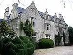
| Adlestrop Park | Adlestrop Park, Adlestrop | House | Mid-17th century | 25 August 1960 | SP2439426865 51°56′23″N 1°38′48″W |
1154355 | 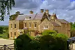 Adlestrop Park |
| Monument with railings to Warren Hastings in the churchyard of the Church of St Peter c. 1 metre east of east end of chancel | Daylesford, Adlestrop | Commemorative monument | 1818 | 30 January 1987 | SP2431325892 51°55′52″N 1°38′52″W |
1089802 | 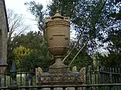 Monument with railings to Warren Hastings in the churchyard of the Church of St Peter c. 1 metre east of east end of chancel |
| Church of St Peter | Ampney St Peter | Church | Late Saxon | 26 November 1958 | SP0818601520 51°42′44″N 1°52′59″W |
1089929 | 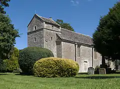 Church of St Peter |
| Gates, gate piers and railings at former west entrance to Sandywell Park | Andoversford | Gate | 18th century | 11 February 1986 | SP0088520192 51°52′49″N 1°59′19″W |
1089390 | 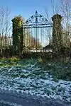 Gates, gate piers and railings at former west entrance to Sandywell Park |
| Sandywell Park | Andoversford | Country house | c.1704 | 23 January 1952 | SP0138120255 51°52′51″N 1°58′53″W |
1341317 |  |
| Ashley Manor | Ashley | Farmhouse | 15th century | 6 September 1954 | ST9313094708 51°39′04″N 2°06′03″W |
1089747 | |
| Church of St James | Ashley | Church | Norman | 6 September 1954 | ST9317294712 51°39′04″N 2°06′00″W |
1341134 | |
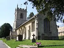
| Church of St Andrew | Aston-sub-Edge | Anglican church | 1797 | 25 August 1960 | SP1383541628 52°04′22″N 1°47′58″W |
1341748 | 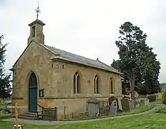 Church of St Andrew |
| Manor Farmhouse | Aston-sub-Edge | Farmhouse | 16th century | 25 August 1960 | SP1390641644 52°04′23″N 1°47′55″W |
1341752 | 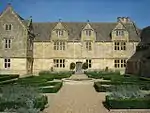 Manor Farmhouse |
| Church of St Mary | Barnsley | Anglican church | 12th century | 26 November 1958 | SP0772905095 51°44′40″N 1°53′22″W |
1303501 | 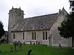 Church of St Mary |
| Barnsley House | Barnsley | House | Late 17th century | 4 June 1952 | SP0767804929 51°44′35″N 1°53′25″W |
1341249 | |
| Gothic summerhouse at Barnsley House | Barnsley | Summerhouse | c.1770 | 4 June 1952 | SP0768504868 51°44′33″N 1°53′24″W |
1089497 | |
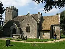
| Church of St Mary | Barrington | Anglican church | Late 12th century | 26 January 1961 | SP2051813482 51°49′11″N 1°42′13″W |
1090369 | 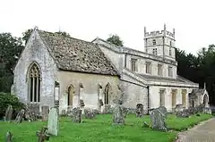 Church of St Mary |
| Clairvoyée, gate and piers set within the eastern boundary wall of Barrington Park | Barrington Park, Barrington | Gate | 18th century | 23 January 1952 | SP2066913952 51°49′26″N 1°42′05″W |
1090368 |  Clairvoyée, gate and piers set within the eastern boundary wall of Barrington Park |
| Dovecote c. 400 metres north of Barrington Park | Barrington Park, Barrington | Dovecote | 18th century | 28 May 1987 | SP2023513936 51°49′25″N 1°42′28″W |
1340832 | 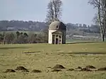 Dovecote c. 400 metres north of Barrington Park |
| Gate piers and flanking wall to Barrington Park Estate | Barrington | Gate piers | 18th century | 28 May 1987 | SP1992412051 51°48′24″N 1°42′45″W |
1340829 | |
| Gothic temple c. 230m south-west of Barrington Park House | Barrington Park, Barrington | Garden temple | Mid-18th century | 28 May 1987 | SP2014913477 51°49′10″N 1°42′33″W |
1340831 | |
| Roman Doric temple circa 50m south of the walled garden | Barrington Park, Barrington | Garden temple | Mid-18th century | 28 May 1987 | SP2056013370 51°49′07″N 1°42′11″W |
1172331 | |
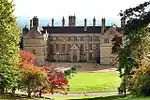
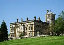
| Batsford Park | Batsford Estate, Batsford | Manor house | 1888–92 | 25 August 1960 | SP1858033692 52°00′05″N 1°43′51″W |
1089576 | |
| Church of St Mary | Batsford | Church | 1861–62 | 25 August 1960 | SP1869233890 52°00′11″N 1°43′45″W |
1341210 | 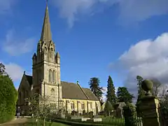 Church of St Mary |
| Church of St Mary Magdalene | Baunton | Anglican church | 12th century | 26 November 1958 | SP0216904674 51°44′27″N 1°58′12″W |
1340878 | 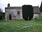 Church of St Mary Magdalene |
| Barn approx. 50m west of Manor Farmhouse | Ablington, Bibury | Barn | Mid–late 16th century | 23 January 1952 | SP1041207669 51°46′03″N 1°51′02″W |
1155118 |  Barn approx. 50m west of Manor Farmhouse |
| Group of 6 monuments in the churchyard approx. 5m south of nave and west of porch to Church of St Mary | Bibury | Gravestone | 17th/18th century | 5 February 1987 | SP1181006497 51°45′25″N 1°49′49″W |
1155814 | 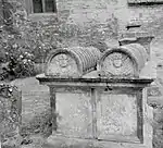 Group of 6 monuments in the churchyard approx. 5m south of nave and west of porch to Church of St Mary |
| The Pigeon House | Bibury | House | Early 16th century | 23 January 1952 | SP1177706756 51°45′34″N 1°49′51″W |
1078800 | |
| Elizabeth Pengree Memorial | Blockley | Commemorative monument | 1770s | 26 August 1983 | SP1648234906 52°00′44″N 1°45′41″W |
1341728 | |
| Norman Cottage Chapel | Aston Magna, Blockley | House | Later | 26 August 1983 | SP2012635707 52°01′10″N 1°42′29″W |
1153040 | |
| Old Manor Cottages | Paxford, Blockley | House | 17th century | 25 August 1960 | SP1861637826 52°02′19″N 1°43′48″W |
1341701 | |
| Orangery | Northwick Park, Blockley | Orangery | Late 17th century | 25 August 1960 | SP1673536403 52°01′33″N 1°45′27″W |
1304221 | |
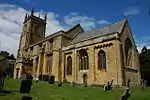
| Parish Church of Saint Peter and Saint Paul | Blockley | Parish church | Late 12th century | 25 August 1960 | SP1646234920 52°00′45″N 1°45′42″W |
1153981 | |
| Paxford House | Paxford House, Blockley | House | 1729 | 25 August 1960 | SP1846037760 52°02′17″N 1°43′56″W |
1341721 | |
| The Manor House | Blockley | Bishop's summer palace | Rebuilt before 1539 | 25 August 1960 | SP1648034896 52°00′44″N 1°45′41″W |
1153475 | |
| Upton Wold House | Blockley | House | Late 17th century | 25 August 1960 | SP1635335032 52°00′49″N 1°45′47″W |
1088633 | |
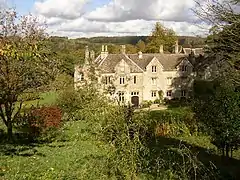
| Bourton House | Bourton-on-the-Hill | Manor house | Late 16th century | 11 January 1985 | SP1773632463 51°59′25″N 1°44′35″W |
1089559 |  Bourton House |
| Diamond Lodge | Sezincote Park, Bourton-on-the-Hill | Lodge | c.1805 | 25 August 1960 | SP1759731640 51°58′59″N 1°44′43″W |
1305446 | 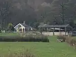 Diamond Lodge |
| Baines House | Bourton-on-the-Water | House | 17th century | 25 August 1960 | SP1662020511 51°52′58″N 1°45′36″W |
1341627 | |
| Harrington House | Bourton-on-the-Water | Country house | c.1730 | 25 August 1960 | SP1666820586 51°53′01″N 1°45′33″W |
1171024 | 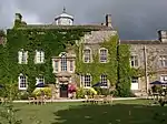 Harrington House |
| Screen walls and gate piers of Harrington House | Bourton-on-the-Water | Gate | c.1730 | 25 August 1960 | SP1664720594 51°53′01″N 1°45′34″W |
1088747 | |
| Church of St Lawrence | Bourton-on-the-Water | Church | 14th century | 25 August 1960 | SP1669520863 51°53′10″N 1°45′32″W |
1170801 | 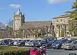 Church of St Lawrence |
| Gates and Gatepiers to the Church of St Lawrence | Bourton-on-the-Water | Gate | Late 19th century | 12 August 1983 | SP1666820840 51°53′09″N 1°45′33″W |
1088766 | 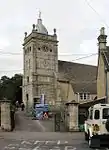 Gates and Gatepiers to the Church of St Lawrence |
| John Jordan bale tomb to south of church | Bourton-on-the-Water | Table tomb | 1774 | 12 August 1983 | SP1671020849 51°53′09″N 1°45′31″W |
1088767 | |
| Sherborne Terrace | Bourton-on-the-Water | Terrace | Mid-17th century | 25 August 1960 | SP1662520601 51°53′01″N 1°45′36″W |
1341623 | 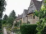 Sherborne Terrace |
| Boxwell Court | Boxwell, Boxwell with Leighterton | Country house | 15th or 16th century | 6 September 1954 | ST8120792715 51°37′59″N 2°16′23″W |
1090042 | |
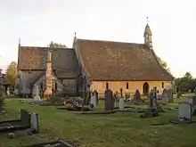
| Church of St Andrew | Leighterton, Boxwell with Leighterton | Parish church | 13th century | 6 September 1954 | ST8237191073 51°37′06″N 2°15′22″W |
1154749 | 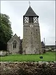 Church of St Andrew |
| Church of St Mary | Boxwell, Boxwell with Leighterton | Parish church | 13th century | 6 September 1954 | ST8122692701 51°37′58″N 2°16′22″W |
1154676 | |
| Group of 3 monuments in the churchyard approx. 2m south of Church of St Mary | Boxwell, Boxwell with Leighterton | Tomb | 1751 | 1 May 1986 | ST8123092687 51°37′58″N 2°16′21″W |
1090041 | |
| Two connected barns east of Church Farmhouse | Leighterton, Boxwell with Leighterton | Dovecote | 1733 | 6 September 1954 | ST8236490957 51°37′02″N 2°15′22″W |
1341011 | 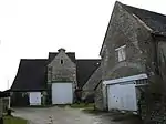 Two connected barns east of Church Farmhouse |
| Unidentified monument in the churchyard approximately 5 metres south-east of porch to Church of St Andrew | Leighterton, Boxwell with Leighterton | Tomb | 1700 | 1 May 1986 | ST8237391063 51°37′05″N 2°15′22″W |
1303672 | |
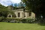
| Church of St Paul | Broadwell | Church | 12th century | 25 August 1960 | SP2004927701 51°56′51″N 1°42′35″W |
1089777 | 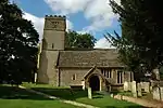 Church of St Paul |
| Row of 6 Chadwell monuments in the churchyard of the Church of St Paul c.2.5 metres south of east end of chancel | Broadwell | Chest tomb | Early 17th century | 30 January 1987 | SP2001127705 51°56′51″N 1°42′37″W |
1341113 | 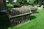 Row of 6 Chadwell monuments in the churchyard of the Church of St Paul c.2.5 metres south of east end of chancel |
| The Manor House | Broadwell | Manor house | Rebuilt 1757 | 25 August 1960 | SP2003827631 51°56′49″N 1°42′36″W |
1089783 | |
| Badger's Hall | Chipping Campden | House | Mid-17th century | 25 August 1960 | SP1512239143 52°03′02″N 1°46′51″W |
1342033 | 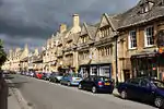 Badger's Hall |
| Bedfont House, Woodward House | Chipping Campden | Town house | c.1740 | 25 August 1960 | SP1526539279 52°03′06″N 1°46′44″W |
1078416 | 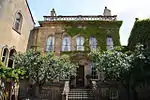 Bedfont House, Woodward House |
| Campden House | Chipping Campden | Country house | 1628 | 25 August 1960 | SP1332237739 52°02′16″N 1°48′26″W |
1078464 | |
| Court House | Chipping Campden | House | 18th century | 25 August 1960 | SP1535639279 52°03′06″N 1°46′39″W |
1342016 | 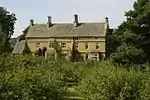 Court House |
| Dovecote to north of Wool Barn | Westington, Chipping Campden | Dovecote | Late 17th or early 18th century | 25 August 1960 | SP1485638751 52°02′49″N 1°47′05″W |
1078360 | |
| East Banqueting House of Old Campden House | Chipping Campden | Banqueting house | Between 1612 and 1627 | 25 August 1960 | SP1554939350 52°03′08″N 1°46′29″W |
1341980 | 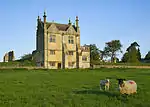 East Banqueting House of Old Campden House |
| Lodges, gates and archway to Old Campden Manor | Chipping Campden | Gate | c.1613 | 25 August 1960 | SP1545539407 52°03′10″N 1°46′34″W |
1341979 |  Lodges, gates and archway to Old Campden Manor |
| Elm Tree House | Chipping Campden | House | 1656 | 25 August 1960 | SP1494439063 52°02′59″N 1°47′01″W |
1342011 | 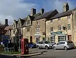 Elm Tree House |
| High Barn | Broad Campden, Chipping Campden | House | Early 17th century | 25 August 1960 | SP1604437783 52°02′18″N 1°46′03″W |
1078485 | |
| Island House and garden walls to east | Chipping Campden | House | 16th century | 25 August 1960 | SP1500439094 52°03′00″N 1°46′57″W |
1342029 | |
| Lloyds Bank and British Legion | Chipping Campden | Servicemens club | Early 18th century | 25 August 1960 | SP1523739241 52°03′05″N 1°46′45″W |
1342036 | |
| Midland Bank | Chipping Campden | Building | Early 18th century | 25 August 1960 | SP1503139115 52°03′01″N 1°46′56″W |
1078399 | |
| New Dover's House | Chipping Campden | Barn | 18th century | 4 July 1973 | SP1524439422 52°03′11″N 1°46′45″W |
1078422 | |
| Norman Chapel and boundary wall | Chipping Campden | Chapel | 1905–07 | 25 August 1960 | 49°46′01″N 7°33′26″W | 1341989 | |
| Stanford House | Chipping Campden | House | 1705 | 25 August 1960 | SP1529739408 52°03′10″N 1°46′42″W |
1341999 | |
| The Martins | Chipping Campden | House | 1660 | 25 August 1960 | SP1513639188 52°03′03″N 1°46′50″W |
1078434 | 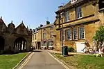 The Martins |
| The Old Silk Mill | Chipping Campden | Silk mill | 18th century | 8 June 1983 | SP1495638977 52°02′56″N 1°47′00″W |
1342026 | 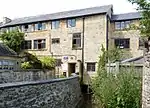 The Old Silk Mill |
| Tithe Barn to south of Campden House | Chipping Campden | Tithe barn | 1628 | 25 August 1960 | SP1332037675 52°02′14″N 1°48′26″W |
1078465 | |
| Town Hall | Chipping Campden | Town hall | 1897 | 25 August 1960 | SP1508439144 52°03′02″N 1°46′53″W |
1078401 | 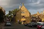 Town Hall |
| West Banqueting House to Old Campden House | Chipping Campden | Banqueting house | c.1627 | 25 August 1960 | SP1543739324 52°03′08″N 1°46′35″W |
1078461 | 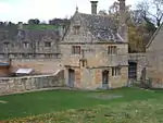 West Banqueting House to Old Campden House |
| Woolstaplers' House | Chipping Campden | House | Probably 14th/15th century | 25 August 1960 | SP1524639257 52°03′05″N 1°46′45″W |
1249083 | |
| Church of St Peter | Stratton, Cirencester | Church | Early 12th century | 14 June 1948 | SP0099603964 51°44′04″N 1°59′13″W |
1187408 | 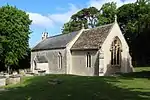 Church of St Peter |
| Church of the Holy Trinity | Cirencester | Church | 1847–51 | 23 July 1971 | SP0260701386 51°42′40″N 1°57′49″W |
1025128 | 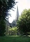 Church of the Holy Trinity |
| Cirencester Park Mansion and attached offices | Cirencester | House | Late 16th century | 14 June 1948 | SP0202602037 51°43′01″N 1°58′19″W |
1280239 | 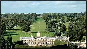 Cirencester Park Mansion and attached offices |
| Cirencester Park wall, gates, lodges and Corinium Museum of Roman Antiquities | Cirencester | Wall & museum | Early/mid-18th century | 5 June 1969 | SP0173501679 51°42′50″N 1°58′35″W |
1187523 | 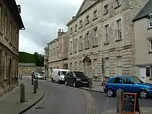 Cirencester Park wall, gates, lodges and Corinium Museum of Roman Antiquities |
| Alfred's Hall at SO972031 | Cirencester Park, Cirencester | Ruin | 1721 | 14 June 1948 | SO9720003100 51°43′36″N 2°02′31″W |
1298719 | 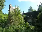 Alfred's Hall at SO972031 |
| Pope's Seat | Cirencester Park, Cirencester | Garden building | Early 18th century | 14 June 1948 | SO9992802376 51°43′12″N 2°00′09″W |
1204826 | 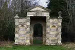 Pope's Seat |
| Queen Anne's Monument | Cirencester Park, Cirencester | Column | 1741 | 23 July 1971 | SP0061801769 51°42′53″N 1°59′33″W |
1187406 | 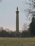 Queen Anne's Monument |
| Hexagon | Cirencester Park, Cirencester | Garden building | c.1736 | 14 June 1948 | SP0130702235 51°43′08″N 1°58′57″W |
1187402 | 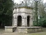 Hexagon |
| Ice house approx. 150m south-west of Cirencester Park Mansion | Cirencester Park, Cirencester | Icehouse | 18th century | 24 May 1993 | SP0189701841 51°42′55″N 1°58′26″W |
1298720 | |
| Ivy Lodge at SO990026 and attached farm buildings and wall | Cirencester Park, Cirencester | House | Early/mid-18th century | 23 July 1971 | SO9907602618 51°43′20″N 2°00′53″W |
1187404 |  Ivy Lodge at SO990026 and attached farm buildings and wall |
| Dollar Street House and attached steps, railing bases and ironwork | Cirencester | House | 1725 | 14 June 1948 | SP0217202296 51°43′10″N 1°58′12″W |
1280530 | |
| Friends' Meeting House | Cirencester | House | Early 19th century | 14 June 1948 | SP0207702245 51°43′08″N 1°58′17″W |
1206705 | |
| Frontiers | Cirencester | Apartment | 1694 | 14 June 1948 | SP0209702379 51°43′12″N 1°58′16″W |
1205997 | |
| No 5, Cecily Hill and attached garden wall | Cirencester | House | Late 17th/early 18th century | 14 June 1948 | SP0195402102 51°43′04″N 1°58′23″W |
1205204 | |
| Gosditch House | Cirencester | House | Early 18th century | 14 June 1948 | SP0225902116 51°43′04″N 1°58′07″W |
1187489 | |
| Lloyd's Bank | Cirencester | Bank (financial) | c.1780 | 14 June 1948 | SP0219101998 51°43′00″N 1°58′11″W |
1187425 | 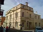 Lloyd's Bank |
| Mead House | Cirencester | Villa | Mid-18th century | 14 June 1948 | SP0203902253 51°43′08″N 1°58′19″W |
1187529 | |
| Obelisk at SP02130132 | Cirencester | Obelisk | 18th century | 23 July 1971 | SP0212801316 51°42′38″N 1°58′14″W |
1187413 | 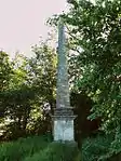 Obelisk at SP02130132 |
| Powell's School | Cirencester | School | c.1714 | 14 June 1948 | SP0211402354 51°43′12″N 1°58′15″W |
1280443 | |
| Sarcophagus approx. 18m east of north-east chapel of Church of St John the Baptist | Cirencester | Sarcophagus | 1790 | 24 May 1993 | SP0235802118 51°43′04″N 1°58′02″W |
1280234 | |
| The Old Barracks | Cirencester | Barracks | 1857 | 23 July 1971 | SP0182702155 51°43′05″N 1°58′30″W |
1187434 | |
| The Old Grammar School and forecourt wall | Cirencester | House | 1534–60 | 23 July 1971 | SP0209801993 51°43′00″N 1°58′16″W |
1280218 | |
| Weavers Hall | Cirencester | Almshouse | Late 15th century | 14 June 1948 | SP0212002295 51°43′10″N 1°58′15″W |
1187527 | 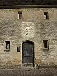 Weavers Hall |
| Woolgatherers and attached warehouse | Cirencester | House | Mid-/late 17th century | 14 June 1948 | SP0202502170 51°43′06″N 1°58′20″W |
1187448 | 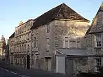 Woolgatherers and attached warehouse |
| 7 Cecily Hill | Cirencester | House | Early/mid-18th century | 14 June 1948 | SP0194502100 51°43′03″N 1°58′24″W |
1187430 | |
| 51 Coxwell Street | Cirencester | House | Late 17th/early 18th century | 14 June 1948 | SP0206802154 51°43′05″N 1°58′17″W |
1205625 | |
| 24, 26 and 28 Thomas Street | Cirencester | House | 15th century | 14 June 1948 | SP0199702172 51°43′06″N 1°58′21″W |
1298660 |  24, 26 and 28 Thomas Street |
| 9–17 Market Place | Cirencester | House | Mid-17th century | 14 June 1948 | SP0235102070 51°43′02″N 1°58′03″W |
1298687 | 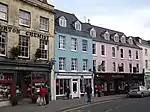 9–17 Market Place |
| 1 Querns Lane | Cirencester | House | 17th century | 15 September 2010 | SP0239701690 51°42′50″N 1°58′00″W |
1393966 | 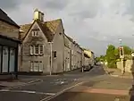 1 Querns Lane |
| 22 Thomas Street | Cirencester | Villa | Mid-/late 18th century | 14 June 1948 | SP0200802191 51°43′06″N 1°58′20″W |
1280091 | |
| 7 Gloucester Street | Cirencester | House | Mid-/late 17th century | 14 June 1948 | SP0210102370 51°43′12″N 1°58′16″W |
1187470 | |
| 2 Watermoor Road | Cirencester | House | Early 17th century | 14 June 1948 | SP0240801686 51°42′50″N 1°58′00″W |
1298592 | |
| 33 Gloucester Street | Cirencester | House | 16th century | 14 June 1948 | SP0207002412 51°43′14″N 1°58′17″W |
1187474 | 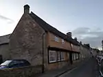 33 Gloucester Street |
| 3 Gosditch Street | Cirencester | House | Late 18th century | 14 June 1948 | SP0225202107 51°43′04″N 1°58′08″W |
1206144 |  3 Gosditch Street |
| 105 and 105b Gloucester Street | Cirencester | House | 1695 | 14 June 1948 | SP0197102518 51°43′17″N 1°58′22″W |
1280387 | |
| Church of St. James | Clapton on the Hill | Anglican church | Late 12th century | 25 August 1960 | SP1628217969 51°51′36″N 1°45′54″W |
1154435 | 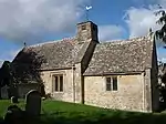 Church of St. James |
| Church of St Matthew | Coates | Anglican church | 13th century | 26 November 1958 | SO9726301005 51°42′28″N 2°02′28″W |
1089306 | 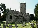 Church of St Matthew |
| Sapperton Canal Tunnel (South Entrance) on former Thames and Severn Canal | Thames and Severn Canal, Coates | Tunnel | 1789 | 4 June 1952 | SO9661300600 51°42′15″N 2°03′01″W |
1089301 | .jpg.webp) Sapperton Canal Tunnel (South Entrance) on former Thames and Severn Canal |
| Church of St Giles | Coberley | Church | 12th century origins | 4 July 1960 | SO9656115829 51°50′28″N 2°03′05″W |
1091770 | 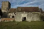 Church of St Giles |
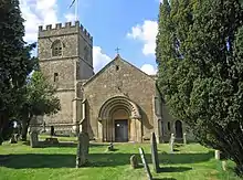
| Church of St John the Baptist | Coln St. Aldwyns | Parish church | Late 12th century | 26 January 1961 | SP1435305156 51°44′42″N 1°47′37″W |
1089209 | 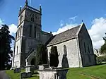 Church of St John the Baptist |
| Chest tomb c.15 metres south of north aisle in the churchyard of the Church of St Oswald | Compton Abdale | Chest tomb | 14th century | 18 June 1986 | SP0595116592 51°50′52″N 1°54′54″W |
1341080 | |
| Church of St Oswald | Compton Abdale | Anglican church | 13th century | 26 January 1961 | SP0593616584 51°50′52″N 1°54′55″W |
1304301 |  Church of St Oswald |
| Church of St Nicholas | Condicote | Anglican church | Late 12th century | 25 August 1960 | SP1516228335 51°57′12″N 1°46′51″W |
1089911 | 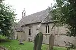 Church of St Nicholas |
| Church of St Mary | Cowley | Church | c.1200 | 4 July 1960 | SO9650514647 51°49′50″N 2°03′08″W |
1340154 | 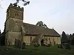 Church of St Mary |
| Robert Briggs Monument in the churchyard of the Church of St Mary | Cowley | Chest tomb | 1709 | 22 October 1987 | SO9652014645 51°49′49″N 2°03′07″W |
1091738 | 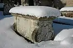 Robert Briggs Monument in the churchyard of the Church of St Mary |
| Dovecote c.50 metres north-west of Daglingworth Manor | Daglingworth | Dovecote | Medieval | 4 February 1952 | SO9964604786 51°44′30″N 2°00′24″W |
1340925 | |
| Thomas Heines Monument in the churchyard of the Church of the Holy Rood, c.12 metres south of the chancel | Daglingworth | Chest tomb | 1683 | 12 February 1988 | SO9935304973 51°44′36″N 2°00′39″W |
1153415 | |
| Church of St Arild | Oldbury-on-the-Hill, Didmarton | Church | Mostly late 15th/early 16th century | 6 September 1954 | ST8187488223 51°35′33″N 2°15′47″W |
1089732 | |
| The Manor House/Dowdeswell Place | Dowdeswell | Manor house | Late 16th–early 17th century | 23 January 1952 | SP0052819172 51°52′16″N 1°59′37″W |
1089365 |  The Manor House/Dowdeswell Place |
| Gate piers and wall in front of the Manor House | Dowdeswell | Gate pier | 17th century | 11 February 1986 | SP0054619189 51°52′17″N 1°59′37″W |
1155154 | Gate piers and wall in front of the Manor House |
| The Eight Gabled House | Dowdeswell | House | Late 16th century | 23 January 1952 | SP0009519883 51°52′39″N 2°00′00″W |
1154697 | |
| Church of St Mary | Driffield | Church | Norman | 26 November 1958 | SU0746399767 51°41′48″N 1°53′36″W |
1341377 |  Church of St Mary |
| Church of St Michael | Harnhill, Driffield | Church | Norman foundation | 26 November 1958 | SP0694200452 51°42′10″N 1°54′03″W |
1153265 |  Church of St Michael |
| Church of St Peter | Duntisbourne Abbots | Parish church | 12th century | 26 November 1958 | SO9708007896 51°46′11″N 2°02′37″W |
1305556 |  Church of St Peter |
| Cotswold Farmhouse | Duntisbourne Abbots | Farmhouse | 17th century | 4 June 1952 | SO9810709386 51°46′59″N 2°01′44″W |
1341789 | |
| Nutbeam Farmhouse | Duntisbourne Leer, Duntisbourne Abbots | Farmhouse | 15th century | 4 June 1952 | SO9799407482 51°45′58″N 2°01′50″W |
1088470 | |
| Pinbury Park | Duntisbourne Rouse | House | 15th century or earlier | 4 June 1952 | SO9553104948 51°44′36″N 2°03′58″W |
1088428 | 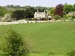 Pinbury Park |
| Charingworth Manor | Charingworth, Ebrington | Manor house | Early 17th century | 20 February 1985 | SP1979939643 52°03′17″N 1°42′46″W |
1341756 | 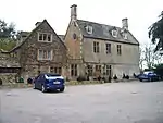 Charingworth Manor |
| Gate piers and walls at end of drive to Ebrington Manor | Ebrington | Gate pier | Late 17th/early 18th century | 20 February 1985 | SP1825740118 52°03′33″N 1°44′06″W |
1088546 | 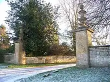 Gate piers and walls at end of drive to Ebrington Manor |
| Summerhouse in grounds of Ebrington Manor | Ebrington | House | Late 17th/early 18th century | 25 August 1960 | SP1821139794 52°03′22″N 1°44′09″W |
1170833 | 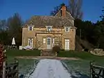 Summerhouse in grounds of Ebrington Manor |
| Harrowby House | Ebrington | House | 13th–17th century | 25 August 1960 | SP1837640039 52°03′30″N 1°44′00″W |
1088517 | |
| Edgeworth Manor | Edgeworth | Country house | 1685 | 4 June 1952 | SO9489805920 51°45′07″N 2°04′31″W |
1341782 | 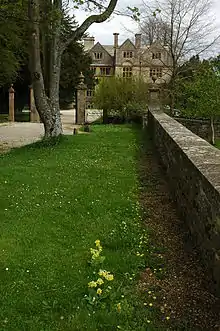 Edgeworth Manor |
| Unidentified monument in the churchyard approx. 1.5m south of Church of St John | Elkstone | Chest tomb | 1692 | 24 June 1985 | SO9670712290 51°48′33″N 2°02′57″W |
1088445 | |
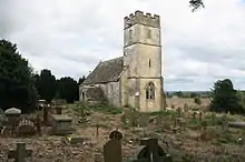
| Church of St Edward | Evenlode | Church | 12th century | 25 August 1960 | SP2206229068 51°57′35″N 1°40′49″W |
1089794 | 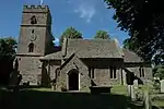 Church of St Edward |
| 3 Morean (possibly Morgan) Monuments immediately adjoining south-east corner of church in churchyard of Church of St Mary | Fairford | Chest tomb | Mid-18th century | 17 June 1986 | SP1517201164 51°42′32″N 1°46′55″W |
1341028 |  3 Morean (possibly Morgan) Monuments immediately adjoining south-east corner of church in churchyard of Church of St Mary |
| Dovecote in former Park Farm yard | Fairford | Dovecote | Medieval | 4 June 1986 | SP1537701202 51°42′34″N 1°46′44″W |
1089954 | |
| Valentine Strong monument, about 11m south-west of south porch in St Mary's churchyard | Fairford | Table tomb | 1662 | 17 June 1986 | SP1514101140 51°42′32″N 1°46′56″W |
1305142 | |
| Unidentified monument, about 3m east of Valentine Strong monument in St Mary's churchyard | Fairford | Chest tomb | 15th century | 17 June 1986 | SP1515001145 51°42′32″N 1°46′56″W |
1090001 | |
| Church of St John the Baptist | Great Rissington | Anglican church | 12th century | 25 August 1960 | SP1951817152 51°51′09″N 1°43′05″W |
1152803 |  Church of St John the Baptist |
| Church of St Michael | Guiting Power | Church | 12th century | 25 June 1980 | SP0956124536 51°55′09″N 1°51′45″W |
1089532 | |
| Church of St Nicholas | Hatherop | Anglican church | 1854–55 | 26 November 1958 | SP1538405095 51°44′40″N 1°46′43″W |
1089446 | 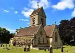 Church of St Nicholas |
| Church of All Saints | Salperton Park, Hazleton | Anglican church | 12th century | 26 January 1961 | SP0769519841 51°52′38″N 1°53′23″W |
1089851 | 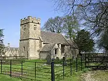 Church of All Saints |
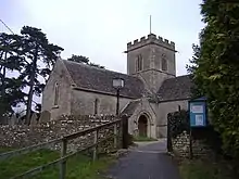
| Church of St Andrew | Hazleton | Anglican church | 12th century | 26 January 1961 | SP0796218229 51°51′45″N 1°53′09″W |
1153706 | 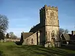 Church of St Andrew |
| Church of St John the Baptist | Kingscote | Parish church | Early English | 6 September 1954 | ST8184496217 51°39′52″N 2°15′50″W |
1089708 | 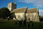 Church of St John the Baptist |
| Church of St Peter | Little Rissington | Anglican church | 12th century | 25 August 1960 | SP1894319976 51°52′41″N 1°43′34″W |
1090280 | 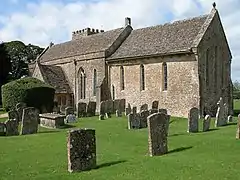 Church of St Peter |
| Church of St Mary | Lower Slaughter | Church | Late 12th or early 13th century arcade | 25 August 1960 | SP1657822616 51°54′07″N 1°45′38″W |
1089920 | .JPG.webp) Church of St Mary |
| Dovecote at the Manor House | Lower Slaughter | Dovecote | Late 16th century | 16 July 1986 | SP1660822648 51°54′08″N 1°45′36″W |
1341062 | |
| Church of St Mary the Virgin | Meysey Hampton | Church | 13th century | 26 November 1958 | SP1170600060 51°41′57″N 1°49′55″W |
1156083 | |
| Villars Farmhouse | Meysey Hampton | Farmhouse | Late 14th century | 4 June 1952 | SU1188199826 51°41′49″N 1°49′46″W |
1156064 | 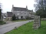 Villars Farmhouse |
| Lemington House and boundary wall to east and railings to north | Moreton-in-Marsh | House | Mid–late 17th century | 5 March 1981 | SP2053832418 51°59′23″N 1°42′08″W |
1341717 | |
| The Steps and the premises of Horne and Sons and The Gateway | Moreton-in-Marsh | Town house | Mid-18th century | 25 August 1960 | SP2048032341 51°59′21″N 1°42′11″W |
1088654 | 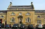 The Steps and the premises of Horne and Sons and The Gateway |
| Cromwell House | Naunton | Gabled house | 16th century | 25 August 1960 | SP1200923494 51°54′35″N 1°49′37″W |
1341072 | May2006.jpg.webp) Cromwell House |
| Dale House | Naunton | House | 17th century | 25 August 1960 | SP1136423322 51°54′30″N 1°50′10″W |
1155063 | |
| Dovecote south-west of Manor House | Naunton | Dovecote | Probably 16th century or earlier | 25 August 1960 | SP1158723369 51°54′31″N 1°49′59″W |
1155655 | 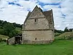 Dovecote south-west of Manor House |
| St Andrew's Parish Church | Naunton | Parish church | 13th century | 25 August 1960 | SP1122023419 51°54′33″N 1°50′18″W |
1089861 | |
| Cross shaft and cross shaft base c.40m south of No 59 | Calmsden, North Cerney | Cross | 15th century | 26 November 1958 | SP0454308631 51°46′35″N 1°56′08″W |
1340930 |  Cross shaft and cross shaft base c.40m south of No 59 |
| Dovecote c.20m south of Eastington Manor | Eastington | Dovecote | 15th century | 23 January 1952 | SP1262513821 51°49′22″N 1°49′06″W |
1303532 |  Dovecote c.20m south of Eastington Manor |
| Eastington Manor | Eastington, Northleach with Eastington | Manor house | 15th century | 23 January 1952 | SP1262113856 51°49′23″N 1°49′06″W |
1090475 |  Eastington Manor |
| Monument in churchyard of Church of St Peter and St Paul, c.4.5m south of south aisle | Northleach, Northleach with Eastington | Chest tomb | 17th century | 25 March 1987 | SP1119514547 51°49′46″N 1°50′20″W |
1090446 | 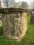 Monument in churchyard of Church of St Peter and St Paul, c.4.5m south of south aisle |
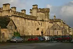
| The Old Prison, formerly Northleach House of Correction | Northleach with Eastington | House of correction | 1792 | 23 January 1952 | SP1089514949 51°49′59″N 1°50′36″W |
1090470 |  The Old Prison, formerly Northleach House of Correction |
| Margaret Parsons monument in the churchyard of the Church of St Nicholas c.4m east of chancel | Lower Oddington, Oddington | Chest tomb | 1695 | 30 January 1987 | SP2350325556 51°55′41″N 1°39′35″W |
1155286 | 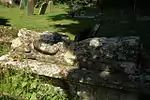 Margaret Parsons monument in the churchyard of the Church of St Nicholas c.4m east of chancel |
| Oddington House | Lower Oddington, Oddington | Country house | 17th century | 25 August 1960 | SP2332625903 51°55′52″N 1°39′44″W |
1341130 | _p1.066_-_Oddington_House%252C_Gloucestershire.jpg.webp) Oddington House |
| Church of St Nicholas | Ozleworth | Church | Mid-12th century | 6 September 1954 | ST7942593288 51°38′17″N 2°17′55″W |
1265165 |  Church of St Nicholas |
| Ozleworth Park | Ozleworth | Country house | Early 18th century | 6 September 1954 | ST7936793302 51°38′17″N 2°17′58″W |
1235221 | 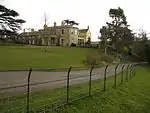 Ozleworth Park |
| Church of All Saints | Preston | Church | 13th century | 26 November 1958 | SP0440500893 51°42′24″N 1°56′16″W |
1089268 | 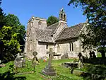 Church of All Saints |
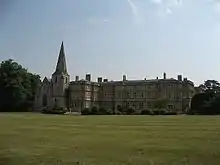
| Rendcomb College | Rendcomb | Country house | 1863–65 | 21 July 1980 | SP0172809866 51°47′15″N 1°58′35″W |
1303962 | |
| Church of St Peter | Rodmarton | Anglican church | 13th and 14th century | 26 November 1958 | ST9427398053 51°40′52″N 2°05′03″W |
1089236 | 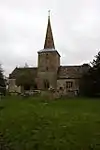 Church of St Peter |
| Hazleton Manor Farmhouse | Hazleton, Rodmarton | Farmhouse | 16th century | 4 June 1952 | ST9301998317 51°41′01″N 2°06′09″W |
1341398 | 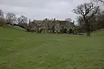 Hazleton Manor Farmhouse |
| Baldwin Memorial, about 8 metres south-east of south transept in churchyard of Church of St Kenelm | Sapperton | Chest tomb | 1677 | 21 March 1985 | SO9474903394 51°43′45″N 2°04′39″W |
1089679 | 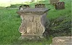 Baldwin Memorial, about 8 metres south-east of south transept in churchyard of Church of St Kenelm |
| Bridge above Snake Pool in gardens of Sezincote House | Sezincote Park, Sezincote | Bridge | 1800–05 | 25 August 1960 | SP1716031221 51°58′45″N 1°45′06″W |
1341253 |  Bridge above Snake Pool in gardens of Sezincote House |
| Clock tower, Home Farm, Sezincote Estate | Sezincote | Storehouse | 1800–05 | 11 January 1985 | SP1716030944 51°58′36″N 1°45′06″W |
1089506 | |
| Home Farm House and attached farm buildings, Sezincote Estate | Sezincote | Farmhouse | 1800–05 | 25 August 1960 | SP1720130919 51°58′35″N 1°45′04″W |
1089504 | |
| Cheltenham Lodges including gates, gate piers and adjoining walls | Sherborne | Gate | Mid-19th century | 25 March 1987 | SP1619113821 51°49′22″N 1°45′59″W |
1090430 | 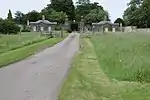 Cheltenham Lodges including gates, gate piers and adjoining walls |
| Church of St Mary Magdalene, adjoining Sherborne House | Sherborne | Anglican church | Mid-19th century | 26 January 1961 | SP1689414729 51°49′51″N 1°45′22″W |
1303082 | 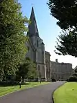 Church of St Mary Magdalene, adjoining Sherborne House |
| Sherborne House | Sherborne | Country house | c.1552 | 23 January 1952 | SP1688914701 51°49′50″N 1°45′23″W |
1090436 | |
| Barn, stable block, granary/smithy and kennel, c. 40m west of Shipton Sollars | Shipton Sollars, Shipton | Stable | 19th century | 23 January 1952 | SP0314818479 51°51′54″N 1°57′20″W |
1341359 | |
| Outbuilding immediately north of and attached to North Farm | Shipton Oliffe, Shipton | Dairy | 16th century | 23 January 1952 | SP0402518932 51°52′08″N 1°56′35″W |
1089309 | |
| Church of St John the Baptist | Shipton Moyne | Anglican church | 1864–65 | 6 September 1954 | ST8922189617 51°36′19″N 2°09′25″W |
1235759 | 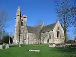 Church of St John the Baptist |
| Church of St Peter | Siddington | Church | Norman | 26 November 1958 | SP0347200186 51°42′01″N 1°57′04″W |
1340986 | 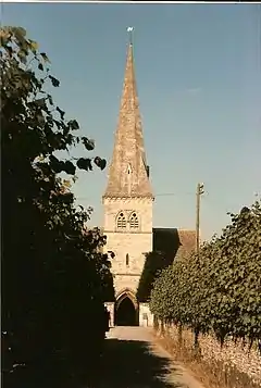 Church of St Peter |
| Two adjoining barns at Church Farm | Siddington | Barn | Late 18th century | 4 June 1952 | SP0344400160 51°42′01″N 1°57′06″W |
1090073 | |
| Church of All Saints | Somerford Keynes | Church | Early 13th century | 26 November 1958 | SU0165495524 51°39′31″N 1°58′39″W |
1153987 |  Church of All Saints |
| Church of All Saints | Shorncote, Somerford Keynes | Church | Norman | 26 November 1958 | SU0253296724 51°40′09″N 1°57′53″W |
1153975 | |
| Southrop Manor | Southrop | Manor house | 12th century | 23 January 1952 | SP2023103447 51°43′46″N 1°42′31″W |
1156690 | |
| Masonic Hall | Stow-on-the-Wold | Grammar school | 1594 | 25 August 1960 | SP1909525722 51°55′47″N 1°43′25″W |
1078374 | 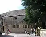 Masonic Hall |
| The King's Arms Hotel, with Camilla | Stow-on-the-Wold | House | Early 17th century | 25 August 1960 | SP1919625757 51°55′48″N 1°43′20″W |
1088796 |  The King's Arms Hotel, with Camilla |
| The Royalist Hotel | Stow-on-the-Wold | House | 16th century | 25 August 1960 | SP1929225692 51°55′46″N 1°43′15″W |
1170376 | 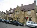 The Royalist Hotel |
| Manor House | Swell | Manor house | Early–mid-17th century | 25 August 1960 | SP1765826859 51°56′24″N 1°44′40″W |
1221816 | |
| Pineapple Spa, Spa Cottages | Lower Swell, Swell | House | c.1807 | 25 August 1960 | SP1793925730 51°55′47″N 1°44′26″W |
1303139 | |
| Syde Manor | Syde | Country house | Late 15th or early 16th century | 24 June 1985 | SO9491410781 51°47′44″N 2°04′31″W |
1341784 | |
| Church of St Saviour | Tetbury | Church | 1848 | 18 April 1973 | ST8877693261 51°38′17″N 2°09′49″W |
1154438 | |
| Unidentified memorial, about 1 metre north-west of north-east path at 11 metres from crossing in churchyard of Church of St Mary | Tetbury | Chest tomb | Mid-18th century | 21 March 1985 | ST8905492994 51°38′08″N 2°09′34″W |
1341195 | |
| Unidentified memorial, about 1m west of path crossing in churchyard of Church of St Mary | Tetbury | Chest tomb | Mid-18th century | 21 March 1985 | ST8903592981 51°38′08″N 2°09′35″W |
1153413 | |
| Unidentified memorial, about 14m south of north-west gate in churchyard of Church of St Mary | Tetbury | Sarcophagus | Mid-18th century | 21 March 1985 | ST8902092995 51°38′08″N 2°09′36″W |
1153440 | |
| Upton House | Tetbury Upton | Country house | 1752 | 6 September 1954 | ST8807895288 51°39′23″N 2°10′25″W |
1155320 | |
| Lower Dean Manor | Turkdean | Manor house | c.1500 | 23 January 1952 | SP1037217304 51°51′15″N 1°51′03″W |
1089818 | |
| Rectory Farmhouse | Turkdean | Farmhouse | 14th–15th century | 23 January 1952 | SP1075617387 51°51′18″N 1°50′43″W |
1089824 | |
| Church of St Peter | Upper Slaughter | Parish church | 12th century | 25 August 1960 | SP1547923229 51°54′27″N 1°46′35″W |
1237720 | .JPG.webp) Church of St Peter |
| Eyford Park | Upper Slaughter | Country house | 1910 | 25 August 1960 | SP1466424649 51°55′13″N 1°47′17″W |
1222480 | 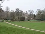 Eyford Park |
| Home Farmhouse | Upper Slaughter | Farmhouse | c.1700 | 16 July 1986 | SP1553423243 51°54′27″N 1°46′32″W |
1237962 | 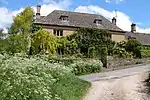 Home Farmhouse |
| Church of St Lawrence | Weston-sub-Edge | Parish church | 13th century | 25 August 1960 | SP1281740585 52°03′49″N 1°48′52″W |
1171337 | 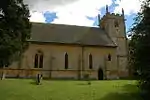 Church of St Lawrence |
| Manor House | Weston Subedge | Manor house | Late 17th century | 25 August 1960 | SP1261441149 52°04′07″N 1°49′03″W |
1341774 | 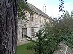 Manor House |
| Italian garden about 100m south-east of Westonbirt House, including camellia house to north | Westonbirt with Lasborough | Camellia house | 1843 | 16 March 1987 | ST8660689600 51°36′18″N 2°11′41″W |
1235738 | 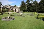 Italian garden about 100m south-east of Westonbirt House, including camellia house to north |
| Lasborough Manor | Lasborough, Westonbirt with Lasborough | Farmhouse | c.1610 | 6 September 1954 | ST8212194159 51°38′45″N 2°15′35″W |
1235928 | 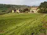 Lasborough Manor |
| Church of St Bartholomew | Whittington | Parish church | 12th century | 26 January 1961 | SP0132120643 51°53′04″N 1°58′56″W |
1341364 | 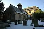 Church of St Bartholomew |
| Syreford Mill | Whittington | Mill house | 17th century | 11 February 1986 | SP0270820273 51°52′52″N 1°57′43″W |
1155809 |  Syreford Mill |
| Five monuments, incl. Annathe Newman Monument, in the churchyard of the Church of St Peter, c. 4.5m north of the tower | Windrush | Gravestone | 1606 | 25 March 1987 | SP1931513040 51°48′56″N 1°43′16″W |
1157115 | 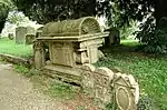 Five monuments, incl. Annathe Newman Monument, in the churchyard of the Church of St Peter, c. 4.5m north of the tower |
| William Trinder Monument and monuments either side, in the churchyard of the Church of St Peter | Windrush | Gravestone | 18th century | 25 March 1987 | SP1932313029 51°48′56″N 1°43′16″W |
1090417 | 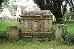 William Trinder Monument and monuments either side, in the churchyard of the Church of St Peter |
| Windrush Mill | Windrush | Mill house | Mid-17th–early 18th century | 23 January 1952 | SP1921613533 51°49′12″N 1°43′21″W |
1157066 | 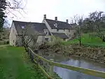 Windrush Mill |
| Church of St Michael | Winson | Parish church | 12th century | 26 January 1961 | SP0907008642 51°46′35″N 1°52′12″W |
1089174 | 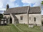 Church of St Michael |
| Group of 9 mainly Howse and Bridges family monuments in the churchyard approximately 6 metres south of porch to Church of St Michael | Winson | Tomb | 1756 | 5 February 1987 | SP0906908628 51°46′34″N 1°52′12″W |
1341406 | |
| Winson Manor | Winson | Country house | c.1740 | 23 January 1952 | SP0908308680 51°46′36″N 1°52′11″W |
1156875 |  Winson Manor |
| Halewell Close | Withington | House | 17th–early 18th century | 23 January 1952 | SP0302815381 51°50′13″N 1°57′27″W |
1341349 | |
| The Old Rectory | Withington | Bishops palace | 14th century | 23 January 1952 | SP0315615621 51°50′21″N 1°57′20″W |
1302905 | 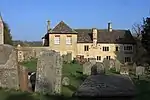 The Old Rectory |
| Church of St Michael | Yanworth | Anglican church | 12th century | 26 January 1961 | SP0792413881 51°49′25″N 1°53′11″W |
1089831 | |
| Stowell Park | Yanworth | House | c.1600 | 23 January 1952 | SP0870513020 51°48′57″N 1°52′30″W |
1089828 | |

See also
Notes
- The date given is the date used by Historic England as significant for the initial building or that of an important part in the structure's description.
- Sometimes known as OSGB36, the grid reference is based on the British national grid reference system used by the Ordnance Survey.
- The "List Entry Number" is a unique number assigned to each listed building and scheduled monument by Historic England.
External links
This article is issued from Wikipedia. The text is licensed under Creative Commons - Attribution - Sharealike. Additional terms may apply for the media files.