Grade II* listed buildings in Tyne and Wear
There are 208 Grade II* listed buildings in Tyne and Wear, England. Over a third of these are constituent parts of the Byker Wall housing estate, which is given its own sub-heading below.
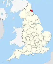
Tyne and Wear shown within England
Gateshead
| Name | Location | Type | Completed [note 1] | Date designated | Grid ref.[note 2] Geo-coordinates |
Entry number [note 3] | Image |
|---|---|---|---|---|---|---|---|
| Ravensworth Castle | Lamesley, Gateshead | Castle | 1808 | 18 November 1985 | NZ2321759094 54°55′34″N 1°38′21″W |
1025151 | |
| Ravensworth Castle | Lamesley, Gateshead | Tower | 12th century | 1 February 1967 | NZ2327259118 54°55′34″N 1°38′18″W |
1025190 |  |
| Axwell Park and Steps and Balustrades to South | Gateshead | House | 1758 | 18 November 1985 | NZ1911262042 54°57′10″N 1°42′11″W |
1025206 | _2003_(1382922501).jpg.webp) Axwell Park and Steps and Balustrades to South |
| Axwell Park Dower House | Gateshead | House | c1770 -80 | 17 September 1984 | NZ1962162444 54°57′23″N 1°41′43″W |
1184875 | |
| Bradley Hall | Gateshead | Country House | c. 1760 | 21 January 1949 | NZ1239163339 54°57′52″N 1°48′29″W |
1355110 | .jpg.webp) Bradley Hall |
| Bridge over River Derwent (Tyne and Wear Bridge Number 761) | Swalwell, Gateshead | Road Bridge | 1779 | 18 November 1985 | NZ1979462322 54°57′19″N 1°41′33″W |
1355119 | |
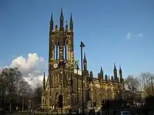
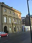
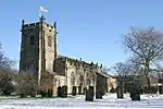
| Church of St Chad | Gateshead | Church | 1900-1903 | 13 January 1983 | NZ2497161700 54°56′58″N 1°36′42″W |
1277841 | 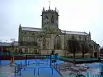 Church of St Chad |
| Church of St Helen | Gateshead | Parish Church | 1876 | 13 January 1983 | NZ2555960319 54°56′13″N 1°36′09″W |
1248532 | 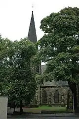 Church of St Helen |
| Crow Hall | Felling, Gateshead | House | Early 18th century | 26 April 1948 | NZ2788461605 54°56′54″N 1°33′58″W |
1355083 | |
| Dunston Hill Hospital | Gateshead | House | 1667-1739 | 18 November 1985 | NZ2208061254 54°56′44″N 1°39′25″W |
1366097 | |
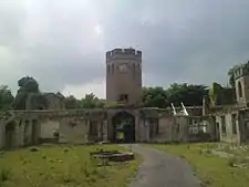
| Gibside | Gibside Estate, Gateshead | House | 1603-20 | 1 February 1950 | NZ1761558911 54°55′28″N 1°43′36″W |
1299730 | 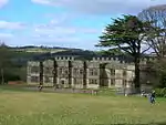 Gibside |
| Haddon Tomb 6.5 Metres North of Transept of Church of St Mary | Heworth, Gateshead | Canopied Tomb | c. 1717 | 18 November 1985 | NZ2867261941 54°57′05″N 1°33′14″W |
1355086 | |
| Heworth Constitutional Club, Formerly Nether Heworth Hall | Gateshead | House | Early 18th century | 26 April 1984 | NZ2877661993 54°57′06″N 1°33′08″W |
1355084 | |
| Orangery About 300 Metres West and 260 Metres South of Gibside | Gibside Estate, Gateshead | Orangery | Late 18th century | 1 February 1950 | NZ1728458606 54°55′19″N 1°43′55″W |
1299709 | 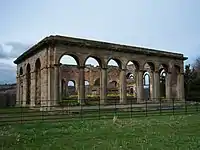 Orangery About 300 Metres West and 260 Metres South of Gibside |
| Stables to South East of Gibside | Gibside Estate, Gateshead | Stable | 1746 | 1 February 1950 | NZ1785658763 54°55′24″N 1°43′23″W |
1185328 | 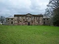 Stables to South East of Gibside |
| Stephens Hall | Ryton, Gateshead | House | 1653 | 18 November 1985 | NZ1562062871 54°57′37″N 1°45′27″W |
1355113 | |
| Swing Bridge over River Tyne | Gateshead | Gate | 1868-76 | 30 July 2004 | NZ2520663703 54°58′02″N 1°36′28″W |
1390930 | |
| The Rectory | Ryton, Gateshead | House | Post Medieval | 21 January 1949 | NZ1512464777 54°58′39″N 1°45′55″W |
1185232 | .jpg.webp) The Rectory |
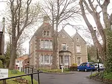
| Underhill | Gateshead | House | 1860s | 2 June 1976 | NZ2622160626 54°56′23″N 1°35′32″W |
1248562 | |
| Walker Terrace | Gateshead | Terrace | Early 19th century | 26 April 1950 | NZ2538062985 54°57′39″N 1°36′19″W |
1277835 | .jpg.webp) Walker Terrace |

Newcastle upon Tyne
The Byker Wall development
| Name | Location | Type | Completed [note 1] | Date designated | Grid ref.[note 2] Geo-coordinates |
Entry number [note 3] | Image |
|---|---|---|---|---|---|---|---|
| 1, 2 and 3 and Attached Ramps | Byker, Newcastle upon Tyne | Flats | 1972 - 1975 | 22 January 2007 | NZ2690864494 54°58′28″N 1°34′52″W |
1392123 |  1, 2 and 3 and Attached Ramps |
| 1, 2 and 3, with Attached Fences, Kerbs and Seating 1,2 and 3, with Attached Fences, Kerbs and Seating | Byker, Newcastle upon Tyne | House | 1974 - 1976 | 22 January 2007 | 49°46′01″N 7°33′26″W | 1392176 | |
| 1,2 and 3, with Attached Walls and Fences, and Electric Substation to Rear of No. 1 1-6, with Attached Walls and Fences | Byker, Newcastle upon Tyne | House | 1974 - 1976 | 22 January 2007 | NZ2730064620 54°58′32″N 1°34′30″W |
1392175 | |
| 1,3 and 5 and Attached Fences | Byker, Newcastle upon Tyne | House | 1974 - 1976 | 22 January 2007 | NZ2725564617 54°58′32″N 1°34′33″W |
1392173 |  1,3 and 5 and Attached Fences |
| 1-11 and Attached Garden Walls 1-5 and Attached Garden Walls 2-6 and Attached Garden Walls Garages | Byker, Newcastle upon Tyne | Housing Estate | 1974 - 1976 | 22 January 2007 | 49°46′01″N 7°33′26″W | 1392127 | |
| 1-11 with Kerbs to Front and Fences to Rear | Byker, Newcastle upon Tyne | Housing Estate | 1974 - 1976 | 22 January 2007 | NZ2735864654 54°58′33″N 1°34′27″W |
1392178 |  1-11 with Kerbs to Front and Fences to Rear |
| 1-115, with Attached Fences, Steps and Timber Heating Ducts | Byker - Carville Road, Newcastle upon Tyne | Flats | 1978 - 1980 | 22 January 2007 | NZ2717564546 54°58′29″N 1°34′37″W |
1392162 |  1-115, with Attached Fences, Steps and Timber Heating Ducts |
| 1-12, with Attached Walls, Fences and Pergolas 1-28 (consec), with Attached Walls, Fences and Pergolas 1-8 (including Shop), w | Byker, Newcastle upon Tyne | Flats | 1972 - 1975 | 22 January 2007 | NZ2730564676 54°58′33″N 1°34′30″W |
1392166 |  1-12, with Attached Walls, Fences and Pergolas 1-28 (consec), with Attached Walls, Fences and Pergolas 1-8 (including Shop), w |
| 1-13 with Attached Steps and Fences 2-8 with Attached Steps and Fences | Byker, Newcastle upon Tyne | House | 1974 - 1976 | 22 January 2007 | 49°46′01″N 7°33′26″W | 1392129 | |
| 1-15 with Attached Garden Fences | Byker, Newcastle upon Tyne | Flats | 1976 - 1978 | 22 January 2007 | 49°46′01″N 7°33′26″W | 1392139 | |
| 1-17 (odd) and 2-30 (even), with Attached Walls, Fences, Pergola and Steps Nos. 130 and 132, with Attached Walls, Fences, Pergo | Byker, Newcastle upon Tyne | Flats | 1978 - 1980 | 22 January 2007 | 49°46′01″N 7°33′26″W | 1392170 | |
| 1-17 and Attached Fences and Curbs | Byker, Newcastle upon Tyne | Terrace | 1972 - 1975 | 22 January 2007 | NZ2695564517 54°58′28″N 1°34′50″W |
1392114 |  1-17 and Attached Fences and Curbs |
| 1-17 with Attached Walls,steps and Entry Walkway | Byker, Newcastle upon Tyne | Flats | 1976 - 1978 | 22 January 2007 | 49°46′01″N 7°33′26″W | 1392141 | |
| 1-18 with Attached Garden Fences | Byker, Newcastle upon Tyne | Flats | 1976 - 1978 | 22 January 2007 | 49°46′01″N 7°33′26″W | 1392143 | |
| 1-20 the Brow with Attached Fences and Bin Stores | Byker, Newcastle upon Tyne | Flats | 1978 - 1981 | 22 January 2007 | 49°46′01″N 7°33′26″W | 1392146 | |
| 1-20, with Car Porch and Attached Timber Fences | Byker - Bolam Street, Newcastle upon Tyne | Flats | 1976 - 1978 | 22 January 2007 | 49°46′01″N 7°33′26″W | 1392142 | |
| 1-35 Including Attached Walls, Fences and Gates | Byker, Newcastle upon Tyne | Housing Estate | Built 1975-78 | 22 January 2007 | 49°46′01″N 7°33′26″W | 1392111 | |
| 1-39 Mount Pleasant House and Attached Walls and Fences | Byker-carville, Newcastle upon Tyne | Fence | 1978 - 1980 | 22 January 2007 | NZ2721264629 54°58′32″N 1°34′35″W |
1392167 | 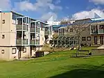 1-39 Mount Pleasant House and Attached Walls and Fences |
| 1-42 Headlam Green, Including Chirton House, Bowling Green Pavilion, Garages, Entrance Gates, Retaining Walls and Attached Fence | Byker, Newcastle upon Tyne | Flats | 1976 - 1978 | 22 January 2007 | 49°46′01″N 7°33′26″W | 1392182 | |
| 1-7 (odd) and 2-8 (even) with Attached Fences to the Rear | Byker, Newcastle upon Tyne | Terrace | 1978 - 1980 | 22 January 2007 | 49°46′01″N 7°33′26″W | 1392169 | |
| 1-7 Thornborrow House with Fences to Rear | Byker, Newcastle upon Tyne | Flats | 1974 - 1976 | 22 January 2007 | NZ2740564700 54°58′34″N 1°34′24″W |
1392179 | |
| 1-8 and Attached Fences | Byker, Newcastle upon Tyne | House | 1976 - 1978 | 22 January 2007 | NZ2708964110 54°58′15″N 1°34′42″W |
1392140 | |
| 18-22 with Attached Fences and Garages to the Rear 4,5 and 6 with Attached Fences 7-21, with Attached Community Centre to Corn | Byker, Newcastle upon Tyne | Flats | 1974 -1976 | 22 January 2007 | NZ2730064563 54°58′30″N 1°34′30″W |
1392174 |  18-22 with Attached Fences and Garages to the Rear 4,5 and 6 with Attached Fences 7-21, with Attached Community Centre to Corn |
| 2-38 with Retaining Walls | Byker, Newcastle upon Tyne | Flats | 1972 - 1975 | 22 January 2007 | 49°46′01″N 7°33′26″W | 1392121 | 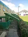 2-38 with Retaining Walls |
| 2-46 and 62-92 | Byker, Newcastle upon Tyne | Flats | 1978-1981 | 22 January 2007 | 49°46′01″N 7°33′26″W | 1392150 | |
| 2-64 with Attached Fences | Byker, Newcastle upon Tyne | Flats | 1978-1980 | 22 January 2007 | NZ2713064530 54°58′29″N 1°34′40″W |
1392161 | |
| 66-84, with Retaining Walls, Timber Fences and Steps to Front | Byker, Newcastle upon Tyne | House | 1978 - 1980 | 22 January 2007 | NZ2715364470 54°58′27″N 1°34′38″W |
1392165 | |
| And Substation Attached to | Byker, Newcastle upon Tyne | Terrace | 1972 to 1975 | 22 January 2007 | 49°46′01″N 7°33′26″W | 1392116 | |
| Attached Brick Walls, Timber Fencing and Dustbin Shelters, and Covered Timber Shelters Outside No. 1 Nos 1-66, Including Salisb | Byker Estate, Newcastle upon Tyne | House | 1975 - 1978 | 22 January 2007 | NZ2659664507 54°58′28″N 1°35′10″W |
1392611 | 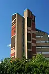 Attached Brick Walls, Timber Fencing and Dustbin Shelters, and Covered Timber Shelters Outside No. 1 Nos 1-66, Including Salisb |
| Avondale House with Attached Fences Walls and Steps | Byker, Newcastle upon Tyne | Apartment | 1979 - 1982 | 22 January 2007 | NZ2712564390 54°58′24″N 1°34′40″W |
1392156 | |
| Byker Neighbourhood Estate Office | Byker, Newcastle upon Tyne | Drawing Office | 1969 | 22 January 2007 | NZ2694564461 54°58′27″N 1°34′50″W |
1392128 | 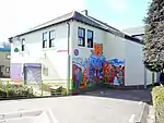 Byker Neighbourhood Estate Office |
| Electricity Sub-station | Byker, Newcastle upon Tyne | Apartment | 1974 - 1976 | 22 January 2007 | 49°46′01″N 7°33′26″W | 1392135 | Electricity Sub-station |
| Fixed Seating and Tables, and Shelters No 3, with Attached Walls and Fences and Table and Seats Nos 11 to 19 (odd), with Attache | Byker, Newcastle upon Tyne | Bungalow | 1976 - 1978 | 22 January 2007 | 49°46′01″N 7°33′26″W | 1392190 | |
| Lychgate Infront of St Lawrence's School | Byker, Newcastle upon Tyne | Lych Gate | 1969 | 15 September 2009 | NZ2733664513 54°58′28″N 1°34′28″W |
1393440 | |
| No 1, with Attached Walls and Fences | Byker, Newcastle upon Tyne | Detached House | 1976 - 1978 | 22 January 2007 | NZ2751064575 54°58′30″N 1°34′18″W |
1392189 | |
| No 6, Attached Walls, Steps, Seats, Table and Fences Nos 1-9, with Attached Walls, Steps and Fences | Byker, Newcastle upon Tyne | Terrace | 1976 - 1978 | 22 January 2007 | 49°46′01″N 7°33′26″W | 1392191 | |
| No. 100, with Attached Fences to Rear | Byker, Newcastle upon Tyne | House | 1978 - 1980 | 22 January 2007 | NZ2723264613 54°58′31″N 1°34′34″W |
1392168 | |
| No. 32, with Attached Fence, Walls and Steps to Churchyard | Byker, Newcastle upon Tyne | Detached House | 1978 - 1980 | 22 January 2007 | NZ2731264514 54°58′28″N 1°34′29″W |
1392171 | |
| No.1 -17, with Kerbs to Front and Attached Fences | Byker, Newcastle upon Tyne | House | 1974 - 1976 | 22 January 2007 | NZ2737464629 54°58′32″N 1°34′26″W |
1392177 | 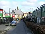 No.1 -17, with Kerbs to Front and Attached Fences |
| Nos 1 and 2, St Lawrence Court, with Attached Fences and Seats | Byker, Newcastle upon Tyne | House | 1974 - 1976 | 22 January 2007 | NZ2736364697 54°58′34″N 1°34′27″W |
1392180 | Nos 1 and 2, St Lawrence Court, with Attached Fences and Seats |
| Nos 11-25 (odd), with Stone Retaining Wall to Front and Fences to Rear | Byker, Newcastle upon Tyne | House | 1976 - 1978 | 22 January 2007 | 49°46′01″N 7°33′26″W | 1392184 | |
| Nos 1-14 (consec), with Attached Fences, Pergolas and Seats Nos 1-7 (consec), with Attached Fences, Pergolas and Seats Nos 18- | Byker, Newcastle upon Tyne | House | 1976 - 1978 | 22 January 2007 | 49°46′01″N 7°33′26″W | 1392183 | |
| Nos 1-14 with Attached Meeting Hall and Garages | Byker - Gordon Road, Newcastle upon Tyne | Flats | 1974 - 1976 | 22 January 2007 | NZ2686964431 54°58′26″N 1°34′54″W |
1392126 | |
| Nos 1-17 (consec), with Attached Walls, Fences, Seats and Pergolas | Byker, Newcastle upon Tyne | Fence | 1976 - 1978 | 22 January 2007 | NZ2752564587 54°58′31″N 1°34′17″W |
1392187 | |
| Nos 1-18 (link Blocks) with Attached Garden Walls | Byker, Newcastle upon Tyne | Flats | 1971-1974 | 22 January 2007 | NZ2680364556 54°58′30″N 1°34′58″W |
1392120 | 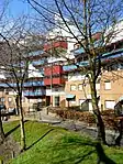 Nos 1-18 (link Blocks) with Attached Garden Walls |
| Nos 1-33, with Attached Walls, Fences and Pergolas | Byker, Newcastle upon Tyne | Flats | 1972 - 1975 | 22 January 2007 | NZ2746264665 54°58′33″N 1°34′21″W |
1392181 | |
| Nos 1-9 (odd) and Nos 2-10 (even) with Attached Walls, Fences, Pergolas and Seats Nos 2 and 4 with Attached Walls, Fences, Perg | Byker, Newcastle upon Tyne | Housing Estate | 1976 - 1978 | 22 January 2007 | 49°46′01″N 7°33′26″W | 1392188 | |
| Nos 2-28 (even), Including Shop, Pergola and Fences | Byker, Newcastle upon Tyne | House | 1976 - 1978 | 22 January 2007 | 49°46′01″N 7°33′26″W | 1392185 | |
| Nos 239-251 with Attached Steps, Walls and Fences Nos. 1-13, with Attached Steps, Ramps, Walls and Fences Nos. 187-205 with At | Byker, Newcastle upon Tyne | Flats | 1970 - 1971 | 22 January 2007 | 49°46′01″N 7°33′26″W | 1392145 | |
| Nos 30-40 (even), with Retaining Walls and Fences | Byker, Newcastle upon Tyne | House | 1976 - 1978 | 22 January 2007 | 49°46′01″N 7°33′26″W | 1392186 | |
| Nos 52-72, and Attached Fences and Shed | Byker, Newcastle upon Tyne | Housing Estate | 1979 - 1982 | 22 January 2007 | 49°46′01″N 7°33′26″W | 1392158 | |
| Nos. 10-22, Including Fences Nos. 8 and 10, Including Fences Nos.1-12, Including Fences | Byker, Newcastle upon Tyne | Bungalow | 1974 - 1976 | 22 January 2007 | 49°46′01″N 7°33′26″W | 1392132 | |
| Nos. 1-14, with Attached Archway and Ramp, and Walls and Fences to Rear | Byker, Newcastle upon Tyne | Flats | 1978 - 1979 | 22 January 2007 | NZ2705364592 54°58′31″N 1°34′44″W |
1392153 |  Nos. 1-14, with Attached Archway and Ramp, and Walls and Fences to Rear |
| Nos. 1-15, and Attached Fences | Byker, Newcastle upon Tyne | Flats | 1976 - 1978 | 22 January 2007 | 49°46′01″N 7°33′26″W | 1392152 | |
| Nos. 1-23, and Attached Fences Nos. 2-12, and Attached Fences | Byker, Newcastle upon Tyne | House | 1978 - 1981 | 22 January 2007 | 49°46′01″N 7°33′26″W | 1392151 | |
| Nos. 1-27, with Attached Garden Fences and Retaining Brick Walls and Pergola Nos. 15 and 17, with Attached Garden Fences and Re | Byker - Gordon Road, Newcastle upon Tyne | Flats | 1974 - 1976 | 22 January 2007 | 49°46′01″N 7°33′26″W | 1392131 | |
| Nos. 14-50 (even) with Attached Walls, Archway and Fences Nos.23-53, with Attached Walls, Archway and Fences | Byker, Newcastle upon Tyne | Housing Estate | 1978 - 1981 | 22 January 2007 | 49°46′01″N 7°33′26″W | 1392147 | |
| Nos. 1-52, and Attached Walls, Seats, Fences, Pergolas and Steps Nos. 1-55, and Attached Walls, Seats, Fences, Pergolas and Ste | Byker, Newcastle upon Tyne | Flats | 1971 - 1974 | 22 January 2007 | 49°46′01″N 7°33′26″W | 1392154 |  Nos. 1-52, and Attached Walls, Seats, Fences, Pergolas and Steps Nos. 1-55, and Attached Walls, Seats, Fences, Pergolas and Ste |
| Nos. 1-59, with Attached Walls and Fences | Byker, Newcastle upon Tyne | House | 1978 - 1981 | 22 January 2007 | 49°46′01″N 7°33′26″W | 1392149 | |
| Nos. 1-63, with Attached Walls, Pergolas and Fences | Byker-avondale Road, Newcastle upon Tyne | Flats | 1979 - 1982 | 22 January 2007 | 49°46′01″N 7°33′26″W | 1392164 | |
| Nos. 2-44, with Attached Wall, Pergola and Fences to Front and Rear, Including No.26a (byker Photographic Workshop) | Byker, Newcastle upon Tyne | Detached House | 1978 - 1979 | 22 January 2007 | 49°46′01″N 7°33′26″W | 1392160 | |
| Nos. 2-92, with Attached Walls, Fences and Steps | Byker, Newcastle upon Tyne | Flats | 1979 - 1982 | 22 January 2007 | 49°46′01″N 7°33′26″W | 1392163 |  Nos. 2-92, with Attached Walls, Fences and Steps |
| Nos. 39-79, with Attached Bin Stores and Sheds, and Walls and Fences to Rear | Byker, Newcastle upon Tyne | Flats | 1978 - 1979 | 22 January 2007 | NZ2705964495 54°58′28″N 1°34′44″W |
1392155 | |
| Nos. 46 and 48, and Attached Fences to Back | Byker, Newcastle upon Tyne | Detached House | 1979 - 1982 | 22 January 2007 | 49°46′01″N 7°33′26″W | 1392159 | |
| Nos. 85-105, with Attached Fences | Byker, Newcastle upon Tyne | House | 1979 - 1982 | 22 January 2007 | 49°46′01″N 7°33′26″W | 1392157 | |
| Swimming Baths | Byker, Newcastle upon Tyne | Bath House | 1907 | 15 September 2009 | NZ2697864627 54°58′32″N 1°34′48″W |
1393439 | Swimming Baths |
| Tom Collins House | Byker - Dunn Terrace, Newcastle upon Tyne | Flats | 1976 - 1978 | 22 January 2007 | NZ2670464461 54°58′27″N 1°35′04″W |
1392110 | 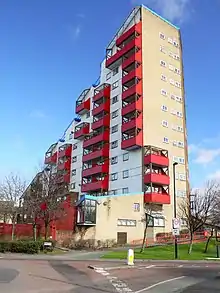 Tom Collins House |
| With Attached Walls and Fences | Byker, Newcastle upon Tyne | Housing Estate | 1976 - 1979 | 22 January 2007 | 49°46′01″N 7°33′26″W | 1392144 | |
| 1–13 Shipley Place | Byker, Newcastle upon Tyne | Garage | 1972 - 1975 | 22 January 2007 | 49°46′01″N 7°33′26″W | 1392113 | |
| 1–9 Brinkburn Lane | Byker - Kendal Street, Newcastle upon Tyne | Flats | 1972 - 1975 | 22 January 2007 | 49°46′01″N 7°33′26″W | 1392125 | |
| 61 Ayton Rise | Byker, Newcastle upon Tyne | House | 1978 - 1981 | 22 January 2007 | NZ2736164160 54°58′17″N 1°34′27″W |
1392148 | |
| 2, 4 and 6 Brock Street | Byker, Newcastle upon Tyne | Flats | 1974 - 1976 | 22 January 2007 | NZ2683264344 54°58′23″N 1°34′57″W |
1392130 | |
| 1–7 Brinkburn Place | Byker, Newcastle upon Tyne | Apartment | Built 1972-75 | 22 January 2007 | 49°46′01″N 7°33′26″W | 1392124 | |
| 1–11 Priory Place | Byker, Newcastle upon Tyne | Flats | 1976 - 1978 | 22 January 2007 | 49°46′01″N 7°33′26″W | 1392118 | |
| 12–18 Brock Street | Byker, Newcastle upon Tyne | Bungalow | 1974 - 1976 | 22 January 2007 | 49°46′01″N 7°33′26″W | 1392134 | |
| 1–25 Kendal Street | Byker, Newcastle upon Tyne | Flats | 1972 - 1975 | 22 January 2007 | 49°46′01″N 7°33′26″W | 1392122 | |
| 10–14 Raby Cross | Byker, Newcastle upon Tyne | Flats | 1976 - 1978 | 22 January 2007 | NZ2712264197 54°58′18″N 1°34′40″W |
1392138 | |
| 24–28 Dibley Street | Byker, Newcastle upon Tyne | Flats | 1974 - 1976 | 22 January 2007 | NZ2689964290 54°58′21″N 1°34′53″W |
1392133 | |
| 1–7 Kendal Place | Byker, Newcastle upon Tyne | Flats | 1972 - 1975 | 22 January 2007 | NZ2685264501 54°58′28″N 1°34′55″W |
1392119 | |
| 1–89 Gordon Road | Byker, Newcastle upon Tyne | Flats | 1972 - 1975 | 22 January 2007 | NZ2692564446 54°58′26″N 1°34′51″W |
1392117 | |
| 1, 2 and 3 Grace Street | Byker, Newcastle upon Tyne | Flats | 1974 - 1976 | 22 January 2007 | NZ2726564603 54°58′31″N 1°34′32″W |
1392172 | 1, 2 and 3 Grace Street |
| 2–8 Raby Cross | Byker, Newcastle upon Tyne | Post Office | 1976 - 1978 | 22 January 2007 | NZ2711364219 54°58′19″N 1°34′41″W |
1392137 | |
| 1–7 Raby Cross | Byker, Newcastle upon Tyne | Flats | 1978 to 1981 | 22 January 2007 | NZ2714264217 54°58′19″N 1°34′39″W |
1392136 | |
| 1–37 Clive Place | Byker Estate, Newcastle upon Tyne | Terrace | 1975 - 1978 | 22 January 2007 | 49°46′01″N 7°33′26″W | 1392112 | |
| 1–14 Priory Green | Byker, Newcastle upon Tyne | Flats | 1972 - 1975 | 22 January 2007 | 49°46′01″N 7°33′26″W | 1392115 | |
Newcastle (except Byker)
| Name | Location | Type | Completed [note 1] | Date designated | Grid ref.[note 2] Geo-coordinates |
Entry number [note 3] | Image |
|---|---|---|---|---|---|---|---|
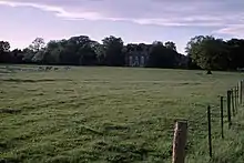
| Border Minstrel Public House to North West of Brandling House | North Gosforth, Newcastle upon Tyne | Country House | 1757 | 27 August 1952 | NZ2482671290 55°02′08″N 1°36′47″W |
1024715 | 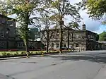 Border Minstrel Public House to North West of Brandling House |
| Caretaker's Flat, Brandling House | Gosforth Park, North Gosforth, Newcastle upon Tyne | House | 1757 | 27 August 1952 | NZ2488771280 55°02′08″N 1°36′44″W |
1355322 |  Caretaker's Flat, Brandling House |
| Gosforth House, Now Brandling House, Part of High Gosforth Park Club | Gosforth Park, North Gosforth, Newcastle upon Tyne | Country House | 1755-64 | 27 August 1952 | NZ2485171251 55°02′07″N 1°36′46″W |
1121859 | 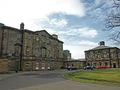 Gosforth House, Now Brandling House, Part of High Gosforth Park Club |
| North Gosforth Chapel | North Gosforth, Newcastle upon Tyne | Chapel | 1296 | 30 March 1987 | NZ2463370108 55°01′30″N 1°36′58″W |
1355323 |  North Gosforth Chapel |
| Woolsington Hall and Wall Attached to North West | Woolsington, Newcastle upon Tyne | House | Third quarter 17th century | 27 August 1952 | NZ1994570831 55°01′54″N 1°41′22″W |
1123737 | |
| Austin Friary Tower Attached to the John George Joicey Museum | Newcastle upon Tyne | Friary | 13th century | 14 June 1954 | NZ2524764191 54°58′18″N 1°36′26″W |
1355203 | .JPG.webp) Austin Friary Tower Attached to the John George Joicey Museum |
| Central Arcade | Newcastle upon Tyne | Lamp Bracket | 1906 | 14 June 1954 | NZ2485464347 54°58′23″N 1°36′48″W |
1355247 | |
| Chapel of St Mary | Newcastle upon Tyne | Chapel | First half 12th century | 14 June 1954 | NZ2593466524 54°59′33″N 1°35′46″W |
1325172 | .jpg.webp) Chapel of St Mary |
| Christ Church and Hall Attached | Shieldfield Green, Newcastle upon Tyne | Church Hall | 1859-61 | 14 June 1954 | NZ2554064599 54°58′31″N 1°36′09″W |
1024748 |  Christ Church and Hall Attached |
| Church of St James with Hall, Sunday School and House Attached | Newcastle upon Tyne | Church Hall | 1882-4 | 30 March 1987 | NZ2512464839 54°58′39″N 1°36′32″W |
1024820 | 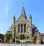 Church of St James with Hall, Sunday School and House Attached |
| Church of St Matthew | Newcastle upon Tyne | Parish Church | 1877 | 14 June 1954 | NZ2383864141 54°58′17″N 1°37′45″W |
1024757 | 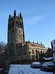 Church of St Matthew |
| Church of St Michael and Presbytery Attached | Newcastle upon Tyne | Priests House | 1889-91 | 17 December 1971 | NZ2314763509 54°57′56″N 1°38′24″W |
1024743 | 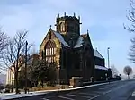 Church of St Michael and Presbytery Attached |
| Church of St Thomas the Martyr | Newcastle upon Tyne | Church | 1825-1830 | 14 June 1954 | NZ2487764909 54°58′41″N 1°36′46″W |
1024952 | |
| Church of the Holy Trinity | Newcastle upon Tyne | Parish Church | 1908 | 17 December 1971 | NZ2614666023 54°59′17″N 1°35′35″W |
1024942 | 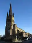 Church of the Holy Trinity |
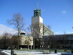
| Civic Centre | Newcastle upon Tyne | Banqueting House | 1956 | 16 November 1995 | NZ2505864947 54°58′43″N 1°36′36″W |
1242692 | |
| Customs House | Quayside, Newcastle upon Tyne | Custom House | 1766 | 17 December 1971 | NZ2540063913 54°58′09″N 1°36′17″W |
1325530 | |
| Derwent Water Chambers | Newcastle upon Tyne | Jettied House | 17th century | 14 June 1954 | NZ2518863868 54°58′08″N 1°36′29″W |
1120904 | 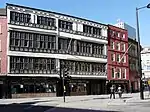 Derwent Water Chambers |
| Education Committee Distribution Centre Office (Ouseburn Schools) | Newcastle upon Tyne | School | 1893 | 17 December 1971 | NZ2651764248 54°58′20″N 1°35′14″W |
1024947 | 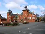 Education Committee Distribution Centre Office (Ouseburn Schools) |
| Emerson Chambers | Newcastle upon Tyne | Shop | c. 1903 | 30 March 1987 | NZ2482964466 54°58′27″N 1°36′49″W |
1024923 | .JPG.webp) Emerson Chambers |
| Entrance Archway, Pair of Chapel Lodges, Walls and Gates to Jesmond Cemetery | Newcastle upon Tyne | Gate | 1836 | 14 June 1954 | NZ2569865562 54°59′02″N 1°36′00″W |
1186766 | .jpg.webp) Entrance Archway, Pair of Chapel Lodges, Walls and Gates to Jesmond Cemetery |
| Exchange Buildings | Newcastle upon Tyne | Exchange | c. 1840 | 14 June 1954 | NZ2487564338 54°58′23″N 1°36′47″W |
1138984 |  Exchange Buildings |
| Hancock Museum of Natural History | Newcastle upon Tyne | Museum | 1878 | 17 December 1971 | NZ2485765169 54°58′50″N 1°36′47″W |
1024951 | 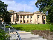 Hancock Museum of Natural History |
| La Sagesse School, Jesmond Towers | Newcastle upon Tyne | House | Early 19th century before 1817 | 17 December 1971 | NZ2549167122 54°59′53″N 1°36′11″W |
1024954 | |
| Lemington Cone | Lemington, Newcastle upon Tyne | Glass Works | Early 17th century | 4 June 1976 | NZ1836164572 54°58′32″N 1°42′53″W |
1299389 | 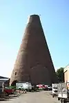 Lemington Cone |
| Literary and Philosophical Society | Newcastle upon Tyne | Library | 1822 | 14 June 1954 | NZ2481363925 54°58′10″N 1°36′50″W |
1121954 | .JPG.webp) Literary and Philosophical Society |
| Lloyd's Bank | Newcastle upon Tyne | House | c. 1839 | 14 June 1954 | NZ2491864355 54°58′23″N 1°36′44″W |
1024880 | 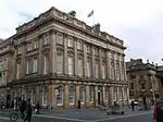 Lloyd's Bank |
| Neville Hall and Wood Memorial Hall | Newcastle upon Tyne | Library | 1869-72 | 12 November 1965 | NZ2479363932 54°58′10″N 1°36′51″W |
1024739 | .JPG.webp) Neville Hall and Wood Memorial Hall |
| Number 20 and Building to Rear (number 18 Now Demolished) | Newcastle upon Tyne | Boiler House | c1849-1859 | 30 September 1983 | NZ2472863678 54°58′02″N 1°36′55″W |
1120815 | .jpg.webp) Number 20 and Building to Rear (number 18 Now Demolished) |
| Old Assembly Rooms | Newcastle upon Tyne | Assembly Rooms | 1774-6 | 14 June 1954 | NZ2460764061 54°58′14″N 1°37′02″W |
1355256 | 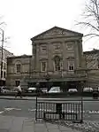 Old Assembly Rooms |
| Ouseburn Viaduct with Accommodation Arch | Newcastle upon Tyne | Railway Viaduct | 1837-9 | 12 November 1965 | NZ2614664720 54°58′35″N 1°35′35″W |
1120788 | 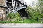 Ouseburn Viaduct with Accommodation Arch |
| George Stephenson Memorial | Newcastle upon Tyne | Statue | 1862 | 12 November 1965 | NZ2474763955 54°58′11″N 1°36′54″W |
1338572 | 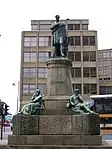 George Stephenson Memorial |
| South African War Memorial | Newcastle upon Tyne | War Memorial | 1907 | 12 November 1965 | NZ2481164862 54°58′40″N 1°36′50″W |
1024847 | 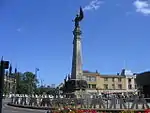 South African War Memorial |
| South Lodge, Gateway, Walls and Gates to Jesmond Cemetery | Newcastle upon Tyne | Gate | 1836 | 14 June 1954 | NZ2578265485 54°59′00″N 1°35′55″W |
1024860 | .jpg.webp) South Lodge, Gateway, Walls and Gates to Jesmond Cemetery |
| St Mary's Training College Administration Block and Chapel | Newcastle upon Tyne | House | 1748 | 17 December 1971 | NZ2211065418 54°58′58″N 1°39′22″W |
1320395 | .jpg.webp) St Mary's Training College Administration Block and Chapel |
| St Mary's Training College Lecture Room Block | Newcastle upon Tyne | Courtyard | 1907 | 17 December 1971 | NZ2203865398 54°58′58″N 1°39′26″W |
1024897 | 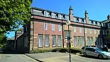 St Mary's Training College Lecture Room Block |
| Statue of Queen Victoria | Newcastle upon Tyne | Statue | c. 1900 | 30 March 1987 | NZ2496164031 54°58′13″N 1°36′42″W |
1024771 | 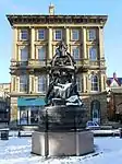 Statue of Queen Victoria |
| Statue of Queen Victoria on Front Lawn of Royal Victoria Infirmary | Newcastle upon Tyne | Terrace | 1906 | 30 March 1987 | NZ2443664939 54°58′42″N 1°37′11″W |
1024801 | 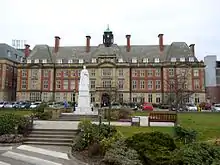 Statue of Queen Victoria on Front Lawn of Royal Victoria Infirmary |
| The John George Joicey Museum (formerly Holy Jesus Hospital) | Newcastle upon Tyne | Museum | 1987 | 14 June 1954 | NZ2522564177 54°58′18″N 1°36′27″W |
1116207 | 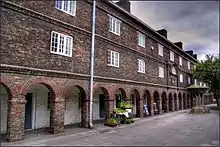 The John George Joicey Museum (formerly Holy Jesus Hospital) |
| The Keelmen's Hospital | Newcastle upon Tyne | Courtyard | 1701 | 14 June 1954 | NZ2554564178 54°58′18″N 1°36′09″W |
1024902 | 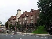 The Keelmen's Hospital |
| The Red House | Newcastle upon Tyne | House | 17th century | 14 June 1954 | NZ2519263877 54°58′08″N 1°36′29″W |
1024778 | 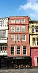 The Red House |
| The Turk's Head Hotel | Newcastle upon Tyne | House | c. 1837 | 12 November 1965 | NZ2490464262 54°58′20″N 1°36′45″W |
1329950 |  The Turk's Head Hotel |
| Tiffany's Club (west Part) | Newcastle upon Tyne | House | c. 1825 | 14 June 1954 | NZ2517164528 54°58′29″N 1°36′30″W |
1024815 | 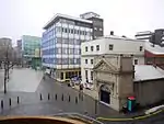 Tiffany's Club (west Part) |
| Trinity House | Newcastle upon Tyne | House | 1954 | 14 June 1954 | NZ2535363993 54°58′12″N 1°36′20″W |
1116390 | .jpg.webp) Trinity House |
| Trinity House Number 12 (school) and Wall and Railings Attached | Newcastle upon Tyne | Gate | 1753 | 30 March 1987 | NZ2537063982 54°58′11″N 1°36′19″W |
1116373 | .jpg.webp) Trinity House Number 12 (school) and Wall and Railings Attached |
| 11 and 13 Shakespeare Street | Newcastle upon Tyne | House | 1837 | 17 December 1971 | NZ2497864313 54°58′22″N 1°36′41″W |
1024783 | .jpg.webp) 11 and 13 Shakespeare Street |
| 1 and 3 Grey Street | Newcastle upon Tyne | House | c. 1835 | 12 November 1965 | NZ2501064102 54°58′15″N 1°36′39″W |
1024871 | 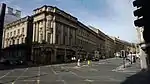 1 and 3 Grey Street |
| 61–67 Grey Street | Newcastle upon Tyne | House | c. 1837 | 14 June 1954 | NZ2491164245 54°58′20″N 1°36′45″W |
1024876 | 61–67 Grey Street |
| 32 Close | Newcastle upon Tyne | Jettied House | 15th century | 14 June 1954 | NZ2503863762 54°58′04″N 1°36′38″W |
1024916 | 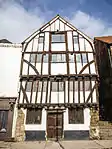 32 Close |
| 33–41 Grey Street | Newcastle upon Tyne | Office | 1954 | 14 June 1954 | NZ2495064173 54°58′18″N 1°36′42″W |
1024873 |  33–41 Grey Street |
| 55–59 Grey Street | Newcastle upon Tyne | House | c. 1837 | 12 November 1965 | NZ2491964235 54°58′20″N 1°36′44″W |
1024875 | 55–59 Grey Street |
| 1 and 3 Market Street | Newcastle upon Tyne | House | c. 1837 | 14 June 1954 | NZ2497064333 54°58′23″N 1°36′41″W |
1087018 | .jpg.webp) 1 and 3 Market Street |
| 86–90 Grainger Street | Newcastle upon Tyne | House | c. 1837 | 12 November 1965 | NZ2478664218 54°58′19″N 1°36′52″W |
1115146 |  86–90 Grainger Street |
| 19–31 Grey Street | Newcastle upon Tyne | House | c. 1835 | 12 November 1965 | NZ2497064146 54°58′17″N 1°36′41″W |
1139024 | 19–31 Grey Street |
| 53 Grey Street | Newcastle upon Tyne | House | c. 1837 | 12 November 1965 | NZ2492264216 54°58′19″N 1°36′44″W |
1138998 | 53 Grey Street |
| 5–13 Grey Street | Newcastle upon Tyne | House | c. 1835 | 12 November 1965 | NZ2499364121 54°58′16″N 1°36′40″W |
1139021 | 5–13 Grey Street |
| 108 and 110 Grainger Street | Newcastle upon Tyne | House | c. 1836 | 12 November 1965 | NZ2480864262 54°58′21″N 1°36′50″W |
1320572 | 108 and 110 Grainger Street |
| 52–78 Grey Street | Newcastle upon Tyne | House | c. 1836 | 12 November 1965 | NZ2496464216 54°58′19″N 1°36′42″W |
1318917 |  52–78 Grey Street |
| 39 and 40 Sandhill | Newcastle upon Tyne | Jettied House | 17th century | 14 June 1954 | NZ2517763853 54°58′07″N 1°36′30″W |
1323105 |  39 and 40 Sandhill |
| 43 and 45 Grey Street | Newcastle upon Tyne | House | c. 1837 | 12 November 1965 | NZ2493564195 54°58′18″N 1°36′43″W |
1329921 | 43 and 45 Grey Street |
| 1–4 Eldon Square | Newcastle upon Tyne | House | 1825-31 | 14 June 1954 | NZ2478764487 54°58′28″N 1°36′51″W |
1355254 | 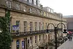 1–4 Eldon Square |
| 80–96 Grey Street | Newcastle upon Tyne | House | c. 1836 | 12 November 1965 | NZ2494364262 54°58′20″N 1°36′43″W |
1355249 |  80–96 Grey Street |
| 15 and 17 Grey Street | Newcastle upon Tyne | House | c. 1835 | 12 November 1965 | NZ2498164133 54°58′16″N 1°36′41″W |
1024872 | |
| 112–118 Grainger Street | Newcastle upon Tyne | House | c. 1836 | 12 November 1965 | NZ2481464276 54°58′21″N 1°36′50″W |
1024869 | .jpg.webp) 112–118 Grainger Street |
| 47–51 Grey Street | Newcastle upon Tyne | House | c. 1837 | 12 November 1965 | NZ2493164203 54°58′19″N 1°36′43″W |
1024874 | 47–51 Grey Street |
| 12, 14 and 16 Cloth Market | Newcastle upon Tyne | House | Late 16th century | 30 March 1987 | NZ2493664088 54°58′15″N 1°36′43″W |
1355229 |  12, 14 and 16 Cloth Market |
| 36 and 38 Sandhill | Newcastle upon Tyne | House | 17th century | 17 December 1971 | NZ2518263862 54°58′07″N 1°36′29″W |
1355313 | 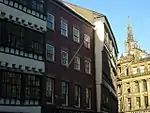 36 and 38 Sandhill |
| 55 and 57 Westgate Road | Newcastle upon Tyne | House | c. 1750 | 17 December 1971 | NZ2461063986 54°58′12″N 1°37′02″W |
1024740 | 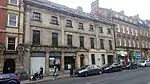 55 and 57 Westgate Road |
| 35 Close | Newcastle upon Tyne | House | Later than 16th century | 29 June 1976 | NZ2505663705 54°58′02″N 1°36′37″W |
1024918 | 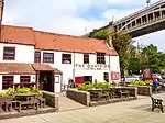 35 Close |
| 68–72 Grainger Street | Newcastle upon Tyne | House | c. 1836 | 12 November 1965 | NZ2477064171 54°58′18″N 1°36′53″W |
1115411 |  68–72 Grainger Street |
| Newcastle and District War Memorial | Newcastle upon Tyne | War memorial | 1923 | 12 November 1965 | NZ2472664491 54°58′28″N 1°36′55″W |
1115605 | .jpg.webp) Newcastle and District War Memorial |
.JPG.webp)
North Tyneside
| Name | Location | Type | Completed [note 1] | Date designated | Grid ref.[note 2] Geo-coordinates |
Entry number [note 3] | Image |
|---|---|---|---|---|---|---|---|
| Accumulator Tower in Albert Edward Dock | North Tyneside | Machinery | 1882 | 19 February 1986 | NZ3530266941 54°59′45″N 1°26′59″W |
1354990 | 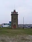 Accumulator Tower in Albert Edward Dock |
| British Gas Research Station Including Attached Restaurant Block to South | Killingworth, North Tyneside | Workshop | 1966-67 | 27 January 1997 | NZ2684671409 55°02′11″N 1°34′53″W |
1259313 |  British Gas Research Station Including Attached Restaurant Block to South |
| Chapel and Crematorium at Whitley Bay Cemetery | North Tyneside | Cemetery Chapel | 1913 | 9 May 2003 | NZ3456674468 55°03′49″N 1°27′37″W |
1096121 |  Chapel and Crematorium at Whitley Bay Cemetery |
| Church of St Peter | North Tyneside | Parish Church | 1809 | 18 August 1947 | NZ3097466708 54°59′38″N 1°31′03″W |
1025326 | |
| Cliff House | Cullercoats, North Tyneside | House | c. 1768 | 23 December 1971 | NZ3641871461 55°02′11″N 1°25′54″W |
1299734 | 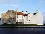 Cliff House |
| Clifford's Fort South and East Wall Facing River | North Tyneside | Wall | 1672 | 19 February 1986 | NZ3636368553 55°00′37″N 1°25′59″W |
1185263 |  Clifford's Fort South and East Wall Facing River |
| Clifford's Fort West and South West Wall | North Tyneside | Wall | 1672 | 19 February 1986 | NZ3628868461 55°00′34″N 1°26′03″W |
1025359 | |
| Collingwood Monument and Guns | Tynemouth, North Tyneside | Cannon | 1845 | 19 February 1986 | NZ3718169069 55°00′53″N 1°25′12″W |
1355011 |  Collingwood Monument and Guns |
| Dial Cottage | North Tyneside | House | 1986 | 27 February 1950 | NZ2747270427 55°01′39″N 1°34′18″W |
1025392 | 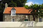 Dial Cottage |
| Tynemouth Station Main and Subsidiary Buildings with Canopies and Footbridge | Tynemouth, North Tyneside | Footbridge | c. 1882 | 2 November 1978 | NZ3664269343 55°01′02″N 1°25′43″W |
1185168 | 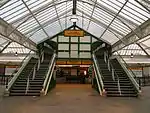 Tynemouth Station Main and Subsidiary Buildings with Canopies and Footbridge |
South Tyneside
| Name | Location | Type | Completed [note 1] | Date designated | Grid ref.[note 2] Geo-coordinates |
Entry number [note 3] | Image |
|---|---|---|---|---|---|---|---|
| Bede Cottage and Bede House and Attached Outbuilding | Monkton, South Tyneside | House | early-mid 17th century | 18 January 1949 | NZ3212463751 54°58′02″N 1°29′59″W |
1186029 |  Bede Cottage and Bede House and Attached Outbuilding |
| Cleadon House | Cleadon, South Tyneside | House | 1738? | 25 February 1949 | NZ3707161738 54°56′56″N 1°25′22″W |
1025212 | |
| Monkton Farmhouse | Monkton, South Tyneside | Farmhouse | Mid 18th century | 18 January 1949 | NZ3202163669 54°58′00″N 1°30′05″W |
1355094 |  Monkton Farmhouse |
| Scots House | West Boldon, South Tyneside | House | Early 18th century | 25 February 1949 | NZ3271960973 54°56′32″N 1°29′27″W |
1185728 | |
| Souter Point Lighthouse and Attached Buildings | Whitburn, South Tyneside | Workers Cottage | 1871 | 26 February 1985 | NZ4080764169 54°58′14″N 1°21′51″W |
1185593 | |
| West Boldon Hall | West Boldon, South Tyneside | House | 1709 | 25 February 1949 | NZ3505960982 54°56′32″N 1°27′15″W |
1025226 | |

Sunderland
| Name | Location | Type | Completed [note 1] | Date designated | Grid ref.[note 2] Geo-coordinates |
Entry number [note 3] | Image |
|---|---|---|---|---|---|---|---|
| Chimney to West of Boiler House at Ryhope Pumping Station | Ryhope, Sunderland | Water Pumping Station | 1866-9 | 19 June 1974 | NZ4036252454 54°51′55″N 1°22′22″W |
1207133 | 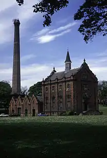 Chimney to West of Boiler House at Ryhope Pumping Station |
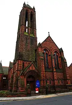
| Church of St George with Trinity and St James with Hall, Walls and Gates | Sunderland | Church | 1888-90 | 17 October 1994 | NZ3955256279 54°53′59″N 1°23′05″W |
1279916 | |
| Church of St Michael | Sunderland | Minster | c. 1807 | 10 November 1978 | NZ3928556953 54°54′21″N 1°23′20″W |
1207993 | |
| Doxford House, Sunderland Polytechnic Hall of Residence with Conservatory | Silksworth, Sunderland | House | c. 1820 | 25 February 1949 | NZ3753552785 54°52′06″N 1°25′00″W |
1279879 | 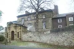 Doxford House, Sunderland Polytechnic Hall of Residence with Conservatory |
| Engine House and Boiler House at Ryhope Pumping Station | Ryhope, Sunderland | Boiler House | 1866-9 | 19 June 1974 | NZ4038052462 54°51′55″N 1°22′21″W |
1218116 | Engine House and Boiler House at Ryhope Pumping Station |
| Fulwell Mill | Fulwell, Sunderland | Windmill | Earlier | 10 November 1978 | NZ3919159469 54°55′42″N 1°23′24″W |
1207109 | 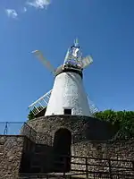 Fulwell Mill |
| Houghton Hall Young Mens Christian Association | Houghton Le Spring, Sunderland | Manor House | Early 17th century | 26 April 1950 | NZ3443649814 54°50′31″N 1°27′55″W |
1184920 | |
| Houghton Le Spring Area Offices of Sunderland District Council | Houghton Le Spring, Sunderland | Vicarage | Early 17th century | 26 April 1950 | NZ3408249832 54°50′32″N 1°28′15″W |
1184817 | |
| Kepier Grammar School | Houghton Le Spring, Sunderland | Apartment | 1950 | 26 April 1950 | NZ3424749885 54°50′33″N 1°28′06″W |
1025443 | |
| Monkwearmouth Museum of Land Transport with Walls, Footbridge, Waiting Room | Sunderland | Station Masters House | 1848 | 8 May 1950 | NZ3961057671 54°54′44″N 1°23′01″W |
1209029 | 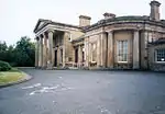 Monkwearmouth Museum of Land Transport with Walls, Footbridge, Waiting Room |
| Mountain Daisy Public House | Sunderland | Public House | 1901 | 2 February 1994 | NZ3835457033 54°54′24″N 1°24′12″W |
1279894 | |
| Old South Pier Lighthouse in Roker Cliff Park Nz 4073 5974 | Sunderland | Lighthouse | 1856 | 10 November 1978 | NZ4071759796 54°55′52″N 1°21′58″W |
1218440 | 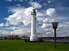 Old South Pier Lighthouse in Roker Cliff Park Nz 4073 5974 |
| The Empire Theatre | Sunderland | Statue | 1906-7 | 10 November 1978 | NZ3926957047 54°54′24″N 1°23′21″W |
1279891 | 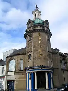 The Empire Theatre |
| Victoria Railway Bridge | Sunderland | Railway Bridge | 1838 | 15 July 1985 | NZ3201454540 54°53′05″N 1°30′09″W |
1354978 |  Victoria Railway Bridge |
| 10 Church Street East | Sunderland | House | Early 18th century | 8 May 1950 | NZ4050357307 54°54′32″N 1°22′11″W |
1279470 | |
| 11 Church Street East | Sunderland | House | Early 18th century | 8 May 1950 | NZ4050957298 54°54′32″N 1°22′11″W |
1207069 | |
.jpg.webp)
Former listed buildings
| Name | Location | Type | Completed [note 1] | Date designated | Grid ref.[note 2] Geo-coordinates | Notes | Entry number [note 3] | Image |
|---|---|---|---|---|---|---|---|---|
| Giant Crane at Former Nem Works | Wallsend on Tyne, North Tyneside | Crane | 1909 | 22 February 1989 | NZ3122266171 54°59′21″N 1°30′49″W | De-listed and demolished in the early 1990s following a public enquiry.[1] | 1253566 | 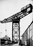 Giant Crane at Former Nem Works |
Notes
- The date given is the date used by Historic England as significant for the initial building or that of an important part in the structure's description.
- Sometimes known as OSGB36, the grid reference is based on the British national grid reference system used by the Ordnance Survey.
- The "List Entry Number" is a unique number assigned to each listed building and scheduled monument by Historic England.
References
- "NEM Hammer-head Crane". Co-Curate. Newcastle University. Retrieved 28 October 2020.
External links
![]() Media related to Grade II* listed buildings in Tyne and Wear at Wikimedia Commons
Media related to Grade II* listed buildings in Tyne and Wear at Wikimedia Commons
This article is issued from Wikipedia. The text is licensed under Creative Commons - Attribution - Sharealike. Additional terms may apply for the media files.