Grade II* listed buildings in Spelthorne
There are over 20,000 Grade II* listed buildings in England. This page is a list of the twelve Grae II* buildings in the district of Spelthorne in Surrey. For links to similar articles in relation to the other 10 districts of Surrey see Grade II* listed buildings in Surrey.
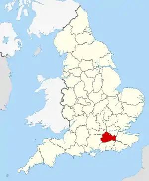
Surrey shown within England
Spelthorne
| Name | Location | Type | Completed [note 1] | Date designated | Grid ref.[note 2] Geo-coordinates |
Entry number [note 3] | Image |
|---|---|---|---|---|---|---|---|
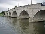
| Chertsey Bridge | (Littleton traditionally), SHEPPERTON close to Laleham Park Chertsey, Runnymede (borough) | Bridge | 1783–85 | 11 August 1952 | TQ0542166624 51°23′20″N 0°29′11″W |
1204646 | |
| Church of St Mary | Staines-upon-Thames | Church | 1828 | 11 August 1952 | TQ0305671865 51°26′11″N 0°31′08″W |
1187031 | |
| Church of St Mary the Virgin | Sunbury-on-Thames | Church | 1752 | 11 September 1951 | TQ1062168514 51°24′18″N 0°24′40″W |
1029661 | 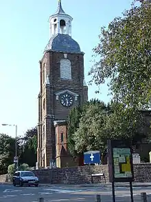 Church of St Mary the Virgin |
| Church of St Nicholas | Shepperton | Church | 17th and 18th century | 11 September 1951 | TQ0770066593 51°23′17″N 0°27′13″W |
1178304 | .jpg.webp) Church of St Nicholas |
| Dunmore House | Stanwell, STAINES-UPON-THAMES | House | c. 1720 | 11 August 1952 | TQ0575274189 51°27′25″N 0°28′46″W |
1204875 | 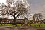 Dunmore House |
| Laleham Abbey | Laleham, STAINES-UPON-THAMES | Country House | 1803–06 | 25 November 1957 | TQ0521668194 51°24′11″N 0°29′20″W |
1187014 | 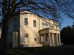 Laleham Abbey |
| Littleton Manor | Littleton, SHEPPERTON (post town) | Hall House | 15th century | 9 December 1969 | TQ0725968652 51°24′24″N 0°27′33″W |
1029672 |  |
| Lord Knyvett's Adult Education Centre | Stanwell, STAINES-UPON-THAMES (post town) | School | c. 1624 | 11 August 1952 | TQ0599474367 51°27′30″N 0°28′33″W |
1204896 | 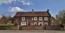 Lord Knyvett's Adult Education Centre |
| Manor House | Shepperton | House | c. 1820 | 9 December 1969 | TQ0777066613 51°23′18″N 0°27′09″W |
1029694 | 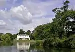 Manor House |
| Sunbury Court | Sunbury-on-Thames | Country House | Early 18th century | 11 September 1951 | TQ1166069085 51°24′35″N 0°23′45″W |
1180231 | 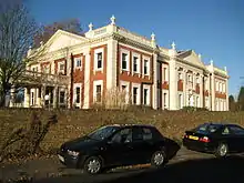 Sunbury Court |
| The (former) Blue Anchor Public House | Staines | Town House | Early to mid 18th century | 11 August 1952 | TQ0342771528 51°26′00″N 0°30′49″W |
1204918 | 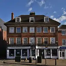 The (former) Blue Anchor Public House |
| The Rectory (Shepperton Rectory) | Shepperton | House | 15th century | 11 September 1951 | TQ0769166632 51°23′19″N 0°27′13″W |
1029698 | |
.jpg.webp)
Notes
- The date given is the date used by Historic England as significant for the initial building or that of an important part in the structure's description.
- Sometimes known as OSGB36, the grid reference is based on the British national grid reference system used by the Ordnance Survey.
- The "List Entry Number" is a unique number assigned to each listed building and scheduled monument by Historic England.
References
External links
![]() Media related to Grade II* listed buildings in Surrey at Wikimedia Commons
Media related to Grade II* listed buildings in Surrey at Wikimedia Commons
This article is issued from Wikipedia. The text is licensed under Creative Commons - Attribution - Sharealike. Additional terms may apply for the media files.