National Register of Historic Places listings in Wyandotte County, Kansas
This is a list of the National Register of Historic Places listings in Wyandotte County, Kansas.
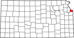
Location of Wyandotte County in Kansas
This is intended to be a complete list of the properties and districts on the National Register of Historic Places in Wyandotte County, Kansas, United States. Latitude and longitude coordinates are provided for many National Register properties and districts; these locations may be seen together in a map.[1]
There are 42 properties and districts listed on the National Register in the county, including one National Historic Landmark. Another two properties were once listed but have been removed.
- This National Park Service list is complete through NPS recent listings posted January 29, 2021.[2]
Current listings
| [3] | Name on the Register[4] | Image | Date listed[5] | Location | City or town | Description |
|---|---|---|---|---|---|---|
| 1 | Argentine Carnegie Library | 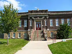 Argentine Carnegie Library |
April 30, 1986 (#86000919) |
1400 Joseph J. Segura Ln 39°04′27″N 94°39′40″W |
Kansas City | |
| 2 | Bonner Springs High School | July 11, 2002 (#02000761) |
200 E. 3rd 39°03′28″N 94°52′57″W |
Bonner Springs | ||
| 3 | Brotherhood Block | July 12, 2019 (#100004198) |
753 State Ave., & 754-756 Minnesota Ave. 39°06′59″N 94°37′45″W |
Kansas City | ||
| 4 | Castle Rock | 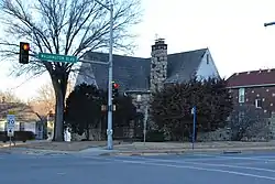 Castle Rock |
February 18, 2000 (#00000109) |
852 Washington Boulevard 39°07′08″N 94°37′56″W |
Kansas City | |
| 5 | Fairfax Hills Historic District | 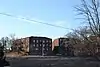 Fairfax Hills Historic District |
June 30, 2007 (#07000608) |
Bounded by Esplanade Ave., Brown Ave., and 12th St., including both sides of Parkwood Boulevard, Coronado Rd. and Hilltop Rd. 39°08′37″N 94°38′17″W |
Kansas City | |
| 6 | Fire Station No. 9 | 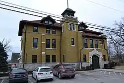 Fire Station No. 9 |
September 5, 1985 (#85001982) |
2 S. 14th St. 39°06′14″N 94°38′42″W |
Kansas City | |
| 7 | Franklin Elementary School | 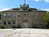 Franklin Elementary School |
June 26, 2013 (#13000437) |
1403 Metropolitan Ave. 39°04′21″N 94°38′43″W |
Kansas City | |
| 8 | Judge Louis Gates House | 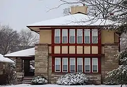 Judge Louis Gates House |
December 1, 1980 (#80001477) |
4146 Cambridge St. 39°03′08″N 94°36′31″W |
Kansas City | |
| 9 | Granada Theater |  Granada Theater |
February 9, 2005 (#05000004) |
1013-1019 Minnesota Ave. 39°06′55″N 94°38′10″W |
Kansas City | |
| 10 | Grinter Place | 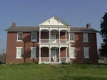 Grinter Place |
January 25, 1971 (#71000338) |
1420 S. 78th St. 39°04′30″N 94°45′37″W |
Kansas City | |
| 11 | H.W. Gates Funeral Home | 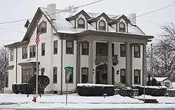 H.W. Gates Funeral Home |
July 6, 2010 (#10000430) |
1901 Olathe Blvd. 39°03′15″N 94°36′27″W |
Kansas City | |
| 12 | Hanover Heights Neighborhood Historic District | 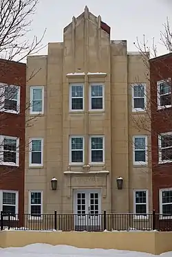 Hanover Heights Neighborhood Historic District |
May 17, 1990 (#90000776) |
Roughly bounded by Olathe Boulevard, Frances St., 43rd Ave., and State Line Rd. 39°03′09″N 94°36′38″W |
Kansas City | |
| 13 | Huron Cemetery | .JPG.webp) Huron Cemetery |
September 3, 1971 (#71000335) |
On Minnesota Ave. between 6th and 7th Sts. 39°06′53″N 94°37′34″W |
Kansas City | |
| 14 | Kansas City, Kansas City Hall and Fire Headquarters | 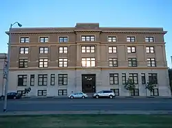 Kansas City, Kansas City Hall and Fire Headquarters |
April 25, 1986 (#86000857) |
805 and 815 N. 6th St. 39°06′51″N 94°37′24″W |
Kansas City | |
| 15 | Kansas City, Kansas High School Gymnasium and Laboratory | 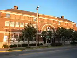 Kansas City, Kansas High School Gymnasium and Laboratory |
January 20, 2012 (#11001038) |
1017 N. 9th St. 39°06′59″N 94°37′55″W |
Kansas City | |
| 16 | Kansas City, Kansas YMCA Building | 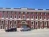 Kansas City, Kansas YMCA Building |
July 12, 2019 (#100004199) |
900 N. 8th St. 39°06′53″N 94°37′47″W |
Kansas City | |
| 17 | Lake of the Forest Historic District | January 22, 1996 (#95001553) |
K-32 39°03′57″N 94°50′24″W |
Bonner Springs | ||
| 18 | Lowell Elementary School | 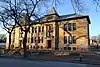 Lowell Elementary School |
January 31, 2008 (#07001485) |
1040 Orville Ave. 39°06′36″N 94°38′14″W |
Kansas City | |
| 19 | Horace Mann Elementary School | 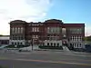 Horace Mann Elementary School |
January 20, 2012 (#11001037) |
824 State Ave. 39°07′01″N 94°37′51″W |
Kansas City | |
| 20 | Cordell D. Meeks Sr. House | 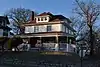 Cordell D. Meeks Sr. House |
October 9, 2013 (#13000819) |
600 Oakland Ave. 39°07′15″N 94°37′29″W |
Kansas City | |
| 21 | Northeast Junior High School | 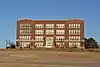 Northeast Junior High School |
October 16, 2008 (#08000988) |
400 Troup Ave. 39°07′39″N 94°37′05″W |
Kansas City | |
| 22 | Quindaro Townsite | 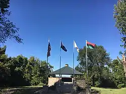 Quindaro Townsite |
May 22, 2002 (#02000547) |
Parallel Parkway and N. 38th St.[6] 39°07′46″N 94°40′22″W |
Kansas City | |
| 23 | Rosedale World War I Memorial Arch | 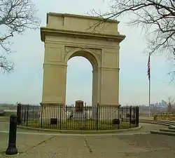 Rosedale World War I Memorial Arch |
August 2, 1977 (#77000599) |
Mt. Marty Park near Booth and Drexel Sts. 39°03′50″N 94°36′54″W |
Kansas City | |
| 24 | St. Augustine Hall | 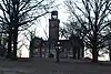 St. Augustine Hall |
February 24, 1971 (#71000336) |
3301 Parallel Ave. 39°07′39″N 94°40′08″W |
Kansas City | |
| 25 | Saint Margaret's Hospital | 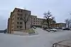 Saint Margaret's Hospital |
January 2, 2013 (#12001123) |
263 S. 8th St., 759 Vermont Ave. 39°05′50″N 94°37′45″W |
Kansas City | |
| 26 | Sauer Castle | 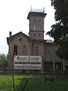 Sauer Castle |
August 2, 1977 (#77000600) |
945 Shawnee Dr. 39°04′07″N 94°38′00″W |
Kansas City | |
| 27 | Schleifer-McAlpine House | 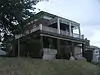 Schleifer-McAlpine House |
October 10, 2007 (#07001072) |
608 Splitlog Ave. 39°06′33″N 94°37′28″W |
Kansas City | |
| 28 | Scottish Rite Temple | 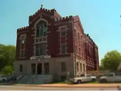 Scottish Rite Temple |
September 11, 1985 (#85002127) |
803 N. 7th St. 39°06′50″N 94°37′34″W |
Kansas City | |
| 29 | Theodore Shafer House | 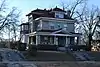 Theodore Shafer House |
February 18, 2000 (#00000108) |
2518 N. 10th St. 39°08′04″N 94°38′07″W |
Kansas City | |
| 30 | Shawnee Street Overpass | 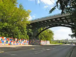 Shawnee Street Overpass |
March 8, 1984 (#84001245) |
Northwest of U.S. Route 35 39°04′19″N 94°37′15″W |
Kansas City | Location was at Shawnee Road and 7th Street Traffic-way;[7] Original structure was replaced during the 2000s with a newer structure. |
| 31 | Simmons Funeral Home | 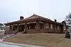 Simmons Funeral Home |
January 8, 2014 (#13001046) |
1404 S. 37th St. 39°04′29″N 94°40′18″W |
Kansas City | |
| 32 | Soldiers and Sailors Memorial Building | .JPG.webp) Soldiers and Sailors Memorial Building |
September 5, 1985 (#85001981) |
600 N. 7th St. 39°06′44″N 94°37′38″W |
Kansas City | |
| 33 | Sumner High School and Athletic Field | 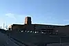 Sumner High School and Athletic Field |
September 6, 2005 (#05000974) |
1610 N. 8th St. 39°07′15″N 94°37′49″W |
Kansas City | |
| 34 | Town House Hotel | 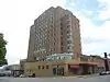 Town House Hotel |
June 27, 2014 (#14000352) |
1011 N. 7th St. Trafficway 39°06′59″N 94°37′35″W |
Kansas City | Now Cross Lines Tower. |
| 35 | Trowbridge Archeological Site | February 24, 1971 (#71000337) |
Between 61st and 63rd Sts., north of May Ln. and Leavenworth Rd.[8] 39°08′40″N 94°43′20″W |
Kansas City | ||
| 36 | Welborn Community Congregational Church | 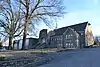 Welborn Community Congregational Church |
April 16, 2013 (#13000166) |
5217 Leavenworth Rd 39°08′33″N 94°42′03″W |
Kansas City | |
| 37 | Westheight Apartments Historic District | 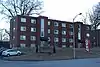 Westheight Apartments Historic District |
July 7, 2015 (#15000388) |
1601-1637 Washington Blvd. 39°07′12″N 94°38′52″W |
Kansas City | |
| 38 | Westheight Manor District | 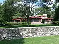 Westheight Manor District |
March 26, 1975 (#75000729) |
Bounded roughly by 18th and 24th Sts. and Oakland and State Aves.; also roughly bounded by State and Wood Aves. and 18th and 25th Sts. 39°07′07″N 94°39′09″W |
Kansas City | Second set of addresses represents a boundary increase |
| 39 | Whitefeather Spring | 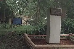 Whitefeather Spring |
August 27, 1975 (#75000728) |
3818 Ruby Ave. 39°04′18″N 94°40′25″W |
Kansas City | |
| 40 | Roy Williamson House | April 18, 2007 (#07000311) |
1865 Edwardsville Dr. 39°03′59″N 94°49′18″W |
Edwardsville | ||
| 41 | Wyandotte County Courthouse | 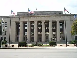 Wyandotte County Courthouse |
April 26, 2002 (#02000398) |
710 N. 7th St. 39°06′51″N 94°37′38″W |
Kansas City | |
| 42 | Wyandotte High School | 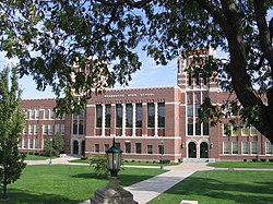 Wyandotte High School |
April 30, 1986 (#86000920) |
2500 Minnesota Ave. 39°06′52″N 94°39′21″W |
Kansas City |
Former listing
| [3] | Name on the Register | Image | Date listed | Date removed | Location | City or town | Summary |
|---|---|---|---|---|---|---|---|
| 1 | Huron Building | July 5, 1984 (#84001243) | June 14, 2000 | 905 N. 7th St. |
Kansas City | Demolished by implosion in 2000.[9] | |
| 2 | St. John the Divine Catholic Church | 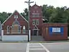 St. John the Divine Catholic Church |
October 9, 2013 (#13000820) | October 5, 2020 | 2511 Metropolitan Ave. 39°04′23″N 94°39′31″W |
Kansas City |
See also
| Wikimedia Commons has media related to National Register of Historic Places in Wyandotte County, Kansas. |
References
- The latitude and longitude information provided in this table was derived originally from the National Register Information System, which has been found to be fairly accurate for about 99% of listings. Some locations in this table may have been corrected to current GPS standards.
- "National Register of Historic Places: Weekly List Actions". National Park Service, United States Department of the Interior. Retrieved on January 29, 2021.
- Numbers represent an alphabetical ordering by significant words. Various colorings, defined here, differentiate National Historic Landmarks and historic districts from other NRHP buildings, structures, sites or objects.
- "National Register Information System". National Register of Historic Places. National Park Service. March 13, 2009.
- The eight-digit number below each date is the number assigned to each location in the National Register Information System database, which can be viewed by clicking the number.
- Location derived from its GNIS feature record; the NRIS lists the site as "Address Restricted"
- 497 Shawnee Road, Kansas City, Kansas, United States. Address is approximate.
- Location derived from page 2 of this Wyandotte County document; the NRIS lists the site as "Address Restricted"

Municipalities and communities of Wyandotte County, Kansas, United States | ||
|---|---|---|
| Cities | Map of Kansas highlighting Wyandotte County | |
| Neighborhoods in Kansas City |
| |
| Footnotes | ‡This populated place also has portions in an adjacent county or counties | |
| ||
This article is issued from Wikipedia. The text is licensed under Creative Commons - Attribution - Sharealike. Additional terms may apply for the media files.