National Register of Historic Places listings in Atchison County, Kansas
This is a list of the National Register of Historic Places listings in Atchison County, Kansas.
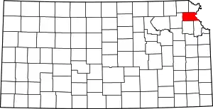
Location of Atchison County in Kansas
This is intended to be a complete list of the properties and districts on the National Register of Historic Places in Atchison County, Kansas, United States. The locations of National Register properties and districts for which the latitude and longitude coordinates are included below, may be seen in a map.[1]
There are 43 properties and districts listed on the National Register in the county.
- This National Park Service list is complete through NPS recent listings posted January 29, 2021.[2]
Current listings
| [3] | Name on the Register[4] | Image | Date listed[5] | Location | City or town | Description |
|---|---|---|---|---|---|---|
| 1 | Atchison Santa Fe Freight Depot | Atchison Santa Fe Freight Depot |
October 11, 2001 (#01001090) |
200 S. Tenth St. 39°33′36″N 95°07′37″W |
Atchison | Today the Santa-Fe Depot Rail Museum |
| 2 | Atchison County Courthouse | 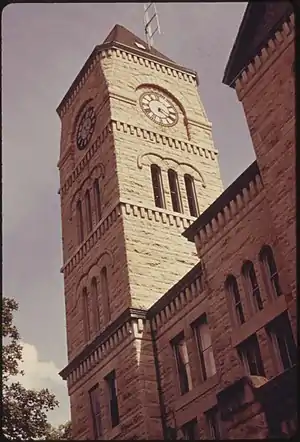 Atchison County Courthouse |
April 16, 1975 (#75000704) |
Southwestern corner of 5th and Parallel Sts. 39°33′58″N 95°07′10″W |
Atchison | |
| 3 | Atchison County Memorial Hall | 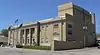 Atchison County Memorial Hall |
April 18, 2007 (#07000317) |
819 Commercial St. 39°33′44″N 95°07′27″W |
Atchison | |
| 4 | Atchison Post Office | 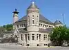 Atchison Post Office |
March 16, 1972 (#72000484) |
621 Kansas Ave.[6] 39°33′48″N 95°07′18″W |
Atchison | |
| 5 | Atchison YMCA | 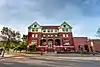 Atchison YMCA |
April 13, 2020 (#100004203) |
325 Commercial St. 39°33′43″N 95°07′02″W |
Atchison | |
| 6 | Francis and Harriet Baker House | _from_SE_1.JPG.webp) Francis and Harriet Baker House |
August 28, 2003 (#03000838) |
823 N. 5th St. 39°34′13″N 95°07′10″W |
Atchison | |
| 7 | Benedictine College North Campus Historic Complex | .jpg.webp) Benedictine College North Campus Historic Complex |
March 17, 1982 (#82002651) |
2nd and Division Sts. 39°34′21″N 95°06′52″W |
Atchison | |
| 8 | George T. and Minnie Searles Bolman House | _from_W_1.JPG.webp) George T. and Minnie Searles Bolman House |
May 17, 2006 (#06000385) |
418 N. 4th St. 39°33′57″N 95°07′03″W |
Atchison | |
| 9 | Henry Braun House | _from_SE_2.JPG.webp) Henry Braun House |
May 17, 2006 (#06000387) |
1307 Division St. 39°34′20″N 95°07′51″W |
Atchison | |
| 10 | J. P. Brown House | 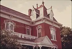 J. P. Brown House |
April 14, 1975 (#75000705) |
805 N. 4th St. 39°34′10″N 95°07′05″W |
Atchison | |
| 11 | Burnes Rental Houses Historic District | 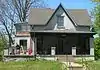 Burnes Rental Houses Historic District |
December 6, 2005 (#05001361) |
615, 617, and 621 N. 3rd St. 39°34′05″N 95°06′59″W |
Atchison | |
| 12 | Campbell Chapel AME Church | _from_S_1.JPG.webp) Campbell Chapel AME Church |
January 17, 2003 (#02001701) |
715 Atchison St. 39°33′55″N 95°07′21″W |
Atchison | |
| 13 | John Drimmel, Sr. Farm | 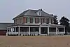 John Drimmel, Sr. Farm |
May 20, 2004 (#04000452) |
16339 290th Rd. 39°34′24″N 95°11′03″W |
Atchison | |
| 14 | Amelia Earhart Birthplace | 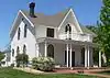 Amelia Earhart Birthplace |
April 16, 1971 (#71000302) |
223 N. Terrace 39°33′50″N 95°06′52″W |
Atchison | |
| 15 | Amelia Earhart Historic District | 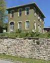 Amelia Earhart Historic District |
February 1, 2002 (#01001543) |
115-125, 200-227, 302-315, 318, 324 2nd St., 203-305 North Terrace, 124, 200, 300 3rd St., and 205, 112, and 224 Santa Fe St. 39°34′05″N 95°06′53″W |
Atchison | |
| 16 | Ebenezer Baptist Church | 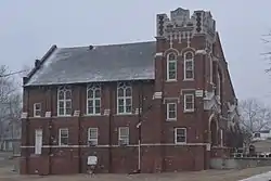 Ebenezer Baptist Church |
November 30, 2005 (#05001343) |
826 Riley 39°34′09″N 95°07′28″W |
Atchison | |
| 17 | James M. Edmiston House | 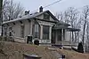 James M. Edmiston House |
May 17, 2006 (#06000386) |
311 S. 7th St. 39°33′33″N 95°07′18″W |
Atchison | |
| 18 | Glancy/Pennell House | 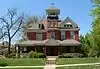 Glancy/Pennell House |
August 26, 1983 (#83000416) |
519 N. 5th St. 39°34′02″N 95°07′10″W |
Atchison | |
| 19 | Glick-Orr House | 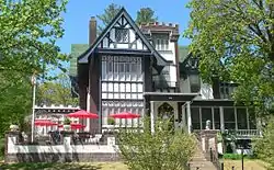 Glick-Orr House |
February 26, 1992 (#92000060) |
503 N. Second St. 39°33′59″N 95°06′56″W |
Atchison | |
| 20 | A. J. Harwi House | _from_SSE_1.JPG.webp) A. J. Harwi House |
May 6, 1975 (#75000706) |
1103 Atchison St. 39°33′56″N 95°07′47″W |
Atchison | |
| 21 | Hausner House | _from_S_2.JPG.webp) Hausner House |
December 6, 2005 (#05001358) |
400 N. 3rd St. 39°33′55″N 95°06′57″W |
Atchison | |
| 22 | W. W. Hetherington House | 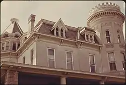 W. W. Hetherington House |
July 12, 1974 (#74000818) |
805 N. 5th St. 39°33′49″N 95°07′08″W |
Atchison | |
| 23 | Michael J. and Mattie Horan House | _from_WNW_1.JPG.webp) Michael J. and Mattie Horan House |
May 17, 2006 (#06000384) |
822 N. 4th St. 39°34′13″N 95°07′02″W |
Atchison | |
| 24 | Frank Howard House | 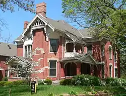 Frank Howard House |
October 15, 1984 (#84000141) |
305 N. Terrace 39°33′51″N 95°06′52″W |
Atchison | |
| 25 | Edgar W. Howe House | _from_ESE_1.JPG.webp) Edgar W. Howe House |
March 16, 1972 (#72000485) |
1117 N. 3rd St. 39°34′28″N 95°07′01″W |
Atchison | |
| 26 | Jansen House | _from_W_1.JPG.webp) Jansen House |
December 6, 2005 (#05001360) |
806 N. 3rd St. 39°34′12″N 95°06′58″W |
Atchison | |
| 27 | Lanphear-Mitchell House | _from_E_2_long.JPG.webp) Lanphear-Mitchell House |
December 6, 2005 (#05001359) |
417 N. 4th St. 39°33′57″N 95°07′05″W |
Atchison | |
| 28 | Lincoln School | 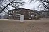 Lincoln School |
June 7, 2006 (#06000469) |
801 Division St. 39°34′18″N 95°07′25″W |
Atchison | |
| 29 | John A. Martin Grade School | 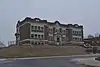 John A. Martin Grade School |
June 23, 2016 (#16000403) |
507 Division St. 39°34′19″N 95°07′12″W |
Atchison | |
| 30 | McInteer Villa | _from_S_1.JPG.webp) McInteer Villa |
March 26, 1975 (#75000707) |
1301 Kansas Ave. 39°33′48″N 95°08′01″W |
Atchison | |
| 31 | Mount St. Scholastica Convent | 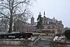 Mount St. Scholastica Convent |
April 13, 1972 (#72000486) |
801 S. 8th St. 39°33′09″N 95°07′27″W |
Atchison | |
| 32 | H. E. Muchnic House | 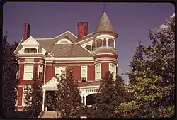 H. E. Muchnic House |
July 12, 1974 (#74000819) |
704 N. 4th St. 39°34′07″N 95°07′02″W |
Atchison | |
| 33 | Robert L. Pease House | _from_SSE_1.JPG.webp) Robert L. Pease House |
August 26, 1983 (#83000417) |
203 N. 2nd St. 39°33′47″N 95°06′56″W |
Atchison | |
| 34 | Price Villa | 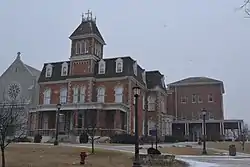 Price Villa |
March 16, 1972 (#72000487) |
801 S. 8th St. 39°33′13″N 95°07′30″W |
Atchison | |
| 35 | Ronald and Dorcas Ramsay House | 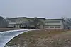 Ronald and Dorcas Ramsay House |
June 7, 2006 (#06000470) |
1415 Riverview Dr. 39°32′44″N 95°06′51″W |
Atchison | |
| 36 | St. Patrick's Catholic Church | 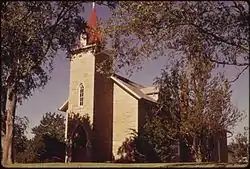 St. Patrick's Catholic Church |
November 25, 1998 (#98001358) |
234th Rd., 2 miles west of U.S. Route 73 39°28′10″N 95°07′17″W |
Atchison | |
| 37 | Schmitt House | _from_NW_1.JPG.webp) Schmitt House |
November 30, 2005 (#05001342) |
1110 W. Division St. 39°34′18″N 95°07′51″W |
Atchison | |
| 38 | Frederick W. Stein House | _from_WNW_1_long.JPG.webp) Frederick W. Stein House |
January 14, 2004 (#03001391) |
324 Santa Fe 39°33′50″N 95°07′03″W |
Atchison | |
| 39 | Stranger Creek Warren Truss Bridge | 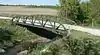 Stranger Creek Warren Truss Bridge |
October 12, 2004 (#04001139) |
On Haskell Rd., 0.8 miles south of the junction with 262 Rd., 0.5 miles south of Farmington 39°30′41″N 95°18′36″W |
Farmington | |
| 40 | Trinity Episcopal Church | 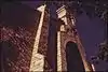 Trinity Episcopal Church |
April 4, 1985 (#85000692) |
300 S. 5th St. 39°33′33″N 95°07′06″W |
Atchison | |
| 41 | B. P. Waggener House | 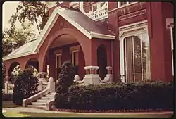 B. P. Waggener House |
May 3, 1974 (#74000820) |
819 N. 4th St. 39°34′13″N 95°07′04″W |
Atchison | |
| 42 | Balie P. Waggener House | 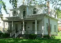 Balie P. Waggener House |
May 17, 2006 (#06000388) |
415 W. Riley St. 39°34′11″N 95°07′06″W |
Atchison | |
| 43 | Wherrett-Mize Drug Company Building | Wherrett-Mize Drug Company Building |
July 6, 2010 (#10000432) |
201 Main St. 39°33′40″N 95°06′56″W |
Atchison |
See also
| Wikimedia Commons has media related to National Register of Historic Places in Atchison County, Kansas. |
References
- The latitude and longitude information provided in this table was derived originally from the National Register Information System, which has been found to be fairly accurate for about 99% of listings. Some locations in this table may have been corrected to current GPS standards.
- "National Register of Historic Places: Weekly List Actions". National Park Service, United States Department of the Interior. Retrieved on January 29, 2021.
- Numbers represent an alphabetical ordering by significant words. Various colorings, defined here, differentiate National Historic Landmarks and historic districts from other NRHP buildings, structures, sites or objects.
- "National Register Information System". National Register of Historic Places. National Park Service. March 13, 2009.
- The eight-digit number below each date is the number assigned to each location in the National Register Information System database, which can be viewed by clicking the number.
- "Postal Service Appoints New Postmaster in Atchison, KS". U.S. Postal Service press release. 2014-04-18. Retrieved 2015-04-03.

Municipalities and communities of Atchison County, Kansas, United States | ||
|---|---|---|
| Cities | Map of Kansas highlighting Atchison County | |
| Unincorporated communities | ||
| Indian reservations | ||
| Townships | ||
| Ghost towns | ||
| Footnotes | ‡This populated place also has portions in an adjacent county or counties | |
| ||
This article is issued from Wikipedia. The text is licensed under Creative Commons - Attribution - Sharealike. Additional terms may apply for the media files.