National Register of Historic Places listings in Rice County, Kansas
This is a list of the National Register of Historic Places listings in Rice County, Kansas.
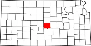
Location of Rice County in Kansas
This is intended to be a complete list of the properties and districts on the National Register of Historic Places in Rice County, Kansas, United States. The locations of National Register properties and districts for which the latitude and longitude coordinates are included below, may be seen in a map.[1]
There are 14 properties and districts listed on the National Register in the county, including 1 National Historic Landmark and two former listings.
- This National Park Service list is complete through NPS recent listings posted February 5, 2021.[2]
Current listings
| [3] | Name on the Register[4] | Image | Date listed[5] | Location | City or town | Description |
|---|---|---|---|---|---|---|
| 1 | Archeological Site Number 14RC10 | July 9, 1982 (#82004887) |
9 miles (14 km) northeast of Lyons[6] |
Little River | A petroglyph site located near the Tobias-Thompson Complex and perhaps related to it[7] | |
| 2 | Archeological Site Number 14RC11 | July 9, 1982 (#82004866) |
Address restricted |
Little River | ||
| 3 | Cooper Hall | May 3, 1974 (#74000845) |
N. Broadway Ave. 38°13′18″N 98°12′27″W |
Sterling | ||
| 4 | Little Arkansas River Crossing | April 5, 2014 (#14000122) |
Northeast of the junction of Ave. P and 30th Rd. 38°18′15″N 97°56′36″W |
Windom | Santa Fe Trail Multiple Property Submission | |
| 5 | Malone Archeological Site | June 26, 1972 (#72000523) |
Eastern side of Cow Creek, west of Lyons[8]:188 38°21′00″N 98°17′24″W |
Lyons | ||
| 6 | Rice County Courthouse | _P5310421.jpg.webp) Rice County Courthouse |
April 26, 2002 (#02000401) |
101 W. Commercial St. 38°20′50″N 98°12′13″W |
Lyons | |
| 7 | Santa Fe Trail-Rice County Trail Segments | May 11, 1995 (#95000582) |
Bushton Blacktop (FAS Highway 570), ¾ mile north of U.S. Route 56; also 4th Rd. at Av. L, ¾ mile north of U.S. Route 56 38°21′34″N 98°25′20″W |
Chase | 4th and L represents a boundary increase of July 17, 2013 | |
| 8 | Santa Fe Trail-Rice County Segment 2 | August 6, 2013 (#13000580) |
Ave. P, ¾ mile west of 30th Rd. 38°18′15″N 97°57′26″W |
Little River | Santa Fe Trail Multiple Property Submission | |
| 9 | Santa Fe Trail-Rice County Segment 3 | August 6, 2013 (#13000581) |
Address Restricted |
Windom | Santa Fe Trail Multiple Property Submission | |
| 10 | Saxman Site | May 3, 1976 (#76000837) |
0.5 miles (0.80 km) south of Saxman on Cow Creek[8]:192 38°16′26″N 98°07′26″W |
Saxman | ||
| 11 | Shay Building | April 12, 2010 (#10000179) |
202 S. Broadway Ave. 38°12′31″N 98°12′24″W |
Sterling | ||
| 12 | Station Little Arkansas | May 11, 1995 (#95000583) |
5 miles south of U.S. Route 56 on FAS Highway 443, ¾ miles west on gravel road 38°18′10″N 97°56′11″W |
Windom | ||
| 13 | Sterling Free Public Carnegie Library | June 25, 1987 (#87000969) |
132 N. Broadway 38°12′38″N 98°12′25″W |
Sterling | Red brick Carnegie library built in 1916, funded by a $10,000 grant | |
| 14 | Tobias-Thompson Complex | 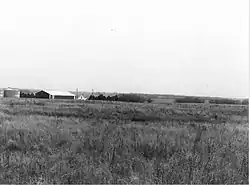 Tobias-Thompson Complex |
October 15, 1966 (#66000349) |
4 miles southeast of Geneseo 38°27′24″N 98°05′31″W |
Geneseo |
Former listings
| [3] | Name on the Register | Image | Date listed | Date removed | Location | City or town | Summary |
|---|---|---|---|---|---|---|---|
| 1 | Charles K. Beckett House | January 16, 2009 (#08001350) | January 17, 2017 | 210 W. Main 38°12′36″N 98°12′31″W |
Sterling | ||
| 2 | Lyons High School | June 9, 2005 (#05000556) | September 14, 2018 | 401 S. Douglas Ave. 38°20′47″N 98°12′27″W |
Lyons |
See also
| Wikimedia Commons has media related to National Register of Historic Places in Rice County, Kansas. |
References
- The latitude and longitude information provided in this table was derived originally from the National Register Information System, which has been found to be fairly accurate for about 99% of listings. Some locations in this table may have been corrected to current GPS standards.
- "National Register of Historic Places: Weekly List Actions". National Park Service, United States Department of the Interior. Retrieved on February 5, 2021.
- Numbers represent an alphabetical ordering by significant words. Various colorings, defined here, differentiate National Historic Landmarks and historic districts from other NRHP buildings, structures, sites or objects.
- "National Register Information System". National Register of Historic Places. National Park Service. March 13, 2009.
- The eight-digit number below each date is the number assigned to each location in the National Register Information System database, which can be viewed by clicking the number.
- Wedel, Waldo. "A Shield and Spear Petroglyph from Central Kansas: Some Possible Implications". Plains Anthropologist 14.44 (1969): 125-129: 125.
- Wedel, Waldo. "A Shield and Spear Petroglyph from Central Kansas: Some Possible Implications". Plains Anthropologist 14.44 (1969): 125-129: 125.
- Wedel, Waldo. "Chain Mail in Plains Archeology". Plains Anthropologist 20.69 (1975): 187-196.

Municipalities and communities of Rice County, Kansas, United States | ||
|---|---|---|
| Cities | Map of Kansas highlighting Rice County | |
| Unincorporated communities | ||
| Ghost towns | ||
| Townships | ||
| ||
This article is issued from Wikipedia. The text is licensed under Creative Commons - Attribution - Sharealike. Additional terms may apply for the media files.