City of Shellharbour
The City of Shellharbour is a local government area in the Illawarra region of New South Wales, Australia. The City is located about 100 kilometres (62 mi) south of Sydney and covers the southern suburbs of the Wollongong urban area centred on Shellharbour and it had an estimated population of 68,460 at the 2016 census.
| City of Shellharbour New South Wales | |||||||||||||||
|---|---|---|---|---|---|---|---|---|---|---|---|---|---|---|---|
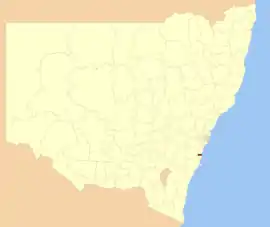 Location in NSW | |||||||||||||||
| Coordinates | 34°35′S 150°52′E | ||||||||||||||
| Population |
| ||||||||||||||
| • Density | 465.7/km2 (1,206/sq mi) | ||||||||||||||
| Established | 1859 | ||||||||||||||
| Area | 147 km2 (56.8 sq mi) | ||||||||||||||
| Mayor | Marianne Saliba | ||||||||||||||
| Council seat | Shellharbour City Centre[3] | ||||||||||||||
| Region | Illawarra | ||||||||||||||
| State electorate(s) | |||||||||||||||
| Federal Division(s) | Whitlam | ||||||||||||||
| Website | City of Shellharbour | ||||||||||||||
| |||||||||||||||
The area is bordered by the City of Wollongong to the north, with the boundary being the Lake Illawarra entrance (and the suburb of Lake Illawarra) and Macquarie Rivulet (Albion Park Rail). The Municipality of Kiama is to the south of the City of Shellharbour.
The Mayor of the Shellharbour City Council is Cr. Marianne Saliba, a member of the Labor Party.
History
Indigenous occupation of the area, particularly of Bass Point, can be traced back to 17,000 BP.
The area was discovered by Europeans Bass and Flinders in 1796.[4] Free settlers began arriving between 1817 and 1831 and the township was founded in 1851. The Shellharbour (Municipal) Council was constituted on 4 June 1859, and was gazetted as a City in 1996. In May 2009, Shellharbour City Council celebrated its sesquicentenary.[5]
A 2015 review of local government boundaries recommended that the City of Shellharbour merge with the City of Wollongong to form a new council with an area of 831 square kilometres (321 sq mi) and support a population of approximately 276,000.[6] On 13 February 2017, the New South Wales Government decided not to forcibly amalgamate Shellharbour Council with Wollongong Council.
Heritage listings
The City of Shellharbour has a number of heritage-listed sites, including:
- Albion Park, Tullimbar Road: Toongla[7]
- Albion Park Rail, Princes Highway: Albion Park railway station[8]
- Dunmore, Illawarra railway: Dunmore railway station[9]
- Shell Cove, Boollwarroo Parade: Bass Point Reserve[10]
Suburbs
The City of Shellharbour contains the following suburbs and localities:
Council
Current composition and election method
As of 2017, Shellharbour City Council is composed of seven Councillors elected proportionally as a single ward. Under the Local Government (Shellharbour and Wollongong Elections) Act, 2011 (NSW). Councillors are elected to hold office until September 2020. Currently the mayor is chosen by the elected councillors.
At the 2017 Shellharbour council election, voters were also asked two referendum questions. The first question was whether they support the direct election of mayor and the second whether they support the implementation of a ward structure.
Current political composition of council as of 2017:
| Party | Councillors | |
|---|---|---|
| Australian Labor Party | 4 | |
| Independents | 1 | |
| Liberal Party of Australia | 1 | |
| Greens | 1 | |
| Total | 7 | |
The current Council, elected in 2017, in order of election, is:[11]
| Councillor | Party | Notes | |
|---|---|---|---|
| Marianne Saliba | Labor | ||
| Nathan Cattell | Liberal | ||
| Robert Petreski | Labor | ||
| Kellie Marsh | Independent | ||
| Moira Hamilton | Labor | ||
| Peter Moran | Green | ||
| John Murray | Labor | ||
Attractions
Shellharbour City has many attractions for family entertainment and recreation. In Albion Park Rail there is a Light Rail Museum and steam trains, Historical Aircraft Restoration Society (HARS) Museum, and Albion Oval; a local sports ground. Shellharbour Village, the beach and playground are also popular attractions. Excellent fishing at Lake Illawarra and superb surfing at Warilla beach. A cycleway goes from Oak Flats to Barrack Point. The Macquarie Valley (Shellharbour) provides scenic views and also includes the Macquarie Pass National Park.
There are various beaches in Shellharbour such as the Blacks Beach, Shellharbour North Beach, Shellharbour South Beach, Warilla Central Beach, Warilla North Beach, and Warilla South Beach which are some of the major crowd pullers.[12]
References
- Australian Bureau of Statistics (27 June 2017). "Shellharbour (C)". 2016 Census QuickStats. Retrieved 14 July 2017.

- "3218.0 – Regional Population Growth, Australia, 2017-18". Australian Bureau of Statistics. 27 March 2019. Retrieved 27 March 2019. Estimated resident population (ERP) at 30 June 2018.
- "Shoalhaven City Council". Department of Local Government. Retrieved 26 November 2006.
- "Bass and Flinders". Australian History. 2012. Archived from the original on 20 March 2012. Retrieved 5 October 2012.
- "Our History". Shellharbour City Council. Archived from the original on 8 February 2008. Retrieved 16 March 2008.
- "Merger proposal: Shellharbour City Council, Wollongong City Council" (PDF). Government of New South Wales. January 2016. p. 7. Retrieved 10 March 2016.
- "Toongla". New South Wales State Heritage Register. Office of Environment and Heritage. H00556. Retrieved 18 May 2018.
- "Albion Park Railway Station Group". New South Wales State Heritage Register. Office of Environment and Heritage. H01072. Retrieved 18 May 2018.
- "Shellharbour Railway Station Group". New South Wales State Heritage Register. Office of Environment and Heritage. H01245. Retrieved 18 May 2018.
- "Bass Point Reserve". New South Wales State Heritage Register. Office of Environment and Heritage. H01896. Retrieved 18 May 2018.
- http://vtr.elections.nsw.gov.au/city-of-shellharbour/councillor
- "Beaches and pools". Shellharbour City Council.