Grade II* listed buildings in North Norfolk
There are over 20,000 Grade II* listed buildings in England. This page is a list of these buildings in the district of North Norfolk in Norfolk.
North Norfolk
| Name | Location | Type | Completed [note 1] | Date designated | Grid ref.[note 2] Geo-coordinates |
Entry number [note 3] | Image |
|---|---|---|---|---|---|---|---|
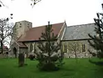
| Church of All Saints | Thwaite, Alby with Thwaite, North Norfolk | Church and Schoolroom | 1835 | 4 October 1960 | TG1928433392 52°51′12″N 1°15′20″E |
1049886 |  Church of All Saints |
| Church of St Ethelbert | Alby, Alby with Thwaite | Parish Church | Medieval | 4 October 1960 | TG2026733618 52°51′18″N 1°16′13″E |
1049885 | 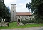 Church of St Ethelbert |
| Church of St Mary | Aldborough | Parish Church | Medieval | 4 October 1960 | TG1790933810 52°51′28″N 1°14′07″E |
1373470 | 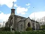 Church of St Mary |
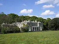
| Beeston Hall | Ashmanhaugh | House | 1784-87 | 2 April 1976 | TG3317521393 52°44′23″N 1°27′10″E |
1049924 | 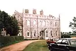 Beeston Hall |
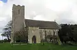
| Church of St Swithin | Ashmanhaugh | Parish Church | 12th century | 16 April 1955 | TG3144921161 52°44′19″N 1°25′38″E |
1049928 | 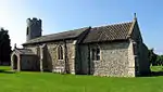 Church of St Swithin |
| Church of St John Baptist | Aylmerton | Parish Church | Medieval | 4 October 1960 | TG1819540067 52°54′49″N 1°14′37″E |
1373639 | .JPG.webp) Church of St John Baptist |
| Cross | Aylmerton | Cross | Medieval | 4 October 1960 | TG1808638794 52°54′08″N 1°14′29″E |
1049519 | 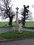 Cross |
| Church of St Mary | Baconsthorpe | Parish Church | Medieval | 4 October 1960 | TG1274136862 52°53′14″N 1°09′38″E |
1049847 | 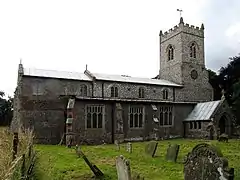 Church of St Mary |
| The Manor House | Baconsthorpe | House | Late 16th century | 20 February 1952 | TG1268336804 52°53′12″N 1°09′35″E |
1049848 | 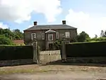 The Manor House |
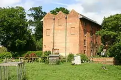
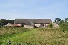
| Bacton Wood Watermill | Bacton | House | 10th century | 11 May 1987 | TG2999830676 52°49′28″N 1°24′44″E |
1049148 | 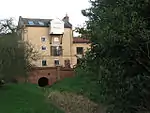 Bacton Wood Watermill |
| Church of St Andrew | Bacton | Parish Church | 14th century | 16 April 1955 | TG3358733698 52°51′00″N 1°28′04″E |
1373817 | 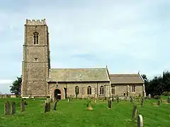 Church of St Andrew |
| North Gatehouse to Broomholm Priory | Bacton | Cluniac Monastery | 15th century | 11 May 1987 | TG3470333364 52°50′48″N 1°29′02″E |
1049146 | .jpg.webp) North Gatehouse to Broomholm Priory |
| Church of All Saints | North Barsham, Norfolk | Parish Church | 13th century | 6 March 1959 | TF9156134963 52°52′41″N 0°50′43″E |
1373710 | 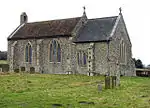 Church of All Saints |
| Church of All Saints | East Barsham, Barsham | Parish Church | Norman | 6 March 1959 | TF9164033706 52°52′00″N 0°50′44″E |
1373686 | 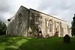 Church of All Saints |
| Church of the Assumption | West Barsham, Barsham | Parish Church | 11th century | 6 March 1959 | TF9048433674 52°52′01″N 0°49′42″E |
1373673 | 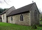 Church of the Assumption |
| Capital 15m East of Manor House | Barton Turf | Column | C5-C6 | 12 May 1987 | TG3530421061 52°44′09″N 1°29′03″E |
1373451 |  |
| Church of St Michael | Barton Turf | Parish Church | 14th century | 16 April 1955 | TG3653820464 52°43′48″N 1°30′07″E |
1049932 | 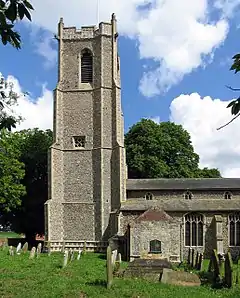 Church of St Michael |
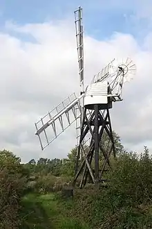
| Turf Fen Windpump at TG 36971888 | Barton Turf | Windpump | 1880 | 12 May 1987 | TG3696018822 52°42′54″N 1°30′25″E |
1049930 | 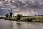 Turf Fen Windpump at TG 36971888 |
| Guildhall | Blakeney, North Norfolk | Merchants House | 15th century | 6 March 1959 | TG0281744077 52°57′21″N 1°01′04″E |
1373987 | 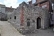 Guildhall |
| Old Rectory | Blakeney | House | 16th century | 30 November 1951 | TG0315643435 52°56′59″N 1°01′21″E |
1373978 | 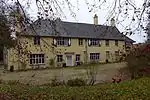 Old Rectory |
| Quay House | Blakeney | House | 18th century | 30 November 1951 | TG0270243984 52°57′18″N 1°00′58″E |
1039444 | 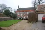 Quay House |
| Red House | Blakeney | House | Late 18th century | 30 November 1951 | TG0258444029 52°57′19″N 1°00′52″E |
1171139 | 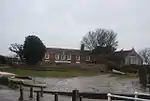 Red House |
| The Friary | Blakeney | House | 17th century | 30 November 1951 | TG0288244065 52°57′20″N 1°01′08″E |
1170123 | |
| Church of All Saints | Bodham | Parish Church | Medieval | 4 October 1960 | TG1256838932 52°54′21″N 1°09′34″E |
1172366 | 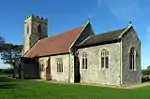 Church of All Saints |
| Briningham House | Briningham | House | 1838 | 16 January 1984 | TG0358634275 52°52′03″N 1°01′23″E |
1170582 | |
| Sharrington Hall | Sharrington, Brinton | House | 30 November 1951 | TG0317036940 52°53′29″N 1°01′07″E |
1049430 | 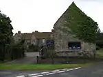 Sharrington Hall | |
| Church of All Saints | Briston | Parish Church | c. 1300 | 6 March 1959 | TG0623432573 52°51′04″N 1°03′41″E |
1049239 | 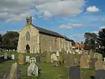 Church of All Saints |
| Church of St Peter | Brumstead | Parish Church | Early 14th century | 16 April 1955 | TG3699726786 52°47′12″N 1°30′47″E |
1049384 | 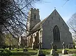 Church of St Peter |
| Cley Windmill | Cley Next the Sea | Apartment | 18th century | 20 February 1952 | TG0449644043 52°57′17″N 1°02′34″E |
1049823 | |
| Church of St Giles | Colby | Parish Church | Medieval | 4 October 1960 | TG2202831126 52°49′55″N 1°17′40″E |
1373434 | 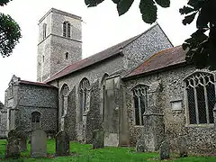 Church of St Giles |
| Church of St Peter | Corpusty | Parish Church | Medieval | 4 October 1960 | TG1149329417 52°49′15″N 1°08′14″E |
1049202 | 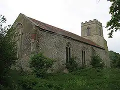 Church of St Peter |
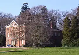
| Cromer Hall including adjoining Stables | Cromer | Country House | 1827 | 21 January 1977 | TG2145841660 52°55′36″N 1°17′36″E |
1049011 | 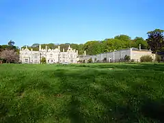 Cromer Hall including adjoining Stables |
| Church of St Nicholas Shereford | Shereford, Dunton | Parish Church | Norman | 6 March 1959 | TF8872829630 52°49′52″N 0°48′00″E |
1049293 | 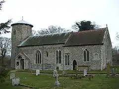 Church of St Nicholas Shereford |
| Church of St Peter | Dunton | Parish Church | c. 1300 | 6 March 1959 | TF8794130315 52°50′15″N 0°47′20″E |
1171893 | 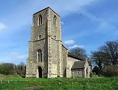 Church of St Peter |
| Church of St Mary | East Ruston | Parish Church | 14th century | 16 April 1955 | TG3642528670 52°48′13″N 1°30′22″E |
1169839 | |
| Church of St Peter and St Paul | Edgefield | Parish Church | 1883-4 | 20 February 1987 | TG0935734200 52°51′52″N 1°06′31″E |
1049204 | 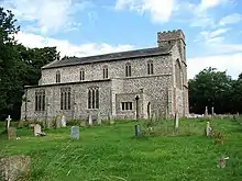 Church of St Peter and St Paul |
| Remains of Former Parish Church of St Peter and St Paul | Edgefield | Parish Church | 11th century | 4 October 1960 | TG0861934707 52°52′10″N 1°05′53″E |
1049203 | .JPG.webp) Remains of Former Parish Church of St Peter and St Paul |
| Church of St Margaret | Calthorpe, Erpingham | Parish Church | Medieval | 4 October 1960 | TG1813731756 52°50′21″N 1°14′14″E |
1049900 | .JPG.webp) Church of St Margaret |
| Red Lion Hotel | Fakenham | Hotel | 16th century | 30 November 1951 | TF9198229660 52°49′49″N 0°50′54″E |
1374006 | |
| Thorpland Hall | Fakenham | House | 16th century | 30 November 1951 | TF9365132170 52°51′08″N 0°52′28″E |
1171226 | .jpg.webp) Thorpland Hall |
| Church of St Margaret | Felbrigg Park, Felbrigg | Parish Church | Medieval | 4 October 1960 | TG1975139013 52°54′13″N 1°15′58″E |
1373643 | |
| Service Wing to East of Hall | Felbrigg Park, Felbrigg | Shop | C20 | 28 January 1988 | TG1931639404 52°54′26″N 1°15′36″E |
1305519 | |
| The Stables | Felbrigg Park, Felbrigg | House | 1825 | 28 January 1988 | TG1938039404 52°54′26″N 1°15′39″E |
1373646 | |
| Church of St Andrew | Felmingham | Parish Church | Medieval | 16 April 1955 | TG2514029257 52°48′50″N 1°20′22″E |
1049164 | 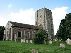 Church of St Andrew |
| Church of St Margaret | Saxlingham, Field Dalling | Church | 1593 | 2 July 1984 | TG0261839605 52°54′56″N 1°00′44″E |
1049795 | 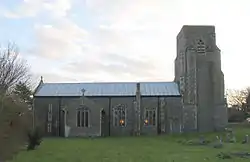 Church of St Margaret |
| Old Rectory | Great Snoring | Manor House | Late 15th century | 30 November 1951 | TF9455034519 52°52′23″N 0°53′21″E |
1373698 | |
| Two Barns and Stable to West of the Old Rectory | Great Snoring | Timber Framed House | 17th century | 30 November 1951 | TF9451334532 52°52′23″N 0°53′19″E |
1373699 | |
| Church of All Saints | Gresham | Parish Church | Medieval | 4 October 1960 | TG1674238562 52°54′03″N 1°13′16″E |
1305530 | 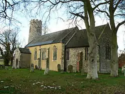 Church of All Saints |
| Bale Hall | Bale, Gunthorpe | House | c. 1700 | 30 November 1951 | TG0097337266 52°53′43″N 0°59′11″E |
1049402 |  Bale Hall |
| Church of St Mary | Gunthorpe | Parish Church | Perpendicular | 6 March 1959 | TG0120335228 52°52′37″N 0°59′18″E |
1305722 |  Church of St Mary |
| Church of St Bartholomew | Hanworth | Church | 1766 | 4 October 1960 | TG2031934902 52°51′59″N 1°16′18″E |
1049862 | .JPG.webp) Church of St Bartholomew |
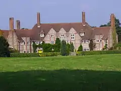
| Gunton Park | Gunton, Hanworth | Country House | c. 1742 | 20 February 1952 | TG2277134112 52°51′30″N 1°18′27″E |
1049868 | .JPG.webp) Gunton Park |
| Hanworth Lodge | Hanworth | Column | Late 18th century | 24 April 1987 | TG2209533584 52°51′14″N 1°17′50″E |
1049869 | .JPG.webp) Hanworth Lodge |
| Sawmill | Hanworth | Saw Mill | Early 19th century | 5 March 1982 | TG2237733465 52°51′10″N 1°18′05″E |
1172478 |  Sawmill |
| The Stables | Hanworth | House | Late 18th century | 5 March 1982 | TG2276234238 52°51′34″N 1°18′27″E |
1172496 | |
| Encircling Wall to St Mary's house | Happisburgh | Wall | 1900 | 11 March 1985 | TG3819930994 52°49′26″N 1°32′03″E |
1373394 | |
| St Mary's (house) including 2 Summerhouses | Happisburgh | House | 1900 | 11 March 1985 | TG3817830990 52°49′26″N 1°32′01″E |
1306318 | |
| Church of All Saints | Helhoughton | Parish Church | Decorated | 6 March 1959 | TF8690826523 52°48′14″N 0°46′17″E |
1305355 |  Church of All Saints |
| Church of All Saints | Hempstead | Parish Church | 14th century | 4 October 1960 | TG1047037038 52°53′22″N 1°07′38″E |
1049211 |  Church of All Saints |
| Church of St Mary | Hickling | Parish Church | Late 14th century | 16 April 1955 | TG4149424258 52°45′43″N 1°34′40″E |
1373694 | 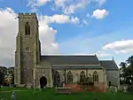 Church of St Mary |
| Windmill at Hickling Heath TG 40862301 | Hickling | Windmill | 1817 | 30 September 1987 | TG4087423014 52°45′04″N 1°34′04″E |
1373693 | 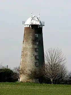 Windmill at Hickling Heath TG 40862301 |
| Thornfield Residential Home for the Elderly | High Kelling | Country House | 1903-4 | 27 September 1972 | TG0984439836 52°54′54″N 1°07′11″E |
1049826 | 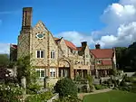 Thornfield Residential Home for the Elderly |
| Hope House | Hindolveston | House | 1714 | 6 March 1984 | TG0384829540 52°49′29″N 1°01′27″E |
1152886 | |
| Hindringham Hall | Hindringham | Moat | 1562 | 30 November 1951 | TF9788636631 52°53′27″N 0°56′24″E |
1373727 | 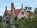 Hindringham Hall |
| Church of St Withburga | Holkham Park, Holkham | Parish Church | 13th century | 6 March 1959 | TF8780443631 52°57′26″N 0°47′40″E |
1171134 | 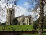 Church of St Withburga |
| Gardener's Bothy | Howe Hill, Holkham | Bothy | Late 18th century | 20 May 1983 | TF8783443002 52°57′05″N 0°47′40″E |
1171274 | |
| Longlands Estate Workshops and Clock Tower | Holkham | Coal Shed | 1850-1856 | 20 May 1983 | TF8796840100 52°55′31″N 0°47′41″E |
1373638 | |
| The Great Barn | Holkham | Workshop | c. 1790 | 20 May 1983 | TF8900141399 52°56′12″N 0°48′39″E |
1049477 |  The Great Barn |
| The Obelisk | Holkham | Obelisk | 1729-30 | 30 November 1951 | TF8836441967 52°56′31″N 0°48′06″E |
1170847 | 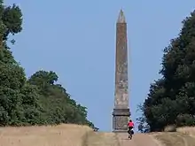 The Obelisk |
| The Vinery | Howe Hill, Holkham | Vinery | 1780 | 20 May 1983 | TF8776242857 52°57′01″N 0°47′36″E |
1049485 | 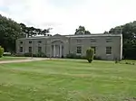 The Vinery |
| Walls, Gates and Gatepiers to Kitchen Garden 100m North of Garden Cottage | Howe Hill | Gate | Late 18th century | 20 May 1983 | TF8758643023 52°57′06″N 0°47′27″E |
1049486 | .jpg.webp) Walls, Gates and Gatepiers to Kitchen Garden 100m North of Garden Cottage |
| Parish Church of St Andrew | Holt | Parish Church | 14th century | 4 October 1960 | TG0811938796 52°54′23″N 1°05′36″E |
1306557 | 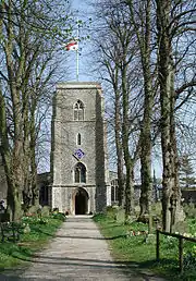 Parish Church of St Andrew |
| The Old Rectory | Holt | Vicarage | 18th century | 20 February 1952 | TG0724038750 52°54′22″N 1°04′49″E |
1049316 | |
| Church of St Peter and St Paul | Honing | Parish Church | 15th century | 16 April 1955 | TG3258828002 52°47′58″N 1°26′56″E |
1169952 | 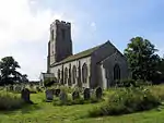 Church of St Peter and St Paul |
| Honing Hall | Honing | House | 1748 | 16 April 1955 | TG3273429051 52°48′31″N 1°27′06″E |
1169963 | |
| Church of St Benedict | Horning | Parish Church | 13th century | 16 April 1955 | TG3549016553 52°41′43″N 1°29′01″E |
1305463 | 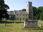 Church of St Benedict |
| Hobb's Mill at TG 34751628 | Horning | Drainage Mill | Late 19th century | 12 May 1987 | TG3475216277 52°41′36″N 1°28′21″E |
1171625 | 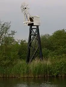 Hobb's Mill at TG 34751628 |
| Remains of St Benet's Abbey | Horning | Abbey (delisted?) | 1020-1545 | 16 April 1955 | TG3833815645 52°41′10″N 1°31′30″E |
1049940 | 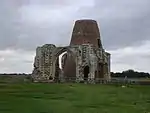 Remains of St Benet's Abbey |
| St Benets Level Windpump at TG 39941564 | Horning | Drainage Mill | Late 18th century | 12 May 1987 | TG3994615633 52°41′07″N 1°32′55″E |
1171700 | 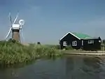 St Benets Level Windpump at TG 39941564 |
| Church of All Saints | Horsey | Parish Church | 13th century | 16 April 1955 | TG4578023034 52°44′56″N 1°38′25″E |
1373715 | 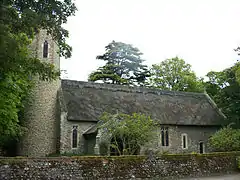 Church of All Saints |
| Horsey Drainage Mill | Horsey | Drainage Mill | Mid 19th century | 15 April 1955 | TG4573322146 52°44′28″N 1°38′20″E |
1373716 | |
| Church of St John | Hoveton | Parish Church | 12th century | 16 April 1955 | TG3092418174 52°42′43″N 1°25′02″E |
1373437 | 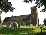 Church of St John |
| Church of St Peter | Hoveton | Parish Church | 1624 | 16 April 1955 | TG3142819549 52°43′27″N 1°25′32″E |
1171821 | 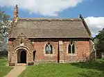 Church of St Peter |
| Greengates | Hoveton | House | c. 1700 | 16 April 1955 | TG3208717498 52°42′19″N 1°26′02″E |
1049908 | |
| Barn at Grange Farm | Ingham | Barn | 15th century | 30 August 1987 | TG3845826036 52°46′45″N 1°32′03″E |
1373717 | |
| Church of St Lawrence | Ingworth | Parish Church | Medieval | 4 October 1960 | TG1927429633 52°49′11″N 1°15′10″E |
1172575 | 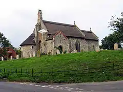 Church of St Lawrence |
| Church of St Mary | Itteringham | Parish Church | Medieval | 4 October 1960 | TG1448830964 52°50′01″N 1°10′58″E |
1373807 | 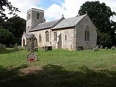 Church of St Mary |
| Manor Farm House and Attached Garden Walls | Itteringham | House | 1707 | 20 February 1952 | TG1465730774 52°49′54″N 1°11′06″E |
1152734 | |
| Remains of Parish Church of Mannington | Mannington, Itteringham | Parish Church | 11th century | 4 October 1960 | TG1417131879 52°50′31″N 1°10′43″E |
1049215 | 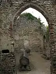 Remains of Parish Church of Mannington |
| Church of St Mary | Kelling | Parish Church | 19th century | 4 October 1960 | TG0887741729 52°55′56″N 1°06′23″E |
1373476 | 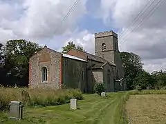 Church of St Mary |
| Kelling Hall | Kelling | Country House | 1913 | 30 September 1987 | TG0908241742 52°55′56″N 1°06′34″E |
1151974 | |
| Church of All Saints | Kettlestone | Parish Church | Decorated | 6 March 1959 | TF9677331704 52°50′49″N 0°55′14″E |
1049261 | Jun2006.jpg.webp) Church of All Saints |
| Church of All Saints | Lessingham | Parish Church | 13th century | 16 April 1955 | TG3920028505 52°48′04″N 1°32′49″E |
1172410 | 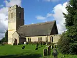 Church of All Saints |
| Church of St Andrew | Hempstead, Lessingham | Parish Church | 13th century | 16 April 1955 | TG4033428407 52°47′59″N 1°33′50″E |
1373720 | |
| Church of St Andrew | Letheringsett, Letheringsett with Glandford | Parish Church | 11th century | 4 October 1960 | TG0604038926 52°54′30″N 1°03′45″E |
1049834 | 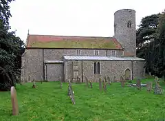 Church of St Andrew |
| Church of St Martin | Glandford, Letheringsett with Glandford | Parish Church | Medieval | 4 October 1960 | TG0439241413 52°55′52″N 1°02′23″E |
1304919 | 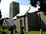 Church of St Martin |
| Hall Farmhouse | Letheringsett, Letheringsett with Glandford | Farmhouse | Early 17th century | 20 February 1952 | TG0617339085 52°54′35″N 1°03′53″E |
1049831 | |
| Letheringsett Hall | Letheringsett, Letheringsett with Glandford | Country House | c. 1809 | 4 October 1960 | TG0606538886 52°54′28″N 1°03′46″E |
1049832 | .jpg.webp) Letheringsett Hall |
| The Mill | Letheringsett with Glandford | Watermill | 1802 | 30 September 1987 | TG0621438702 52°54′22″N 1°03′54″E |
1049838 | |
| Church of St Andrew | Little Barningham | Parish Church | Medieval | 4 October 1960 | TG1417433322 52°51′17″N 1°10′47″E |
1373831 | .JPG.webp) Church of St Andrew |
| Boardman's Windmill | Ludham | Drainage Mill | Late 19th century | 12 May 1987 | TG3694019250 52°43′08″N 1°30′25″E |
1373439 | |
| Ludham Hall including attached Chapel | Ludham | House | Late 18th century | 16 April 1955 | TG3808117566 52°42′12″N 1°31′21″E |
1171892 | 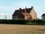 Ludham Hall including attached Chapel |
| Church of St Mary Barningham Winter | Barningham, Matlaske | Parish Church | Medieval | 4 October 1960 | TG1466535680 52°52′33″N 1°11′18″E |
1049180 | 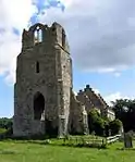 Church of St Mary Barningham Winter |
| Church of St Peter | Matlaske | Parish Church | Saxon | 4 October 1960 | TG1509534869 52°52′06″N 1°11′39″E |
1049184 | 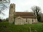 Church of St Peter |
| Church of St Peter | North Barningham, Matlaske | Parish Church | Medieval | 4 October 1960 | TG1506937150 52°53′20″N 1°11′43″E |
1373647 | 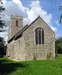 Church of St Peter |
| Coach House and Stables to Barningham Hall | Barningham, Matlaske | House | 17th century | 20 February 1987 | TG1473135433 52°52′25″N 1°11′21″E |
1049179 | |
| Melton Constable Hall North Wing and Stable Court South Wing | Melton Constable Park, Melton Constable | Country House | 1810 | 25 September 1986 | TG0311831935 52°50′48″N 1°00′53″E |
1373774 | 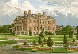 Melton Constable Hall North Wing and Stable Court South Wing |
| The Bath House | Melton Constable Park, Melton Constable | Bath House | 1764 | 6 March 1984 | TG0280531945 52°50′48″N 1°00′37″E |
1373811 | |
| Greenhouse 150 Metres North West of Hoveton Hall | Neatishead | Bothy | c1809-12 | 7 October 1987 | TG3154020119 52°43′45″N 1°25′40″E |
1049916 | |
| R30 Operations Room | Neatishead, North Norfolk | Operations Block | 1942 | 22 February 2008 | TG3454418501 52°42′48″N 1°28′15″E |
1393421 | |
| Friends Meeting House | North Walsham, North Norfolk | Friends Meeting House | 1772 | 21 June 1950 | TG2851631732 52°50′05″N 1°23′28″E |
1373956 | 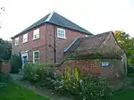 Friends Meeting House |
| Ivy Cottage | North Walsham, North Norfolk | House | Early 18th century | 29 September 1972 | TG2810630242 52°49′17″N 1°23′02″E |
1039530 | |
| 14 Aylsham Road | North Walsham, North Norfolk | House | Early 18th century | 21 June 1950 | TG2806230255 52°49′18″N 1°23′00″E |
1039533 | |
| Church of St Martin | Overstrand | Parish Church | Medieval | 4 October 1960 | TG2407640764 52°55′03″N 1°19′54″E |
1049816 | .JPG.webp) Church of St Martin |
| The Pleasaunce | Overstrand | House | Pre 1897 | 27 September 1972 | TG2475540902 52°55′07″N 1°20′30″E |
1049817 |  The Pleasaunce |
| Clock Tower, Loggias, Towers, and Associated Buildings at the Pleasaunce | Overstrand | Loggia | 1897-1899 | 15 February 1988 | TG2479240912 52°55′07″N 1°20′32″E |
1170821 | 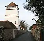 Clock Tower, Loggias, Towers, and Associated Buildings at the Pleasaunce |
| Covered Walk at the Pleasaunce | Overstrand | Covered Way | 1897-1899 | 27 September 1972 | TG2471240882 52°55′06″N 1°20′28″E |
1049818 | |
| Gateway at the Pleasaunce | Overstrand | Gate | c. 1900 | 15 February 1988 | TG2476540802 52°55′03″N 1°20′30″E |
1049819 | |
| Gazebo at the Pleasaunce | Overstrand | Gazebo | Late 19th century | 27 September 1972 | TG2465740986 52°55′09″N 1°20′25″E |
1305854 | |
| Paston Great Barn | Paston | Engine House | 1581 | 16 April 1955 | TG3219034538 52°51′30″N 1°26′51″E |
1306240 | |
| Church of St Michael | Plumstead | Parish Church | Pre 19th century | 4 October 1960 | TG1325434893 52°52′09″N 1°10′01″E |
1152882 | 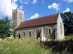 Church of St Michael |
| Heigham Holmes Windpump | Potter Heigham | Drainage Mill | Mid 19th century | 12 May 1987 | TG4496320239 52°43′27″N 1°37′34″E |
1172656 | 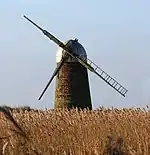 Heigham Holmes Windpump |
| Potter Heigham Bridge | Potter Heigham | Bridge | 14th century | 20 February 1952 | TG4199918473 52°42′35″N 1°34′52″E |
1152457 |  Potter Heigham Bridge |
| Church of St Martin | South Raynham, Raynham | Parish Church | 14th century | 6 March 1959 | TF8808324328 52°47′02″N 0°47′15″E |
1049275 | 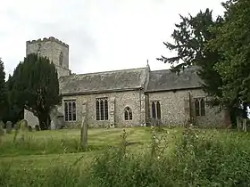 Church of St Martin |
| Church of St Mary | East Raynham, Raynham | Church | 1866-1868 | 6 March 1959 | TF8797025540 52°47′41″N 0°47′11″E |
1172454 | 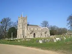 Church of St Mary |
| Church of St Mary | Roughton | Parish Church | Medieval | 4 October 1960 | TG2202436524 52°52′49″N 1°17′53″E |
1049531 |  Church of St Mary |
| Church of the Holy Trinity | West Runton, Runton | Parish Church | Medieval | 4 October 1960 | 49°46′01″N 7°33′26″W | 1049535 |  Church of the Holy Trinity |
| Church of St Andrew | Ryburgh | Parish Church | Norman | 6 March 1959 | TF9620627269 52°48′26″N 0°54′34″E |
1305377 |  Church of St Andrew |
| Church of St Mary and All Saints | Sculthorpe, Norfolk | Parish Church | 14th century | 6 March 1959 | TF8995931911 52°51′04″N 0°49′11″E |
1049380 |  Church of St Mary and All Saints |
| Cranmer Hall | Cranmer Park, Sculthorpe, North Norfolk | House | c. 1719 | 30 November 1951 | TF8868332728 52°51′32″N 0°48′04″E |
1049376 | |
| Stables, Carriage Entrance Gates, Wall and Door to Arch | Cranmer Hall, Sculthorpe, North Norfolk | Gate | 1866 | 16 January 1984 | TF8861132720 52°51′32″N 0°48′00″E |
1171447 | |
| Church of St John | Waxham, North Norfolk | Parish Church | 12th century | 16 April 1955 | TG4405726227 52°46′42″N 1°37′02″E |
1049359 |  Church of St John |
| Church of St Margaret | Sea Palling, North Norfolk | Parish Church | 13th century | 16 April 1955 | TG4298926820 52°47′03″N 1°36′07″E |
1049358 | 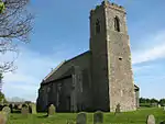 Church of St Margaret |
| Church of All Saints | Skeyton, North Norfolk | Parish Church | 13th century | 16 April 1955 | TG2461825703 52°46′56″N 1°19′45″E |
1373825 | 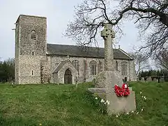 Church of All Saints |
| Church of St Bartholomew | Sloley | Parish Church | Late C13/Early 14th century | 16 April 1955 | TG2988624123 52°45′57″N 1°24′22″E |
1373826 | 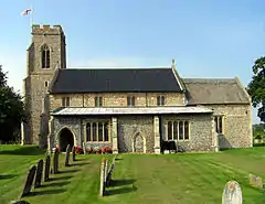 Church of St Bartholomew |
| Church of St Peter | Smallburgh | Parish Church | 14th century | 16 April 1955 | TG3337323960 52°45′46″N 1°27′27″E |
1049883 | .JPG.webp) Church of St Peter |
| Beechlands Farmhouse | Southrepps | House | 1744 | 20 February 1952 | TG2563936754 52°52′51″N 1°21′07″E |
1305745 | |
| Southrepps Hall | Southrepps | House | Early 18th century | 20 February 1952 | TG2418737064 52°53′03″N 1°19′50″E |
1171164 | |
| Church of St Mary the Virgin | Stalham | Parish Church | 14th century | 16 April 1955 | TG3730825165 52°46′19″N 1°31′00″E |
1172564 |  Church of St Mary the Virgin |
| Stalham Hall | Stalham | House | c. 1670 | 16 April 1955 | TG3794324938 52°46′10″N 1°31′33″E |
1305053 | |
| Church of All Saints | Stibbard | Parish Church | c. 1100 | 6 March 1959 | TF9830628428 52°49′01″N 0°56′29″E |
1049230 | 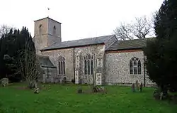 Church of All Saints |
| Sennowe Hall Clock Tower | Sennowe Park, Stibbard | Clock Tower | 1905-1907 | 6 March 1984 | TF9805325636 52°47′31″N 0°56′09″E |
1049228 | |
| Sennowe Hall, and Stable Court | Sennowe Park, Stibbard | House | Early 19th century | 6 March 1984 | TF9813025618 52°47′30″N 0°56′13″E |
1153104 | |
| Entrance Lodge to Stiffkey Old Hall | Stiffkey | Entrance Lodge | 1604 | 20 May 1983 | TF9743542931 52°56′51″N 0°56′14″E |
1049466 | |
| Old Rectory | Stiffkey | House | C20 | 30 November 1951 | TF9738943090 52°56′56″N 0°56′12″E |
1049464 | |
| Stiffkey Old Hall | Stiffkey | House | 1576 onwards | 30 November 1951 | TF9742642963 52°56′52″N 0°56′13″E |
1373654 | 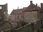 Stiffkey Old Hall |
| 1 Church Street | Stiffkey | House | Late 16th century | 19 December 1979 | TF9714143080 52°56′56″N 0°55′58″E |
1171483 | |
| Church of St Lawrence | Hunworth, Stody | Parish Church | Medieval | 20 February 1987 | TG0648835492 52°52′38″N 1°04′01″E |
1049189 |  Church of St Lawrence |
| Hunworth Mill and attached Millhouse | Stody | Mill House | Early 18th century | 27 September 1972 | TG0664335606 52°52′42″N 1°04′10″E |
1049191 | |
| Church of St Andrew | Metton, Sustead | Parish Church | Medieval | 4 October 1960 | 49°46′01″N 7°33′26″W | 1049496 | 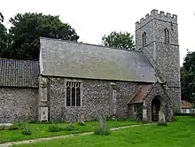 Church of St Andrew |
| Church of St Mary | Bessingham, Sustead | Parish Church | Medieval | 4 October 1960 | TG1668137055 52°53′14″N 1°13′09″E |
1305371 | 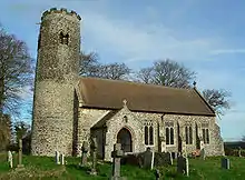 Church of St Mary |
| Church of St Peter and St Paul | Sustead | Parish Church | Medieval | 4 October 1960 | TG1828037018 52°53′11″N 1°14′35″E |
1305393 | 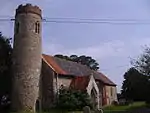 Church of St Peter and St Paul |
| Outbuilding and adjoining Walls to North, South and East at Hall Farm | Sustead | Dwelling | Early 17th century | 20 February 1952 | TG1916636861 52°53′04″N 1°15′22″E |
1305348 | |
| Church of St Michael | Sutton | Parish Church | Early 14th century | 16 April 1955 | TG3884223948 52°45′37″N 1°32′18″E |
1172607 | 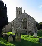 Church of St Michael |
| Sutton Mill | Sutton | Corn Mill | 1789 | 16 April 1955 | TG3957723871 52°45′33″N 1°32′57″E |
1049326 | 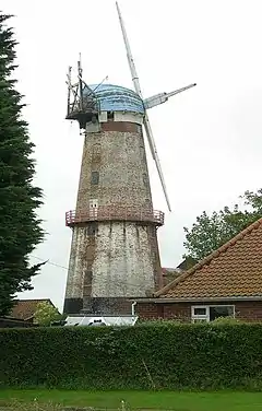 Sutton Mill |
| Church of St Giles | Bradfield | Parish Church | 14th century | 16 April 1955 | TG2679733302 52°50′58″N 1°22′00″E |
1306217 | 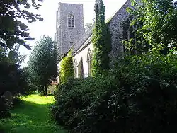 Church of St Giles |
| Church of St Nicholas | Swafield | Parish Church | Early 14th century | 16 April 1955 | TG2862133072 52°50′48″N 1°23′37″E |
1306194 | 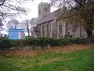 Church of St Nicholas |
| Church of St. Michael | Swanton Abbott | Parish Church | Medieval | 16 April 1955 | TG2658926253 52°47′11″N 1°21′32″E |
1049172 | 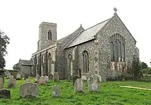 Church of St. Michael |
| Church of St Edmund | Swanton Novers | Parish Church | Norman | 6 March 1959 | TG0154832380 52°51′04″N 0°59′30″E |
1304415 | 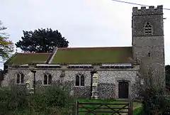 Church of St Edmund |
| Church of All Saints | Thornage | Parish Church | 11th century | 4 October 1960 | TG0498736210 52°53′03″N 1°02′43″E |
1373820 | 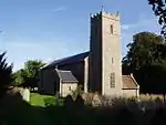 Church of All Saints |
| Thornage Hall | Thornage | c. 1482 | 20 February 1952 | TG0479136364 52°53′09″N 1°02′33″E |
1304519 | 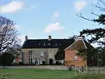 Thornage Hall | |
| Dovecote, circa 30 Metres South East of Thornage Hall | Thornage | Dovecote | 1728 | 4 October 1960 | TG0484236342 52°53′08″N 1°02′35″E |
1049195 | 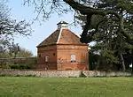 Dovecote, circa 30 Metres South East of Thornage Hall |
| Thornage Water Mill | Thornage | Watermill | Late 18th century | 13 November 1978 | TG0611436754 52°53′19″N 1°03′44″E |
1153034 | |
| Church of St Margaret | Thorpe Market | Parish Church | 1796 | 4 October 1960 | TG2449635381 52°52′09″N 1°20′03″E |
1049786 | 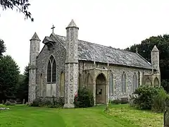 Church of St Margaret |
| Gunton Tower | Thorpe Market | Lookout | c. 1830 | 4 October 1960 | TG2389234880 52°51′53″N 1°19′29″E |
1049785 | 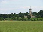 Gunton Tower |
| Church of St Andrew | Thurning | Parish Church | 14th century | 6 March 1959 | TG0803829446 52°49′21″N 1°05′10″E |
1153202 | 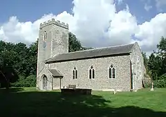 Church of St Andrew |
| Church of St Andrew | Thursford | Parish Church | c. 1200 | 6 March 1959 | TF9839433797 52°51′54″N 0°56′45″E |
1049238 | 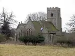 Church of St Andrew |
| Church of St John the Baptist | Trimingham | Parish Church | Medieval | 4 October 1960 | TG2793738756 52°53′52″N 1°23′15″E |
1049787 | |
| Hall Farmhouse | Trunch | Farmhouse | Late 16th century | 16 April 1955 | TG2920534859 52°51′45″N 1°24′13″E |
1306152 | |
| Sheringham Hall | Upper Sheringham | Country House | 1812-19 | 30 September 1987 | TG1336942328 52°56′09″N 1°10′25″E |
1049799 | |
| Berry Hall | Walsingham | House | 16th century | 30 November 1951 | TF9409737659 52°54′05″N 0°53′04″E |
1374003 | |
| Black Lion Hotel | Walsingham | Hotel | 15th century | 30 November 1951 | TF9334936734 52°53′36″N 0°52′22″E |
1049549 | 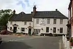 Black Lion Hotel |
| Bull Inn | Walsingham | Timber Framed House | 16th century | 30 November 1951 | TF9347436856 52°53′40″N 0°52′29″E |
1039387 | |
| Church House | Walsingham | House | Early 18th century | 30 November 1951 | TF9346036492 52°53′28″N 0°52′27″E |
1171656 | 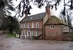 Church House |
| Dow House | Walsingham | Timber Framed House | Early 16th century | 30 November 1951 | TF9337336686 52°53′34″N 0°52′23″E |
1039355 | 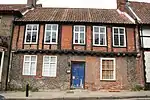 Dow House |
| Elmham House | Walsingham | House | 18th century | 30 November 1951 | TF9334036694 52°53′35″N 0°52′21″E |
1373616 | 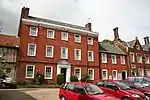 Elmham House |
| Kitchen and Refectory at the College of Clergy | Walsingham | Kitchen | 16th century | 30 November 1951 | TF9356236938 52°53′42″N 0°52′34″E |
1373613 | |
| Maytyr House | Walsingham | Timber Framed House | 16th century | 30 November 1951 | TF9340036814 52°53′38″N 0°52′25″E |
1374015 | |
| Methodist Chapel | Walsingham | Methodist Chapel | 1794 | 14 March 1977 | TF9334136642 52°53′33″N 0°52′21″E |
1373993 | 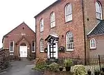 Methodist Chapel |
| Oxford Stores Public House | Walsingham | Timber Framed House | 16th century | 30 November 1951 | TF9337836722 52°53′35″N 0°52′24″E |
1039358 | .jpg.webp) Oxford Stores Public House |
| Ruins of Church of St Edmund | Walsingham | Church | 12th century | 15 February 1979 | TF8968037388 52°54′02″N 0°49′07″E |
1039409 | .jpg.webp) Ruins of Church of St Edmund |
| Shire Hall | Walsingham | Court Room | Late 18th century | 30 November 1951 | TF9344936835 52°53′39″N 0°52′28″E |
1039388 | 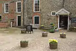 Shire Hall |
| St Augustine's at the College of Clergy | Walsingham | Theological College | 16th century | 30 November 1951 | TF9357636910 52°53′41″N 0°52′34″E |
1373612 | |
| The Manor House | Walsingham | Manor House | 16th century | 30 November 1951 | TF9397837674 52°54′05″N 0°52′58″E |
1374023 | |
| 9 and 10 Common Place | Walsingham | House | 16th century | 30 November 1951 | TF9346636840 52°53′39″N 0°52′28″E |
1171703 | |
| 19 High Street | Walsingham | Timber Framed House | 16th century | 6 March 1959 | TF9337836695 52°53′34″N 0°52′23″E |
1039356 | |
| 21 High Street | Walsingham | Timber Framed House | Late 16th century | 6 March 1959 | TF9338136709 52°53′35″N 0°52′24″E |
1039357 | |
| 33 High Street | Walsingham | House/Tea Room | 16th century | 30 November 1951 | TF9338836807 52°53′38″N 0°52′24″E |
1374014 | 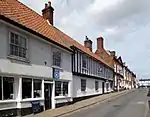 33 High Street |
| 48 High Street | Walsingham | Timber Framed House | Late 15th century | 30 November 1951 | TF9341936817 52°53′38″N 0°52′26″E |
1305347 |  48 High Street |
| 50 High Street | Walsingham | House | Earlier Core | 30 November 1951 | TF9341936827 52°53′39″N 0°52′26″E |
1374021 | 50 High Street |
| 52 High Street | Walsingham | House | Earlier Core | 30 November 1951 | TF9342136834 52°53′39″N 0°52′26″E |
1171980 | 52 High Street |
| 54 High Street (Shop by the Pump) | Walsingham | Timber Framed House/shop | 16th century | 30 November 1951 | TF9342436840 52°53′39″N 0°52′26″E |
1374029 | 54 High Street (Shop by the Pump) |
| Church of All Saints | Warham | Parish Church | 13th century | 6 March 1959 | 49°46′01″N 7°33′26″W | 1049439 |  Church of All Saints |
| Church of St Nicholas | Wells-next-the-Sea | Parish Church | Established early 13th century | 19 January 1951 | TF9183443157 52°57′05″N 0°51′15″E |
1230479 |  Church of St Nicholas |
| Marsh House | Wells-next-the-Sea | House | 1742 | 19 January 1951 | TF9181943328 52°57′11″N 0°51′14″E |
1231197 | |
| Ostrich House | Wells-next-the-Sea | House | 19 January 1951 | TF9170743194 52°57′07″N 0°51′08″E |
1230203 | | |
| St Michael's Cottage | Wells-next-the-Sea | House | 16th century | 13 June 1972 | TF9163543756 52°57′25″N 0°51′05″E |
1231195 | |
| Old Hall Farm House | Westwick | Manor House | 16th century | 16 April 1955 | TG2880024882 52°46′23″N 1°23′26″E |
1152425 | |
| Church of All Saints | Weybourne | Parish Church | 11th century | 4 October 1960 | TG1117043032 52°56′35″N 1°08′29″E |
1152481 | _-_geograph.org.uk_-_614155.jpg.webp) Church of All Saints |
| Church of St Margaret | Wolterton, Wickmere | Ruined Church | Medieval | 4 October 1960 | TG1634732052 52°50′33″N 1°12′40″E |
1304991 | .JPG.webp) Church of St Margaret |
| The Stables, Wolterton Hall | Wolterton, Wickmere | Stable | c. 1750 | 24 April 1987 | TG1639431784 52°50′24″N 1°12′41″E |
1152001 | |
| Wiveton Hall | Wiveton | House | 1653 | 30 November 1951 | TG0390444099 52°57′20″N 1°02′03″E |
1373519 | |
| Church of All Saints | Wood Norton | Parish Church | 15th century | 6 March 1959 | TG0105827777 52°48′36″N 0°58′54″E |
1373800 |  Church of All Saints |
| Undercroft at St Andrews Cottage | Worstead | House | Medieval | 29 April 1987 | TG3025626039 52°46′58″N 1°24′46″E |
1049141 | |
.JPG.webp)

.JPG.webp)
Notes
- The date given is the date used by Historic England as significant for the initial building or that of an important part in the structure's description.
- Sometimes known as OSGB36, the grid reference is based on the British national grid reference system used by the Ordnance Survey.
- The "List Entry Number" is a unique number assigned to each listed building and scheduled monument by Historic England.
External links
![]() Media related to Grade II* listed buildings in Norfolk, England at Wikimedia Commons
Media related to Grade II* listed buildings in Norfolk, England at Wikimedia Commons
This article is issued from Wikipedia. The text is licensed under Creative Commons - Attribution - Sharealike. Additional terms may apply for the media files.