Grade II* listed buildings in Scarborough (borough)
There are over 20,000 Grade II* listed buildings in England. This page is a list of these buildings in the district of Scarborough in North Yorkshire.
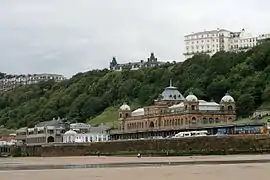
Scarborough
| Name | Location | Type | Completed [note 1] | Date designated | Grid ref.[note 2] Geo-coordinates |
Entry number [note 3] | Image |
|---|---|---|---|---|---|---|---|
| Pond House | Aislaby, Scarborough | House | 18th century | 6 October 1969 | NZ8597808736 54°28′00″N 0°40′30″W |
1316048 |  |
| St Hildas Preparatory School | Aislaby, Scarborough | House | Third Quarter of 18th century | 19 February 1952 | NZ8612907995 54°27′36″N 0°40′22″W |
1148951 | |
| Church of St Hilda | Danby Dale, Danby, Scarborough | Church | 14th century | 6 October 1969 | NZ6961906309 54°26′51″N 0°55′40″W |
1316255 |  Church of St Hilda |
| Duck Bridge | Danby, Scarborough | Bridge | 1717 | 6 October 1969 | NZ7195507739 54°27′36″N 0°53′30″W |
1302337 | 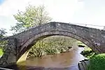 Duck Bridge |
| Church of St John the Baptist | East Ayton, Scarborough | Church | Early 12th century | 18 January 1967 | SE9913284952 54°15′02″N 0°28′48″W |
1167755 |  Church of St John the Baptist |
| Beggars Bridge | Egton, Scarborough | Packhorse Bridge | 1619 | 7 July 1989 | NZ7844205476 54°26′19″N 0°47′31″W |
1296156 |  Beggars Bridge |
| Delves Cottage | Delves, Egton, Scarborough | House | 17th century | 7 July 1989 | NZ7910904563 54°25′49″N 0°46′55″W |
1148817 |  Delves Cottage |
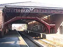
| Filey railway station | Filey, Scarborough | Station | Late 19th century | 23 August 1985 | TA1136880683 54°12′35″N 0°17′38″W |
1167853 | |
| Church of St John the Evangelist | Folkton, Scarborough | Tower | 13th century | 30 June 1966 | TA0536079689 54°12′08″N 0°23′11″W |
1148153 | .jpg.webp) Church of St John the Evangelist |
| Church of St Stephen | Robin Hood's Bay, Fylingdales, Scarborough | Parish Church | 1868-1870 | 6 October 1969 | 49°46′01″N 7°33′26″W | 1148649 | .jpg.webp) Church of St Stephen |
| Farsyde House | Fylingdales, Scarborough | House | 16th century | 4 January 1990 | NZ9502004390 54°25′34″N 0°32′13″W |
1167925 | |
| Pigsty to South-west of the Cottage | Fyling Park, Fylingdales, Scarborough | Pigsty | 1891 | 15 April 1988 | NZ9366604094 54°25′25″N 0°33′28″W |
1148678 | 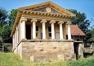 Pigsty to South-west of the Cottage |
| Thorpe Hall | Fylingthorpe, Fylingdales, Scarborough | House | 1680 | 6 October 1969 | NZ9440504935 54°25′52″N 0°32′46″W |
1148707 | |
| Beggars Bridge over River Esk | Glaisdale, Scarborough | Bridge | 1619 | 6 October 1969 | NZ7843805476 54°26′19″N 0°47′32″W |
1148573 | 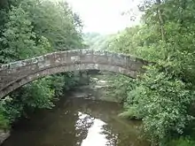 Beggars Bridge over River Esk |
| Church of St James the Greater | Lealholm, Glaisdale, Scarborough | Church | 1902 | 6 October 1969 | NZ7632407674 54°27′31″N 0°49′27″W |
1178962 | 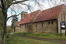 Church of St James the Greater |
| Hart Hall | Glaisdale Side, Glaisdale, Scarborough | Farmhouse | 1768 | 26 August 1987 | NZ7743804977 54°26′04″N 0°48′28″W |
1148578 | |
| Quarry Cottage | Glaisdale Side, Glaisdale, Scarborough | Farmhouse | 19th century | 6 October 1969 | NZ7694704746 54°25′56″N 0°48′55″W |
1316247 | |
| Street Farmhouse and Outbuildings Adjoining | Street, Glaisdale, Scarborough | Farmhouse | 1749 | 6 October 1969 | NZ7342304719 54°25′57″N 0°52′11″W |
1316254 | |
| Wesleyan Chapel | Lealholm, Glaisdale, Scarborough | Wesleyan Methodist Chapel | 1839 | 6 October 1969 | NZ7611607575 54°27′28″N 0°49′39″W |
1316252 | 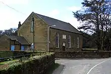 Wesleyan Chapel |
| Brereton Cottage Brereton House | Goathland Village, Goathland, Scarborough | Farmhouse | Earlier | 6 October 1969 | NZ8318401302 54°24′01″N 0°43′13″W |
1316155 | |
| Church of St Mary, Entrance Steps and Attached Handrail | Goathland Village, Goathland, Scarborough | Church | 1894-1896 | 6 October 1969 | NZ8277600700 54°23′42″N 0°43′36″W |
1174270 |  Church of St Mary, Entrance Steps and Attached Handrail |
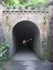
| North York Moors Railway Pedestrian Subway about 110m Long | North Yorkshire Moors Railway, Grosmont, Scarborough | Subway | c. 1834 | 7 July 1989 | NZ8282205096 54°26′04″N 0°43′29″W |
1148752 | |
| Kirkhill | Staithes, Hinderwell, Scarborough | House | Late 18th century or Early 19th century | 6 October 1969 | NZ7834318794 54°33′30″N 0°47′24″W |
1148940 | |
| Church of All Saints | Hunmanby, Scarborough | Tower | 12th century | 30 June 1966 | TA0958477470 54°10′53″N 0°19′21″W |
1316442 | 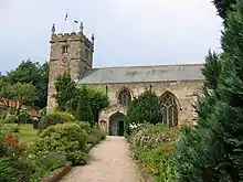 Church of All Saints |
| Hunmanby Hall | Hunmanby, Scarborough | Cross Wing House | Later 17th century | 11 January 1952 | TA0936077264 54°10′46″N 0°19′33″W |
1316443 | |
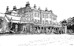
| Mulgrave Castle and Screen Walls to North | Lythe, Scarborough | Country House | Before 1735 | 6 October 1969 | NZ8478912557 54°30′05″N 0°41′32″W |
1148891 | |
| Stable Building to North of Mulgrave Castle | Lythe, Scarborough | Stable | 1787 | 6 October 1969 | NZ8475612623 54°30′07″N 0°41′34″W |
1179666 | |
| Church of St Laurence | Newby and Scalby, Scarborough | Church | C12-C13 | 26 November 1985 | TA0090990329 54°17′55″N 0°27′03″W |
1148211 | 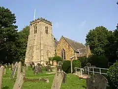 Church of St Laurence |
| Church of Saint Peter | Reighton, Scarborough | Church | 12th century | 30 June 1966 | TA1309475226 54°09′37″N 0°16′10″W |
1296580 | 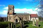 Church of Saint Peter |
| Church of St Leonard | Speeton, Reighton, Scarborough | Church | Anglo-Danish | 30 June 1966 | TA1513574699 54°09′19″N 0°14′18″W |
1148130 |  Church of St Leonard |
| The Old Hall | Ugthorpe, Ugthorpe, Scarborough | House | 1586 | 19 February 1952 | NZ7945111024 54°29′18″N 0°46′30″W |
1173451 | |
| Baysdale Abbey Bridge | Baysdale, Westerdale, Scarborough | Bridge | Medieval | 6 October 1969 | NZ6204106774 54°27′09″N 1°02′41″W |
1316276 | .jpg.webp) Baysdale Abbey Bridge |
| Baysdale Abbey Bridge | Baysdale, Westerdale, Scarborough | Bridge | Medieval | 18 July 1979 | NZ6204106773 54°27′09″N 1°02′41″W |
1189041 | Baysdale Abbey Bridge |
| Bee House to west of Dale Head Farmhouse and Wall to left | Westerdale, Westerdale, Scarborough | Bee Bole | 1832 | 20 December 1990 | NZ6777204442 54°25′51″N 0°57′24″W |
1316282 |  Bee House to west of Dale Head Farmhouse and Wall to left |
| Old Ralph Cross | Ledging Hill, Westerdale, Scarborough | Wayside Cross | 11th century | 20 December 1990 | NZ6741901991 54°24′32″N 0°57′46″W |
1179098 |  Old Ralph Cross |
| Young Ralph Cross | Ledging Hill, Westerdale, Scarborough | Wayside Cross | 11th century | 6 October 1969 | NZ6772202093 54°24′35″N 0°57′29″W |
1148563 |  Young Ralph Cross |
| Bagdale Old Hall | Whitby, Scarborough | Hotel | 1883 | 23 February 1954 | NZ8964610826 54°29′06″N 0°37′04″W |
1148376 |  Bagdale Old Hall |
| Brunswick Methodist Church and the Brunswick Room | Whitby, Scarborough | Meeting Hall | 1891-2 | 23 December 1994 | NZ8973110932 54°29′09″N 0°36′59″W |
1261233 | .jpg.webp) Brunswick Methodist Church and the Brunswick Room |
| Church of St Hilda | West Cliff, Whitby, Scarborough | Parish Church | 1884-86 | 9 January 1996 | NZ8945811259 54°29′20″N 0°37′14″W |
1272560 | 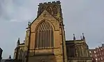 Church of St Hilda |
| Church of St Ninian | Whitby, Scarborough | Church | 1776-1778 | 23 February 1954 | NZ8981810964 54°29′10″N 0°36′54″W |
1148349 | .jpg.webp) Church of St Ninian |
| Ewe Cote Hall | Ewe Cote, Whitby, Scarborough | House | 1697 | 23 February 1954 | NZ8785610795 54°29′06″N 0°38′43″W |
1148252 | |
| Garden Walls to Ewe Cote Hall | Ewe Cote, Whitby, Scarborough | Garden Wall | 1697 | 23 February 1954 | NZ8786410766 54°29′05″N 0°38′43″W |
1204632 | |
| Ruswarp Hall | Ruswarp, Whitby, Scarborough | House | Late 17th century | 23 February 1954 | NZ8892809335 54°28′18″N 0°37′45″W |
1205169 | |
| Garden Wall and Gate Piers to Ruswarp Hall (Nos 4 and 6) | Ruswarp, Whitby, Scarborough | Gate Pier | Late 17th century | 4 December 1972 | NZ8891109326 54°28′17″N 0°37′46″W |
1148235 | |
| Low Stakesby Mansion | Whitby, Scarborough | Country House | 18th century | 23 February 1954 | NZ8902510731 54°29′03″N 0°37′39″W |
1316349 | |
| Old Town Hall | Whitby, Scarborough | Town Hall | 1788 | 23 February 1954 | NZ9000411168 54°29′16″N 0°36′44″W |
1261706 | |
| St Columbans | Whitby, Scarborough | House | 1790 | 23 February 1954 | NZ8954310272 54°28′48″N 0°37′10″W |
1254352 | |
| St Hilda | Whitby, Scarborough | House | 19th century | 23 February 1954 | NZ8953210990 54°29′11″N 0°37′10″W |
1253879 | 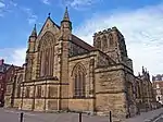 St Hilda |
| The Missions to Seaman | Whitby, Scarborough | House | Late 18th century | 23 February 1954 | NZ8982811109 54°29′15″N 0°36′54″W |
1316432 | 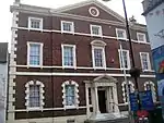 The Missions to Seaman |
| Whitby Council Offices | Whitby, Scarborough | Terrace | Late 18th century | 23 February 1954 | NZ8960211029 54°29′12″N 0°37′06″W |
1261569 | |
| 1–6 St Hildas Terrace | Whitby, Scarborough | House | Early 19th century | 23 February 1954 | NZ8942410992 54°29′11″N 0°37′16″W |
1253837 | |
| 7–10 St Hildas Terrace | Whitby, Scarborough | House | 19th century | 23 February 1954 | NZ8945110986 54°29′11″N 0°37′15″W |
1253838 | |
| 11 and 12 St Hildas Terrace | Whitby, Scarborough | Terrace | Late 18th century | 23 February 1954 | NZ8948010986 54°29′11″N 0°37′13″W |
1253839 | |
| 13 and 14 St Hildas Terrace | Whitby, Scarborough | Terrace | Late 18th century | 23 February 1954 | NZ8949610985 54°29′11″N 0°37′12″W |
1253840 | |
| 15 and 16 St Hildas Terrace | Whitby, Scarborough | Terrace | Late 18th century | 23 February 1954 | NZ8951110988 54°29′11″N 0°37′11″W |
1253878 | .jpg.webp) 15 and 16 St Hildas Terrace |
| 18 and 19 St Hildas Terrace | Whitby, Scarborough | Terrace | Late 18th century | 23 February 1954 | NZ8954310990 54°29′11″N 0°37′10″W |
1261567 | |
| 20 St Hildas Terrace | Whitby, Scarborough | Terrace | Late 18th century | 23 February 1954 | NZ8956010991 54°29′11″N 0°37′09″W |
1261568 | |
| 21 St Hildas Terrace | Whitby, Scarborough | Terrace | Late 18th century | 23 February 1954 | NZ8959211006 54°29′11″N 0°37′07″W |
1253883 | .jpg.webp) 21 St Hildas Terrace |
| 23 St Hildas Terrace | Whitby, Scarborough | Government Office | Late 18th century | 4 December 1972 | NZ8962511010 54°29′11″N 0°37′05″W |
1253884 | .jpg.webp) 23 St Hildas Terrace |
| 24 St Hildas Terrace | Whitby, Scarborough | House | Late 18th century | 23 February 1954 | NZ8963811014 54°29′12″N 0°37′04″W |
1261570 | .jpg.webp) 24 St Hildas Terrace |
| 25 St Hildas Terrace | Whitby, Scarborough | Terrace | Late 18th century | 23 February 1954 | NZ8966711028 54°29′12″N 0°37′03″W |
1253886 | .jpg.webp) 25 St Hildas Terrace |
| 19 Grape Lane | Whitby, Scarborough | House | Late 18th century | 23 February 1954 | NZ9001111043 54°29′12″N 0°36′43″W |
1204530 | |
| All Saints Church | Wykeham, Scarborough | Church | 1853-1855 | 18 January 1967 | SE9648283393 54°14′14″N 0°31′16″W |
1316131 | 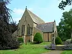 All Saints Church |
| Wykeham Abbey | Wykeham, Scarborough | Country House | Mid 18th century | 13 December 1951 | SE9618281914 54°13′26″N 0°31′34″W |
1173210 | |
| Church of St Andrew (United Reformed) | Scarborough | Congregational Chapel | 1864-8 | 8 June 1973 | TA0410087761 54°16′30″N 0°24′10″W |
1243011 | |
| Church of St Columba | Scarborough | Church | 1926 | 19 March 1981 | TA0359288969 54°17′09″N 0°24′37″W |
1272794 | .jpg.webp) Church of St Columba |
| Cliff End House | Scarborough | House | latter part of 18th century | 22 December 1953 | TA0434388324 54°16′48″N 0°23′56″W |
1258208 | |
| Crescent House the Art Gallery | Scarborough | Villa | late 1840s | 8 June 1973 | TA0417588199 54°16′44″N 0°24′05″W |
1273502 | |
| Crown Hotel & Wessex Court | Scarborough | Terrace | circa 1840-50 | 22 December 1953 | TA0429387976 54°16′36″N 0°23′59″W |
1258434 | |
| Natural History Museum (Woodend) | Scarborough | Villa | 1835-40 | 22 December 1953 | TA0412488154 54°16′42″N 0°24′08″W |
1258213 | .jpg.webp) Natural History Museum (Woodend) |
| St Martin's Vicarage | Scarborough | Vicarage | probably later | 8 June 1973 | TA0418587715 54°16′28″N 0°24′06″W |
1258210 | |
| The Grand Hotel | Scarborough | Hotel | 1863-7 | 8 June 1973 | TA0439888403 54°16′50″N 0°23′53″W |
1243163 |  The Grand Hotel |
| The Museum | Scarborough | Museum | 1828-29 | 22 December 1953 | TA0431988265 54°16′46″N 0°23′57″W |
1273293 | |
| The Spa | Scarborough | Belvedere | 18th century | 8 June 1973 | TA0444787853 54°16′32″N 0°23′51″W |
1259818 | |
| The Talbot Hotel | Scarborough | House | mid to late 18th century | 22 December 1953 | TA0433388756 54°17′02″N 0°23′56″W |
1259106 | |
| Trinity House | Scarborough | House | founded 1602 | 8 June 1973 | TA0460488790 54°17′03″N 0°23′41″W |
1243198 | 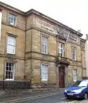 Trinity House |
| Vicarage | Scarborough | House | 1832-33 to 1856-7 | 22 December 1953 | TA0413288336 54°16′48″N 0°24′08″W |
1258211 | |
| 14a, 14b and 17 St Nicholas Street | Scarborough | Apartment | early to mid 18th century | 22 December 1953 | TA0436288569 54°16′56″N 0°23′55″W |
1243164 | |
| 1–14 The Crescent | Scarborough | Terrace | 1832-33 to 1856-7 | 22 December 1953 | TA0410588197 54°16′44″N 0°24′09″W |
1258212 | |
| 23 and 24 King Street | Scarborough | House | Mid 18th century | 22 December 1953 | TA0440488630 54°16′58″N 0°23′52″W |
1258560 | |
| 37 and 39 Eastborough | Scarborough | House | 18th century | 22 December 1953 | TA0460388718 54°17′00″N 0°23′41″W |
1258403 | |
| 7 Queen Street | Scarborough | House | Late 18th century | 22 December 1953 | TA0435988719 54°17′00″N 0°23′55″W |
1259104 | |
| 49 Quay Street | Scarborough | House | Late 17th century | 22 December 1953 | TA0502488827 54°17′03″N 0°23′18″W |
1259085 | |
| 5 Queen Street | Scarborough | House | Late 18th century | 22 December 1953 | TA0436688707 54°17′00″N 0°23′54″W |
1259087 | |
| 32 Queen Street | Scarborough | House | Late 18th century | 22 December 1953 | TA0432088840 54°17′04″N 0°23′57″W |
1259109 | |
| 9 Tuthill | Scarborough | House | early to mid 18th century | 8 June 1973 | TA0478488844 54°17′04″N 0°23′31″W |
1243443 | |
| 2 Quay Street | Scarborough | Timber Framed House | C15/C16 | 22 December 1953 | TA0485488831 54°17′04″N 0°23′27″W |
1259086 | |
| 45 Quay Street | Scarborough | House | C15/C16 | 22 December 1953 | TA0501088831 54°17′04″N 0°23′19″W |
1259084 | .jpg.webp) 45 Quay Street |


.jpg.webp)
Notes
- The date given is the date used by Historic England as significant for the initial building or that of an important part in the structure's description.
- Sometimes known as OSGB36, the grid reference is based on the British national grid reference system used by the Ordnance Survey.
- The "List Entry Number" is a unique number assigned to each listed building and scheduled monument by Historic England.
External links
![]() Media related to Grade II* listed buildings in the Borough of Scarborough at Wikimedia Commons
Media related to Grade II* listed buildings in the Borough of Scarborough at Wikimedia Commons
This article is issued from Wikipedia. The text is licensed under Creative Commons - Attribution - Sharealike. Additional terms may apply for the media files.