Grade II* listed buildings in South Cambridgeshire
There are over 20,000 Grade II* listed buildings in England. This page is a list of these buildings in the district of South Cambridgeshire in Cambridgeshire.
List
| Name | Location | Type | Completed [note 1] | Date designated | Grid ref.[note 2] Geo-coordinates |
Entry number [note 3] | Image |
|---|---|---|---|---|---|---|---|
| Gatehouse c.65M to North West of Down Hall | Abington Pigotts, South Cambridgeshire | Moat | Early 16th century | 22 November 1967 | TL3047043735 52°04′36″N 0°05′51″W |
1128303 | 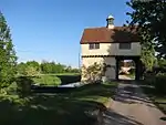 Gatehouse c.65M to North West of Down Hall |
| Manor Farmhouse | Abington Pigotts | Farmhouse | After 1680 | 22 November 1967 | TL3039344813 52°05′11″N 0°05′54″W |
1330849 |  |
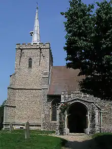
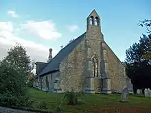
| Parish Church of St Michael and All Angels | Abington Pigotts | Parish Church | 12th century | 22 November 1967 | TL3043944663 52°05′06″N 0°05′52″W |
1128297 | 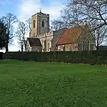 Parish Church of St Michael and All Angels |
| The Almshouses & School House | Babraham | House | 1959-60 | 22 November 1967 | TL5129750419 52°07′53″N 0°12′32″E |
1127746 | 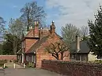 The Almshouses & School House |
| Newlyn | Barrington | House | Early 14th Century | 22 November 1967 | TL3909849700 52°07′41″N 0°01′50″E |
1161944 | |
| Royal Oak Inn | Barrington | House, now Pub | Mid 15th Century | 22 November 1967 | TL3898249478 52°07′34″N 0°01′44″E |
1127606 | 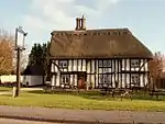 Royal Oak Inn |
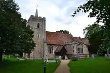
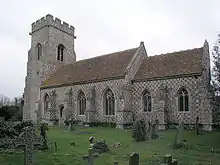
| Church of St Peter | Barton | Parish Church | 14th century | 31 August 1962 | TL4078455726 52°10′55″N 0°03′28″E |
1127829 | 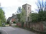 Church of St Peter |
| Manor Farmhouse | Barton | Farmhouse | Early 17th century | 31 August 1962 | TL4090955761 52°10′56″N 0°03′34″E |
1161183 | |
| Pryors Hold | Barton | House | c. 1600 | 31 August 1982 | TL4052855808 52°10′57″N 0°03′14″E |
1127828 |  Pryors Hold |
| Bourn Hall | Bourn | House/Clinic | 11th century | 31 August 1962 | TL3226656165 52°11′16″N 0°04′00″W |
1162529 | |
| Manor Farmhouse | Bourn | Farmhouse | Late 13th century | 31 August 1962 | TL3250556674 52°11′33″N 0°03′47″W |
1127209 | |
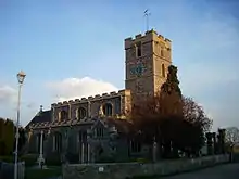
| Parish Church of St Peter | Boxworth | Parish Church | 12th century | 31 August 1962 | TL3483364491 52°15′43″N 0°01′33″W |
1331352 |  Parish Church of St Peter |
| Parish Church of St Michael and All Angels | Caldecote | Parish Church | 14th century | 31 August 1962 | TL3471356256 52°11′17″N 0°01′51″W |
1127190 | 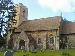 Parish Church of St Michael and All Angels |
| Church of St Peter | Carlton | Parish Church | 12th century | 22 November 1967 | TL6418552967 52°09′02″N 0°23′54″E |
1127132 | 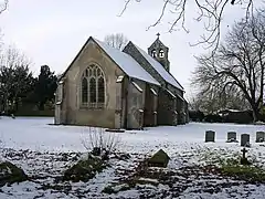 Church of St Peter |
| Church of All Saints | Castle Camps | Parish Church | 13th century | 22 November 1967 | TL6256542540 52°03′27″N 0°22′11″E |
1127134 | 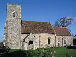 Church of All Saints |
| Caxton Hall | Caxton | House | c. 1670 | 31 August 1962 | TL3011158284 52°12′27″N 0°05′50″W |
1309363 | |
| Caxton Manor House | Caxton | House | 19th century | 31 August 1962 | TL3036058316 52°12′28″N 0°05′37″W |
1309423 |  Caxton Manor House |
| Parish Church of St Andrew | Caxton | Parish Church | 13th century | 31 August 1962 | TL3001357807 52°12′11″N 0°05′56″W |
1127203 | 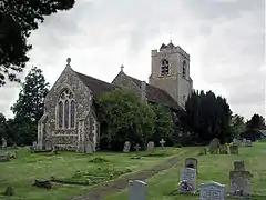 Parish Church of St Andrew |
| The Crown House | Caxton | House | c. 1860 | 31 August 1962 | TL3033958377 52°12′30″N 0°05′38″W |
1162925 |  The Crown House |
| Chapel to South West of Childerley Hall | Childerley | House | Later | 31 August 1962 | TL3555761549 52°14′08″N 0°00′59″W |
1163081 |  Chapel to South West of Childerley Hall |
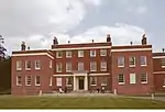
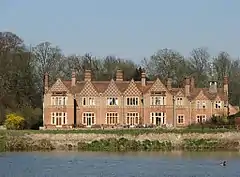
| Childerley Hall | Childerley | Country House | Late 16th century | 31 August 1962 | TL3560461579 52°14′09″N 0°00′56″W |
1127204 | .jpg.webp) Childerley Hall |
| Glebe Cottage | Comberton | House | 17th century or 18th century | 31 August 1962 | TL3839555486 52°10′49″N 0°01′22″E |
1127798 | |
| Conington Hall | Conington | House | c. 1820 | 31 August 1962 | TL3186666470 52°16′50″N 0°04′06″W |
1265942 | .jpg.webp) Conington Hall |
| Parish Church of St Mary | Conington | Parish Church | 14th century | 31 August 1962 | TL3201166059 52°16′37″N 0°03′59″W |
1226274 | 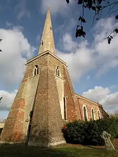 Parish Church of St Mary |
| Church of St James | Croxton | Parish Church | Late 13th century | 31 August 1962 | TL2523459226 52°13′01″N 0°10′06″W |
1127168 | 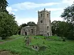 Church of St James |
| Croxton Park | Croxton Park, Croxton | Country House | Rebuilt c.1760 | 31 August 1962 | TL2526159372 52°13′06″N 0°10′04″W |
1127163 | |
| Church of All Saints | Croydon | Parish Church | 13th century | 22 November 1967 | TL3154449610 52°07′45″N 0°04′47″W |
1163333 |  Church of All Saints |
| Church of St Peter and St Paul | Dry Drayton | Parish Church | Late 13th century | 31 August 1962 | TL3799961957 52°14′19″N 0°01′10″E |
1162717 |  Church of St Peter and St Paul |
| Building 59 (Operations Block) | South Camp, Imperial War Museum (former RAF Duxford), Duxford | Operations Block | Built 1928 | 1 December 2005 | TL4582946139 52°05′40″N 0°07′38″E |
1391608 |  Building 59 (Operations Block) |
| Building 78 (Hangar A) | South Camp, Imperial War Museum (former RAF Duxford), Duxford | Aircraft Hangar | 1917 | 15 February 1973 | TL4584546064 52°05′37″N 0°07′39″E |
1309405 | 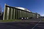 Building 78 (Hangar A) |
| Building 79 (hangar B) | South Camp, Imperial War Museum (former Raf Duxford), Duxford | Aircraft Hangar | 1917 | 15 February 1973 | TL4592246109 52°05′39″N 0°07′43″E |
1128126 | |
| Building 84 (hangar C) | South Camp, Imperial War Museum (former Raf Duxford), Duxford | Aircraft Hangar | 1917 | 15 February 1973 | TL4607946207 52°05′42″N 0°07′52″E |
1162959 | |
| Chapel of Hospital of St John the Baptist | Duxford | Chapel | 13th century | 22 November 1967 | TL4850147275 52°06′14″N 0°10′01″E |
1128091 |  Chapel of Hospital of St John the Baptist |
| Parish Church of St John the Baptist and St Pandionia | Eltisley | Parish Church | c. 1200 | 31 August 1962 | TL2684159664 52°13′14″N 0°08′41″W |
1127179 | 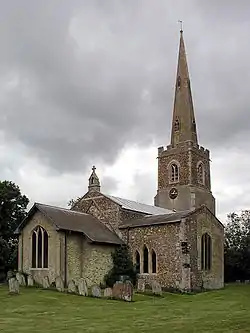 Parish Church of St John the Baptist and St Pandionia |
| Barn to North West of Ditton Hall | Fen Ditton | Exchange | Late 15th century or early 16th century | 15 June 1977 | TL4817460338 52°13′17″N 0°10′04″E |
1331306 |  Barn to North West of Ditton Hall |
| Biggin Abbey | Fen Ditton | Farmhouse | 17th century | 31 August 1962 | TL4873861757 52°14′02″N 0°10′36″E |
1178408 |  Biggin Abbey |
| Ditton Hall | Fen Ditton | House | c. 1635 | 31 August 1962 | TL4818360292 52°13′15″N 0°10′04″E |
1127399 |  Ditton Hall |
| Home Farmhouse | Fen Ditton | Farmhouse | 17th century or earlier | 22 August 1984 | TL4876260165 52°13′11″N 0°10′35″E |
1331303 | 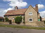 Home Farmhouse |
| Musgrave Farmhouse | Fen Ditton | Farmhouse | Late 16th century and earlier 17th century | 11 April 1980 | TL4849860268 52°13′14″N 0°10′21″E |
1331305 |  Musgrave Farmhouse |
| Parish Church of St Mary Virgin | Fen Ditton | Parish Church | c. 1300 | 31 August 1962 | TL4826760371 52°13′18″N 0°10′09″E |
1127430 | 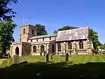 Parish Church of St Mary Virgin |
| The Old Rectory | Fen Ditton | Jettied House | 16th century | 31 August 1962 | TL4823760417 52°13′19″N 0°10′07″E |
1127431 | 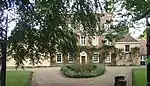 The Old Rectory |
| Parish Church of St Mary | Fen Drayton | Parish Church | Late 13th century | 31 August 1962 | TL3395668113 52°17′41″N 0°02′14″W |
1127229 | 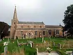 Parish Church of St Mary |
| The Homestead | Fen Drayton | House | Early 16th century | 31 August 1962 | TL3395968366 52°17′50″N 0°02′13″W |
1127233 | |
| The Three Tuns Inn | Fen Drayton | Jettied House | Late 15th century or early 16th century | 31 August 1962 | TL3390368250 52°17′46″N 0°02′16″W |
1127232 | .jpg.webp) The Three Tuns Inn |
| Chrishall Grange | Fowlmere | Country House | Early 18th century | 26 November 1951 | TL4430642730 52°03′51″N 0°06′13″E |
1163121 | |
| Garden Gates and Railings to Chrishall Grange | Fowlmere | Gate | Early 18th century | 17 December 1986 | TL4430742716 52°03′51″N 0°06′13″E |
1330939 | |
| Church of St Vigor | Fulbourn | Church | 13th century | 31 August 1962 | TL5206856233 52°11′00″N 0°13′22″E |
1331062 |  Church of St Vigor |
| Highfield House | Fulbourn | Farmhouse | 16th century | 31 August 1962 | TL5191456356 52°11′04″N 0°13′14″E |
1331035 | |
| Almhouses | Gamlingay | Terrace | 1665 | 22 November 1967 | TL2391252318 52°09′19″N 0°11′25″W |
1128179 | .jpg.webp) Almhouses |
| Chapel adjoining Almhouses at East End | Gamlingay | Chapel | 1745 | 3 September 1986 | TL2393652316 52°09′19″N 0°11′23″W |
1318156 | Chapel adjoining Almhouses at East End |
| Havelock House | Gamlingay | House | 1688 | 22 November 1967 | TL2374752326 52°09′19″N 0°11′33″W |
1163764 | |
| The Cock Inn | Gamlingay | Jettied House | Late 16th century or early 17th century | 22 November 1967 | TL2382952352 52°09′20″N 0°11′29″W |
1330904 | .jpg.webp) The Cock Inn |
| The Emplins | Gamlingay | House | 16th century | 21 February 1972 | TL2419652309 52°09′18″N 0°11′10″W |
1309190 |  The Emplins |
| Church of St Andrew | Girton | Village Hall | Late 15th century | 31 August 1962 | TL4238062328 52°14′27″N 0°05′02″E |
1164101 |  Church of St Andrew |
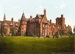
| Girton College | Girton | Further Education College | 1873 | 14 September 1984 | TL4245060932 52°13′41″N 0°05′03″E |
1331334 | |
| Church of St Andrew and St Mary | Grantchester | Parish Church | 12th century | 31 August 1962 | TL4336655464 52°10′44″N 0°05′43″E |
1309436 |  Church of St Andrew and St Mary |
| Manor Farmhouse | Grantchester | Farmhouse | 17th century | 31 August 1962 | TL4330655419 52°10′42″N 0°05′40″E |
1309385 | 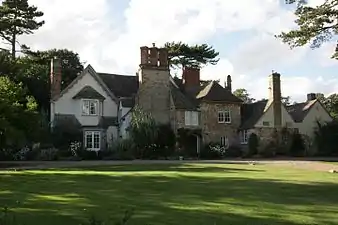 Manor Farmhouse |
| Parish Church of St Botolph | Graveley | Parish Church | 13th century | 31 August 1962 | TL2497864080 52°15′39″N 0°10′13″W |
1265814 | 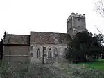 Parish Church of St Botolph |
| Abington Hall (The Welding Institute) | Great Abington | Country House | 1711-3 | 22 November 1967 | TL5274148833 52°07′00″N 0°13′46″E |
1127722 | 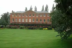 Abington Hall (The Welding Institute) |
| Gildencroft | Great Abington | House | Mid 16th century | 30 September 1985 | TL5319248706 52°06′56″N 0°14′09″E |
1127719 | 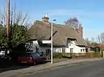 Gildencroft |
| Parish Church of St Mary | Great Abington | Parish Church | c. 1200 | 22 November 1967 | TL5307048864 52°07′01″N 0°14′03″E |
1161650 | 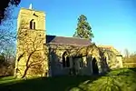 Parish Church of St Mary |
| Little Chishill Mill | Great and Little Chishill | Post Mill | 1712 | 22 November 1967 | TL4132138843 52°01′48″N 0°03′31″E |
1330927 | 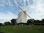 Little Chishill Mill |
| Parish Church of St Nicolas | Little Chishill, Great and Little Chishill | Parish Church | 12th century | 22 November 1967 | TL4184137244 52°00′56″N 0°03′56″E |
1162491 | 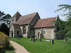 Parish Church of St Nicolas |
| Parish Church of St Swithun | Great Chishill, Great and Little Chishill | Parish Church | 13th century | 22 November 1967 | TL4221638868 52°01′48″N 0°04′18″E |
1128142 | 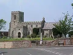 Parish Church of St Swithun |
| Church of St Mary | Great Eversden | Parish Church | Late Medieval | 22 November 1967 | TL3665453329 52°09′41″N 0°00′13″W |
1127621 | 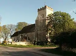 Church of St Mary |
| The Manor House | Great Eversden | Moat | c. 1600 | 22 November 1967 | TL3598353761 52°09′55″N 0°00′48″W |
1127584 |  The Manor House |
| Rectory Farmhouse | Great Shelford | Farmhouse | 18th century and 19th century | 31 August 1962 | TL4570951861 52°08′45″N 0°07′41″E |
1331067 | |
| Church of St Nicholas | Great Wilbraham | Parish Church | 12th century | 31 August 1962 | TL5483757760 52°11′47″N 0°15′50″E |
1317779 |  Church of St Nicholas |
| Outbuilding at Wilbraham Temple | Great Wilbraham | Manor House | Late 15th century | 31 August 1962 | TL5532157969 52°11′53″N 0°16′16″E |
1164558 | |
| Wilbraham Temple | Great Wilbraham | House | Late 17th century | 31 August 1962 | TL5533457945 52°11′52″N 0°16′17″E |
1127875 | |
| Morden Hall | Guilden Morden | Farmhouse | 18th century | 22 November 1967 | TL2846843953 52°04′45″N 0°07′36″W |
1128236 | |
| Parish Church of St Mary | Hardwick | Parish Church | Earlier 14th century | 31 August 1962 | TL3722958607 52°12′31″N 0°00′25″E |
1163557 |  Parish Church of St Mary |
| Church of All Saints | Harston | Church | Early Medieval | 31 August 1962 | TL4180650967 52°08′20″N 0°04′14″E |
1331060 | 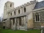 Church of All Saints |
| Harston House and Part of Garden Wall | Harston | House | c. 1710 | 31 August 1962 | TL4224650831 52°08′15″N 0°04′37″E |
1317695 | |
| Manor House | Harston | House | Early 18th century | 31 August 1962 | TL4183850933 52°08′19″N 0°04′16″E |
1127877 | 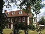 Manor House |
| Haslingfield Manor | Haslingfield | Manor House | Mid 16th century | 31 August 1962 | TL4055352308 52°09′04″N 0°03′11″E |
1331121 | |
| Church of St Denis | East Hatley, Hatley | Parish Church | 13th century | 22 November 1967 | TL2852450513 52°08′17″N 0°07′24″W |
1128153 | 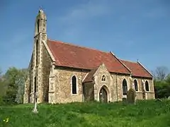 Church of St Denis |
| Church of St George | Hatley St George, Hatley | Parish Church | 14th century | 22 November 1967 | TL2773351126 52°08′37″N 0°08′05″W |
1128154 | 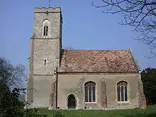 Church of St George |
| Hatley Park | Hatley St George, Hatley | Country House | 17th century | 22 November 1967 | TL2759750979 52°08′33″N 0°08′13″W |
1317995 |  Hatley Park |
| Holy Trinity Parish Church | Heydon | Parish Church | Late 15th century | 17 December 1986 | TL4324739980 52°02′23″N 0°05′14″E |
1309193 | 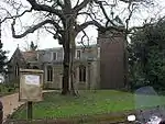 Holy Trinity Parish Church |
| Burford Farmhouse | Hildersham | Farmhouse | 17th century | 22 November 1967 | TL5442648400 52°06′45″N 0°15′14″E |
1161908 | |
| Hildersham Hall | Hildersham | Farmhouse | 17th century | 17 March 1978 | TL5427948339 52°06′43″N 0°15′06″E |
1161818 | |
| Mabbutts | Hildersham | Farmhouse | Mid 16th century | 22 November 1967 | TL5453748620 52°06′52″N 0°15′20″E |
1309917 | .jpg.webp) Mabbutts |
| Hinxton Hall | Hinxton | Country House | 1748-1756 | 22 November 1967 | TL4980344824 52°04′53″N 0°11′05″E |
1330969 | |
| Parish Church of St Mary and St John the Evangelist | Hinxton | Parish Church | c. 1200 | 22 November 1967 | TL4970745175 52°05′05″N 0°11′01″E |
1163553 | |
| The Oak House | Hinxton | House | c. 1930 | 22 November 1967 | TL4944645491 52°05′15″N 0°10′47″E |
1128078 | |
| The Old Manor House | Hinxton | Jettied House | c. 1580 | 22 November 1967 | TL4959945096 52°05′02″N 0°10′55″E |
1330970 | |
| The Olde House | Histon | House | 17th century | 31 August 1962 | TL4388263520 52°15′04″N 0°06′23″E |
1127408 | |
| Barn to North of Abbey Farmhouse | Ickleton | Barn | Early 14th century | 6 June 1986 | TL4896743765 52°04′20″N 0°10′19″E |
1165037 | |
| Mowbrays | Ickleton | Farmhouse | Late 17th century | 22 November 1967 | TL4946743820 52°04′21″N 0°10′46″E |
1330960 | |
| Padcot | Ickleton | House | Early 17th century | 22 November 1967 | TL4910643599 52°04′14″N 0°10′27″E |
1330956 | |
| Impington Mill | Impington | Windmill | Early 19th century | 31 August 1962 | TL4415162328 52°14′25″N 0°06′35″E |
1127378 |  Impington Mill |
| House on the Green | Kingston | Cross Passage House | Late 15th century | 7 June 1979 | TL3455955075 52°10′39″N 0°02′01″W |
1127596 | |
| Kingston Wood Farmhouse | Kingston | Cross Passage House | Late 15th century or early 16th century | 22 November 1967 | TL3276754008 52°10′06″N 0°03′36″W |
1127595 | |
| The Old Rectory | Kingston | House | late C16/early 17th century | 22 November 1967 | TL3465855433 52°10′51″N 0°01′55″W |
1163215 | |
| Parish Church of All Saints | Knapwell | Parish Church | 14th century | 31 August 1962 | TL3357963013 52°14′57″N 0°02′41″W |
1163735 | 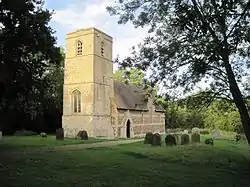 Parish Church of All Saints |
| The Old Rectory | Landbeach | Farmhouse | Early 16th century | 31 August 1962 | TL4769665324 52°15′58″N 0°09′47″E |
1178950 | |
| Barham Hall | Linton | Farmhouse | Early 16th century | 22 November 1967 | TL5740646094 52°05′27″N 0°17′46″E |
1161958 | |
| Chandlers or Chaundlers | Linton | House | 17th century | 29 October 1955 | TL5628146825 52°05′52″N 0°16′48″E |
1127670 |  Chandlers or Chaundlers |
| Linton House | Linton | House | Late 17th century | 22 November 1967 | TL5618646804 52°05′51″N 0°16′43″E |
1331158 |  Linton House |
| Queens House | Linton | House | 1731 | 22 November 1967 | TL5593846632 52°05′46″N 0°16′30″E |
1127677 |  Queens House |
| The Guildhall | Linton | House | 1697 | 22 November 1967 | TL5616246713 52°05′48″N 0°16′42″E |
1331166 | 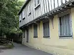 The Guildhall |
| 1 and 3 Coles Lane | Linton | House | Late 17th century | 22 November 1967 | TL5620346834 52°05′52″N 0°16′44″E |
1127668 | 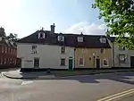 1 and 3 Coles Lane |
| 87 and 89 High Street | Linton | Jettied House | 16th century or earlier | 22 November 1967 | TL5627546823 52°05′52″N 0°16′48″E |
1127669 | |
| Parish Church of St Catherine | Litlington | Parish Church | 12th century | 22 November 1967 | TL3098442747 52°04′03″N 0°05′26″W |
1128238 | 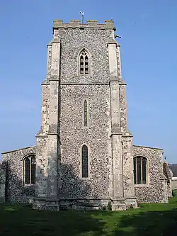 Parish Church of St Catherine |
| Abington Pottery | Little Abington | House | Mid-Late 16th century | 22 November 1967 | TL5330849176 52°07′11″N 0°14′16″E |
1127657 |  Abington Pottery |
| Parish Church of St Mary the Virgin | Little Abington | Parish Church | 11th century | 22 November 1967 | TL5295049197 52°07′12″N 0°13′57″E |
1309328 | 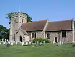 Parish Church of St Mary the Virgin |
| Church of St Helen | Little Eversden | Parish Church | 14th century | 22 November 1967 | TL3748853288 52°09′39″N 0°00′31″E |
1309238 | 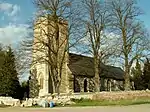 Church of St Helen |
| Five Gables Farmhouse | Little Eversden | Cross Wing House | 17th century | 22 November 1967 | TL3697253433 52°09′44″N 0°00′04″E |
1163252 | 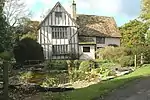 Five Gables Farmhouse |
| Church of Saint Peter and Saint Paul | Little Gransden | Parish Church | Mid 13th century | 22 November 1967 | TL2708355174 52°10′49″N 0°08′34″W |
1317971 | 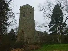 Church of Saint Peter and Saint Paul |
| Church of All Saints | Little Shelford | Parish Church | 12th century | 31 August 1962 | TL4534551664 52°08′39″N 0°07′22″E |
1164832 | |
| Little Shelford Manor | Little Shelford | House | Earlier | 31 August 1962 | TL4554851810 52°08′43″N 0°07′32″E |
1127852 | |
| Church of St John the Evangelist | Little Wilbraham | Church | 11th century or 12th century | 31 August 1962 | TL5456358600 52°12′14″N 0°15′37″E |
1167060 | 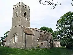 Church of St John the Evangelist |
| Parish Church of All Saints | Lolworth | Cross | Early 12th century | 31 August 1962 | TL3689064183 52°15′32″N 0°00′15″E |
1127241 | 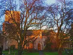 Parish Church of All Saints |
| Church of St Michael | Longstanton | Church | Early 13th century | 31 August 1962 | TL4029365854 52°16′23″N 0°03′17″E |
1127298 | |
| Church of St Mary | Longstowe | Parish Church | C14-C15 | 22 November 1967 | TL3106355430 52°10′54″N 0°05′04″W |
1128165 | 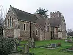 Church of St Mary |
| Church of St Mary Magdalene | Madingley | Parish Church | 13th century | 31 August 1962 | TL3950460336 52°13′25″N 0°02′27″E |
1127740 | 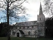 Church of St Mary Magdalene |
| Gateway to Stable Courtyard at Madingley Hall | Madingley | Gate | 1758 | 31 August 1962 | TL3927060444 52°13′29″N 0°02′15″E |
1127741 | |
| Madingley Mill, at Mill Farm, Madingley Hill | Madingley | Post Mill | 1936 | 31 August 1962 | TL4079559513 52°12′57″N 0°03′34″E |
1163652 |  Madingley Mill, at Mill Farm, Madingley Hill |
| Memorial and attached Walls, Steps and Pool Surround at American Military Cemetery | Madingley | Boundary Wall | 1952-1954 | 25 September 1998 | TL4051159550 52°12′59″N 0°03′19″E |
1376611 | 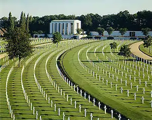 Memorial and attached Walls, Steps and Pool Surround at American Military Cemetery |
| The Manor House | Madingley | Jettied House | 15th century | 31 August 1962 | TL3955060626 52°13′34″N 0°02′30″E |
1127744 | |
| Parish Church of All Saints | Melbourn | Parish Church | 13th century | 18 October 1985 | TL3821844833 52°05′05″N 0°00′57″E |
1127546 | 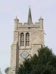 Parish Church of All Saints |
| The Manor House | Melbourn | Manor House | Early 18th century | 22 November 1967 | TL3818844645 52°04′59″N 0°00′55″E |
1318037 | |
| Milton House | Milton | House | c. 1768 | 31 August 1962 | TL4794562697 52°14′33″N 0°09′56″E |
1127351 | .jpg.webp) Milton House |
| Parish Church of All Saints | Milton | Parish Church | Norman | 31 August 1962 | TL4802062883 52°14′39″N 0°10′00″E |
1127349 | 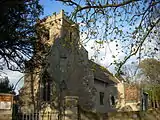 Parish Church of All Saints |
| Church of St Margaret | Newton | Parish Church | 13th century | 31 August 1962 | TL4353049159 52°07′20″N 0°05′42″E |
1331108 | 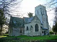 Church of St Margaret |
| The Cottage | Newton | Garage | Added 1907-8 | 29 August 1984 | TL4393449233 52°07′22″N 0°06′04″E |
1165063 | |
| Church of St Andrew | Oakington and Westwick | Parish Church | Early 13th century | 31 August 1962 | TL4149264799 52°15′47″N 0°04′19″E |
1164356 | 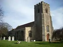 Church of St Andrew |
| Malton Farmhouse | Orwell, Cambridgeshire | Farmhouse | 15th century | 26 October 1982 | TL3733448310 52°06′58″N 0°00′15″E |
1128354 | |
| Parish Church of St John the Baptist | Pampisford | Parish Church | 12th century | 22 November 1967 | TL4977548248 52°06′44″N 0°11′09″E |
1163297 | 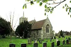 Parish Church of St John the Baptist |
| Papworth Hall | Papworth Everard | Country House | 1809-13 | 31 August 1962 | TL2886962742 52°14′52″N 0°06′50″W |
1226279 | 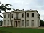 Papworth Hall |
| Parish Church of St Peter | Papworth Everard | Parish Church | 13th century | 31 August 1962 | TL2826662644 52°14′49″N 0°07′22″W |
1226356 | 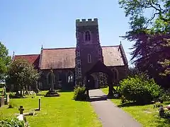 Parish Church of St Peter |
| Parish Church of St John the Baptist | Papworth St Agnes | Parish Church | 1530 | 31 August 1962 | TL2693564481 52°15′50″N 0°08′29″W |
1331388 | |
| Church of All Saints | Rampton | Parish Church | 12th century | 31 August 1962 | TL4285268111 52°17′33″N 0°05′35″E |
1127273 | 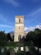 Church of All Saints |
| Great Eastern Drying Shed, Large Tannery Building at Hutchings and Hardings Limited | Sawston | Leather Drying Shed | Mid 19th century | 10 September 1987 | TL4867848866 52°07′05″N 0°10′12″E |
1127985 | |
| Queen's Head Inn | Sawston | Timber Framed House | Late 15th century | 22 November 1967 | TL4863149178 52°07′15″N 0°10′10″E |
1317362 | 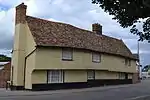 Queen's Head Inn |
| Church of All Saints | Shepreth | Parish Church | 12th century | 22 November 1967 | TL3928247479 52°06′29″N 0°01′57″E |
1330821 | 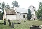 Church of All Saints |
| Docwras Manor | Shepreth | Kitchen | 16th century | 22 November 1967 | TL3924647967 52°06′45″N 0°01′55″E |
1128332 | 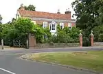 Docwras Manor |
| Glebe House | Wendy | House | c. 1828 | 22 November 1967 | TL3230647617 52°06′40″N 0°04′10″W |
1330864 | |
| Bramleys | Shudy Camps | Base Cruck House | 14th century | 2 January 1986 | TL6168044912 52°04′44″N 0°21′29″E |
1331018 | |
| Church of St Mary | Shudy Camps | Parish Church | 13th century | 22 November 1967 | TL6205944411 52°04′28″N 0°21′48″E |
1127948 | 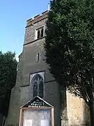 Church of St Mary |
| Church of St Andrew | Stapleford | Cross | Saxon | 31 August 1962 | TL4709652114 52°08′52″N 0°08′54″E |
1165349 | 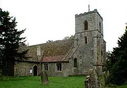 Church of St Andrew |
| Middlefield and Garden Wall | Stapleford | House | 1908 | 29 August 1984 | TL4799152892 52°09′16″N 0°09′43″E |
1317370 | |
| Parish Church of St Peter and St Paul | Steeple Morden | Parish Church | Late 13th century | 22 November 1967 | TL2857342467 52°03′56″N 0°07′33″W |
1164121 | 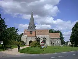 Parish Church of St Peter and St Paul |
| Parish Church of St Mary | Stow cum Quy | Parish Church | 12th century | 31 August 1962 | TL5158559902 52°12′59″N 0°13′03″E |
1179413 |  Parish Church of St Mary |
| Quy Hall | Stow cum Quy | Country House | Probably late C15-C16 | 22 August 1984 | TL5153661135 52°13′39″N 0°13′02″E |
1331325 | |
| The Vicarage | Stow cum Quy | Vicarage | 1887 | 22 August 1984 | TL5206260478 52°13′17″N 0°13′29″E |
1301981 | |
| Ryder's Farmhouse | Swavesey | Farmhouse | Late 13th century | 11 April 1980 | TL3636268324 52°17′46″N 0°00′07″W |
1164456 | |
| Church of St Giles | Tadlow | Parish Church | 13th century | 22 November 1967 | TL2799747613 52°06′43″N 0°07′56″W |
1317879 | 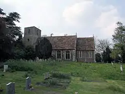 Church of St Giles |
| Church of All Saints | Teversham | Parish Church | 13th century | 31 August 1962 | TL4962058531 52°12′17″N 0°11′17″E |
1331278 | 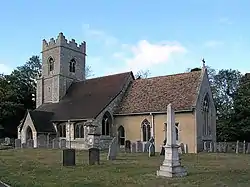 Church of All Saints |
| Bassetts | Thriplow | Farmhouse | Late 16th century | 22 November 1967 | TL4358946376 52°05′50″N 0°05′41″E |
1317239 | |
| Parish Church of St George | Thriplow | Parish Church | 13th century | 22 November 1967 | TL4420546956 52°06′08″N 0°06′14″E |
1128042 | 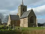 Parish Church of St George |
| The Manor House | Thriplow | House | c. 1800 | 22 November 1967 | TL4390446414 52°05′50″N 0°05′58″E |
1128012 | .jpg.webp) The Manor House |
| Thriplow Bury | Thriplow | House | c. 1713 | 22 November 1967 | TL4354346186 52°05′43″N 0°05′38″E |
1317262 | |
| Parish Church of St Andrew | Toft | Parish Church | Eartlier | 31 August 1962 | TL3623155778 52°11′00″N 0°00′32″W |
1127146 | 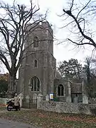 Parish Church of St Andrew |
| Church of St John | Waterbeach | Parish Church | c. 1200 | 31 August 1962 | TL4973765099 52°15′49″N 0°11′34″E |
1127366 | |
| Church of St Mary | West Wickham | Parish Church | 13th century | 22 November 1967 | TL6120649214 52°07′04″N 0°21′11″E |
1127918 | 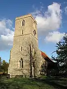 Church of St Mary |
| Church of St Andrew | West Wratting | Parish Church | Medieval | 22 November 1967 | TL6060852348 52°08′46″N 0°20′45″E |
1165084 | 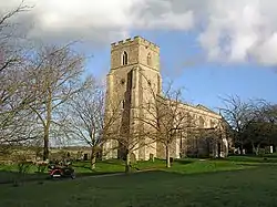 Church of St Andrew |
| Concordia House | West Wratting | House | Late 18th century | 22 November 1967 | TL6119151746 52°08′26″N 0°21′15″E |
1127932 | |
| West Wratting Park House | West Wratting | House | c. 1730 | 22 November 1967 | TL6103051577 52°08′20″N 0°21′06″E |
1127902 | |
| Windmill at Mill Cottage | West Wratting | Smock Mill | 1726 | 11 April 1986 | TL6055051010 52°08′03″N 0°20′40″E |
1165266 |  Windmill at Mill Cottage |
| Church of St Mary | Weston Colville | Parish Church | Medieval | 22 November 1967 | TL6161953152 52°09′11″N 0°21′39″E |
1164509 | 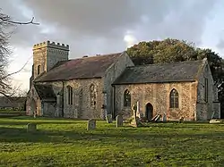 Church of St Mary |
| Rectory Farmhouse | Whaddon | Farmhouse | Early 14th century | 22 November 1967 | TL3522246547 52°06′03″N 0°01′38″W |
1128193 | |
| The Grange | Dyers Green, Whaddon | Farmhouse | Early 18th century | 18 June 1986 | TL3507745535 52°05′30″N 0°01′47″W |
1128228 | |
| Rayners Farmhouse | Whittlesford | Farmhouse | Late 16th century | 22 November 1967 | TL4655348598 52°06′59″N 0°08′20″E |
1128023 | |
| The Guildhall | Whittlesford | House | Late 15th century or early 16th century | 22 November 1967 | TL4727948313 52°06′49″N 0°08′58″E |
1165789 |  The Guildhall |
| Cattell's Mill | Willingham, Cambridgeshire | Windmill | 1828 | 31 August 1962 | TL4042869748 52°18′28″N 0°03′30″E |
1164972 | 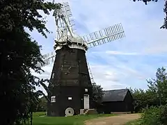 Cattell's Mill |
| Church of St Andrew | Wimpole | Parish Church | Medieval | 22 November 1967 | TL3364750998 52°08′28″N 0°02′54″W |
1330900 | 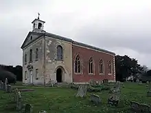 Church of St Andrew |
| Folly Castle about 3/4 Mile North of Wimpole Hall | Wimpole | Folly | 1768-70 | 22 November 1967 | TL3345252076 52°09′03″N 0°03′03″W |
1317807 | 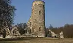 Folly Castle about 3/4 Mile North of Wimpole Hall |
| Stable Block, about 250 Yards South East of Wimpole Hall | Wimpole | Courtyard | 1852 | 3 September 1986 | TL3377050942 52°08′26″N 0°02′48″W |
1164273 |  Stable Block, about 250 Yards South East of Wimpole Hall |
| The Great Barn, at Park Farm, about Half Mile North East of Wimpole | Old Wimpole, Wimpole | Barn | Later | 3 September 1986 | TL3407951408 52°08′41″N 0°02′31″W |
1317761 | 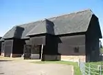 The Great Barn, at Park Farm, about Half Mile North East of Wimpole |
Notes
- The date given is the date used by Historic England as significant for the initial building or that of an important part in the structure's description.
- Sometimes known as OSGB36, the grid reference is based on the British national grid reference system used by the Ordnance Survey.
- The "List Entry Number" is a unique number assigned to each listed building and scheduled monument by Historic England.
External links
![]() Media related to Grade II* listed buildings in Cambridgeshire at Wikimedia Commons
Media related to Grade II* listed buildings in Cambridgeshire at Wikimedia Commons
This article is issued from Wikipedia. The text is licensed under Creative Commons - Attribution - Sharealike. Additional terms may apply for the media files.